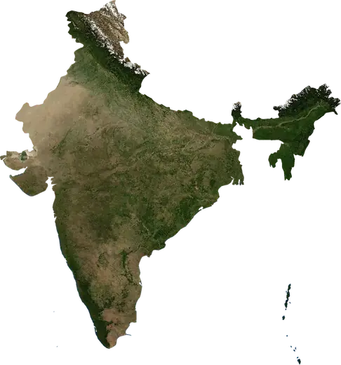
 India
India: earthquakes and wildfires
Latest earthquakes and active wildfires in India on a live map, the strongest earthquakes and largest fires on record, and statistics by year.
Live map – India
Key statistics (30 days)
Earthquakes M2.5+ and the wildfire fronts shown on the map.
Fire danger
Forecast for the area around: Mumbai. Danger can vary locally; follow official guidance. Source: Copernicus EMS – EFFIS (FWI).
Severe weather (forecast)
The forecast shows no heavy rain, gales or thunderstorms for today and tomorrow.
Forecast for the area around: India. It does not replace warnings from the national weather service. Source: ECMWF / Copernicus EMS.
Recent events in India
- 2.53 h agoM2.5 earthquake near Silchar, India – now33 mi ESE of Silchar, India
- 3.34 h agoM3.3 earthquake near Ludhiana, India – now14 mi SSE of Ludhiana, India
- 2.94 h agoM2.9 earthquake near Nagpur, India – now22 mi SSE of Nagpur, India
- 5 h agoWildfire near Firozpur, India – active1,428 acres · 16 mi SE of Firozpur, India
- 5 h agoWildfire near Fazilka, India – active882 acres · 9 mi N of Fazilka, India
- 5 h agoWildfire near Moga, India – active10,070 acres · 16 mi SE of Moga, India
Historical overview
Earthquakes M3.0+ and significant events of other hazards.
About India
India has recorded 8,098 earthquakes of magnitude 3.0 or more since 1976. The strongest was M7.6 in 2001.
Satellites have detected 599 significant wildfires here; the largest burned about 384,565 acres.
The area has also been affected by 2 tropical cyclones, floods, volcanic events or tsunami messages.
Know the official emergency number, prepare an emergency kit and follow the instructions of your civil protection authority.
Learn more ›Earthquakes
8,098 earthquakes of magnitude 3.0 or more since 1976. The strongest was M7.6.
Recent earthquakes
| Mag | Location | Time (UTC) | Depth |
|---|---|---|---|
| 2.5 | 33 mi ESE of Silchar, India | 15.5 mi | |
| 3.3 | 14 mi SSE of Ludhiana, India | 48.0 mi | |
| 2.9 | 22 mi SSE of Nagpur, India | 3.1 mi | |
| 3.3 | 14 mi NW of Bhatpara, India | 157.5 mi | |
| 3.1 | 43 mi WNW of Koloriang, India | 6.2 mi | |
| 3.5 | 18 mi NNW of Yingkiong, India | 12.4 mi | |
| 4.0 | 42 mi SW of Guwahati, India | 6.2 mi | |
| 2.8 | 48 mi WNW of Gangtok, India | 24.2 mi | |
| 2.9 | 10 mi S of Bunjwah, India | 6.2 mi | |
| 3.0 | 12 mi ESE of Kagaznagar, India | 6.2 mi |
Show all (108)
Strongest earthquakes on record
| Mag | Location | Time (UTC) | Depth |
|---|---|---|---|
| 7.6 | 6 mi N of Bhachau, India | 10.6 mi | |
| 7.5 | 147 mi WNW of Campbell Bay, India | 21.7 mi | |
| 7.5 | 58 mi N of Diglipur, India | 3.1 mi | |
| 7.2 | 133 mi WNW of Campbell Bay, India | 9.9 mi | |
| 7.2 | 65 mi W of Campbell Bay, India | 24.4 mi | |
| 7.0 | 54 mi NE of Dehradun, India | 6.2 mi | |
| 6.9 | 40 mi NW of Gangtok, India | 31.1 mi | |
| 6.9 | 87 mi NNE of Leh, India | 20.5 mi | |
| 6.8 | 45 mi ESE of Diglipur, India | 48.5 mi | |
| 6.7 | 18 mi W of Imphal, India | 34.2 mi | |
| 6.7 | 30 mi NNW of Diglipur, India | 21.1 mi | |
| 6.7 | 171 mi SW of Campbell Bay, India | 7.3 mi | |
| 6.6 | 53 mi ESE of Campbell Bay, India | 6.2 mi | |
| 6.6 | 73 mi SW of Garacharma, India | 10.6 mi | |
| 6.6 | 166 mi NW of Campbell Bay, India | 10.0 mi |
Earthquakes per year (M3.0+)
Year
| 2026 | 94 | M5.2 |
| 2025 | 152 | M6.4 |
| 2024 | 117 | M5.2 |
| 2023 | 152 | M5.9 |
| 2022 | 198 | M5.5 |
| 2021 | 148 | M6.1 |
| 2020 | 124 | M6.1 |
| 2019 | 219 | M5.9 |
| 2018 | 103 | M5.8 |
| 2017 | 94 | M6.0 |
| 2016 | 88 | M6.7 |
| 2015 | 156 | M6.6 |
| 2014 | 277 | M6.4 |
| 2013 | 132 | M5.7 |
| 2012 | 138 | M5.7 |
| 2011 | 88 | M6.9 |
| 2010 | 176 | M7.5 |
| 2009 | 196 | M7.5 |
| 2008 | 367 | M6.6 |
| 2007 | 161 | M6.1 |
| 2006 | 392 | M6.3 |
| 2005 | 1,823 | M7.2 |
| 2004 | 599 | M7.2 |
| 2003 | 95 | M6.0 |
| 2002 | 117 | M6.5 |
| 2001 | 196 | M7.6 |
| 2000 | 104 | M5.9 |
| 1999 | 91 | M6.6 |
| 1998 | 100 | M6.0 |
| 1997 | 78 | M6.1 |
| 1996 | 148 | M6.9 |
| 1995 | 75 | M5.5 |
| 1994 | 68 | M5.9 |
| 1993 | 83 | M6.2 |
| 1992 | 60 | M6.0 |
| 1991 | 79 | M7.0 |
| 1990 | 53 | M6.1 |
| 1989 | 46 | M5.8 |
| 1988 | 43 | M5.3 |
| 1987 | 33 | M6.3 |
| 1986 | 49 | M6.0 |
| 1985 | 57 | M5.6 |
| 1984 | 153 | M6.0 |
| 1983 | 80 | M6.8 |
| 1982 | 65 | M6.3 |
| 1981 | 34 | M5.7 |
| 1980 | 46 | M6.2 |
| 1979 | 38 | M5.9 |
| 1978 | 38 | M5.6 |
| 1977 | 29 | M5.4 |
| 1976 | 46 | M5.9 |
Wildfires
599 major fires since 2025. The largest covered about 384,565 acres.
Recent fires
| Area | Location | Since | Status |
|---|---|---|---|
| 1,428 acres | 16 mi SE of Firozpur, India | Active | |
| 882 acres | 9 mi N of Fazilka, India | Active | |
| 10,070 acres | 16 mi SE of Moga, India | Active | |
| 3,343 acres | 16 mi WNW of Mansa, India | Active | |
| 1,179 acres | near Jalalabad, India | Active | |
| 21,664 acres | 10 mi WSW of Firozpur, India | Active | |
| 2,691 acres | 8 mi SSW of Ludhiana, India | Active | |
| 33,396 acres | 11 mi N of Moga, India | Active | |
| 5,723 acres | 11 mi SE of Moga, India | Active | |
| 39,655 acres | 15 mi SSE of Bhopal, India | Active |
Show all (200)
| Area | Location | Since | Status |
|---|---|---|---|
| 10,756 acres | 19 mi NE of Gwalior, India | Active | |
| 979 acres | 29 mi WNW of Guna, India | Active | |
| 1,663 acres | 11 mi WNW of Suratgarh, India | Active | |
| 210,837 acres | 28 mi S of Gwalior, India | Active | |
| 351,687 acres | near Alampur, India | Active | |
| 185,630 acres | 12 mi N of Sheopur, India | Active | |
| 2,908 acres | 6 mi ENE of Suratgarh, India | Active | |
| 384,565 acres | 5 mi ENE of Itarsi, India | Active | |
| 9,543 acres | 11 mi SW of Mungaoli, India | Active | |
| 2,538 acres | 8 mi N of Mungaoli, India | Active | |
| 1,100 acres | 16 mi SE of Bathinda, India | Active | |
| 57,632 acres | 11 mi SW of Bodhan, India | Active | |
| 1,673 acres | 84 mi SSE of Diu, India | Active | |
| 5,889 acres | 14 mi WSW of Surat, India | Active | |
| 1,905 acres | 5 mi N of Mangaluru, India | Active | |
| 1,176 acres | 6 mi NNW of Fazilka, India | Active | |
| 1,035 acres | 16 mi NNW of Bikaner, India | Active | |
| 2,548 acres | near Akalgarh, India | Active | |
| 3,754 acres | 22 mi NNE of Bikaner, India | Active | |
| 1,122 acres | 20 mi N of Bikaner, India | Active | |
| 4,831 acres | 23 mi NNW of Bikaner, India | Active | |
| 4,453 acres | 15 mi W of Jammu, India | Active | |
| 1,137 acres | near Jalalabad, India | Active | |
| 1,623 acres | 21 mi E of Anupgarh, India | Active | |
| 1,043 acres | 5 mi ENE of Bamhni, India | Active | |
| 12,012 acres | 18 mi NNW of Belpahar, India | Active | |
| 1,258 acres | 4 mi NNE of Jabalpur, India | Active | |
| 8,006 acres | 10 mi NE of Satna, India | Active | |
| 1,344 acres | 19 mi SE of Murwara, India | Active | |
| 3,679 acres | 31 mi ENE of Jabalpur, India | Active | |
| 976 acres | 22 mi SE of Patna, India | Active | |
| 2,397 acres | 26 mi SE of Patna, India | Active | |
| 890 acres | 10 mi WSW of Rewa, India | Active | |
| 2,936 acres | near Singrauli, India | Active | |
| 803 acres | 31 mi WNW of Murwara, India | Active | |
| 1,147 acres | 7 mi ESE of Jalaun, India | Active | |
| 840 acres | 8 mi SSW of Konch, India | Active | |
| 89,581 acres | near Basoda, India | Active | |
| 4,092 acres | 4 mi NE of Pawai, India | Active | |
| 749 acres | 26 mi WNW of Kanpur, India | Active | |
| 6,029 acres | 7 mi SE of Seoni Chhapara, India | Active | |
| 14,421 acres | 5 mi WNW of Satna, India | Active | |
| 833 acres | 9 mi WNW of Auraiya, India | Active | |
| 88,439 acres | 4 mi SW of Seoni, India | Active | |
| 1,040 acres | near Lakhnadon, India | Active | |
| 754 acres | 14 mi SE of Mangrol, India | Active | |
| 5,167 acres | 11 mi NE of Nagpur, India | Active | |
| 1,030 acres | 27 mi W of Murwara, India | Active | |
| 8,100 acres | 26 mi W of Satna, India | Active | |
| 1,018 acres | 12 mi SSW of Orai, India | Active | |
| 3,677 acres | 33 mi NNE of Jabalpur, India | Active | |
| 976 acres | 4 mi ESE of Datia, India | Active | |
| 7,883 acres | 13 mi SW of Chanderi, India | Active | |
| 1,542 acres | 4 mi ESE of Orai, India | Active | |
| 28,207 acres | 22 mi ESE of Kota, India | Active | |
| 1,448 acres | 4 mi SE of Jhinjhak, India | Active | |
| 3,025 acres | 12 mi WNW of Guna, India | Active | |
| 19,052 acres | 29 mi E of Baran, India | Active | |
| 4,099 acres | 15 mi NW of Talcher, India | Active | |
| 3,148 acres | 6 mi N of Baran, India | Active | |
| 2,199 acres | near Auraiya, India | Active | |
| 13,126 acres | 12 mi SW of Jharsuguda, India | Active | |
| 3,220 acres | 11 mi E of Gwalior, India | Active | |
| 9,138 acres | 3 mi NW of Kharagpur, India | Active | |
| 5,392 acres | 3 mi WNW of Raigarh, India | Active | |
| 1,557 acres | 35 mi E of Guna, India | Active | |
| 8,688 acres | 10 mi S of Satna, India | Active | |
| 3,037 acres | 8 mi NE of Samthar, India | Active | |
| 1,690 acres | near Kakarati, India | Active | |
| 1,774 acres | 24 mi ESE of Sheopur, India | Active | |
| 845 acres | 26 mi NW of Satna, India | Active | |
| 6,529 acres | 10 mi SE of Hamirpur, India | Active | |
| 121,845 acres | 24 mi NE of Seoni, India | Active | |
| 885 acres | 7 mi W of Konch, India | Active | |
| 2,691 acres | 7 mi ENE of Jalaun, India | Active | |
| 2,869 acres | 22 mi N of Orai, India | Active | |
| 833 acres | 15 mi SE of Lucknow, India | Active | |
| 1,337 acres | 29 mi NE of Murwara, India | Active | |
| 48,341 acres | 34 mi NNE of Gorakhpur, India | Active | |
| 979 acres | 18 mi NW of Beawar, India | Active | |
| 3,390 acres | 12 mi NE of Gwalior, India | Active | |
| 31,533 acres | 3 mi SW of Dhanbad, India | Active | |
| 2,498 acres | 28 mi NW of Kanpur, India | Active | |
| 1,851 acres | 25 mi WSW of Kanpur, India | Active | |
| 4,693 acres | 23 mi NE of Gwalior, India | Active | |
| 3,877 acres | 6 mi WSW of Katras, India | Active | |
| 1,416 acres | 3 mi NNE of Samthar, India | Active | |
| 3,487 acres | 5 mi WNW of Durgapur, India | Active | |
| 1,898 acres | 28 mi E of Orai, India | Active | |
| 1,972 acres | near Chirmiri, India | Active | |
| 1,950 acres | 83 mi SSE of Diu, India | Active | |
| 146,924 acres | 11 mi NNW of Jabalpur, India | Active | |
| 939 acres | 13 mi N of Raichur, India | Active | |
| 1,211 acres | 16 mi SSE of Nirmal, India | Active | |
| 3,442 acres | 16 mi S of Ramgundam, India | Active | |
| 8,206 acres | 7 mi WNW of Angul, India | Active | |
| 8,028 acres | 8 mi WNW of Amur, India | Active | |
| 16,242 acres | 10 mi WNW of Medak, India | Active | |
| 1,161 acres | 16 mi ESE of Ramagundam, India | Active | |
| 9,948 acres | 24 mi WNW of Dhenkanal, India | Active | |
| 5,204 acres | 8 mi W of Byasanagar, India | Active | |
| 15,054 acres | near Dera Colliery Township, India | Active | |
| 3,497 acres | 23 mi SSW of Nizamabad, India | Active | |
| 9,733 acres | 7 mi NNW of Nizamabad, India | Active | |
| 7,156 acres | 24 mi SSE of Ramagundam, India | Active | |
| 9,405 acres | 3 mi SE of Nizamabad, India | Active | |
| 11,728 acres | 23 mi S of Ramgundam, India | Active | |
| 3,146 acres | 17 mi ESE of Baroda, India | Active | |
| 932 acres | 10 mi ENE of Baroda, India | Active | |
| 4,421 acres | 20 mi WSW of Gorakhpur, India | Active | |
| 1,675 acres | 4 mi NW of Gwalior, India | Active | |
| 2,446 acres | 29 mi SSE of Shivpuri, India | Active | |
| 14,819 acres | 5 mi SSE of Nautanwa, India | Active | |
| 2,451 acres | 5 mi NNE of Saja, India | Active | |
| 1,070 acres | 21 mi SE of Satna, India | Active | |
| 2,654 acres | 23 mi E of Bhopal, India | Active | |
| 4,670 acres | 10 mi E of Jagdalpur, India | Active | |
| 5,135 acres | 5 mi W of Byasanagar, India | Active | |
| 8,280 acres | near Raurkela Industrial Township, India | Active | |
| 4,512 acres | 24 mi SW of Jamshedpur, India | Active | |
| 3,118 acres | 18 mi SSE of Satna, India | Active | |
| 815 acres | 23 mi ESE of Chhindwara, India | Active | |
| 12,887 acres | 4 mi W of Bokaro, India | Active | |
| 1,290 acres | 27 mi N of Kulti, India | Active | |
| 3,642 acres | near Gotegaon, India | Active | |
| 4,431 acres | 24 mi S of Navi Mumbai, India | Active | |
| 746 acres | 14 mi SSW of Navi Mumbai, India | Active | |
| 1,757 acres | 3 mi NE of Manawar, India | Active | |
| 983 acres | 22 mi WSW of Gandhidham, India | Active | |
| 4,912 acres | 17 mi SW of Jamnagar, India | Active | |
| 1,512 acres | near Pindwara, India | Active | |
| 2,026 acres | 30 mi WSW of Gandhidham, India | Active | |
| 1,030 acres | near Mithapur, India | Active | |
| 2,612 acres | 3 mi NNE of Ariyalur, India | Active | |
| 7,475 acres | near Bhilai, India | Active | |
| 902 acres | 15 mi NNW of Nagpur, India | Active | |
| 2,718 acres | 10 mi NNE of Nagpur, India | Active | |
| 1,628 acres | 12 mi W of Chanda, India | Active | |
| 2,674 acres | near Manuguru, India | Active | |
| 1,166 acres | 14 mi WSW of Ballarpur, India | Active | |
| 1,030 acres | 106 mi S of Diu, India | Active | |
| 3,543 acres | 5 mi ESE of Ramagundam, India | Active | |
| 2,632 acres | 26 mi SSW of Nagaur, India | Active | |
| 2,506 acres | 91 mi WSW of Shirgaon, India | Active | |
| 2,160 acres | 26 mi ESE of Kalaburagi, India | Active | |
| 1,932 acres | 5 mi WSW of Kotputli, India | Active | |
| 2,263 acres | 12 mi ENE of Ballari, India | Active | |
| 15,338 acres | 17 mi W of Ballari, India | Active | |
| 1,502 acres | near Thummalamenta, India | Active | |
| 1,935 acres | 11 mi W of Gorakhpur, India | Active | |
| 3,160 acres | 30 mi ESE of Etawah, India | Active | |
| 1,394 acres | 6 mi ENE of Sutrapara, India | Active | |
| 974 acres | near Kodinar, India | Active | |
| 1,025 acres | 7 mi ENE of Jafarabad, India | Active | |
| 1,408 acres | 5 mi NNE of Bicholim, India | Active | |
| 1,077 acres | 4 mi N of Manuguru, India | Active | |
| 2,454 acres | 5 mi NNE of Navi Mumbai, India | Active | |
| 2,488 acres | 8 mi WNW of Hosapete, India | Active | |
| 1,549 acres | near Navelim, India | Active | |
| 2,567 acres | 6 mi SSE of Jhargram, India | Active | |
| 2,390 acres | 21 mi NNE of Bilaspur, India | Active | |
| 1,782 acres | 6 mi WSW of Bhachau, India | Active | |
| 16,959 acres | 9 mi WSW of Korba, India | Active | |
| 1,438 acres | near Koira, India | Active | |
| 7,341 acres | 10 mi NNW of Raigarh, India | Active | |
| 5,204 acres | near Champa, India | Active | |
| 3,348 acres | 10 mi E of Raigarh, India | Active | |
| 3,388 acres | near Jharsuguda, India | Active | |
| 1,490 acres | 7 mi ESE of Raigarh, India | Active | |
| 8,920 acres | 6 mi S of Jharsuguda, India | Active | |
| 1,893 acres | 11 mi SW of Bilaspur, India | Active | |
| 7,020 acres | 15 mi NNE of Sambalpur, India | Active | |
| 1,715 acres | 8 mi NE of Bhatapara, India | Active | |
| 1,806 acres | 22 mi NNE of Raipur, India | Active | |
| 1,898 acres | 20 mi NNE of Raipur, India | Active | |
| 15,948 acres | 10 mi NNE of Raipur, India | Active | |
| 7,621 acres | 5 mi N of Raipur, India | Active | |
| 2,478 acres | 17 mi NW of Shimla, India | Active | |
| 1,334 acres | 3 mi N of Chittorgarh, India | Active | |
| 1,201 acres | 27 mi NW of Nimach, India | Active | |
| 1,621 acres | 6 mi NW of Bilaspur, India | Active | |
| 4,601 acres | near Jamshedpur, India | Active | |
| 1,067 acres | 5 mi N of Nimbahera, India | Active | |
| 1,759 acres | 24 mi S of Bilaspur, India | Active | |
| 798 acres | 5 mi SW of Gotan, India | Active | |
| 5,357 acres | 21 mi WNW of Saunda, India | Active | |
| 1,668 acres | 12 mi SSE of Bhatapara, India | Active | |
| 3,620 acres | 12 mi WNW of Raigarh, India | Active | |
| 3,798 acres | 8 mi SSW of Dhanbad, India | Active | |
| 2,231 acres | 23 mi NNE of Ranchi, India | Active |
Largest fires on record
| Area | Location | Since | Status |
|---|---|---|---|
| 384,565 acres | 5 mi ENE of Itarsi, India | Active | |
| 351,687 acres | near Alampur, India | Active | |
| 210,837 acres | 28 mi S of Gwalior, India | Active | |
| 185,630 acres | 12 mi N of Sheopur, India | Active | |
| 168,086 acres | 9 mi SSW of Bansi, India | Active | |
| 146,924 acres | 11 mi NNW of Jabalpur, India | Active | |
| 121,845 acres | 24 mi NE of Seoni, India | Active | |
| 89,581 acres | near Basoda, India | Active | |
| 88,439 acres | 4 mi SW of Seoni, India | Active | |
| 63,380 acres | 12 mi WNW of Nokha, India | Inactive | |
| 57,632 acres | 11 mi SW of Bodhan, India | Active | |
| 56,849 acres | 25 mi SW of Narayanpur, India | Inactive | |
| 48,341 acres | 34 mi NNE of Gorakhpur, India | Active | |
| 44,605 acres | 14 mi WNW of Nokha, India | Inactive | |
| 40,609 acres | 19 mi NNW of Bhairamgarh, India | Inactive |
Major fires per year
Year
| 2026 | 505 | 384,565 acres |
| 2025 | 94 | 168,086 acres |
Storms
Last 12 months
| Level | Location | Time | Status |
|---|---|---|---|
| Red | Tropical cyclone MURASU-26 – India | Inactive | |
| Red | Tropical cyclone ARNAB-26 – India | Inactive |
Significant events on record
| Level | Location | Time | Status |
|---|---|---|---|
| Red | Tropical cyclone MURASU-26 – India | Inactive | |
| Red | Tropical cyclone ARNAB-26 – India | Inactive |
Regions
- Andaman and Nicobar
- Assam
- Ladakh
- Uttarakhand
- Manipur
- Arunachal Pradesh
- Jammu and Kashmir
- Gujarat
- Himachal Pradesh
- Mizoram
- West Bengal
- Maharashtra
- Nagaland
- Meghalaya
- Sikkim
- Punjab
- Tripura
- Rajasthan
- Haryana
- Madhya Pradesh
- National Capital Territory of Delhi
- Uttar Pradesh
- Odisha
- Andhra Pradesh
- Bihar
- Chhattisgarh
- Telangana
- Jharkhand
- Karnataka
- Tamil Nadu
Places
- Mumbai
- Delhi
- Ahmedabad
- Kolkata
- Surat
- Pune
- Jaipur
- Navi Mumbai
- Lucknow
- Thane
- Vadodara
- Ludhiana
- Nashik
- Agra
- Faridabad
- Rajkot
- Najafgarh
- Jamshedpur
- Kalyan
- Dombivali
- Meerut
- Virar
- Srinagar
- Ghaziabad
- Dhanbad
- Amritsar
- Vijayawada
- Jabalpur
- Jodhpur
- Gwalior
- Howrah
- Shivaji Nagar
- Solapur
- Chandigarh
- Guwahati
- Gurugram
- Bhiwandi
- Jalandhar
- Rohini
- Bhayandar
- Narela
- Aligarh
- Bareilly
- Moradabad
- Warangal
- Dharavi
- Guntur
- Puducherry
- Amravati
- Bikaner
- Cuttack
- Borivli
- Bhavnagar
- Sangli
- Jamnagar
- Jammu
- Bokaro
- Nanded
- Kolhapur
- Kalaburagi
- Dehradun
- Durgapur
- Ulhasnagar
- Loni
- Siliguri
- Bilimora
- Karol Bagh
- Asansol
- Saharanpur
- Bhatpara
- Malegaon
- Modinagar
- Gaya
- Jalgaon
- Ramgundam
- Udaipur
- Maheshtala
- Patiala
- Shyamnagar
- Akola