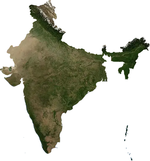
 Punjab
: earthquakes and wildfires
Latest earthquakes and wildfires in Punjab (India) on a live map, the strongest earthquakes and largest fires on record.
Live map – Punjab
Loading live map…
Latest event33,606 acres18 h ago11 mi N of Moga, India
Low
Moderate
High
Very high
Extreme
Very extreme
Forecast: Copernicus EFFIS (FWI index)
Very light rain (0.1–1 mm)
Light rain (1–5 mm)
Moderate rain (5–10 mm)
Heavy rain (10–25 mm)
Very heavy rain (25–50 mm)
Extreme rain (≥ 50 mm)
Forecast: ECMWF via Copernicus EMS – GWIS
Calm (< 7 km/h, 0–1 Bf)
Light breeze (7–18 km/h, 2–3 Bf)
Moderate breeze (18–36 km/h, 4–5 Bf)
Strong breeze (36–54 km/h, 5–7 Bf)
Gale (54–72 km/h, 7–8 Bf)
Storm (≥ 72 km/h, 9+ Bf)
Forecast: ECMWF via Copernicus EMS – GWIS
Very low lightning
Low lightning
Moderate lightning
High lightning
Very high lightning
Extreme lightning
Forecast: ECMWF via Copernicus EMS – GWIS
Earthquakes
Wildfires
Floods
Storms
Volcanoes
Tsunamis
Key statistics (30 days)
Earthquakes M2.5+ and the wildfire fronts shown on the map.
Recent events in Punjab
- 18 h agoWildfire near Moga, India – active33,606 acres · 11 mi N of Moga, India
- 18 h agoWildfire near Fazilka, India – active2,268 acres · 6 mi NNW of Fazilka, India
- 19 h agoWildfire near Mansa, India – active3,385 acres · 16 mi WNW of Mansa, India
- 19 h agoWildfire near Batala, India – active875 acres · 22 mi N of Batala, India
- 19 h agoWildfire near Ludhiana, India – active2,985 acres · 8 mi SSW of Ludhiana, India
- 19 h agoWildfire near Moga, India – active10,280 acres · 16 mi SE of Moga, India
Historical overview
Earthquakes M3.0+ and significant events of other hazards.
About Punjab
Punjab has recorded 32 earthquakes of magnitude 3.0 or more since 1976. The strongest was M5.4 in 1976.
Satellites have detected 24 significant wildfires here; the largest burned about 33,606 acres.
Know the official emergency number, prepare an emergency kit and follow the instructions of your civil protection authority.
Learn more ›Earthquakes
32 earthquakes of magnitude 3.0 or more since 1976. The strongest was M5.4.
Recent earthquakes
| Mag | Location | Time (UTC) | Depth |
|---|---|---|---|
| 3.3 | 14 mi SSE of Ludhiana, India | 48.0 mi | |
| 4.4 | 55 mi ENE of Pathankot, India | 6.2 mi |
Strongest earthquakes on record
| Mag | Location | Time (UTC) | Depth |
|---|---|---|---|
| 5.4 | 44 mi NNE of Pathankot, India | 31.1 mi | |
| 4.9 | 62 mi ENE of Pathankot, India | 25.5 mi | |
| 4.9 | 28 mi NE of Pathankot, India | 20.5 mi | |
| 4.8 | 59 mi ENE of Pathankot, India | 6.2 mi | |
| 4.8 | 59 mi ENE of Pathankot, India | 7.5 mi | |
| 4.8 | 27 mi NNE of Pathankot, India | 20.5 mi | |
| 4.8 | 39 mi N of Pathankot, India | 20.5 mi | |
| 4.6 | 42 mi ENE of Pathankot, India | 20.5 mi | |
| 4.6 | near Guru Har Sahai, India | 32.1 mi | |
| 4.6 | 40 mi NNE of Pathankot, India | 31.7 mi | |
| 4.5 | 15 mi NE of Hoshiarpur, India | 18.6 mi | |
| 4.5 | 38 mi NNE of Pathankot, India | 30.9 mi | |
| 4.4 | 55 mi ENE of Pathankot, India | 6.2 mi | |
| 4.4 | 18 mi NE of Hoshiarpur, India | 25.5 mi | |
| 4.3 | 66 mi NE of Pathankot, India | 6.2 mi |
Earthquakes per year (M3.0+)
Year
| 2026 | 2 | M4.4 |
| 2025 | 2 | M4.2 |
| 2020 | 2 | M4.3 |
| 2018 | 1 | M4.1 |
| 2013 | 3 | M4.9 |
| 2012 | 1 | M4.8 |
| 2010 | 1 | M4.5 |
| 2009 | 2 | M3.9 |
| 2008 | 3 | M4.3 |
| 2006 | 1 | M3.8 |
| 2005 | 3 | M4.8 |
| 1998 | 1 | M3.3 |
| 1995 | 1 | M4.9 |
| 1992 | 1 | M4.6 |
| 1982 | 1 | M4.8 |
| 1981 | 2 | M4.6 |
| 1980 | 1 | M4.8 |
| 1978 | 1 | M4.0 |
| 1977 | 1 | M4.6 |
| 1976 | 2 | M5.4 |
Wildfires
24 major fires since 2025. The largest covered about 33,606 acres.
Recent fires
| Area | Location | Since | Status |
|---|---|---|---|
| 33,606 acres | 11 mi N of Moga, India | Active | |
| 2,268 acres | 6 mi NNW of Fazilka, India | Active | |
| 3,385 acres | 16 mi WNW of Mansa, India | Active | |
| 875 acres | 22 mi N of Batala, India | Active | |
| 2,985 acres | 8 mi SSW of Ludhiana, India | Active | |
| 10,280 acres | 16 mi SE of Moga, India | Active | |
| 21,706 acres | 10 mi WSW of Firozpur, India | Active | |
| 5,849 acres | 11 mi SE of Moga, India | Active | |
| 2,785 acres | 3 mi W of Fazilka, India | Inactive | |
| 1,428 acres | 16 mi SE of Firozpur, India | Inactive |
Show all (70)
| Area | Location | Since | Status |
|---|---|---|---|
| 1,179 acres | near Jalalabad, India | Inactive | |
| 1,100 acres | 16 mi SE of Bathinda, India | Inactive | |
| 2,548 acres | near Akalgarh, India | Inactive | |
| 1,137 acres | near Jalalabad, India | Inactive | |
| 1,184 acres | 6 mi ENE of Barnala, India | Inactive | |
| 1,176 acres | 21 mi NW of Moga, India | Inactive | |
| 2,053 acres | 15 mi SSE of Amritsar, India | Inactive | |
| 6,501 acres | 27 mi NNW of Moga, India | Inactive | |
| 2,152 acres | 26 mi W of Patiala, India | Inactive | |
| 840 acres | 23 mi SE of Amritsar, India | Inactive | |
| 3,131 acres | 21 mi N of Jalandhar, India | Inactive | |
| 2,226 acres | 6 mi SSW of Nakodar, India | Inactive | |
| 27,594 acres | 6 mi NNE of Amritsar, India | Inactive | |
| 1,008 acres | 8 mi NNW of Faridkot, India | Inactive | |
| 2,819 acres | 14 mi S of Ludhiana, India | Inactive | |
| 761 acres | 7 mi ESE of Nabha, India | Inactive | |
| 11,631 acres | 23 mi S of Ludhiana, India | Inactive | |
| 890 acres | 29 mi WSW of Patiala, India | Inactive | |
| 16,435 acres | 16 mi WSW of Moga, India | Inactive | |
| 2,839 acres | 4 mi SW of Dasuya, India | Inactive | |
| 8,792 acres | 6 mi WNW of Rampura Phul, India | Inactive | |
| 882 acres | 3 mi N of Moga, India | Inactive | |
| 1,675 acres | 16 mi S of Amritsar, India | Inactive | |
| 5,286 acres | 15 mi NNW of Amritsar, India | Inactive | |
| 2,315 acres | 23 mi SSE of Ludhiana, India | Inactive | |
| 1,184 acres | 6 mi E of Sunam, India | Inactive | |
| 1,181 acres | 10 mi E of Fazilka, India | Inactive | |
| 1,307 acres | 4 mi SW of Faridkot, India | Inactive | |
| 929 acres | 13 mi NNE of Bathinda, India | Inactive | |
| 1,653 acres | 4 mi SSW of Sangrur, India | Inactive | |
| 761 acres | 4 mi NNE of Giddarbaha, India | Inactive | |
| 1,058 acres | 13 mi ESE of Muktsar, India | Inactive | |
| 1,478 acres | 5 mi SW of Jaito, India | Inactive | |
| 966 acres | 7 mi N of Phagwara, India | Inactive | |
| 1,436 acres | near Bhadaur, India | Inactive | |
| 1,053 acres | 11 mi SW of Ludhiana, India | Inactive | |
| 4,097 acres | 7 mi SE of Maler Kotla, India | Inactive | |
| 927 acres | 24 mi SSW of Ludhiana, India | Inactive | |
| 764 acres | 18 mi SSE of Bathinda, India | Inactive | |
| 4,571 acres | 4 mi WSW of Giddarbaha, India | Inactive | |
| 1,861 acres | 14 mi NW of Bathinda, India | Inactive | |
| 1,772 acres | 9 mi ENE of Bhadaur, India | Inactive | |
| 1,050 acres | near Moga, India | Inactive | |
| 890 acres | 27 mi WSW of Patiala, India | Inactive | |
| 759 acres | 16 mi SE of Ludhiana, India | Inactive | |
| 1,060 acres | 5 mi N of Bareta, India | Inactive | |
| 2,197 acres | 8 mi SW of Bathinda, India | Inactive | |
| 1,307 acres | 26 mi SSE of Ludhiana, India | Inactive | |
| 843 acres | 30 mi SW of Ludhiana, India | Inactive | |
| 1,006 acres | 8 mi E of Jalandhar, India | Inactive | |
| 1,611 acres | near Mansa, India | Inactive | |
| 2,110 acres | 32 mi S of Ludhiana, India | Inactive | |
| 4,744 acres | 9 mi NNE of Firozpur, India | Inactive | |
| 855 acres | 5 mi ENE of Sardulgarh, India | Inactive | |
| 2,310 acres | 4 mi S of Zira, India | Inactive | |
| 840 acres | 4 mi NNW of Kapurthala Town, India | Inactive | |
| 2,590 acres | 10 mi N of Kapurthala Town, India | Inactive | |
| 3,716 acres | 7 mi SSW of Kot Kapura, India | Inactive | |
| 2,679 acres | 21 mi SSE of Amritsar, India | Inactive | |
| 3,030 acres | 6 mi N of Gurdaspur, India | Inactive |
Largest fires on record
| Area | Location | Since | Status |
|---|---|---|---|
| 33,606 acres | 11 mi N of Moga, India | Active | |
| 27,594 acres | 6 mi NNE of Amritsar, India | Inactive | |
| 21,706 acres | 10 mi WSW of Firozpur, India | Active | |
| 16,435 acres | 16 mi WSW of Moga, India | Inactive | |
| 11,631 acres | 23 mi S of Ludhiana, India | Inactive | |
| 10,280 acres | 16 mi SE of Moga, India | Active | |
| 8,792 acres | 6 mi WNW of Rampura Phul, India | Inactive | |
| 6,501 acres | 27 mi NNW of Moga, India | Inactive | |
| 5,849 acres | 11 mi SE of Moga, India | Active | |
| 5,286 acres | 15 mi NNW of Amritsar, India | Inactive | |
| 4,744 acres | 9 mi NNE of Firozpur, India | Inactive | |
| 4,571 acres | 4 mi WSW of Giddarbaha, India | Inactive | |
| 4,097 acres | 7 mi SE of Maler Kotla, India | Inactive | |
| 3,716 acres | 7 mi SSW of Kot Kapura, India | Inactive | |
| 3,385 acres | 16 mi WNW of Mansa, India | Active |
Major fires per year
Year
| 2026 | 20 | 33,606 acres |
| 2025 | 4 | 27,594 acres |
Places
- Ludhiana
- Amritsar
- Jalandhar
- Patiala
- Bathinda
- Pathankot
- Hoshiarpur
- Mohali
- Moga
- Batala
- Abohar
- Maler Kotla
- Khanna
- Muktsar
- Barnala
- Firozpur
- Phagwara
- Kapurthala Town
- Zerakpur
- Rajpura
- Faridkot
- Gobindgarh
- Gurdaspur
- Fazilka
- Kharar
- Tarn Taran
- Sirhind
- Ropar
- Naya Gaon
- Nangal
- Jalandhar Cantonment
- Nawanshahr
- Patti
- Jalalabad
- Zira
- Nakodar
- Mamun
- Kurali
- Mukerian
- Jandiala Guru
- Gil
- Sujanpur
- Kartarpur
- Basi
- Jandiala
- Doraha
- Bagha Purana
- Dasuya
- Machhiwara
- Talwara
- Phillaur
- Morinda
- Dinanagar
- Qadian
- Urmar
- Sanehwal
- Balachor
- Lalru
- Sanaur
- Ajnala
- Adampur
- Banga
- Dhariwal
- Bhikkiwind Uttar
- Nangli
- Basi
- Kot Kapura
- Kotkapura
- Jaito
- Giddarbaha
- Mahna
- Malout
- Jagraon
- Raikot
- Rampura Phul
- Rampura
- Maur
- Tapa
- Talwandi Sabo
- Mansa