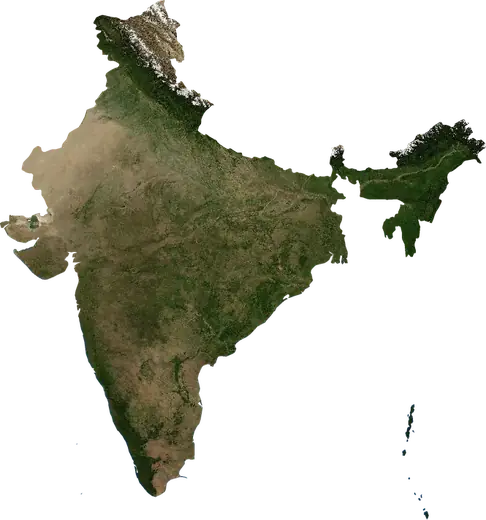
 Nanded
: earthquakes and wildfires
Was there an earthquake or a fire near Nanded just now? Live map within 62 mi, the strongest earthquakes, the largest fires and statistics for Nanded, India.
Live map – Nanded
Earthquakes within 62 mi of the city center.
Key statistics (30 days)
Earthquakes M2.5+ and the wildfire fronts shown on the map.
Recent events in Nanded
- 4 h agoWildfire near Bodhan, India – active59,550 acres · 11 mi SW of Bodhan, India
- 4 h agoWildfire near Nizamabad, India – active10,247 acres · 7 mi NNW of Nizamabad, India
- 27 h agoWildfire near Nizamabad, India – active2,422 acres · 8 mi SW of Nizamabad, India
- 2 days agoWildfire near Nizamabad, India1,636 acres · 4 mi NNE of Nizamabad, India
- 4 days agoWildfire near Dharmabad, India1,858 acres · 8 mi SE of Dharmabad, India
- 4 days agoWildfire near Amur, India1,124 acres · 10 mi NNW of Amur, India
Historical overview
Earthquakes M3.0+ and significant events of other hazards.
About Nanded
Nanded has recorded 6 earthquakes of magnitude 3.0 or more since 2024. The strongest was M4.6 in 2024.
Satellites have detected 4 significant wildfires here; the largest burned about 58,989 acres.
Know the official emergency number, prepare an emergency kit and follow the instructions of your civil protection authority.
Learn more ›Did you feel an earthquake in Nanded?
No reports yet.
Earthquakes
6 earthquakes of magnitude 3.0 or more since 2024 within 62 mi. The strongest was M4.6.
Recent earthquakes
| Mag | Location | Time (UTC) | Depth |
|---|---|---|---|
| 4.1 | 8 mi E of Parbhani, India | 6.2 mi | |
| 4.1 | 34 mi NNE of Nanded, India | 6.2 mi | |
| 4.2 | 11 mi SE of Parbhani, India | 6.2 mi | |
| 4.5 | 9 mi NE of Basmat, India | 6.2 mi |
Strongest earthquakes on record
| Mag | Location | Time (UTC) | Depth |
|---|---|---|---|
| 4.6 | 13 mi NNE of Basmat, India | 6.2 mi | |
| 4.5 | 9 mi NE of Basmat, India | 6.2 mi |
Earthquakes per year (M3.0+)
Year
| 2026 | 4 | M4.5 |
| 2024 | 2 | M4.6 |
Wildfires
4 major fires since 2026 within 62 mi. The largest covered about 58,989 acres.
Recent fires
| Area | Location | Since | Status |
|---|---|---|---|
| 59,550 acres | 11 mi SW of Bodhan, India | Active | |
| 10,247 acres | 7 mi NNW of Nizamabad, India | Active | |
| 2,422 acres | 8 mi SW of Nizamabad, India | Active | |
| 1,636 acres | 4 mi NNE of Nizamabad, India | Inactive | |
| 1,858 acres | 8 mi SE of Dharmabad, India | Inactive | |
| 1,124 acres | 10 mi NNW of Amur, India | Inactive | |
| 9,304 acres | 4 mi N of Bodhan, India | Inactive | |
| 1,161 acres | 8 mi SE of Bodhan, India | Inactive | |
| 3,776 acres | 20 mi SW of Nizamabad, India | Inactive | |
| 1,349 acres | 14 mi N of Nizamabad, India | Inactive |
Show all (11)
| Area | Location | Since | Status |
|---|---|---|---|
| 1,675 acres | 8 mi SSE of Deglur, India | Inactive |
Largest fires on record
| Area | Location | Since | Status |
|---|---|---|---|
| 59,550 acres | 11 mi SW of Bodhan, India | Active | |
| 10,247 acres | 7 mi NNW of Nizamabad, India | Active | |
| 9,304 acres | 4 mi N of Bodhan, India | Inactive | |
| 3,776 acres | 20 mi SW of Nizamabad, India | Inactive |
Nearby places
- Mudkhed 12 mi
- Basmat 16 mi
- Purna 19 mi
- Loha 20 mi
- Kandahar 21 mi
- Bhokar 23 mi
- Mukher 32 mi
- Hadgaon 32 mi
- Kalamnuri 35 mi
- Parbhani 36 mi
- Umarkhed 39 mi
- Gangakher 39 mi
- Dharmabad 40 mi
- Ahmadpur 40 mi
- Hingoli 40 mi
- Bhaisa 42 mi
- Deglur 46 mi
- Bodhan 51 mi
- Jintur 51 mi
- Manwath 54 mi
- Udgir 55 mi
- Parli Vaijnath 55 mi