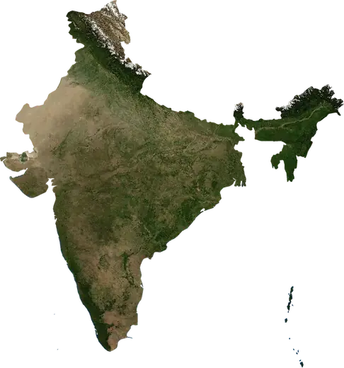
 Odisha
: earthquakes and wildfires
Latest earthquakes and wildfires in Odisha (India) on a live map, the strongest earthquakes and largest fires on record.
Live map – Odisha
Key statistics (30 days)
Earthquakes M2.5+ and the wildfire fronts shown on the map.
Recent events in Odisha
- 7 h agoWildfire near Raurkela Industrial Township, India – active1,258 acres · 33 mi ESE of Raurkela Industrial Township, India
- 7 h agoWildfire near Belpahar, India – active12,056 acres · 18 mi NNW of Belpahar, India
- 7 h agoWildfire near Angul, India – active5,150 acres · 10 mi NW of Angul, India
- 7 h agoWildfire near Angul, India – active8,253 acres · 7 mi WNW of Angul, India
- 7 h agoWildfire near Dhenkanal, India – active9,948 acres · 24 mi WNW of Dhenkanal, India
- 7 h agoWildfire near Byasanagar, India – active5,182 acres · 5 mi W of Byasanagar, India
Historical overview
Earthquakes M3.0+ and significant events of other hazards.
About Odisha
Odisha has recorded 11 earthquakes of magnitude 3.0 or more since 1982. The strongest was M6.0 in 2014.
Satellites have detected 45 significant wildfires here; the largest burned about 15,054 acres.
Know the official emergency number, prepare an emergency kit and follow the instructions of your civil protection authority.
Learn more ›Earthquakes
11 earthquakes of magnitude 3.0 or more since 1982. The strongest was M6.0.
Recent earthquakes
No earthquakes of magnitude 2.5+ in the last 12 months.
Strongest earthquakes on record
| Mag | Location | Time (UTC) | Depth |
|---|---|---|---|
| 6.0 | 172 mi SE of Konarka, India | 29.3 mi | |
| 5.5 | 127 mi SE of Konarka, India | 6.2 mi | |
| 5.5 | 93 mi SSE of Puri, India | 14.9 mi | |
| 5.1 | 139 mi ESE of Paradip Garh, India | 6.2 mi | |
| 4.8 | 9 mi NW of Sundergarh, India | 20.5 mi | |
| 4.7 | 145 mi SE of Konarka, India | 20.5 mi | |
| 4.7 | 10 mi SSE of Koira, India | 20.5 mi | |
| 4.6 | 43 mi SSW of Rourkela, India | 6.2 mi | |
| 4.5 | 144 mi SE of Arjyapalli Marine, India | 20.5 mi | |
| 4.4 | 3 mi N of Dera Colliery Township, India | 20.5 mi | |
| 3.9 | 11 mi WNW of Talcher, India | 6.2 mi |
Earthquakes per year (M3.0+)
Year
| 2025 | 1 | M5.1 |
| 2021 | 1 | M3.9 |
| 2014 | 1 | M6.0 |
| 2001 | 1 | M4.8 |
| 1996 | 1 | M4.7 |
| 1995 | 2 | M4.7 |
| 1992 | 1 | M4.5 |
| 1986 | 1 | M4.4 |
| 1985 | 1 | M5.5 |
| 1982 | 1 | M5.5 |
Wildfires
45 major fires since 2025. The largest covered about 15,054 acres.
Recent fires
| Area | Location | Since | Status |
|---|---|---|---|
| 1,258 acres | 33 mi ESE of Raurkela Industrial Township, India | Active | |
| 12,056 acres | 18 mi NNW of Belpahar, India | Active | |
| 5,150 acres | 10 mi NW of Angul, India | Active | |
| 8,253 acres | 7 mi WNW of Angul, India | Active | |
| 9,948 acres | 24 mi WNW of Dhenkanal, India | Active | |
| 5,182 acres | 5 mi W of Byasanagar, India | Active | |
| 5,204 acres | 8 mi W of Byasanagar, India | Active | |
| 4,099 acres | 15 mi NW of Talcher, India | Active | |
| 13,126 acres | 12 mi SW of Jharsuguda, India | Active | |
| 8,280 acres | near Raurkela Industrial Township, India | Active |
Show all (57)
| Area | Location | Since | Status |
|---|---|---|---|
| 897 acres | near Rajgangpur, India | Active | |
| 4,438 acres | 7 mi WNW of Byasanagar, India | Active | |
| 2,340 acres | 10 mi NNW of Belpahar, India | Active | |
| 1,483 acres | near Koira, India | Active | |
| 8,920 acres | 6 mi S of Jharsuguda, India | Active | |
| 15,054 acres | near Dera Colliery Township, India | Active | |
| 1,488 acres | 33 mi ESE of Raurkela Industrial Township, India | Active | |
| 3,388 acres | near Jharsuguda, India | Active | |
| 7,020 acres | 15 mi NNE of Sambalpur, India | Active | |
| 902 acres | 4 mi NE of Joda, India | Active | |
| 1,302 acres | near Rajgangpur, India | Active | |
| 2,795 acres | near Jharsuguda, India | Active | |
| 875 acres | 23 mi SSW of Balangir, India | Active | |
| 1,339 acres | 33 mi ESE of Bhadrak, India | Inactive | |
| 3,020 acres | 7 mi W of Rourkela, India | Inactive | |
| 1,527 acres | 5 mi S of Paradip Garh, India | Inactive | |
| 764 acres | 24 mi SSE of Barbil, India | Inactive | |
| 937 acres | 11 mi WNW of Cuttack, India | Inactive | |
| 3,272 acres | 56 mi SSE of Balangir, India | Inactive | |
| 2,992 acres | 13 mi WNW of Daringbarhi, India | Inactive | |
| 3,165 acres | 6 mi N of Phulbani, India | Inactive | |
| 7,653 acres | 15 mi NNE of Tikarapara, India | Inactive | |
| 4,599 acres | 37 mi SSE of Balangir, India | Inactive | |
| 4,468 acres | 53 mi S of Balangir, India | Inactive | |
| 4,930 acres | 20 mi S of Rampur, India | Inactive | |
| 7,416 acres | 19 mi SSE of Rampur, India | Inactive | |
| 2,679 acres | 38 mi ENE of Rayagada, India | Inactive | |
| 5,056 acres | 14 mi E of Kurmur, India | Inactive | |
| 3,146 acres | 20 mi E of Nowrangapur, India | Inactive | |
| 2,530 acres | 3 mi SSE of Rampur, India | Inactive | |
| 2,886 acres | 7 mi ENE of Athmallik, India | Inactive | |
| 3,262 acres | 11 mi W of Daspalla, India | Inactive | |
| 7,618 acres | 16 mi SSW of Athmallik, India | Inactive | |
| 3,296 acres | 6 mi N of Athmallik, India | Inactive | |
| 2,572 acres | 8 mi NW of Bangomunda, India | Inactive | |
| 2,582 acres | 38 mi N of Nowrangapur, India | Inactive | |
| 6,390 acres | 25 mi WSW of Kharhial, India | Inactive | |
| 7,136 acres | 49 mi ESE of Nowrangapur, India | Inactive | |
| 2,906 acres | 38 mi NNW of Nowrangapur, India | Inactive | |
| 2,805 acres | 57 mi WNW of Bhawanipatna, India | Inactive | |
| 6,247 acres | 18 mi NNW of Anandpur, India | Inactive | |
| 3,492 acres | 13 mi WSW of Rairangpur, India | Inactive | |
| 4,596 acres | 7 mi W of Khandpara, India | Inactive | |
| 4,502 acres | 10 mi SE of Baripada, India | Inactive | |
| 3,521 acres | 10 mi NW of Kamakhyanagar, India | Inactive | |
| 4,520 acres | 14 mi ESE of Bargarh, India | Inactive | |
| 7,408 acres | 11 mi NE of Jaleshwar, India | Inactive |
Largest fires on record
| Area | Location | Since | Status |
|---|---|---|---|
| 15,054 acres | near Dera Colliery Township, India | Active | |
| 13,126 acres | 12 mi SW of Jharsuguda, India | Active | |
| 12,056 acres | 18 mi NNW of Belpahar, India | Active | |
| 9,948 acres | 24 mi WNW of Dhenkanal, India | Active | |
| 8,920 acres | 6 mi S of Jharsuguda, India | Active | |
| 8,280 acres | near Raurkela Industrial Township, India | Active | |
| 8,253 acres | 7 mi WNW of Angul, India | Active | |
| 7,653 acres | 15 mi NNE of Tikarapara, India | Inactive | |
| 7,618 acres | 16 mi SSW of Athmallik, India | Inactive | |
| 7,416 acres | 19 mi SSE of Rampur, India | Inactive | |
| 7,408 acres | 11 mi NE of Jaleshwar, India | Inactive | |
| 7,136 acres | 49 mi ESE of Nowrangapur, India | Inactive | |
| 7,020 acres | 15 mi NNE of Sambalpur, India | Active | |
| 6,390 acres | 25 mi WSW of Kharhial, India | Inactive | |
| 6,247 acres | 18 mi NNW of Anandpur, India | Inactive |
Major fires per year
Year
| 2026 | 43 | 15,054 acres |
| 2025 | 2 | 7,408 acres |
Places
- Cuttack
- Rourkela
- Raurkela Industrial Township
- Sambalpur
- Baripada
- Bargarh
- Barpali
- Phulbani
- Kantabanji
- Belpahar
- Sundergarh
- Bhawanipatna
- Talcher
- Jharsuguda
- Deogarh
- Angul
- Brajarajnagar
- Baud
- Balangir
- Titlagarh
- Patnagarh
- Malakanagiri
- Hirakud
- Burla
- Dhenkanal
- Bhanjanagar
- Sonepur
- Keonjhargarh
- Bhuban
- Rayagada
- Gunupur
- Rajgangpur
- Choudwar
- Karanjia
- Byasanagar
- Nowrangapur
- Rairangpur
- Khordha
- Jaleshwar
- Soro
- Remuna
- Bhubaneswar
- Balasore
- Polasara
- Jatani
- Jajpur
- Bhadrak
- Basudebpur
- Bada Barabil
- Anandpur
- Barbil
- Joda
- Koraput
- Jeypore
- Asika
- Sunabeda
- Dhamanagar
- Patamundai
- Paralakhemundi
- Paradip Garh
- Kendraparha
- Jagatsinghapur
- Hinjilicut
- Birmitrapur
- Puri
- Brahmapur