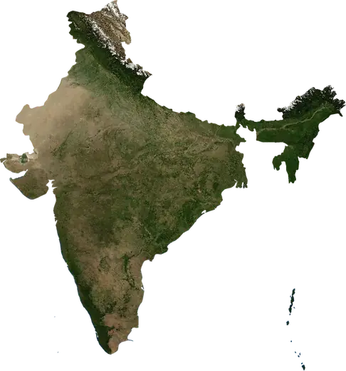
 Andhra Pradesh
: earthquakes and wildfires
Latest earthquakes and wildfires in Andhra Pradesh (India) on a live map, the strongest earthquakes and largest fires on record.
Live map – Andhra Pradesh
Loading live map…
Latest event939 acres6 h ago5 mi WSW of Jaggaiahpet, India
Low
Moderate
High
Very high
Extreme
Very extreme
Forecast: Copernicus EFFIS (FWI index)
Very light rain (0.1–1 mm)
Light rain (1–5 mm)
Moderate rain (5–10 mm)
Heavy rain (10–25 mm)
Very heavy rain (25–50 mm)
Extreme rain (≥ 50 mm)
Forecast: ECMWF via Copernicus EMS – GWIS
Calm (< 7 km/h, 0–1 Bf)
Light breeze (7–18 km/h, 2–3 Bf)
Moderate breeze (18–36 km/h, 4–5 Bf)
Strong breeze (36–54 km/h, 5–7 Bf)
Gale (54–72 km/h, 7–8 Bf)
Storm (≥ 72 km/h, 9+ Bf)
Forecast: ECMWF via Copernicus EMS – GWIS
Very low lightning
Low lightning
Moderate lightning
High lightning
Very high lightning
Extreme lightning
Forecast: ECMWF via Copernicus EMS – GWIS
Earthquakes
Wildfires
Floods
Storms
Volcanoes
Tsunamis
Key statistics (30 days)
Earthquakes M2.5+ and the wildfire fronts shown on the map.
Recent events in Andhra Pradesh
- 6 h agoWildfire near Jaggaiahpet, India – active939 acres · 5 mi WSW of Jaggaiahpet, India
- 6 h agoWildfire near Thummalamenta, India – active1,502 acres · near Thummalamenta, India
- 30 h agoWildfire near Visakhapatnam, India – active7,260 acres · 5 mi S of Visakhapatnam, India
- 3 days agoWildfire near Bobbili, India1,030 acres · near Bobbili, India
- 4 days agoWildfire near Pulivendla, India1,137 acres · 14 mi W of Pulivendla, India
- 4 days agoWildfire near Nandyal, India756 acres · 17 mi S of Nandyal, India
Historical overview
Earthquakes M3.0+ and significant events of other hazards.
About Andhra Pradesh
Andhra Pradesh has recorded 8 earthquakes of magnitude 3.0 or more since 1980. The strongest was M5.1 in 2021.
Satellites have detected 43 significant wildfires here; the largest burned about 25,484 acres.
Know the official emergency number, prepare an emergency kit and follow the instructions of your civil protection authority.
Learn more ›Earthquakes
8 earthquakes of magnitude 3.0 or more since 1980. The strongest was M5.1.
Recent earthquakes
| Mag | Location | Time (UTC) | Depth |
|---|---|---|---|
| 4.5 | 117 mi SE of Yarada, India | 6.2 mi |
Strongest earthquakes on record
| Mag | Location | Time (UTC) | Depth |
|---|---|---|---|
| 5.1 | 161 mi SSE of Razole, India | 6.2 mi | |
| 4.6 | 14 mi W of Piduguralla, India | 20.5 mi | |
| 4.6 | 13 mi E of Ongole, India | 20.5 mi | |
| 4.5 | 117 mi SE of Yarada, India | 6.2 mi | |
| 4.5 | 45 mi NW of Guntur, India | 6.2 mi | |
| 4.5 | 17 mi NE of Rajahmundry, India | 20.5 mi | |
| 4.2 | 83 mi SE of Narasannapeta, India | 6.2 mi | |
| 4.1 | 8 mi ESE of Vinukonda, India | 6.2 mi |
Earthquakes per year (M3.0+)
Year
| 2026 | 1 | M4.5 |
| 2022 | 1 | M4.2 |
| 2021 | 1 | M5.1 |
| 2020 | 1 | M4.5 |
| 1996 | 1 | M4.1 |
| 1995 | 1 | M4.6 |
| 1987 | 1 | M4.6 |
| 1980 | 1 | M4.5 |
Wildfires
43 major fires since 2025. The largest covered about 25,484 acres.
Recent fires
| Area | Location | Since | Status |
|---|---|---|---|
| 939 acres | 5 mi WSW of Jaggaiahpet, India | Active | |
| 1,502 acres | near Thummalamenta, India | Active | |
| 7,260 acres | 5 mi S of Visakhapatnam, India | Active | |
| 1,030 acres | near Bobbili, India | Inactive | |
| 1,137 acres | 14 mi W of Pulivendla, India | Inactive | |
| 756 acres | 17 mi S of Nandyal, India | Inactive | |
| 892 acres | 34 mi N of Vijayawada, India | Inactive | |
| 1,134 acres | 26 mi SSE of Nandyal, India | Inactive | |
| 751 acres | 19 mi NW of Proddatur, India | Inactive | |
| 885 acres | 5 mi WNW of Parvatipuram, India | Inactive |
Show all (58)
Largest fires on record
| Area | Location | Since | Status |
|---|---|---|---|
| 25,484 acres | 16 mi SSW of Razampeta, India | Inactive | |
| 17,831 acres | 20 mi ESE of Guntur, India | Inactive | |
| 12,172 acres | 57 mi N of Rajahmundry, India | Inactive | |
| 9,578 acres | 10 mi NE of Chinnachowk, India | Inactive | |
| 7,351 acres | 21 mi E of Kadapa, India | Inactive | |
| 7,260 acres | 5 mi S of Visakhapatnam, India | Active | |
| 6,936 acres | 20 mi ENE of Nandyal, India | Inactive | |
| 6,828 acres | 11 mi E of Srisailam Project RFC Township, India | Inactive | |
| 5,829 acres | 11 mi WSW of Badvel, India | Inactive | |
| 5,787 acres | 49 mi NNW of Rajahmundry, India | Inactive | |
| 5,651 acres | 10 mi WSW of Srisailain, India | Inactive | |
| 5,429 acres | 19 mi ENE of Nandyal, India | Inactive | |
| 5,419 acres | 11 mi S of Srisailain, India | Inactive | |
| 5,263 acres | 11 mi ENE of Chinnachowk, India | Inactive | |
| 4,814 acres | 22 mi ENE of Nandyal, India | Inactive |
Major fires per year
Year
| 2026 | 40 | 25,484 acres |
| 2025 | 3 | 4,799 acres |
Places
- Vijayawada
- Guntur
- Kakinada
- Rajahmundry
- Ongole
- Thenali
- Bhimavaram
- Narasaraopet
- Tadepalligudem
- Mangalagiri
- Amaravati
- Chilakalurupet
- Giddalur
- Gopavaram
- Nandyal
- Markapur
- Cumbum
- Atmakur
- Srisailain
- Pamuru
- Nandikotkur
- Jammalamadugu
- Badvel
- Srisailam Project RFC Township
- Proddatur
- Kadapa
- Betamcherla
- Chemmumiahpet
- Chinnachowk
- Kanigiri
- Erraguntla
- Banganapalle
- Kanigiri U
- Mamidalapadu
- Podili
- Kurnool
- Rayachoti
- Razampeta
- Venkatagiri
- Pulivendla
- Pileru
- Tirupati
- Nuzvid
- Darsi
- Akkarampalle
- Avilala
- Ibrahimpatnam
- Ramavarappadu
- Kanuru
- Poranki
- Tadepalle
- Sattenapalle
- Renigunta
- Polavaram
- Piduguralla
- Nandigama
- Macherla
- Kondapalle
- Kaikalur
- Gudur
- Eluru
- Dhone
- Rampachodavaram
- Tiruchanur
- Tirupati NMA
- Yanamalakuduru
- Vuyyuru
- Vetapalem
- Tadpatri
- Samalkot
- Repalle
- Ponnuru
- Pithapuram
- Peddapuram
- Pedana
- Madanapalle
- Machilipatnam
- Kovvur
- Gudivada
- Chirala