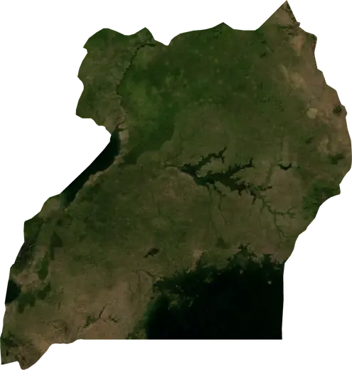
 Ouganda
Tremblements de terre et feux de forêt – Ouganda
Ouganda : derniers tremblements de terre et feux de forêt actifs sur une carte en direct, les séismes les plus forts et les plus grands feux enregistrés, statistiques par année.
Carte en direct – Ouganda
Statistiques clés (30 jours)
Séismes de M2,5+ et fronts d'incendie affichés sur la carte.
Danger d’incendie
Prévision pour la région de : Kampala. Le danger peut varier localement; suivez les consignes officielles. Source : Copernicus EMS – EFFIS (FWI).
Temps violent (prévision)
- Aujourd’hui: Pluie – Pluie extrême (≥ 50 mm) · Mbale
- Demain: Pluie – Pluie extrême (≥ 50 mm) · Mbale
Prévision pour la région de : Ouganda. Ne remplace pas les avertissements du service météorologique national. Source : ECMWF / Copernicus EMS.
Événements récents – Ouganda
- il y a 14 hFeu de forêt près de Moroto, Ouganda – actif7,0 km² · à 14 km OSO de Moroto, Ouganda
- il y a 26 hFeu de forêt près de Koboko, Ouganda – actif3,6 km² · à 49 km O de Koboko, Ouganda
- il y a 37 hFeu de forêt près de Iganga, Ouganda – actif3,8 km² · près de Iganga, Ouganda
- il y a 2 joursFeu de forêt près de Lira, Ouganda26 km² · à 51 km NNE de Lira, Ouganda
- il y a 2 joursFeu de forêt près de Pader, Ouganda13 km² · à 12 km OSO de Pader, Ouganda
- il y a 2 joursFeu de forêt près de Kitgum, Ouganda34 km² · à 48 km ENE de Kitgum, Ouganda
Aperçu historique
Séismes de M3,0+ et événements importants des autres aléas.
À propos – Ouganda
Ouganda a enregistré 103 séismes de magnitude 3,0 ou plus depuis 1977. Le plus fort a été de M6,2 en 1994.
Les satellites y ont détecté 125 feux de forêt importants; le plus grand a brûlé environ 71 km².
Connaissez le numéro d'urgence officiel, préparez une trousse d'urgence et suivez les consignes de votre autorité de sécurité civile.
En savoir plus ›Séismes
Séismes aujourd’hui : Ouganda →
103 séismes de magnitude 3,0 ou plus depuis 1977. Le plus fort : M6,2.
Séismes récents
| Mag. | Lieu | Heure (UTC) | Profondeur |
|---|---|---|---|
| 4,4 | à 27 km N de Nakasongola, Ouganda | 10,0 km | |
| 4,2 | à 8 km E de Mpondwe, Ouganda | 10,0 km |
Séismes les plus forts enregistrés
| Mag. | Lieu | Heure (UTC) | Profondeur |
|---|---|---|---|
| 6,2 | à 10 km SSE de Nyahuka, Ouganda | 14,0 km | |
| 5,6 | à 42 km N de Hoima, Ouganda | 33,0 km | |
| 5,4 | près de Buhesi, Ouganda | 10,0 km | |
| 5,4 | à 6 km OSO de Mpondwe, Ouganda | 33,0 km | |
| 5,3 | à 30 km SSE de Mpondwe, Ouganda | 10,0 km | |
| 5,3 | à 17 km NO de Kasese, Ouganda | 10,0 km | |
| 5,2 | à 53 km ONO de Hoima, Ouganda | 10,0 km | |
| 5,2 | à 9 km O de Hima, Ouganda | 10,0 km | |
| 5,2 | près de Kibiito, Ouganda | 10,0 km | |
| 5,2 | à 30 km OSO de Wanseko, Ouganda | 33,0 km | |
| 5,0 | à 37 km NNO de Hoima, Ouganda | 10,0 km | |
| 5,0 | à 43 km ONO de Hoima, Ouganda | 10,0 km | |
| 5,0 | à 36 km N de Hoima, Ouganda | 33,0 km | |
| 4,9 | près de Buhesi, Ouganda | 10,0 km | |
| 4,9 | à 8 km OSO de Buhesi, Ouganda | 10,0 km |
Séismes par année (M3,0+)
Année
| 2026 | 2 | M4,4 |
| 2025 | 1 | M4,7 |
| 2024 | 2 | M4,5 |
| 2023 | 6 | M4,6 |
| 2022 | 5 | M4,9 |
| 2021 | 3 | M4,5 |
| 2020 | 6 | M4,6 |
| 2019 | 5 | M4,8 |
| 2018 | 1 | M4,5 |
| 2017 | 3 | M5,3 |
| 2015 | 4 | M4,7 |
| 2014 | 2 | M4,5 |
| 2013 | 5 | M5,2 |
| 2012 | 2 | M4,8 |
| 2011 | 1 | M5,0 |
| 2010 | 1 | M4,5 |
| 2009 | 1 | M4,9 |
| 2008 | 1 | M4,4 |
| 2006 | 3 | M5,2 |
| 2005 | 2 | M4,5 |
| 2004 | 5 | M4,8 |
| 2003 | 1 | M3,8 |
| 2002 | 2 | M4,8 |
| 2001 | 1 | M5,3 |
| 1998 | 4 | M4,8 |
| 1997 | 8 | M4,8 |
| 1996 | 2 | M5,4 |
| 1995 | 2 | M4,5 |
| 1994 | 7 | M6,2 |
| 1993 | 1 | M4,9 |
| 1991 | 2 | M5,6 |
| 1990 | 3 | M4,7 |
| 1989 | 1 | M4,8 |
| 1988 | 2 | M4,6 |
| 1986 | 1 | M4,7 |
| 1984 | 1 | M4,7 |
| 1983 | 1 | M5,2 |
| 1979 | 1 | M5,0 |
| 1977 | 2 | M5,4 |
Feux de forêt
125 feux majeurs depuis 2025. Le plus grand couvrait environ 71 km².
Feux récents
| Superficie | Lieu | Depuis | État |
|---|---|---|---|
| 7,0 km² | à 14 km OSO de Moroto, Ouganda | Actif | |
| 3,6 km² | à 49 km O de Koboko, Ouganda | Actif | |
| 3,8 km² | près de Iganga, Ouganda | Actif | |
| 26 km² | à 51 km NNE de Lira, Ouganda | Inactif | |
| 13 km² | à 12 km OSO de Pader, Ouganda | Inactif | |
| 34 km² | à 48 km ENE de Kitgum, Ouganda | Inactif | |
| 10 km² | à 35 km S de Kotido, Ouganda | Inactif | |
| 16 km² | à 37 km NO de Kapchorwa, Ouganda | Inactif | |
| 10 km² | à 26 km E de Abim, Ouganda | Inactif | |
| 16 km² | à 25 km SSO de Kotido, Ouganda | Inactif |
Tout afficher (128)
Plus grands feux enregistrés
| Superficie | Lieu | Depuis | État |
|---|---|---|---|
| 71 km² | à 46 km NNO de Yumbe, Ouganda | Inactif | |
| 43 km² | à 8 km SE de Pakwach, Ouganda | Inactif | |
| 40 km² | à 32 km ESE de Pakwach, Ouganda | Inactif | |
| 37 km² | à 24 km ENE de Kotido, Ouganda | Inactif | |
| 34 km² | à 46 km NNE de Kitgum, Ouganda | Inactif | |
| 34 km² | à 48 km ENE de Kitgum, Ouganda | Actif | |
| 34 km² | à 8 km NE de Lukaya, Ouganda | Inactif | |
| 33 km² | à 28 km NE de Abim, Ouganda | Inactif | |
| 32 km² | à 61 km S de Mbarara, Ouganda | Inactif | |
| 31 km² | à 41 km N de Koboko, Ouganda | Inactif | |
| 26 km² | à 60 km N de Masindi, Ouganda | Inactif | |
| 26 km² | à 51 km NNE de Lira, Ouganda | Actif | |
| 25 km² | à 18 km SSE de Kisinga, Ouganda | Inactif | |
| 25 km² | à 40 km NO de Masindi, Ouganda | Inactif | |
| 25 km² | à 36 km NE de Kitgum, Ouganda | Inactif |
Feux majeurs par année
Année
| 2026 | 74 | 71 km² |
| 2025 | 51 | 37 km² |
Régions
Localités
- Kampala
- Nansana
- Kira
- Bunamwaya
- Kyengera
- Kasangati
- Mbarara
- Njeru
- Mukono
- Gulu
- Kajansi
- Katabi
- Lugazi
- Hoima
- Mubende
- Lira
- Ibanda
- Masaka
- Kasese
- Masindi
- Mityana
- Entebbe
- Rutoma
- Bwizibwera
- Arua
- Koboko
- Fort Portal
- Mpondwe
- Kabale
- Rwamwanja Refugee Camp
- Yumbe
- Paidha
- Nebbi
- Ishaka
- Rukungiri
- Adjumani
- Buyale
- Nyachera
- Kyegegwa
- Pakwach
- Kyenjojo
- Kagadi
- Muhorro
- Kyaka II Refugee Camp
- Kasozi
- Anaka
- Kamwenge
- Kyangwali Refugee Camp
- Opit
- Rubanda
- Bundibugyo
- Kigumba
- Ntungamo
- Lwakyomba
- Kihihi
- Kitgum
- Abim
- Kotido
- Soroti
- Mabare
- Isingiro
- Nakivale Refugee Camp
- Kapchorwa
- Kumi
- Kasaali
- Kalisizo
- Nakaloke
- Iryango
- Mbale
- Apac
- Pallisa
- Butaleja
- Budaka
- Dokolo
- Namayumba
- Mpigi
- Lukaya
- Kasanje
- Bukuya