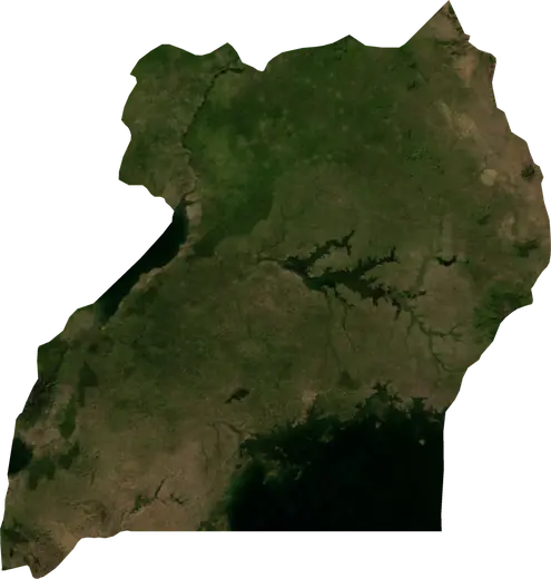
 Ouest
Tremblements de terre et feux de forêt – Ouest
Ouest (Ouganda) : derniers séismes et feux de forêt sur une carte en direct, les séismes les plus forts et les plus grands feux enregistrés.
Carte en direct – Ouest
Chargement de la carte en direct…
Dernier événement13 km²il y a 76 joursà 15 km N de Kihihi, Ouganda
Faible
Modéré
Élevé
Très élevé
Extrême
Très extrême
Prévision : Copernicus EFFIS (indice FWI)
Pluie très faible (0.1–1 mm)
Pluie faible (1–5 mm)
Pluie modérée (5–10 mm)
Pluie forte (10–25 mm)
Pluie très forte (25–50 mm)
Pluie extrême (≥ 50 mm)
Prévision : ECMWF via Copernicus EMS – GWIS
Calme (< 7 km/h, 0–1 Bf)
Brise légère (7–18 km/h, 2–3 Bf)
Brise modérée (18–36 km/h, 4–5 Bf)
Vent fort (36–54 km/h, 5–7 Bf)
Coup de vent (54–72 km/h, 7–8 Bf)
Tempête (≥ 72 km/h, 9+ Bf)
Prévision : ECMWF via Copernicus EMS – GWIS
Très peu de foudre
Peu de foudre
Activité orageuse modérée
Activité orageuse élevée
Activité orageuse très élevée
Activité orageuse extrême
Prévision : ECMWF via Copernicus EMS – GWIS
Séismes
Feux de forêt
Inondations
Tempêtes
Volcans
Tsunamis
Statistiques clés (30 jours)
Séismes de M2,5+ et fronts d'incendie affichés sur la carte.
Événements récents – Ouest
- il y a 76 joursFeu de forêt près de Kihihi, Ouganda13 km² · à 15 km N de Kihihi, Ouganda
- il y a 77 joursFeu de forêt près de Mpondwe, Ouganda13 km² · à 14 km O de Mpondwe, Ouganda
- il y a 141 joursFeu de forêt près de Kyamahungu, Ouganda10 km² · à 32 km O de Kyamahungu, Ouganda
- il y a 149 joursFeu de forêt près de Mbarara, Ouganda32 km² · à 61 km S de Mbarara, Ouganda
- il y a 154 joursFeu de forêt près de Mbarara, Ouganda13 km² · à 58 km SSO de Mbarara, Ouganda
- 4,2il y a 194 joursSéisme de magnitude 4,2 près de Mpondwe, Ougandaà 8 km E de Mpondwe, Ouganda
Aperçu historique
Séismes de M3,0+ et événements importants des autres aléas.
À propos – Ouest
Ouest a enregistré 84 séismes de magnitude 3,0 ou plus depuis 1977. Le plus fort a été de M6,2 en 1994.
Les satellites y ont détecté 14 feux de forêt importants; le plus grand a brûlé environ 32 km².
Connaissez le numéro d'urgence officiel, préparez une trousse d'urgence et suivez les consignes de votre autorité de sécurité civile.
En savoir plus ›Séismes
84 séismes de magnitude 3,0 ou plus depuis 1977. Le plus fort : M6,2.
Séismes récents
| Mag. | Lieu | Heure (UTC) | Profondeur |
|---|---|---|---|
| 4,2 | à 8 km E de Mpondwe, Ouganda | 10,0 km |
Séismes les plus forts enregistrés
| Mag. | Lieu | Heure (UTC) | Profondeur |
|---|---|---|---|
| 6,2 | à 10 km SSE de Nyahuka, Ouganda | 14,0 km | |
| 5,6 | à 42 km N de Hoima, Ouganda | 33,0 km | |
| 5,4 | près de Buhesi, Ouganda | 10,0 km | |
| 5,4 | à 6 km OSO de Mpondwe, Ouganda | 33,0 km | |
| 5,3 | à 30 km SSE de Mpondwe, Ouganda | 10,0 km | |
| 5,3 | à 17 km NO de Kasese, Ouganda | 10,0 km | |
| 5,2 | à 53 km ONO de Hoima, Ouganda | 10,0 km | |
| 5,2 | à 9 km O de Hima, Ouganda | 10,0 km | |
| 5,2 | près de Kibiito, Ouganda | 10,0 km | |
| 5,2 | à 30 km OSO de Wanseko, Ouganda | 33,0 km | |
| 5,0 | à 37 km NNO de Hoima, Ouganda | 10,0 km | |
| 5,0 | à 43 km ONO de Hoima, Ouganda | 10,0 km | |
| 5,0 | à 36 km N de Hoima, Ouganda | 33,0 km | |
| 4,9 | près de Buhesi, Ouganda | 10,0 km | |
| 4,9 | à 8 km OSO de Buhesi, Ouganda | 10,0 km |
Séismes par année (M3,0+)
Année
| 2026 | 1 | M4,2 |
| 2025 | 1 | M4,7 |
| 2024 | 2 | M4,5 |
| 2023 | 6 | M4,6 |
| 2022 | 4 | M4,9 |
| 2021 | 1 | M4,5 |
| 2020 | 6 | M4,6 |
| 2019 | 4 | M4,6 |
| 2018 | 1 | M4,5 |
| 2017 | 3 | M5,3 |
| 2015 | 3 | M4,7 |
| 2014 | 2 | M4,5 |
| 2013 | 5 | M5,2 |
| 2012 | 2 | M4,8 |
| 2011 | 1 | M5,0 |
| 2009 | 1 | M4,9 |
| 2006 | 3 | M5,2 |
| 2005 | 2 | M4,5 |
| 2004 | 4 | M4,8 |
| 2003 | 1 | M3,8 |
| 2002 | 1 | M4,8 |
| 2001 | 1 | M5,3 |
| 1998 | 4 | M4,8 |
| 1997 | 2 | M4,6 |
| 1996 | 2 | M5,4 |
| 1995 | 2 | M4,5 |
| 1994 | 7 | M6,2 |
| 1993 | 1 | M4,9 |
| 1991 | 2 | M5,6 |
| 1989 | 1 | M4,8 |
| 1988 | 2 | M4,6 |
| 1986 | 1 | M4,7 |
| 1984 | 1 | M4,7 |
| 1983 | 1 | M5,2 |
| 1979 | 1 | M5,0 |
| 1977 | 2 | M5,4 |
Feux de forêt
14 feux majeurs depuis 2025. Le plus grand couvrait environ 32 km².
Feux récents
| Superficie | Lieu | Depuis | État |
|---|---|---|---|
| 13 km² | à 15 km N de Kihihi, Ouganda | Inactif | |
| 13 km² | à 14 km O de Mpondwe, Ouganda | Inactif | |
| 10 km² | à 32 km O de Kyamahungu, Ouganda | Inactif | |
| 32 km² | à 61 km S de Mbarara, Ouganda | Inactif | |
| 13 km² | à 58 km SSO de Mbarara, Ouganda | Inactif | |
| 14 km² | à 18 km SSO de Mpondwe, Ouganda | Inactif | |
| 19 km² | à 50 km SSO de Kasese, Ouganda | Inactif | |
| 13 km² | à 27 km NNE de Kihihi, Ouganda | Inactif | |
| 26 km² | à 60 km N de Masindi, Ouganda | Inactif | |
| 22 km² | à 43 km N de Masindi, Ouganda | Inactif |
Tout afficher (14)
| Superficie | Lieu | Depuis | État |
|---|---|---|---|
| 25 km² | à 18 km SSE de Kisinga, Ouganda | Inactif | |
| 18 km² | à 21 km ONO de Kihihi, Ouganda | Inactif | |
| 18 km² | à 38 km ONO de Masindi, Ouganda | Inactif | |
| 25 km² | à 40 km NO de Masindi, Ouganda | Inactif |
Plus grands feux enregistrés
| Superficie | Lieu | Depuis | État |
|---|---|---|---|
| 32 km² | à 61 km S de Mbarara, Ouganda | Inactif | |
| 26 km² | à 60 km N de Masindi, Ouganda | Inactif | |
| 25 km² | à 18 km SSE de Kisinga, Ouganda | Inactif | |
| 25 km² | à 40 km NO de Masindi, Ouganda | Inactif | |
| 22 km² | à 43 km N de Masindi, Ouganda | Inactif | |
| 19 km² | à 50 km SSO de Kasese, Ouganda | Inactif | |
| 18 km² | à 21 km ONO de Kihihi, Ouganda | Inactif | |
| 18 km² | à 38 km ONO de Masindi, Ouganda | Inactif | |
| 14 km² | à 18 km SSO de Mpondwe, Ouganda | Inactif | |
| 13 km² | à 58 km SSO de Mbarara, Ouganda | Inactif | |
| 13 km² | à 27 km NNE de Kihihi, Ouganda | Inactif | |
| 13 km² | à 14 km O de Mpondwe, Ouganda | Inactif | |
| 13 km² | à 15 km N de Kihihi, Ouganda | Inactif | |
| 10 km² | à 32 km O de Kyamahungu, Ouganda | Inactif |
Feux majeurs par année
Année
| 2026 | 11 | 32 km² |
| 2025 | 3 | 25 km² |
Localités
- Mbarara
- Hoima
- Ibanda
- Kasese
- Masindi
- Rutoma
- Bwizibwera
- Fort Portal
- Mpondwe
- Kabale
- Rwamwanja Refugee Camp
- Ishaka
- Rukungiri
- Buyale
- Nyachera
- Kyegegwa
- Kyenjojo
- Kagadi
- Muhorro
- Kyaka II Refugee Camp
- Kasozi
- Kamwenge
- Kyangwali Refugee Camp
- Rubanda
- Bundibugyo
- Kigumba
- Ntungamo
- Lwakyomba
- Kihihi
- Mabare
- Isingiro
- Nakivale Refugee Camp
- Iryango