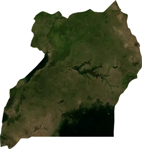
 Uganda
Cutremure și incendii de vegetație în Uganda
Ultimele cutremure și incendii de vegetație active din Uganda pe o hartă live, cele mai puternice cutremure și cele mai mari incendii înregistrate, statistici pe ani.
Hartă live – Uganda
Statistici principale (30 de zile)
Cutremure M2.5+ și fronturile de incendiu afișate pe hartă.
Pericol de incendiu
Prognoză pentru zona din jurul: Kampala. Pericolul poate varia local; urmați instrucțiunile autorităților. Sursa: Copernicus EMS – EFFIS (FWI).
Vreme severă (prognoză)
- Azi: Ploaie – Ploaie extremă (≥ 50 mm) · Mbale
- Mâine: Ploaie – Ploaie extremă (≥ 50 mm) · Mbale
Prognoză pentru zona din jurul: Uganda. Nu înlocuiește avertizările serviciului meteorologic național. Sursa: ECMWF / Copernicus EMS.
Evenimente recente – Uganda
- acum 12 hIncendiu de vegetație activ lângă Moroto, Uganda7,0 km² · la 14 km VSV de Moroto, Uganda
- acum 24 hIncendiu de vegetație activ lângă Koboko, Uganda3,6 km² · la 49 km V de Koboko, Uganda
- acum 35 hIncendiu de vegetație activ lângă Iganga, Uganda3,8 km² · lângă Iganga, Uganda
- acum 48 hIncendiu de vegetație activ lângă Lira, Uganda26 km² · la 51 km NNE de Lira, Uganda
- acum 48 hIncendiu de vegetație activ lângă Pader, Uganda13 km² · la 12 km VSV de Pader, Uganda
- acum 48 hIncendiu de vegetație activ lângă Kitgum, Uganda34 km² · la 48 km ENE de Kitgum, Uganda
Privire istorică
Cutremure M3,0+ și evenimente importante ale altor hazarduri.
Despre Uganda
Uganda: au fost înregistrate 103 cutremure cu magnitudine 3,0 sau mai mare din 1977. Cel mai puternic a fost M6,2, în 1994.
Sateliții au detectat aici 125 incendii de vegetație importante; cel mai mare a ars aproximativ 71 km².
Află numărul oficial de urgență, pregătește un kit de urgență și urmează instrucțiunile autorităților de protecție civilă.
Află mai multe ›Cutremure
103 cutremure cu magnitudinea de cel puțin 3,0 din 1977. Cel mai puternic a avut M6,2.
Cutremure recente
| Mag. | Locație | Ora (UTC) | Adâncime |
|---|---|---|---|
| 4,4 | la 27 km N de Nakasongola, Uganda | 10,0 km | |
| 4,2 | la 8 km E de Mpondwe, Uganda | 10,0 km |
Cele mai puternice cutremure înregistrate
| Mag. | Locație | Ora (UTC) | Adâncime |
|---|---|---|---|
| 6,2 | la 10 km SSE de Nyahuka, Uganda | 14,0 km | |
| 5,6 | la 42 km N de Hoima, Uganda | 33,0 km | |
| 5,4 | lângă Buhesi, Uganda | 10,0 km | |
| 5,4 | la 6 km VSV de Mpondwe, Uganda | 33,0 km | |
| 5,3 | la 30 km SSE de Mpondwe, Uganda | 10,0 km | |
| 5,3 | la 17 km NV de Kasese, Uganda | 10,0 km | |
| 5,2 | la 53 km VNV de Hoima, Uganda | 10,0 km | |
| 5,2 | la 9 km V de Hima, Uganda | 10,0 km | |
| 5,2 | lângă Kibiito, Uganda | 10,0 km | |
| 5,2 | la 30 km VSV de Wanseko, Uganda | 33,0 km | |
| 5,0 | la 37 km NNV de Hoima, Uganda | 10,0 km | |
| 5,0 | la 43 km VNV de Hoima, Uganda | 10,0 km | |
| 5,0 | la 36 km N de Hoima, Uganda | 33,0 km | |
| 4,9 | lângă Buhesi, Uganda | 10,0 km | |
| 4,9 | la 8 km VSV de Buhesi, Uganda | 10,0 km |
Cutremure pe an (magnitudine 3,0+)
An
| 2026 | 2 | M4,4 |
| 2025 | 1 | M4,7 |
| 2024 | 2 | M4,5 |
| 2023 | 6 | M4,6 |
| 2022 | 5 | M4,9 |
| 2021 | 3 | M4,5 |
| 2020 | 6 | M4,6 |
| 2019 | 5 | M4,8 |
| 2018 | 1 | M4,5 |
| 2017 | 3 | M5,3 |
| 2015 | 4 | M4,7 |
| 2014 | 2 | M4,5 |
| 2013 | 5 | M5,2 |
| 2012 | 2 | M4,8 |
| 2011 | 1 | M5,0 |
| 2010 | 1 | M4,5 |
| 2009 | 1 | M4,9 |
| 2008 | 1 | M4,4 |
| 2006 | 3 | M5,2 |
| 2005 | 2 | M4,5 |
| 2004 | 5 | M4,8 |
| 2003 | 1 | M3,8 |
| 2002 | 2 | M4,8 |
| 2001 | 1 | M5,3 |
| 1998 | 4 | M4,8 |
| 1997 | 8 | M4,8 |
| 1996 | 2 | M5,4 |
| 1995 | 2 | M4,5 |
| 1994 | 7 | M6,2 |
| 1993 | 1 | M4,9 |
| 1991 | 2 | M5,6 |
| 1990 | 3 | M4,7 |
| 1989 | 1 | M4,8 |
| 1988 | 2 | M4,6 |
| 1986 | 1 | M4,7 |
| 1984 | 1 | M4,7 |
| 1983 | 1 | M5,2 |
| 1979 | 1 | M5,0 |
| 1977 | 2 | M5,4 |
Incendii de vegetație
125 incendii majore din 2025. Cel mai mare a acoperit aproximativ 71 km².
Incendii recente
| Suprafață | Locație | Din | Stare |
|---|---|---|---|
| 7,0 km² | la 14 km VSV de Moroto, Uganda | Activ | |
| 3,6 km² | la 49 km V de Koboko, Uganda | Activ | |
| 3,8 km² | lângă Iganga, Uganda | Activ | |
| 26 km² | la 51 km NNE de Lira, Uganda | Activ | |
| 13 km² | la 12 km VSV de Pader, Uganda | Activ | |
| 34 km² | la 48 km ENE de Kitgum, Uganda | Activ | |
| 10 km² | la 35 km S de Kotido, Uganda | Inactiv | |
| 16 km² | la 37 km NV de Kapchorwa, Uganda | Inactiv | |
| 10 km² | la 26 km E de Abim, Uganda | Inactiv | |
| 16 km² | la 25 km SSV de Kotido, Uganda | Inactiv |
Afișează tot (128)
Cele mai mari incendii înregistrate
| Suprafață | Locație | Din | Stare |
|---|---|---|---|
| 71 km² | la 46 km NNV de Yumbe, Uganda | Inactiv | |
| 43 km² | la 8 km SE de Pakwach, Uganda | Inactiv | |
| 40 km² | la 32 km ESE de Pakwach, Uganda | Inactiv | |
| 37 km² | la 24 km ENE de Kotido, Uganda | Inactiv | |
| 34 km² | la 46 km NNE de Kitgum, Uganda | Inactiv | |
| 34 km² | la 48 km ENE de Kitgum, Uganda | Activ | |
| 34 km² | la 8 km NE de Lukaya, Uganda | Inactiv | |
| 33 km² | la 28 km NE de Abim, Uganda | Inactiv | |
| 32 km² | la 61 km S de Mbarara, Uganda | Inactiv | |
| 31 km² | la 41 km N de Koboko, Uganda | Inactiv | |
| 26 km² | la 60 km N de Masindi, Uganda | Inactiv | |
| 26 km² | la 51 km NNE de Lira, Uganda | Activ | |
| 25 km² | la 18 km SSE de Kisinga, Uganda | Inactiv | |
| 25 km² | la 40 km NV de Masindi, Uganda | Inactiv | |
| 25 km² | la 36 km NE de Kitgum, Uganda | Inactiv |
Incendii majore pe an
An
| 2026 | 74 | 71 km² |
| 2025 | 51 | 37 km² |
Regiuni
Localități
- Kampala
- Nansana
- Kira
- Bunamwaya
- Kyengera
- Kasangati
- Mbarara
- Njeru
- Mukono
- Gulu
- Kajansi
- Katabi
- Lugazi
- Hoima
- Mubende
- Lira
- Ibanda
- Masaka
- Kasese
- Masindi
- Mityana
- Entebbe
- Rutoma
- Bwizibwera
- Arua
- Koboko
- Fort Portal
- Mpondwe
- Kabale
- Rwamwanja Refugee Camp
- Yumbe
- Paidha
- Nebbi
- Ishaka
- Rukungiri
- Adjumani
- Buyale
- Nyachera
- Kyegegwa
- Pakwach
- Kyenjojo
- Kagadi
- Muhorro
- Kyaka II Refugee Camp
- Kasozi
- Anaka
- Kamwenge
- Kyangwali Refugee Camp
- Opit
- Rubanda
- Bundibugyo
- Kigumba
- Ntungamo
- Lwakyomba
- Kihihi
- Kitgum
- Abim
- Kotido
- Soroti
- Mabare
- Isingiro
- Nakivale Refugee Camp
- Kapchorwa
- Kumi
- Kasaali
- Kalisizo
- Nakaloke
- Iryango
- Mbale
- Apac
- Pallisa
- Butaleja
- Budaka
- Dokolo
- Namayumba
- Mpigi
- Lukaya
- Kasanje
- Bukuya