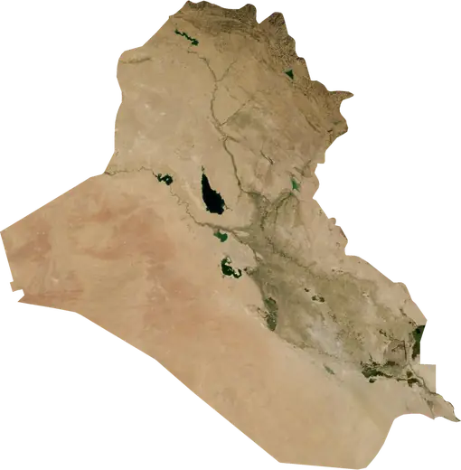
 Dihok
Dihok: earthquakes and wildfires
Was there an earthquake or a fire near Dihok just now? Live map within 62 mi, the strongest earthquakes, the largest fires and statistics for Dihok, Iraq.
Live map – Dihok
Earthquakes within 62 mi of the city center.
Key statistics (30 days)
Earthquakes M2.5+ and the wildfire fronts shown on the map.
Recent events in Dihok
- 2 days agoWildfire near Dereluk Devera Niheliya, Iraq4,250 acres · 17 mi SW of Dereluk Devera Niheliya, Iraq
- 2 days agoWildfire near Mosul, Iraq2,446 acres · 42 mi NNE of Mosul, Iraq
- 2 days agoWildfire near Mosul, Iraq2,491 acres · 32 mi NNE of Mosul, Iraq
- 2 days agoWildfire near Mosul, Iraq1,463 acres · 35 mi NE of Mosul, Iraq
- 2 days agoWildfire near Erbil, Iraq4,112 acres · 16 mi WNW of Erbil, Iraq
- 2 days agoWildfire near Al Mawsil al Jadidah, Iraq2,689 acres · 12 mi NW of Al Mawsil al Jadidah, Iraq
Historical overview
Earthquakes M3.0+ and significant events of other hazards.
About Dihok
Dihok has recorded 51 earthquakes of magnitude 3.0 or more since 1982. The strongest was M5.3 in 2012.
Satellites have detected 18 significant wildfires here; the largest burned about 10,235 acres.
Know the official emergency number, prepare an emergency kit and follow the instructions of your civil protection authority.
Learn more ›Did you feel an earthquake in Dihok?
No reports yet.
Earthquakes
51 earthquakes of magnitude 3.0 or more since 1982 within 62 mi. The strongest was M5.3.
Recent earthquakes
No earthquakes of magnitude 2.5+ in the last 12 months.
Strongest earthquakes on record
| Mag | Location | Time (UTC) | Depth |
|---|---|---|---|
| 5.3 | 8 mi ESE of Cizre, Republic of Türkiye | 3.1 mi | |
| 5.1 | 10 mi W of Cey, Republic of Türkiye | 6.2 mi | |
| 5.0 | 24 mi NE of Zaxo, Iraq | 10.9 mi | |
| 4.9 | 29 mi NE of Mosul, Iraq | 4.3 mi | |
| 4.8 | 22 mi NNE of Silopi, Republic of Türkiye | 6.2 mi | |
| 4.8 | 5 mi WSW of Zaxo, Iraq | 20.5 mi | |
| 4.7 | 4 mi S of 'Akra, Iraq | 20.5 mi | |
| 4.7 | 8 mi NNW of Sumayl, Iraq | 20.5 mi | |
| 4.7 | 28 mi NW of Erbil, Iraq | 20.5 mi | |
| 4.7 | 29 mi N of Erbil, Iraq | 20.5 mi | |
| 4.7 | 6 mi ENE of Silopi, Republic of Türkiye | 6.2 mi | |
| 4.7 | 5 mi WNW of Zaxo, Iraq | 10.5 mi | |
| 4.7 | 35 mi N of Erbil, Iraq | 41.6 mi | |
| 4.7 | 6 mi ESE of Silopi, Republic of Türkiye | 6.2 mi | |
| 4.6 | 7 mi NNE of Sheladiz, Iraq | 6.2 mi |
Earthquakes per year (M3.0+)
Year
| 2024 | 1 | M4.3 |
| 2023 | 1 | M4.3 |
| 2021 | 1 | M4.4 |
| 2019 | 1 | M4.3 |
| 2018 | 1 | M4.1 |
| 2013 | 3 | M4.9 |
| 2012 | 4 | M5.3 |
| 2011 | 5 | M5.1 |
| 2008 | 1 | M4.0 |
| 2005 | 6 | M4.3 |
| 2003 | 3 | M4.8 |
| 2002 | 3 | M4.5 |
| 2000 | 1 | M3.9 |
| 1999 | 3 | M4.2 |
| 1998 | 1 | M3.7 |
| 1997 | 2 | M4.7 |
| 1996 | 1 | M3.5 |
| 1993 | 1 | M4.7 |
| 1991 | 5 | M4.8 |
| 1989 | 1 | M4.6 |
| 1988 | 2 | M4.7 |
| 1984 | 2 | M4.6 |
| 1983 | 1 | M4.6 |
| 1982 | 1 | M4.7 |
Wildfires
18 major fires since 2026 within 62 mi. The largest covered about 10,235 acres.
Recent fires
| Area | Location | Since | Status |
|---|---|---|---|
| 4,250 acres | 17 mi SW of Dereluk Devera Niheliya, Iraq | Inactive | |
| 2,446 acres | 42 mi NNE of Mosul, Iraq | Inactive | |
| 2,491 acres | 32 mi NNE of Mosul, Iraq | Inactive | |
| 1,463 acres | 35 mi NE of Mosul, Iraq | Inactive | |
| 4,112 acres | 16 mi WNW of Erbil, Iraq | Inactive | |
| 2,689 acres | 12 mi NW of Al Mawsil al Jadidah, Iraq | Inactive | |
| 10,235 acres | 34 mi WSW of Zaxo, Iraq | Inactive | |
| 1,067 acres | 29 mi NNE of Mosul, Iraq | Inactive | |
| 2,355 acres | 9 mi WSW of Zaxo, Iraq | Inactive | |
| 2,528 acres | 36 mi WSW of Zaxo, Iraq | Inactive |
Show all (27)
| Area | Location | Since | Status |
|---|---|---|---|
| 1,226 acres | 11 mi E of Sinjar, Iraq | Inactive | |
| 3,202 acres | 7 mi W of Zaxo, Iraq | Inactive | |
| 2,004 acres | 11 mi S of Zaxo, Iraq | Inactive | |
| 1,653 acres | 24 mi N of Mosul, Iraq | Inactive | |
| 749 acres | 27 mi NE of Mosul, Iraq | Inactive | |
| 944 acres | 37 mi NNW of Erbil, Iraq | Inactive | |
| 1,401 acres | 5 mi WNW of Silopi, Republic of Türkiye | Inactive | |
| 934 acres | 8 mi SE of Cizre, Republic of Türkiye | Inactive | |
| 3,104 acres | 4 mi W of Sumayl, Iraq | Inactive | |
| 939 acres | 14 mi S of Silopi, Republic of Türkiye | Inactive | |
| 857 acres | 9 mi W of Silopi, Republic of Türkiye | Inactive | |
| 3,842 acres | 22 mi S of Al Malikiyah, Syria | Inactive | |
| 1,092 acres | 4 mi WSW of Silopi, Republic of Türkiye | Inactive | |
| 1,053 acres | 6 mi WNW of Silopi, Republic of Türkiye | Inactive | |
| 1,562 acres | 8 mi SW of Silopi, Republic of Türkiye | Inactive | |
| 897 acres | 6 mi SSE of Silopi, Republic of Türkiye | Inactive | |
| 2,422 acres | 6 mi SSW of Silopi, Republic of Türkiye | Inactive |
Largest fires on record
| Area | Location | Since | Status |
|---|---|---|---|
| 10,235 acres | 34 mi WSW of Zaxo, Iraq | Inactive | |
| 4,250 acres | 17 mi SW of Dereluk Devera Niheliya, Iraq | Inactive | |
| 4,112 acres | 16 mi WNW of Erbil, Iraq | Inactive | |
| 3,842 acres | 22 mi S of Al Malikiyah, Syria | Inactive | |
| 3,202 acres | 7 mi W of Zaxo, Iraq | Inactive | |
| 3,104 acres | 4 mi W of Sumayl, Iraq | Inactive | |
| 2,689 acres | 12 mi NW of Al Mawsil al Jadidah, Iraq | Inactive | |
| 2,528 acres | 36 mi WSW of Zaxo, Iraq | Inactive | |
| 2,491 acres | 32 mi NNE of Mosul, Iraq | Inactive | |
| 2,422 acres | 6 mi SSW of Silopi, Republic of Türkiye | Inactive | |
| 1,562 acres | 8 mi SW of Silopi, Republic of Türkiye | Inactive | |
| 1,401 acres | 5 mi WNW of Silopi, Republic of Türkiye | Inactive | |
| 1,092 acres | 4 mi WSW of Silopi, Republic of Türkiye | Inactive | |
| 1,053 acres | 6 mi WNW of Silopi, Republic of Türkiye | Inactive | |
| 939 acres | 14 mi S of Silopi, Republic of Türkiye | Inactive |
Nearby places
- Sinah 5 mi
- Simele 8 mi
- Sumayl 8 mi
- Batifa 21 mi
- Zaxo 26 mi
- Tallkayf 27 mi
- Mosul 37 mi
- Al Mawsil al Jadidah 37 mi
- Dereluk Devera Niheliya 39 mi
- Silopi 39 mi
- Sheladiz 45 mi
- Al-Hamdaniya 46 mi
- 'Akra 50 mi
- Akre 51 mi
- Al Malikiyah 51 mi
- Sirnak 54 mi