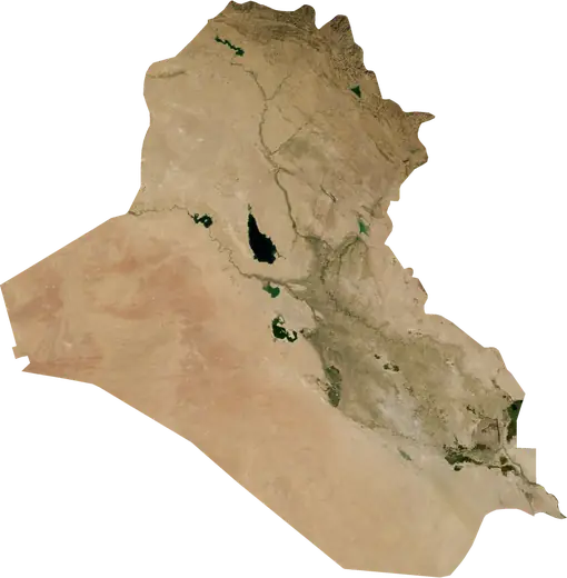
 Iraq
Iraq: earthquakes and wildfires
Latest earthquakes and active wildfires in Iraq on a live map, the strongest earthquakes and largest fires on record, and statistics by year.
Live map – Iraq
Key statistics (30 days)
Earthquakes M2.5+ and the wildfire fronts shown on the map.
Fire danger
Forecast for the area around: Ash Shatrah. Danger can vary locally; follow official guidance. Source: Copernicus EMS – EFFIS (FWI).
Severe weather (forecast)
The forecast shows no heavy rain, gales or thunderstorms for today and tomorrow.
Forecast for the area around: Iraq. It does not replace warnings from the national weather service. Source: ECMWF / Copernicus EMS.
Recent events in Iraq
- 6 h agoWildfire near Kirkuk, Iraq – active2,375 acres · near Kirkuk, Iraq
- 6 h agoWildfire near Kirkuk, Iraq – active1,858 acres · 9 mi NW of Kirkuk, Iraq
- 6 h agoWildfire near Mosul, Iraq – active2,451 acres · 32 mi NNE of Mosul, Iraq
- 6 h agoWildfire near Zaxo, Iraq – active10,037 acres · 34 mi WSW of Zaxo, Iraq
- 6 h agoWildfire near Baghdad, Iraq – active2,491 acres · 4 mi SSE of Baghdad, Iraq
- 6 h agoWildfire near Kirkuk, Iraq – active1,028 acres · 26 mi NNW of Kirkuk, Iraq
Historical overview
Earthquakes M3.0+ and significant events of other hazards.
About Iraq
Iraq has recorded 454 earthquakes of magnitude 3.0 or more since 1980. The strongest was M7.3 in 2017.
Satellites have detected 63 significant wildfires here; the largest burned about 11,073 acres.
Know the official emergency number, prepare an emergency kit and follow the instructions of your civil protection authority.
Learn more ›Earthquakes
454 earthquakes of magnitude 3.0 or more since 1980. The strongest was M7.3.
Recent earthquakes
| Mag | Location | Time (UTC) | Depth |
|---|---|---|---|
| 4.2 | 5 mi NE of Khanaqin, Iraq | 6.2 mi | |
| 4.1 | 12 mi SE of Kirkuk, Iraq | 6.2 mi | |
| 4.4 | 19 mi SE of Kirkuk, Iraq | 6.2 mi | |
| 4.1 | 11 mi SE of Kirkuk, Iraq | 6.2 mi | |
| 4.1 | 13 mi SE of Kirkuk, Iraq | 6.2 mi | |
| 4.3 | 11 mi SE of Kirkuk, Iraq | 6.2 mi | |
| 4.1 | 15 mi WSW of Khanaqin, Iraq | 6.2 mi | |
| 4.2 | 43 mi NE of Kut, Iraq | 6.2 mi | |
| 4.9 | 38 mi SSE of Kelar, Iraq | 6.2 mi | |
| 4.6 | 21 mi SE of Kelar, Iraq | 6.2 mi |
Show all (17)
| Mag | Location | Time (UTC) | Depth |
|---|---|---|---|
| 4.3 | 16 mi NW of Mandali, Iraq | 6.2 mi | |
| 4.1 | 17 mi WNW of Mandali, Iraq | 6.2 mi | |
| 4.2 | 34 mi NNE of Basra, Iraq | 6.2 mi | |
| 4.8 | 42 mi NNE of Basra, Iraq | 6.2 mi | |
| 4.0 | 12 mi NNE of Al-'Alam, Iraq | 6.2 mi | |
| 4.5 | 11 mi E of Khanaqin, Iraq | 6.2 mi | |
| 4.3 | 13 mi E of Bayji, Iraq | 6.2 mi |
Strongest earthquakes on record
| Mag | Location | Time (UTC) | Depth |
|---|---|---|---|
| 7.3 | 19 mi S of Halabja, Iraq | 11.8 mi | |
| 5.8 | 13 mi ESE of Khanaqin, Iraq | 8.7 mi | |
| 5.8 | 6 mi SSE of Koysinceq, Iraq | 20.5 mi | |
| 5.6 | 40 mi SSE of Kelar, Iraq | 8.7 mi | |
| 5.6 | 15 mi SE of Kelar, Iraq | 3.7 mi | |
| 5.5 | 10 mi ESE of Mandali, Iraq | 6.2 mi | |
| 5.4 | 5 mi ESE of Derbendixan, Iraq | 10.9 mi | |
| 5.4 | 18 mi SE of Khanaqin, Iraq | 8.7 mi | |
| 5.4 | 62 mi SSW of Al Mawsil al Jadidah, Iraq | 11.2 mi | |
| 5.3 | 19 mi SE of Mandali, Iraq | 6.2 mi | |
| 5.3 | 9 mi ESE of Mandali, Iraq | 6.2 mi | |
| 5.3 | 11 mi ENE of Mandali, Iraq | 6.2 mi | |
| 5.3 | 16 mi ENE of Mandali, Iraq | 6.2 mi | |
| 5.3 | 45 mi S of Sulaymaniyah, Iraq | 6.2 mi | |
| 5.3 | 36 mi SE of Mandali, Iraq | 20.5 mi |
Earthquakes per year (M3.0+)
Year
| 2026 | 15 | M4.9 |
| 2025 | 6 | M4.8 |
| 2024 | 9 | M4.9 |
| 2023 | 8 | M5.1 |
| 2022 | 12 | M4.6 |
| 2021 | 11 | M5.2 |
| 2020 | 17 | M5.0 |
| 2019 | 30 | M5.6 |
| 2018 | 67 | M5.5 |
| 2017 | 36 | M7.3 |
| 2016 | 3 | M4.1 |
| 2015 | 2 | M4.4 |
| 2014 | 8 | M5.1 |
| 2013 | 22 | M5.8 |
| 2012 | 33 | M5.1 |
| 2011 | 8 | M4.6 |
| 2009 | 2 | M5.1 |
| 2008 | 11 | M4.5 |
| 2007 | 3 | M4.5 |
| 2006 | 8 | M4.8 |
| 2005 | 14 | M5.0 |
| 2004 | 13 | M4.9 |
| 2003 | 3 | M4.7 |
| 2002 | 8 | M5.3 |
| 2001 | 5 | M4.7 |
| 2000 | 6 | M4.6 |
| 1999 | 13 | M5.1 |
| 1998 | 3 | M4.3 |
| 1997 | 2 | M4.7 |
| 1996 | 4 | M4.5 |
| 1995 | 7 | M4.6 |
| 1994 | 2 | M4.7 |
| 1993 | 2 | M5.4 |
| 1992 | 3 | M4.8 |
| 1991 | 7 | M5.1 |
| 1990 | 3 | M4.6 |
| 1989 | 5 | M4.8 |
| 1988 | 14 | M4.9 |
| 1987 | 2 | M4.4 |
| 1986 | 6 | M4.9 |
| 1985 | 4 | M4.8 |
| 1984 | 5 | M4.7 |
| 1983 | 2 | M4.7 |
| 1982 | 3 | M4.6 |
| 1981 | 2 | M5.1 |
| 1980 | 5 | M5.8 |
Wildfires
63 major fires since 2026. The largest covered about 11,073 acres.
Recent fires
| Area | Location | Since | Status |
|---|---|---|---|
| 2,375 acres | near Kirkuk, Iraq | Active | |
| 1,858 acres | 9 mi NW of Kirkuk, Iraq | Active | |
| 2,451 acres | 32 mi NNE of Mosul, Iraq | Active | |
| 10,037 acres | 34 mi WSW of Zaxo, Iraq | Active | |
| 2,491 acres | 4 mi SSE of Baghdad, Iraq | Active | |
| 1,028 acres | 26 mi NNW of Kirkuk, Iraq | Active | |
| 2,582 acres | 30 mi NE of Amarah, Iraq | Active | |
| 8,325 acres | 25 mi NE of Amarah, Iraq | Active | |
| 4,688 acres | 7 mi S of Qal'at Sukkar, Iraq | Active | |
| 2,375 acres | 32 mi NE of Amarah, Iraq | Active |
Show all (114)
| Area | Location | Since | Status |
|---|---|---|---|
| 2,755 acres | 30 mi NNE of Amarah, Iraq | Active | |
| 2,815 acres | 9 mi W of Kut, Iraq | Active | |
| 2,071 acres | 25 mi SE of Sadr City, Iraq | Active | |
| 3,180 acres | 21 mi ESE of Sadr City, Iraq | Active | |
| 2,031 acres | 8 mi SE of Sadr City, Iraq | Active | |
| 2,844 acres | 47 mi SSW of Kirkuk, Iraq | Active | |
| 5,145 acres | 14 mi NNE of Al-'Alam, Iraq | Active | |
| 3,185 acres | 15 mi S of Kirkuk, Iraq | Active | |
| 4,085 acres | 13 mi W of Kirkuk, Iraq | Active | |
| 3,563 acres | 24 mi WNW of Kirkuk, Iraq | Active | |
| 3,126 acres | 27 mi WNW of Kirkuk, Iraq | Active | |
| 4,999 acres | 32 mi WNW of Kirkuk, Iraq | Active | |
| 3,329 acres | 32 mi SW of Basra, Iraq | Active | |
| 5,014 acres | 16 mi S of Basra, Iraq | Active | |
| 4,300 acres | 31 mi SW of Basra, Iraq | Active | |
| 4,759 acres | 30 mi WSW of Basra, Iraq | Active | |
| 1,179 acres | 29 mi WSW of Basra, Iraq | Active | |
| 2,817 acres | 12 mi WSW of Basra, Iraq | Active | |
| 2,948 acres | 28 mi WSW of Basra, Iraq | Active | |
| 1,554 acres | 27 mi WSW of Basra, Iraq | Active | |
| 1,134 acres | 49 mi SSW of Al Madinah, Iraq | Active | |
| 2,733 acres | 28 mi W of Basra, Iraq | Active | |
| 11,073 acres | 27 mi W of Basra, Iraq | Active | |
| 3,363 acres | 25 mi S of Al Madinah, Iraq | Active | |
| 4,833 acres | 30 mi SSW of Al Madinah, Iraq | Active | |
| 2,016 acres | 18 mi NNW of Basra, Iraq | Active | |
| 4,201 acres | 20 mi S of Al Madinah, Iraq | Active | |
| 5,545 acres | 26 mi NNE of Basra, Iraq | Active | |
| 2,731 acres | 14 mi SSE of Al Madinah, Iraq | Active | |
| 5,545 acres | 40 mi NNE of Basra, Iraq | Active | |
| 2,520 acres | 10 mi SSE of Al Madinah, Iraq | Active | |
| 3,277 acres | 7 mi SE of Al Madinah, Iraq | Active | |
| 2,520 acres | 16 mi E of Al Qurnah, Iraq | Active | |
| 4,537 acres | 22 mi ENE of Al Qurnah, Iraq | Active | |
| 3,991 acres | 12 mi ENE of Al Qurnah, Iraq | Active | |
| 6,931 acres | 4 mi N of Al Madinah, Iraq | Active | |
| 4,789 acres | 39 mi NE of Al Madinah, Iraq | Active | |
| 2,478 acres | 44 mi NE of Al Madinah, Iraq | Active | |
| 5,491 acres | 16 mi NE of Qal'at Salih, Iraq | Active | |
| 2,773 acres | 13 mi WSW of Ash Shatrah, Iraq | Active | |
| 1,470 acres | 43 mi SE of Nasiriyah, Iraq | Active | |
| 7,166 acres | 45 mi S of Basra, Iraq | Active | |
| 4,922 acres | 11 mi WSW of Basra, Iraq | Active | |
| 1,218 acres | 8 mi N of Al Madinah, Iraq | Active | |
| 2,429 acres | 12 mi N of Qal'at Salih, Iraq | Active | |
| 8,066 acres | 12 mi WSW of Kirkuk, Iraq | Active | |
| 2,142 acres | 38 mi ENE of Al Madinah, Iraq | Active | |
| 3,049 acres | 23 mi NE of Amarah, Iraq | Active | |
| 5,241 acres | 5 mi NW of Kirkuk, Iraq | Active | |
| 4,945 acres | 27 mi NW of Kirkuk, Iraq | Active | |
| 1,428 acres | 3 mi SW of Basra, Iraq | Active | |
| 3,993 acres | 16 mi WNW of Erbil, Iraq | Active | |
| 2,315 acres | 9 mi WSW of Zaxo, Iraq | Active | |
| 4,211 acres | 17 mi SW of Dereluk Devera Niheliya, Iraq | Active | |
| 2,367 acres | 42 mi NNE of Mosul, Iraq | Active | |
| 2,528 acres | 36 mi WSW of Zaxo, Iraq | Active | |
| 5,211 acres | 10 mi W of Basra, Iraq | Active | |
| 3,912 acres | 13 mi SW of Basra, Iraq | Active | |
| 1,344 acres | 23 mi W of Basra, Iraq | Active | |
| 2,592 acres | 17 mi SSW of Al Hindiyah, Iraq | Active | |
| 1,092 acres | 45 mi WSW of Karbala, Iraq | Active | |
| 1,166 acres | 6 mi S of Kufa, Iraq | Active | |
| 1,974 acres | 34 mi NE of Al Madinah, Iraq | Active | |
| 1,344 acres | 10 mi N of Al Madinah, Iraq | Active | |
| 756 acres | 23 mi ENE of Al Qurnah, Iraq | Active | |
| 3,151 acres | 26 mi S of Al Madinah, Iraq | Active | |
| 3,324 acres | 8 mi WSW of Basra, Iraq | Active | |
| 1,423 acres | 35 mi NE of Mosul, Iraq | Active | |
| 988 acres | 29 mi NNE of Mosul, Iraq | Active | |
| 2,451 acres | 22 mi WSW of Erbil, Iraq | Active | |
| 3,005 acres | 22 mi WSW of Erbil, Iraq | Active | |
| 1,226 acres | 11 mi E of Sinjar, Iraq | Active | |
| 1,740 acres | 14 mi NNE of Hillah, Iraq | Active | |
| 956 acres | 19 mi W of Hit, Iraq | Active | |
| 2,221 acres | 34 mi NE of Amarah, Iraq | Active | |
| 2,014 acres | 16 mi SE of Al Qa'im, Iraq | Active | |
| 1,507 acres | 16 mi NNE of Qal'at Salih, Iraq | Active | |
| 2,478 acres | 23 mi WSW of As Samawah, Iraq | Active | |
| 966 acres | 19 mi SW of As Samawah, Iraq | Active | |
| 1,960 acres | 12 mi ENE of Kifri, Iraq | Active | |
| 1,324 acres | near Sadr City, Iraq | Active | |
| 2,310 acres | 7 mi SSW of As Samawah, Iraq | Active | |
| 2,649 acres | 12 mi NW of Al Mawsil al Jadidah, Iraq | Active | |
| 3,202 acres | 7 mi W of Zaxo, Iraq | Active | |
| 10,522 acres | 20 mi SW of Erbil, Iraq | Active | |
| 6,655 acres | 5 mi N of Bayji, Iraq | Active | |
| 2,004 acres | 11 mi S of Zaxo, Iraq | Active | |
| 2,254 acres | 29 mi S of Erbil, Iraq | Active | |
| 1,653 acres | 24 mi N of Mosul, Iraq | Active | |
| 749 acres | 27 mi NE of Mosul, Iraq | Active | |
| 944 acres | 37 mi NNW of Erbil, Iraq | Active | |
| 1,819 acres | 23 mi NW of Kirkuk, Iraq | Active | |
| 1,322 acres | 3 mi WSW of Bayji, Iraq | Active | |
| 1,925 acres | 42 mi NE of Al Madinah, Iraq | Active | |
| 3,625 acres | 24 mi E of Sadr City, Iraq | Active | |
| 1,315 acres | 29 mi ESE of Ash Sharqat, Iraq | Inactive | |
| 865 acres | 25 mi SW of Zaxo, Iraq | Inactive | |
| 1,668 acres | 17 mi NNW of Tuz Khurmatu, Iraq | Inactive | |
| 1,665 acres | 11 mi SSW of Kirkuk, Iraq | Inactive | |
| 1,347 acres | 8 mi NNW of Kirkuk, Iraq | Inactive | |
| 949 acres | 26 mi WNW of Al Mawsil al Jadidah, Iraq | Inactive | |
| 3,104 acres | 4 mi W of Sumayl, Iraq | Inactive | |
| 4,023 acres | 31 mi WNW of Kirkuk, Iraq | Inactive | |
| 5,510 acres | 15 mi WSW of Tuz Khurmatu, Iraq | Inactive |
Largest fires on record
| Area | Location | Since | Status |
|---|---|---|---|
| 11,073 acres | 27 mi W of Basra, Iraq | Active | |
| 10,522 acres | 20 mi SW of Erbil, Iraq | Active | |
| 10,037 acres | 34 mi WSW of Zaxo, Iraq | Active | |
| 8,325 acres | 25 mi NE of Amarah, Iraq | Active | |
| 8,066 acres | 12 mi WSW of Kirkuk, Iraq | Active | |
| 7,166 acres | 45 mi S of Basra, Iraq | Active | |
| 6,931 acres | 4 mi N of Al Madinah, Iraq | Active | |
| 6,655 acres | 5 mi N of Bayji, Iraq | Active | |
| 5,545 acres | 26 mi NNE of Basra, Iraq | Active | |
| 5,545 acres | 40 mi NNE of Basra, Iraq | Active | |
| 5,510 acres | 15 mi WSW of Tuz Khurmatu, Iraq | Inactive | |
| 5,491 acres | 16 mi NE of Qal'at Salih, Iraq | Active | |
| 5,241 acres | 5 mi NW of Kirkuk, Iraq | Active | |
| 5,211 acres | 10 mi W of Basra, Iraq | Active | |
| 5,145 acres | 14 mi NNE of Al-'Alam, Iraq | Active |
Regions
Places
- Baghdad
- Al Mawsil al Jadidah
- Mosul
- Erbil
- Basra
- Karbala
- Sadr City
- Kirkuk
- Abu Ghurayb
- Sulaymaniyah
- Nasiriyah
- Najaf
- Hillah
- Abu al-Kahsib
- Dihok
- Amarah
- Al Diwaniyah
- Kut
- Zaxo
- Al Madinah
- Kelar
- Al Fallujah
- Ash Shatrah
- Khanaqin
- Bayji
- Ash Sharqat
- Samarra'
- Al Miqdadiyah
- As Samawah
- Baqubah
- Simele
- Sumayl
- Xebat
- Khasnahzan
- Qeladize
- Al Hindiyah
- Al Qurnah
- Baharkah
- Sinah
- Az Zubayr
- Al Mahmudiyah
- Tuz Khurmatu
- Ranyah
- An Nu'maniyah
- Kufa
- Qal'at Sukkar
- Abu Gharaq
- Umm Qasr
- 'Akra
- Al Faw
- Al-Musayab
- Nahiyat al Iskandariyah
- Al Harithah
- Soran
- Hajiawa
- Al Hayy
- As Suwayrah
- Khalis
- Halabja
- Derbendixan
- Al-Hamdaniya
- Sheladiz
- Ar Rumaythah
- Koysinceq
- Al 'Aziziyah
- Dereluk Devera Niheliya
- Jamjamal
- Tikrit
- Balad
- Qal'at Salih
- Pirmam
- Sinjar
- 'Afak
- Shaqlawah
- Harir
- Kifri
- Shurash
- Mandali
- Batifa
- Baynjiwayn