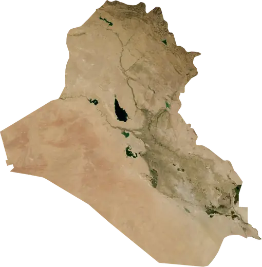
 Kut
Kut: earthquakes and wildfires
Was there an earthquake or a fire near Kut just now? Live map within 62 mi, the strongest earthquakes, the largest fires and statistics for Kut, Iraq.
Live map – Kut
Earthquakes within 62 mi of the city center.
Key statistics (30 days)
Earthquakes M2.5+ and the wildfire fronts shown on the map.
Recent events in Kut
- 9 h agoWildfire near Qal'at Sukkar, Iraq – active4,940 acres · 7 mi S of Qal'at Sukkar, Iraq
- 9 h agoWildfire near Kut, Iraq – active2,899 acres · 9 mi W of Kut, Iraq
- 21 h agoWildfire near Mehran, Iran – active5,036 acres · 7 mi SSW of Mehran, Iran
- 21 h agoWildfire near Mehran, Iran – active3,222 acres · 9 mi S of Mehran, Iran
- 4.2172 days agoM4.2 earthquake near Kut, Iraq43 mi NE of Kut, Iraq
Historical overview
Earthquakes M3.0+ and significant events of other hazards.
About Kut
Kut has recorded 74 earthquakes of magnitude 3.0 or more since 1982. The strongest was M5.6 in 1998.
Satellites have detected 4 significant wildfires here; the largest burned about 5,036 acres.
Know the official emergency number, prepare an emergency kit and follow the instructions of your civil protection authority.
Learn more ›Did you feel an earthquake in Kut?
No reports yet.
Earthquakes
74 earthquakes of magnitude 3.0 or more since 1982 within 62 mi. The strongest was M5.6.
Recent earthquakes
| Mag | Location | Time (UTC) | Depth |
|---|---|---|---|
| 4.2 | 43 mi NE of Kut, Iraq | 6.2 mi |
Strongest earthquakes on record
| Mag | Location | Time (UTC) | Depth |
|---|---|---|---|
| 5.6 | 31 mi SSW of Ilam, Iran | 20.5 mi | |
| 5.5 | 41 mi WNW of Dehloran, Iran | 20.5 mi | |
| 5.3 | 36 mi SE of Mandali, Iraq | 20.5 mi | |
| 5.2 | 29 mi S of Ilam, Iran | 6.2 mi | |
| 5.1 | 41 mi NE of Kut, Iraq | 21.7 mi | |
| 5.0 | 31 mi SE of Mandali, Iraq | 28.1 mi | |
| 4.9 | 40 mi WNW of Dehloran, Iran | 6.2 mi | |
| 4.9 | 32 mi SE of Mandali, Iraq | 15.0 mi | |
| 4.8 | 15 mi ENE of Mehran, Iran | 9.3 mi | |
| 4.8 | 39 mi SW of Ilam, Iran | 9.8 mi | |
| 4.8 | 42 mi NE of Kut, Iraq | 33.4 mi | |
| 4.8 | 18 mi NE of 'Ali al Gharbi, Iraq | 31.5 mi | |
| 4.7 | 7 mi SSW of Qal'at Sukkar, Iraq | 6.2 mi | |
| 4.7 | 36 mi SE of Mandali, Iraq | 29.6 mi | |
| 4.7 | 3 mi W of 'Ali al Gharbi, Iraq | 29.2 mi |
Earthquakes per year (M3.0+)
Year
| 2026 | 1 | M4.2 |
| 2024 | 1 | M4.3 |
| 2023 | 1 | M4.2 |
| 2022 | 2 | M4.3 |
| 2021 | 1 | M4.1 |
| 2019 | 3 | M4.6 |
| 2018 | 5 | M5.2 |
| 2017 | 3 | M5.1 |
| 2016 | 2 | M4.1 |
| 2015 | 2 | M4.9 |
| 2014 | 1 | M4.1 |
| 2013 | 2 | M4.0 |
| 2012 | 7 | M4.6 |
| 2009 | 4 | M4.8 |
| 2008 | 2 | M4.0 |
| 2007 | 1 | M4.2 |
| 2005 | 6 | M5.0 |
| 2004 | 5 | M4.7 |
| 2003 | 1 | M4.6 |
| 2002 | 4 | M5.3 |
| 2001 | 3 | M5.5 |
| 1998 | 1 | M5.6 |
| 1996 | 2 | M4.5 |
| 1995 | 1 | M4.2 |
| 1992 | 2 | M4.8 |
| 1991 | 1 | M4.0 |
| 1990 | 1 | M4.1 |
| 1988 | 6 | M4.8 |
| 1987 | 1 | M4.4 |
| 1985 | 1 | M4.6 |
| 1982 | 1 | M4.4 |
Wildfires
4 major fires since 2026 within 62 mi. The largest covered about 5,036 acres.
Recent fires
| Area | Location | Since | Status |
|---|---|---|---|
| 4,940 acres | 7 mi S of Qal'at Sukkar, Iraq | Active | |
| 2,899 acres | 9 mi W of Kut, Iraq | Active | |
| 5,036 acres | 7 mi SSW of Mehran, Iran | Active | |
| 3,222 acres | 9 mi S of Mehran, Iran | Active |
Largest fires on record
| Area | Location | Since | Status |
|---|---|---|---|
| 5,036 acres | 7 mi SSW of Mehran, Iran | Active | |
| 4,940 acres | 7 mi S of Qal'at Sukkar, Iraq | Active | |
| 3,222 acres | 9 mi S of Mehran, Iran | Active | |
| 2,899 acres | 9 mi W of Kut, Iraq | Active |
Nearby places
- An Nu'maniyah 24 mi
- Al Hayy 27 mi
- 'Afak 46 mi
- Qal'at Sukkar 47 mi
- Al 'Aziziyah 52 mi
- Al Diwaniyah 63 mi
- As Suwayrah 67 mi
- Al-Qasim 68 mi
- Ar Rumaythah 77 mi
- Ash Shatrah 79 mi
- Ash Shamiyah 81 mi
- Hillah 82 mi
- Al Mahawil 83 mi
- Ilam 85 mi
- Dehloran 85 mi
- Abu Gharaq 86 mi
- Kufa 87 mi
- Mandali 87 mi
- As Samawah 87 mi
- Nahiyat Ghammas 88 mi
- Nahiyat al Iskandariyah 89 mi
- Amarah 91 mi
- Saddat al Hindiyah 91 mi
- Al-Musayab 91 mi
- Al Mishkhab 92 mi