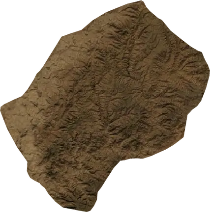
 Lesotho
Gempa dan kebakaran hutan di Lesotho
Gempa terbaru dan kebakaran hutan aktif di Lesotho pada peta langsung, gempa terkuat dan kebakaran terbesar yang pernah tercatat, serta statistik per tahun.
Peta langsung – Lesotho
Statistik utama (30 hari)
Gempa M2.5+ dan titik kebakaran yang tampil di peta.
Bahaya kebakaran
Prakiraan untuk wilayah sekitar: Maseru. Bahaya dapat berbeda secara lokal; ikuti arahan resmi. Sumber: Copernicus EMS – EFFIS (FWI).
Cuaca ekstrem (prakiraan)
- Hari ini: Hujan – Hujan sangat lebat (25–50 mm) · Hlotse
- Besok: Hujan – Hujan sangat lebat (25–50 mm) · Hlotse
- Besok: Petir – Aktivitas petir sangat tinggi · Mohale's Hoek
Prakiraan untuk wilayah sekitar: Lesotho. Tidak menggantikan peringatan dari badan meteorologi nasional. Sumber: ECMWF / Copernicus EMS.
Kejadian terbaru di Lesotho
- 76 hari laluKebakaran hutan dekat Quthing, Lesotho16 km² · 42 km Tg Quthing, Lesotho
- 82 hari laluKebakaran hutan dekat Qacha's Nek, Lesotho15 km² · 20 km BBD Qacha's Nek, Lesotho
- 89 hari laluKebakaran hutan dekat Qacha's Nek, Lesotho13 km² · 13 km TTg Qacha's Nek, Lesotho
- 102 hari laluKebakaran hutan dekat Qacha's Nek, Lesotho16 km² · 50 km TTL Qacha's Nek, Lesotho
- 107 hari laluKebakaran hutan dekat Qacha's Nek, Lesotho26 km² · 55 km TTL Qacha's Nek, Lesotho
- 129 hari laluKebakaran hutan dekat Qacha's Nek, Lesotho11 km² · 55 km TTL Qacha's Nek, Lesotho
Tinjauan historis
Gempa M3,0+ dan kejadian signifikan dari bencana lainnya.
Tentang Lesotho
Lesotho mencatat 7 gempa bermagnitudo 3,0 atau lebih sejak 1987. Yang terkuat adalah M4,5 pada 2016.
Satelit mendeteksi 6 kebakaran hutan signifikan di sini; yang terbesar membakar sekitar 26 km².
Ketahui nomor darurat resmi, siapkan perlengkapan darurat, dan ikuti arahan otoritas perlindungan sipil.
Pelajari lebih lanjut ›Gempa
7 gempa bermagnitudo 3,0 ke atas sejak 1987. Terkuat M4,5.
Gempa terbaru
Tidak ada gempa bermagnitudo 2,5+ dalam 12 bulan terakhir.
Gempa terkuat yang pernah tercatat
| Mag | Lokasi | Waktu (UTC) | Kedalaman |
|---|---|---|---|
| 4,5 | 11 km B Qacha's Nek, Lesotho | 10,0 km | |
| 4,3 | 45 km Tg Maseru, Lesotho | 5,0 km | |
| 4,3 | 11 km SBD Semonkong, Lesotho | 10,0 km | |
| 4,3 | 66 km STg Maseru, Lesotho | 10,0 km | |
| 3,8 | dekat Ramabanta, Lesotho | 10,0 km | |
| 3,7 | 35 km TL Mohale's Hoek, Lesotho | 5,0 km | |
| 3,6 | 48 km TL Quthing, Lesotho | 5,0 km |
Gempa per tahun (M3,0+)
Tahun
| 2016 | 2 | M4,5 |
| 2002 | 2 | M4,3 |
| 1995 | 1 | M3,7 |
| 1993 | 1 | M3,8 |
| 1987 | 1 | M3,6 |
Kebakaran hutan
6 kebakaran besar sejak 2026. Yang terbesar seluas sekitar 26 km².
Kebakaran terbaru
| Luas | Lokasi | Sejak | Status |
|---|---|---|---|
| 16 km² | 42 km Tg Quthing, Lesotho | Tidak aktif | |
| 15 km² | 20 km BBD Qacha's Nek, Lesotho | Tidak aktif | |
| 13 km² | 13 km TTg Qacha's Nek, Lesotho | Tidak aktif | |
| 16 km² | 50 km TTL Qacha's Nek, Lesotho | Tidak aktif | |
| 26 km² | 55 km TTL Qacha's Nek, Lesotho | Tidak aktif | |
| 11 km² | 55 km TTL Qacha's Nek, Lesotho | Tidak aktif |
Kebakaran terbesar yang pernah tercatat
| Luas | Lokasi | Sejak | Status |
|---|---|---|---|
| 26 km² | 55 km TTL Qacha's Nek, Lesotho | Tidak aktif | |
| 16 km² | 50 km TTL Qacha's Nek, Lesotho | Tidak aktif | |
| 16 km² | 42 km Tg Quthing, Lesotho | Tidak aktif | |
| 15 km² | 20 km BBD Qacha's Nek, Lesotho | Tidak aktif | |
| 13 km² | 13 km TTg Qacha's Nek, Lesotho | Tidak aktif | |
| 11 km² | 55 km TTL Qacha's Nek, Lesotho | Tidak aktif |