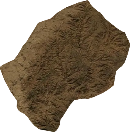
 Lesotho
Erdbeben und Waldbrände – Lesotho
Erdbeben und Waldbrände Lesotho: die neuesten Beben und aktiven Brände auf der Live-Karte, die stärksten aufgezeichneten Erdbeben und größten Brände, Statistik nach Jahren.
Live-Karte – Lesotho
Kennzahlen (30 Tage)
Erdbeben ab M2,5 und die auf der Karte gezeigten Brandfronten.
Waldbrandgefahr
Prognose für das Gebiet um: Maseru. Die Gefahr kann örtlich abweichen; folgen Sie den Anweisungen der Behörden. Quelle: Copernicus EMS – EFFIS (FWI).
Unwetter (Prognose)
- Heute: Regen – Sehr starker Regen (25–50 mm) · Hlotse
- Morgen: Regen – Sehr starker Regen (25–50 mm) · Hlotse
- Morgen: Blitze – Sehr hohe Blitzaktivität · Mohale's Hoek
Prognose für das Gebiet um: Lesotho. Ersetzt nicht die Warnungen des nationalen Wetterdienstes. Quelle: ECMWF / Copernicus EMS.
Aktuelle Ereignisse in Lesotho
- vor 76 TagenWaldbrand bei Quthing, Lesotho16 km² · 42 km SO von Quthing, Lesotho
- vor 82 TagenWaldbrand bei Qacha's Nek, Lesotho15 km² · 20 km WSW von Qacha's Nek, Lesotho
- vor 89 TagenWaldbrand bei Qacha's Nek, Lesotho13 km² · 13 km OSO von Qacha's Nek, Lesotho
- vor 102 TagenWaldbrand bei Qacha's Nek, Lesotho16 km² · 50 km ONO von Qacha's Nek, Lesotho
- vor 107 TagenWaldbrand bei Qacha's Nek, Lesotho26 km² · 55 km ONO von Qacha's Nek, Lesotho
- vor 129 TagenWaldbrand bei Qacha's Nek, Lesotho11 km² · 55 km ONO von Qacha's Nek, Lesotho
Historischer Überblick
Erdbeben ab M3,0 und bedeutende Ereignisse anderer Gefahrenarten.
Über Lesotho
In Lesotho wurden seit 1987 7 Erdbeben der Magnitude 3,0 oder mehr registriert. Das stärkste war M4,5 im Jahr 2016.
Satelliten haben hier 6 bedeutende Waldbrände erfasst; der größte verbrannte etwa 26 km².
Kennen Sie die offizielle Notrufnummer, halten Sie ein Notfallset bereit und befolgen Sie die Anweisungen Ihrer Katastrophenschutzbehörde.
Mehr erfahren ›Erdbeben
7 Erdbeben der Stärke 3,0 oder mehr seit 1987. Das stärkste hatte M4,5.
Neueste Erdbeben
Keine Erdbeben der Stärke 2,5+ in den letzten 12 Monaten.
Die stärksten aufgezeichneten Erdbeben
| Stärke | Ort | Zeit (UTC) | Tiefe |
|---|---|---|---|
| 4,5 | 11 km W von Qacha's Nek, Lesotho | 10,0 km | |
| 4,3 | 45 km SO von Maseru, Lesotho | 5,0 km | |
| 4,3 | 11 km SSW von Semonkong, Lesotho | 10,0 km | |
| 4,3 | 66 km SSO von Maseru, Lesotho | 10,0 km | |
| 3,8 | bei Ramabanta, Lesotho | 10,0 km | |
| 3,7 | 35 km NO von Mohale's Hoek, Lesotho | 5,0 km | |
| 3,6 | 48 km NO von Quthing, Lesotho | 5,0 km |
Erdbeben pro Jahr (Stärke 3,0+)
Jahr
| 2016 | 2 | M4,5 |
| 2002 | 2 | M4,3 |
| 1995 | 1 | M3,7 |
| 1993 | 1 | M3,8 |
| 1987 | 1 | M3,6 |
Waldbrände
6 Großbrände seit 2026. Der größte erstreckte sich über etwa 26 km².
Neueste Brände
| Fläche | Ort | Seit | Status |
|---|---|---|---|
| 16 km² | 42 km SO von Quthing, Lesotho | Inaktiv | |
| 15 km² | 20 km WSW von Qacha's Nek, Lesotho | Inaktiv | |
| 13 km² | 13 km OSO von Qacha's Nek, Lesotho | Inaktiv | |
| 16 km² | 50 km ONO von Qacha's Nek, Lesotho | Inaktiv | |
| 26 km² | 55 km ONO von Qacha's Nek, Lesotho | Inaktiv | |
| 11 km² | 55 km ONO von Qacha's Nek, Lesotho | Inaktiv |
Die größten aufgezeichneten Brände
| Fläche | Ort | Seit | Status |
|---|---|---|---|
| 26 km² | 55 km ONO von Qacha's Nek, Lesotho | Inaktiv | |
| 16 km² | 50 km ONO von Qacha's Nek, Lesotho | Inaktiv | |
| 16 km² | 42 km SO von Quthing, Lesotho | Inaktiv | |
| 15 km² | 20 km WSW von Qacha's Nek, Lesotho | Inaktiv | |
| 13 km² | 13 km OSO von Qacha's Nek, Lesotho | Inaktiv | |
| 11 km² | 55 km ONO von Qacha's Nek, Lesotho | Inaktiv |