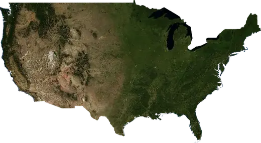
 United States
: earthquakes and wildfires
Latest earthquakes and active wildfires in United States on a live map, the strongest earthquakes and largest fires on record, and statistics by year.
Live map – United States
Key statistics (30 days)
Earthquakes M2.5+ and the wildfire fronts shown on the map.
Fire danger
Forecast for the area around: Jacksonville. Danger can vary locally; follow official guidance. Source: Copernicus EMS – EFFIS (FWI).
Severe weather (forecast)
- Today: Rain – Extreme rain (≥ 50 mm) · San Antonio
- Tomorrow: Rain – Extreme rain (≥ 50 mm) · San Antonio
Forecast for the area around: United States. It does not replace warnings from the national weather service. Source: ECMWF / Copernicus EMS.
Recent events in United States
- 2.72 h agoM2.7 earthquake near Nikiski, United States – now154 mi WNW of Nikiski, United States
- 2.53 h agoM2.5 earthquake near Healy, United States – now61 mi WSW of Healy, United States
- 2.54 h agoM2.5 earthquake near Susitna North, United States – now7 mi NNE of Susitna North, United States
- 2.55 h agoM2.5 earthquake near Hilo, United States – now35 mi SSW of Hilo, United States
- 2.65 h agoM2.6 earthquake near Pearsall, United States – now8 mi E of Pearsall, United States
- 3.65 h agoM3.6 earthquake near Kodiak, United States – now180 mi SE of Kodiak, United States
Historical overview
Earthquakes M3.0+ and significant events of other hazards.
About United States
United States has recorded 94,395 earthquakes of magnitude 3.0 or more since 1976. The strongest was M8.2 in 2021.
Satellites have detected 1,200 significant wildfires here; the largest burned about 93,062 acres.
The area has also been affected by 1 tropical cyclones, floods, volcanic events or tsunami messages.
Know the official emergency number, prepare an emergency kit and follow the instructions of your civil protection authority.
Learn more ›Earthquakes
Earthquakes today: United States →
94,395 earthquakes of magnitude 3.0 or more since 1976. The strongest was M8.2.
Recent earthquakes
| Mag | Location | Time (UTC) | Depth |
|---|---|---|---|
| 2.7 | 154 mi WNW of Nikiski, United States | 0.3 mi | |
| 2.5 | 61 mi WSW of Healy, United States | 2.0 mi | |
| 2.5 | 7 mi NNE of Susitna North, United States | 3.1 mi | |
| 2.5 | 35 mi SSW of Hilo, United States | 18.7 mi | |
| 2.6 | 8 mi E of Pearsall, United States | 3.1 mi | |
| 3.6 | 180 mi SE of Kodiak, United States | 20.4 mi | |
| 2.7 | 35 mi WNW of Anchorage, United States | 38.7 mi | |
| 2.7 | 13 mi NNE of Anchorage, United States | 5.0 mi | |
| 2.5 | 167 mi SSE of Dillingham, United States | 43.2 mi | |
| 2.6 | 89 mi ESE of Dillingham, United States | 0.2 mi |
Show all (200)
| Mag | Location | Time (UTC) | Depth |
|---|---|---|---|
| 2.9 | 41 mi ENE of Carson City, United States | 1.1 mi | |
| 2.5 | 47 mi SW of Kodiak Station, United States | 26.7 mi | |
| 2.6 | 162 mi E of Sand Point, United States | 3.1 mi | |
| 3.5 | 13 mi ENE of Susitna North, United States | 5.8 mi | |
| 2.5 | 92 mi W of Fairbanks, United States | 10.6 mi | |
| 3.0 | 10 mi NW of Santa Teresa, United States | 6.2 mi | |
| 2.6 | 66 mi SSE of Healy, United States | 42.8 mi | |
| 2.5 | 40 mi ENE of Carson City, United States | 6.9 mi | |
| 2.6 | 170 mi SW of Kodiak Station, United States | 29.1 mi | |
| 3.1 | 31 mi WNW of Oklahoma City, United States | 3.9 mi | |
| 2.7 | 44 mi W of Anchor Point, United States | 64.9 mi | |
| 2.5 | 42 mi ESE of Boise, United States | 5.8 mi | |
| 2.5 | 50 mi WSW of Anchor Point, United States | 48.8 mi | |
| 2.5 | 70 mi NNW of Susitna North, United States | 71.4 mi | |
| 3.9 | 55 mi E of Bear Creek, United States | 9.1 mi | |
| 3.4 | 31 mi WNW of Oklahoma City, United States | 4.2 mi | |
| 3.0 | 38 mi SE of Carlsbad, United States | 4.4 mi | |
| 3.0 | 37 mi SE of Carlsbad, United States | 7.9 mi | |
| 3.4 | 16 mi E of Ogden, United States | 3.2 mi | |
| 3.1 | 38 mi WSW of Gold Beach, United States | 2.8 mi | |
| 3.4 | 67 mi WSW of Gold Beach, United States | 6.2 mi | |
| 3.5 | 67 mi WSW of Cordova, United States | 1.2 mi | |
| 2.9 | 63 mi E of Alturas, United States | 0.0 mi | |
| 3.9 | 169 mi SW of Unalaska, United States | 6.2 mi | |
| 2.7 | 16 mi SSE of Pāhala, United States | 18.3 mi | |
| 3.4 | 18 mi WNW of Okanogan, United States | 5.5 mi | |
| 2.7 | 36 mi ESE of Seward, United States | 8.9 mi | |
| 2.8 | 93 mi WSW of Healy, United States | 11.1 mi | |
| 3.2 | 172 mi S of Kodiak Station, United States | 81.3 mi | |
| 2.5 | 71 mi NW of Anchorage, United States | 52.4 mi | |
| 2.6 | 13 mi WNW of Three Rivers, United States | 5.0 mi | |
| 2.7 | 54 mi SSW of Carlsbad, United States | 3.5 mi | |
| 4.1 | 63 mi NE of Kodiak, United States | 17.5 mi | |
| 2.6 | 167 mi ENE of Sand Point, United States | 9.2 mi | |
| 3.4 | 53 mi SSW of Carlsbad, United States | 3.5 mi | |
| 3.0 | 115 mi ESE of Prudhoe Bay, United States | 10.7 mi | |
| 2.5 | 67 mi NNE of Knik-Fairview, United States | 12.1 mi | |
| 3.2 | 43 mi SW of Anchor Point, United States | 57.0 mi | |
| 3.4 | 39 mi ESE of Sand Point, United States | 21.7 mi | |
| 3.4 | 29 mi SW of Ely, United States | 3.6 mi | |
| 3.6 | 31 mi SW of Ely, United States | 0.6 mi | |
| 2.6 | 169 mi ENE of Sand Point, United States | 3.1 mi | |
| 2.5 | 55 mi SSW of Carlsbad, United States | 3.8 mi | |
| 3.3 | 6 mi ESE of Nikiski, United States | 38.1 mi | |
| 3.5 | 55 mi SSE of King Cove, United States | 0.0 mi | |
| 2.5 | 5 mi SE of San Pedro, United States | 4.9 mi | |
| 2.7 | 50 mi WSW of Craig, United States | 6.2 mi | |
| 2.6 | 7 mi ESE of Watsonville, United States | 0.0 mi | |
| 3.4 | 160 mi ENE of Kotzebue, United States | 1.4 mi | |
| 3.0 | 21 mi W of Green River, United States | -2.1 mi | |
| 2.5 | 53 mi NW of Anchor Point, United States | 91.8 mi | |
| 3.2 | 46 mi SSW of Homer, United States | 34.1 mi | |
| 2.5 | 17 mi ESE of Cohoe, United States | 41.9 mi | |
| 2.7 | 21 mi ESE of Discovery Harbor, United States | 28.7 mi | |
| 2.7 | 74 mi E of Cordova, United States | 3.1 mi | |
| 3.1 | 9 mi E of Pearsall, United States | 4.7 mi | |
| 2.5 | 41 mi W of Cohoe, United States | 64.2 mi | |
| 2.5 | 42 mi SW of Anchorage, United States | 0.1 mi | |
| 2.8 | 106 mi SE of Prudhoe Bay, United States | 4.7 mi | |
| 3.7 | 102 mi SE of Prudhoe Bay, United States | 2.7 mi | |
| 2.5 | 106 mi WSW of Kodiak Station, United States | 3.1 mi | |
| 3.1 | 10 mi SSE of Cohoe, United States | 38.0 mi | |
| 4.4 | 52 mi SE of Akutan, United States | 23.0 mi | |
| 3.9 | 59 mi SE of Akutan, United States | 22.9 mi | |
| 2.5 | 20 mi SW of Colorado City, United States | 5.9 mi | |
| 3.3 | 114 mi S of Kodiak Station, United States | 3.6 mi | |
| 3.1 | 113 mi S of Kodiak Station, United States | 12.5 mi | |
| 2.6 | 9 mi E of Pearsall, United States | 5.3 mi | |
| 2.5 | 88 mi WSW of Healy, United States | 10.7 mi | |
| 2.5 | 52 mi S of Carlsbad, United States | 4.1 mi | |
| 2.8 | 154 mi S of Prudhoe Bay, United States | 3.1 mi | |
| 3.7 | 80 mi S of Sitka, United States | 2.1 mi | |
| 3.7 | 84 mi SSE of Homer, United States | 25.0 mi | |
| 4.3 | 159 mi SW of Unalaska, United States | 26.2 mi | |
| 2.9 | 82 mi WNW of Susitna North, United States | 0.1 mi | |
| 2.7 | 6 mi WNW of Kalifornsky, United States | 42.2 mi | |
| 2.7 | 5 mi N of Portola, United States | -0.9 mi | |
| 2.5 | 49 mi W of Anchor Point, United States | 72.0 mi | |
| 2.6 | 84 mi NW of Susitna North, United States | 0.7 mi | |
| 2.7 | 6 mi NNW of Waikoloa, United States | 2.8 mi | |
| 2.6 | 54 mi NNW of Kodiak Station, United States | 40.0 mi | |
| 2.5 | 43 mi W of Anchor Point, United States | 69.0 mi | |
| 2.9 | 37 mi SSW of Wailea-Makena, United States | 2.0 mi | |
| 2.6 | 36 mi SSW of Wailea-Makena, United States | 0.8 mi | |
| 4.3 | 11 mi SE of Joseph, United States | 7.3 mi | |
| 2.6 | 7 mi E of Pāhala, United States | 17.9 mi | |
| 2.8 | 31 mi SW of Ely, United States | 2.4 mi | |
| 3.3 | 83 mi WNW of Susitna North, United States | 3.1 mi | |
| 2.6 | 8 mi NW of Dilley, United States | 4.1 mi | |
| 2.5 | 9 mi E of Pearsall, United States | 4.5 mi | |
| 3.2 | 176 mi WNW of Haines, United States | 5.5 mi | |
| 3.4 | 54 mi WSW of Kodiak Station, United States | 14.6 mi | |
| 2.6 | 3 mi S of Nikiski, United States | 44.0 mi | |
| 3.0 | 54 mi SSW of Carlsbad, United States | 3.5 mi | |
| 2.6 | 27 mi NW of Nikiski, United States | 57.6 mi | |
| 2.7 | 59 mi WSW of Healy, United States | 3.1 mi | |
| 2.5 | 11 mi ESE of Pearsall, United States | 4.4 mi | |
| 2.5 | near Pāhala, United States | 19.2 mi | |
| 3.5 | 59 mi NNW of Susitna North, United States | 69.8 mi | |
| 2.6 | 4 mi S of Pāhala, United States | 7.7 mi | |
| 3.3 | 55 mi S of Unalaska, United States | 3.9 mi | |
| 3.8 | 153 mi W of Ferndale, United States | 6.2 mi | |
| 2.8 | 10 mi E of Pearsall, United States | 4.4 mi | |
| 2.6 | 17 mi N of Windsor, United States | 0.3 mi | |
| 2.9 | 12 mi WSW of Colorado City, United States | 4.5 mi | |
| 2.9 | 28 mi WNW of Anchorage, United States | 35.7 mi | |
| 2.7 | 38 mi WSW of Kahaluu-Keauhou, United States | 3.5 mi | |
| 3.0 | 74 mi NE of Knik-Fairview, United States | 13.0 mi | |
| 2.7 | 62 mi SSE of King Cove, United States | 6.2 mi | |
| 3.5 | 37 mi S of Anchorage, United States | 20.7 mi | |
| 2.5 | 69 mi ESE of Akutan, United States | 12.2 mi | |
| 3.5 | 30 mi SW of Ely, United States | 3.0 mi | |
| 2.8 | 127 mi SW of Unalaska, United States | 26.5 mi | |
| 2.8 | 101 mi S of King Cove, United States | 6.3 mi | |
| 2.5 | 43 mi ESE of Salinas, United States | 5.8 mi | |
| 3.4 | 93 mi WSW of Kodiak Station, United States | 3.1 mi | |
| 2.6 | 55 mi NNW of Susitna North, United States | 56.5 mi | |
| 3.4 | 28 mi WSW of Trinidad, United States | 3.1 mi | |
| 2.5 | 29 mi SW of Hilo, United States | 0.2 mi | |
| 2.5 | 72 mi NE of Kodiak, United States | 4.7 mi | |
| 2.6 | 10 mi NNE of Milford, United States | 2.1 mi | |
| 3.0 | 30 mi WNW of Anchorage, United States | 44.2 mi | |
| 2.5 | 12 mi WNW of Montpelier, United States | 2.7 mi | |
| 2.5 | 66 mi W of Kodiak Station, United States | 28.5 mi | |
| 2.7 | 47 mi NNE of Knik-Fairview, United States | 12.4 mi | |
| 3.0 | 59 mi SSE of King Cove, United States | 0.5 mi | |
| 2.6 | 166 mi SW of Unalaska, United States | 2.9 mi | |
| 2.7 | 9 mi NE of Milford, United States | 2.9 mi | |
| 4.0 | 126 mi SE of Unalaska, United States | 17.3 mi | |
| 3.1 | 8 mi NE of Milford, United States | 2.2 mi | |
| 2.9 | 5 mi E of Anchor Point, United States | 47.6 mi | |
| 2.5 | 60 mi W of Anchorage, United States | 50.7 mi | |
| 2.6 | 24 mi NNW of Sun Valley, United States | 7.4 mi | |
| 2.7 | 9 mi NE of Milford, United States | 3.2 mi | |
| 3.4 | 31 mi WNW of Oklahoma City, United States | 3.6 mi | |
| 2.9 | 42 mi WSW of Anchorage, United States | 44.0 mi | |
| 2.6 | 73 mi NNW of Susitna North, United States | 83.5 mi | |
| 2.7 | 18 mi WNW of Valdez, United States | 11.1 mi | |
| 2.6 | near Cohoe, United States | 38.6 mi | |
| 2.7 | 3 mi E of Hoback, United States | 3.1 mi | |
| 3.1 | 22 mi W of Green River, United States | -1.2 mi | |
| 2.6 | 103 mi SSW of King Cove, United States | 15.4 mi | |
| 2.6 | 59 mi NW of Kodiak Station, United States | 43.3 mi | |
| 2.9 | 3 mi NE of Kalaoa, United States | 8.6 mi | |
| 2.8 | 35 mi WSW of Ely, United States | 0.0 mi | |
| 2.5 | 90 mi SSW of King Cove, United States | 0.6 mi | |
| 3.1 | 17 mi SW of Homer, United States | 36.2 mi | |
| 2.7 | 137 mi WSW of Kodiak Station, United States | 43.1 mi | |
| 2.5 | 146 mi SW of Unalaska, United States | 3.7 mi | |
| 2.6 | 87 mi SSW of King Cove, United States | 9.4 mi | |
| 2.6 | 88 mi SSW of King Cove, United States | 5.7 mi | |
| 3.1 | 80 mi ESE of Akutan, United States | 9.1 mi | |
| 2.7 | 59 mi S of Sand Point, United States | 3.0 mi | |
| 2.8 | 25 mi N of Anchorage, United States | 9.1 mi | |
| 2.8 | 94 mi SSW of King Cove, United States | 6.2 mi | |
| 2.7 | 101 mi SSW of King Cove, United States | 6.2 mi | |
| 2.5 | 54 mi SSW of Carlsbad, United States | 3.3 mi | |
| 3.1 | 104 mi SSW of King Cove, United States | 4.5 mi | |
| 2.7 | 75 mi SSW of King Cove, United States | 8.0 mi | |
| 2.8 | 106 mi S of King Cove, United States | 14.4 mi | |
| 2.8 | 97 mi SSW of King Cove, United States | 12.0 mi | |
| 2.7 | 102 mi SSW of King Cove, United States | 4.0 mi | |
| 2.7 | 103 mi SSW of King Cove, United States | 11.2 mi | |
| 2.6 | 27 mi SW of La Quinta, United States | 4.7 mi | |
| 2.9 | 98 mi SSW of King Cove, United States | 6.2 mi | |
| 2.6 | 73 mi ESE of Akutan, United States | 6.2 mi | |
| 3.1 | 87 mi W of Kodiak Station, United States | 56.0 mi | |
| 2.5 | 70 mi SSW of King Cove, United States | 9.0 mi | |
| 2.9 | 108 mi SSW of King Cove, United States | 6.8 mi | |
| 2.5 | 46 mi E of Sand Point, United States | 3.4 mi | |
| 3.1 | 101 mi SSW of King Cove, United States | 3.3 mi | |
| 3.1 | 131 mi WNW of Port Orford, United States | 6.2 mi | |
| 2.8 | 103 mi SSW of King Cove, United States | 10.7 mi | |
| 3.1 | 102 mi S of King Cove, United States | 11.9 mi | |
| 4.7 | 102 mi SSW of King Cove, United States | 17.4 mi | |
| 2.8 | 104 mi SSW of King Cove, United States | 3.0 mi | |
| 2.7 | 60 mi S of Sand Point, United States | 5.2 mi | |
| 3.3 | 101 mi SSW of King Cove, United States | 2.7 mi | |
| 2.8 | 98 mi SSW of King Cove, United States | 8.8 mi | |
| 2.5 | 119 mi WSW of Kodiak Station, United States | 2.7 mi | |
| 3.2 | 101 mi SSW of King Cove, United States | 6.0 mi | |
| 2.5 | 134 mi SW of Unalaska, United States | 10.4 mi | |
| 2.5 | 62 mi S of King Cove, United States | 6.7 mi | |
| 3.6 | 99 mi SSW of King Cove, United States | 6.2 mi | |
| 2.9 | 104 mi SSW of King Cove, United States | 6.8 mi | |
| 3.0 | 104 mi SSW of King Cove, United States | 3.8 mi | |
| 2.9 | 104 mi S of King Cove, United States | 6.2 mi | |
| 3.0 | 105 mi S of King Cove, United States | 5.9 mi | |
| 4.6 | 107 mi SSW of King Cove, United States | 10.0 mi | |
| 2.8 | 57 mi ENE of Susitna North, United States | 30.4 mi |
Strongest earthquakes on record
| Mag | Location | Time (UTC) | Depth |
|---|---|---|---|
| 8.2 | 105 mi E of Sand Point, United States | 19.9 mi | |
| 7.9 | 174 mi SE of Kodiak, United States | 8.7 mi | |
| 7.9 | 89 mi S of Badger, United States | 3.1 mi | |
| 7.9 | 165 mi SE of Cordova, United States | 6.2 mi | |
| 7.8 | 77 mi ESE of Sand Point, United States | 17.4 mi | |
| 7.6 | 61 mi SE of Sand Point, United States | 17.4 mi | |
| 7.6 | 6 mi N of Yucca Valley, United States | 0.6 mi | |
| 7.5 | 69 mi WSW of Craig, United States | 5.6 mi | |
| 7.5 | 139 mi E of Cordova, United States | 11.2 mi | |
| 7.3 | 54 mi S of Sand Point, United States | 12.4 mi | |
| 7.3 | 29 mi NE of Sun Valley, United States | 8.7 mi | |
| 7.2 | 61 mi S of Sand Point, United States | 19.9 mi | |
| 7.2 | 97 mi WSW of Crescent City, United States | 6.2 mi | |
| 7.2 | 58 mi E of Victorville, United States | – | |
| 7.2 | 161 mi SE of Cordova, United States | 6.2 mi |
Earthquakes per year (M3.0+)
Year
| 2026 | 2,260 | M6.3 |
| 2025 | 2,421 | M7.3 |
| 2024 | 2,305 | M7.0 |
| 2023 | 2,246 | M7.2 |
| 2022 | 2,284 | M6.8 |
| 2021 | 2,701 | M8.2 |
| 2020 | 3,793 | M7.8 |
| 2019 | 3,325 | M7.1 |
| 2018 | 7,791 | M7.9 |
| 2017 | 1,861 | M5.9 |
| 2016 | 2,328 | M7.1 |
| 2015 | 2,590 | M6.9 |
| 2014 | 2,207 | M6.8 |
| 2013 | 1,422 | M7.5 |
| 2012 | 1,253 | M6.3 |
| 2011 | 1,432 | M6.1 |
| 2010 | 2,310 | M6.7 |
| 2009 | 1,342 | M6.5 |
| 2008 | 1,487 | M6.3 |
| 2007 | 1,365 | M6.4 |
| 2006 | 1,282 | M6.7 |
| 2005 | 1,433 | M7.2 |
| 2004 | 1,664 | M6.8 |
| 2003 | 1,572 | M6.6 |
| 2002 | 1,946 | M7.9 |
| 2001 | 1,164 | M6.9 |
| 2000 | 1,116 | M6.5 |
| 1999 | 1,981 | M7.2 |
| 1998 | 1,584 | M6.1 |
| 1997 | 1,373 | M6.1 |
| 1996 | 1,472 | M6.3 |
| 1995 | 1,318 | M6.6 |
| 1994 | 1,894 | M7.0 |
| 1993 | 1,333 | M6.9 |
| 1992 | 3,043 | M7.6 |
| 1991 | 1,253 | M7.0 |
| 1990 | 1,247 | M6.6 |
| 1989 | 1,422 | M6.9 |
| 1988 | 1,153 | M6.4 |
| 1987 | 1,157 | M7.9 |
| 1986 | 1,603 | M6.8 |
| 1985 | 1,080 | M6.6 |
| 1984 | 1,339 | M6.7 |
| 1983 | 1,696 | M7.3 |
| 1982 | 1,192 | M6.1 |
| 1981 | 1,280 | M6.2 |
| 1980 | 2,779 | M7.2 |
| 1979 | 1,253 | M7.5 |
| 1978 | 1,002 | M6.6 |
| 1977 | 943 | M6.0 |
| 1976 | 1,167 | M6.3 |
Wildfires
1,200 major fires since 2025. The largest covered about 93,062 acres.
Recent fires
| Area | Location | Since | Status |
|---|---|---|---|
| 59,162 acres | 25 mi SSW of Hilo, United States | Active | |
| 4,277 acres | near Claypool, United States | Active | |
| 1,132 acres | 5 mi NE of Norfolk, United States | Active | |
| 3,205 acres | near Soda Springs, United States | Active | |
| 3,786 acres | near Granite City, United States | Active | |
| 2,333 acres | 34 mi SSW of Enterprise, United States | Active | |
| 1,737 acres | 12 mi ENE of Muscatine, United States | Active | |
| 21,822 acres | 6 mi NNE of Hammond, United States | Active | |
| 1,384 acres | 14 mi SE of Salisbury, United States | Active | |
| 1,035 acres | 5 mi N of Cartersville, United States | Active |
Show all (200)
| Area | Location | Since | Status |
|---|---|---|---|
| 1,265 acres | near Knoxville, United States | Active | |
| 1,819 acres | 8 mi ESE of Blytheville, United States | Active | |
| 1,861 acres | 4 mi SSE of Osceola, United States | Active | |
| 3,007 acres | 32 mi N of Memphis, United States | Active | |
| 3,104 acres | 7 mi WSW of New South Memphis, United States | Active | |
| 2,600 acres | near Calera, United States | Active | |
| 1,661 acres | 4 mi ENE of Tuscaloosa, United States | Active | |
| 3,027 acres | 9 mi ENE of Goose Creek, United States | Active | |
| 2,491 acres | 26 mi SW of New Albany, United States | Active | |
| 1,542 acres | 12 mi WSW of Cordele, United States | Active | |
| 2,024 acres | 13 mi NNE of Navarre, United States | Active | |
| 4,411 acres | 29 mi N of Prichard, United States | Active | |
| 1,366 acres | near Sainte Genevieve, United States | Active | |
| 3,595 acres | 20 mi NNE of Fort Wayne, United States | Active | |
| 2,083 acres | 5 mi SSE of Crawfordsville, United States | Active | |
| 1,977 acres | 28 mi SSW of South Suffolk, United States | Active | |
| 2,444 acres | near Sault Ste. Marie, United States | Active | |
| 1,806 acres | near Torrance, United States | Active | |
| 4,777 acres | 4 mi SE of Carson, United States | Active | |
| 2,155 acres | 38 mi ENE of Clovis, United States | Active | |
| 1,169 acres | 8 mi NNE of Oakhurst, United States | Active | |
| 1,320 acres | near Martinez, United States | Active | |
| 2,095 acres | 13 mi NE of Sunrise Manor, United States | Active | |
| 1,554 acres | 46 mi SSE of Carlsbad, United States | Active | |
| 1,008 acres | 17 mi ESE of Pecos, United States | Active | |
| 870 acres | near Artesia, United States | Active | |
| 1,334 acres | 4 mi E of Midland, United States | Active | |
| 5,268 acres | 20 mi ESE of Midland, United States | Active | |
| 798 acres | 16 mi WSW of Monahans, United States | Active | |
| 3,781 acres | 22 mi ESE of Pecos, United States | Active | |
| 1,006 acres | 40 mi SSE of Carlsbad, United States | Active | |
| 1,186 acres | 16 mi NE of Sunrise Manor, United States | Active | |
| 1,806 acres | 4 mi SSE of Santa Clarita, United States | Active | |
| 890 acres | near Laramie, United States | Active | |
| 1,567 acres | near Superior, United States | Active | |
| 2,296 acres | 7 mi NNW of Beulah, United States | Active | |
| 1,423 acres | 26 mi NNW of Pecos, United States | Active | |
| 1,532 acres | 10 mi NNE of Corpus Christi, United States | Active | |
| 2,160 acres | 12 mi E of Corpus Christi, United States | Active | |
| 1,092 acres | 8 mi S of Monahans, United States | Active | |
| 2,815 acres | 18 mi N of Corpus Christi, United States | Active | |
| 1,203 acres | 5 mi E of Denver City, United States | Active | |
| 1,038 acres | near Monroe, United States | Active | |
| 793 acres | 24 mi S of Birmingham, United States | Active | |
| 2,432 acres | 3 mi ENE of Jackson, United States | Active | |
| 2,983 acres | 15 mi NNE of Prichard, United States | Active | |
| 1,591 acres | 40 mi SW of Hobbs, United States | Active | |
| 1,799 acres | 36 mi SSE of Carlsbad, United States | Active | |
| 1,520 acres | 12 mi W of Fort Wayne, United States | Active | |
| 1,112 acres | near Bourbonnais, United States | Active | |
| 2,634 acres | near Robinson, United States | Active | |
| 2,177 acres | 6 mi WNW of Edwardsville, United States | Active | |
| 2,661 acres | near Sainte Genevieve, United States | Active | |
| 1,408 acres | 6 mi SSE of Fond du Lac, United States | Active | |
| 1,423 acres | 16 mi WSW of Wyoming, United States | Active | |
| 956 acres | near Midland, United States | Active | |
| 927 acres | 8 mi E of New Orleans, United States | Active | |
| 7,754 acres | 5 mi WNW of Corpus Christi, United States | Active | |
| 882 acres | 10 mi WNW of Monroeville, United States | Active | |
| 2,607 acres | 44 mi NNE of Midland, United States | Active | |
| 2,649 acres | near Baton Rouge, United States | Active | |
| 2,777 acres | 9 mi SSW of Baton Rouge, United States | Active | |
| 3,796 acres | 21 mi SE of Baton Rouge, United States | Active | |
| 1,554 acres | near Coconut Creek, United States | Active | |
| 2,058 acres | 20 mi W of Jacksonville, United States | Active | |
| 1,777 acres | 4 mi SW of Petersburg, United States | Active | |
| 820 acres | near Maryland Heights, United States | Active | |
| 1,265 acres | 8 mi N of Jackson, United States | Active | |
| 2,239 acres | near Birmingham, United States | Active | |
| 3,237 acres | near Alabaster, United States | Active | |
| 941 acres | near Mitchell, United States | Active | |
| 1,305 acres | 6 mi WNW of Batesville, United States | Active | |
| 1,782 acres | near Mountain Brook, United States | Active | |
| 3,002 acres | 6 mi WNW of Decatur, United States | Active | |
| 1,273 acres | 10 mi W of Muscle Shoals, United States | Active | |
| 1,362 acres | 8 mi W of Iuka, United States | Active | |
| 1,253 acres | 4 mi NNE of Birmingham, United States | Active | |
| 6,625 acres | 9 mi WSW of Columbus, United States | Active | |
| 1,404 acres | 4 mi SW of Hamlet, United States | Active | |
| 1,223 acres | 3 mi W of Roanoke, United States | Active | |
| 786 acres | near West Point, United States | Active | |
| 1,250 acres | 8 mi SSW of Kenosha, United States | Active | |
| 956 acres | 9 mi W of Marion, United States | Active | |
| 1,285 acres | 24 mi SW of Shreveport, United States | Active | |
| 1,782 acres | near Jeanerette, United States | Active | |
| 4,908 acres | 15 mi SW of Prairieville, United States | Active | |
| 5,095 acres | 14 mi NNW of Bayou Cane, United States | Active | |
| 17,680 acres | 15 mi WNW of Thibodaux, United States | Active | |
| 9,304 acres | 4 mi N of Grand Bayou Mobile Home Park, United States | Active | |
| 2,142 acres | 17 mi SSE of Hattiesburg, United States | Active | |
| 2,128 acres | 27 mi NNE of Dothan, United States | Active | |
| 1,149 acres | 18 mi SW of Alabaster, United States | Active | |
| 3,835 acres | 11 mi E of Blytheville, United States | Active | |
| 1,008 acres | 6 mi SE of Sulphur, United States | Active | |
| 2,444 acres | 10 mi SW of Baton Rouge, United States | Active | |
| 1,428 acres | 10 mi NNW of Baton Rouge, United States | Active | |
| 4,169 acres | 8 mi WSW of Lake Charles, United States | Active | |
| 8,172 acres | 4 mi SSW of Port Arthur, United States | Active | |
| 1,236 acres | 30 mi ESE of San Antonio, United States | Active | |
| 1,092 acres | near Bunkie, United States | Active | |
| 1,740 acres | 14 mi WNW of Jonesboro, United States | Active | |
| 2,355 acres | 28 mi NW of Baton Rouge, United States | Active | |
| 2,693 acres | 18 mi ENE of Tallahassee, United States | Active | |
| 966 acres | near Simmesport, United States | Active | |
| 754 acres | 3 mi WNW of Alma, United States | Active | |
| 2,773 acres | 16 mi NE of Port Arthur, United States | Active | |
| 1,075 acres | near Columbia, United States | Active | |
| 890 acres | 8 mi ESE of Donaldsonville, United States | Active | |
| 899 acres | 35 mi NNE of Clovis, United States | Active | |
| 3,371 acres | near Seattle, United States | Active | |
| 1,001 acres | near El Segundo, United States | Active | |
| 1,001 acres | 6 mi ESE of Arnold, United States | Active | |
| 5,229 acres | 8 mi NE of Port Lavaca, United States | Active | |
| 1,107 acres | 24 mi SSE of Victoria, United States | Active | |
| 1,050 acres | 8 mi N of Baton Rouge, United States | Active | |
| 1,782 acres | 17 mi SE of Mesa, United States | Active | |
| 3,373 acres | near Beaumont, United States | Active | |
| 9,158 acres | 10 mi SSE of Port Arthur, United States | Active | |
| 2,108 acres | 16 mi ENE of Houston, United States | Active | |
| 5,508 acres | 21 mi E of Houston, United States | Active | |
| 14,045 acres | 14 mi E of Houston, United States | Active | |
| 4,428 acres | 8 mi ESE of Houston, United States | Active | |
| 4,868 acres | 22 mi ESE of Houston, United States | Active | |
| 9,657 acres | near Texas City, United States | Active | |
| 1,997 acres | 4 mi NW of Sweeny, United States | Active | |
| 1,577 acres | near Clute, United States | Active | |
| 4,922 acres | 10 mi NE of Corpus Christi, United States | Active | |
| 914 acres | 17 mi NW of Tyler, United States | Active | |
| 1,384 acres | 9 mi NNE of Enid, United States | Active | |
| 1,226 acres | 10 mi N of Broken Arrow, United States | Active | |
| 1,124 acres | 13 mi SE of Conway, United States | Active | |
| 2,224 acres | 5 mi SW of Peoria, United States | Active | |
| 759 acres | 16 mi NE of West Gulfport, United States | Active | |
| 1,880 acres | 14 mi S of Alvin, United States | Active | |
| 1,176 acres | 9 mi E of DeRidder, United States | Active | |
| 1,347 acres | 4 mi W of Seguin, United States | Active | |
| 1,077 acres | 4 mi SSE of Farmington, United States | Active | |
| 3,131 acres | 12 mi SW of Leesburg, United States | Active | |
| 4,384 acres | 7 mi W of Laplace, United States | Active | |
| 1,371 acres | near Freeport, United States | Active | |
| 1,139 acres | 6 mi ESE of New Orleans, United States | Active | |
| 2,234 acres | 27 mi SSE of New Orleans, United States | Active | |
| 1,502 acres | 32 mi E of Van Buren, United States | Active | |
| 1,260 acres | 8 mi SSE of Franklin, United States | Active | |
| 793 acres | 7 mi S of New South Memphis, United States | Active | |
| 882 acres | 23 mi NNE of Lafayette, United States | Active | |
| 2,288 acres | 20 mi SSE of Arlington, United States | Active | |
| 1,633 acres | 36 mi SSW of Fort Worth, United States | Active | |
| 2,481 acres | 4 mi ESE of Pascagoula, United States | Active | |
| 3,546 acres | 9 mi W of Kenner, United States | Active | |
| 4,727 acres | 5 mi WNW of Lake Charles, United States | Active | |
| 2,525 acres | 14 mi S of Sulphur, United States | Active | |
| 5,918 acres | 6 mi SE of Beaumont, United States | Active | |
| 2,370 acres | near Port Neches, United States | Active | |
| 4,616 acres | near Groves, United States | Active | |
| 1,011 acres | 25 mi WSW of Beaumont, United States | Active | |
| 5,844 acres | 28 mi ENE of Houston, United States | Active | |
| 2,474 acres | 25 mi WNW of Bowling Green, United States | Active | |
| 3,514 acres | 17 mi SE of Toledo, United States | Active | |
| 991 acres | 8 mi N of Charlotte, United States | Active | |
| 1,868 acres | 19 mi WNW of Indianapolis, United States | Active | |
| 865 acres | 19 mi N of Rolla, United States | Active | |
| 988 acres | near Osceola, United States | Active | |
| 2,039 acres | 8 mi NNW of Tiffin, United States | Active | |
| 3,156 acres | 4 mi SE of Dearborn, United States | Active | |
| 761 acres | 5 mi SE of Shell Lake, United States | Active | |
| 959 acres | 21 mi S of Lakeland, United States | Inactive | |
| 1,453 acres | 11 mi SW of The Villages, United States | Inactive | |
| 1,038 acres | 13 mi SW of Anderson, United States | Inactive | |
| 875 acres | 5 mi ESE of Cedartown, United States | Inactive | |
| 912 acres | 11 mi WNW of Summerville, United States | Inactive | |
| 969 acres | 15 mi W of Gainesville, United States | Inactive | |
| 8,028 acres | near Cleveland, United States | Inactive | |
| 1,816 acres | 23 mi NW of Kokomo, United States | Inactive | |
| 4,134 acres | 26 mi SW of Florence, United States | Inactive | |
| 1,290 acres | 11 mi S of Madison, United States | Inactive | |
| 902 acres | 7 mi ESE of Oroville, United States | Inactive | |
| 8,607 acres | 48 mi NW of Spokane, United States | Inactive | |
| 1,730 acres | 62 mi S of Boise, United States | Inactive | |
| 1,043 acres | 63 mi SSW of Boise, United States | Inactive | |
| 1,490 acres | 14 mi NW of Big Spring, United States | Inactive | |
| 776 acres | 26 mi N of Alice, United States | Inactive | |
| 1,386 acres | near Tuckerman, United States | Inactive | |
| 1,423 acres | 22 mi NNW of Jonesboro, United States | Inactive | |
| 2,293 acres | 14 mi W of Paragould, United States | Inactive | |
| 971 acres | 11 mi NE of Pittsburg, United States | Inactive | |
| 2,204 acres | 18 mi SE of New Iberia, United States | Inactive | |
| 924 acres | 11 mi NW of Baton Rouge, United States | Inactive | |
| 1,090 acres | 46 mi SE of Midland, United States | Inactive | |
| 840 acres | near Cottonport, United States | Inactive |
Largest fires on record
| Area | Location | Since | Status |
|---|---|---|---|
| 93,062 acres | 39 mi NNW of Wenatchee, United States | Inactive | |
| 89,366 acres | 14 mi E of Beaver, United States | Inactive | |
| 82,768 acres | 21 mi NW of Blanding, United States | Inactive | |
| 72,085 acres | 13 mi WSW of Mineral Wells, United States | Inactive | |
| 71,668 acres | 12 mi WNW of Tonasket, United States | Inactive | |
| 71,589 acres | 20 mi NE of Prineville, United States | Inactive | |
| 64,601 acres | 11 mi S of Fillmore, United States | Inactive | |
| 59,162 acres | 25 mi SSW of Hilo, United States | Active | |
| 57,706 acres | 17 mi NE of Prineville, United States | Inactive | |
| 55,141 acres | 67 mi SSW of Nampa, United States | Inactive | |
| 54,002 acres | 63 mi W of Caldwell, United States | Inactive | |
| 53,834 acres | 17 mi NNE of Klamath Falls, United States | Inactive | |
| 48,974 acres | 13 mi NW of Hines, United States | Inactive | |
| 48,660 acres | 69 mi E of Redmond, United States | Inactive | |
| 48,613 acres | 26 mi WSW of Pueblo, United States | Inactive |
Major fires per year
Year
| 2026 | 1,139 | 93,062 acres |
| 2025 | 61 | 4,870 acres |
Storms
Last 12 months
| Level | Location | Time | Status |
|---|---|---|---|
| Green | Tropical cyclone JOSEPHINE-26 – United States | Inactive |
Significant events on record
| Level | Location | Time | Status |
|---|---|---|---|
| Green | Tropical cyclone JOSEPHINE-26 – United States | Inactive |
Regions
- Alaska
- California
- Hawaii
- Nevada
- Oklahoma
- Oregon
- Idaho
- Washington
- Montana
- New Mexico
- Texas
- Utah
- Wyoming
- Kansas
- Colorado
- Arizona
- Arkansas
- Tennessee
- Missouri
- Nebraska
- Illinois
- Kentucky
- South Dakota
- Alabama
- Ohio
- New York
- South Carolina
- Maine
- Virginia
- Louisiana
- Mississippi
- Indiana
- North Carolina
- Massachusetts
- Georgia
- New Hampshire
- Pennsylvania
- West Virginia
- New Jersey
- Connecticut
- Florida
- Michigan
- North Dakota
- Minnesota
- Wisconsin
Places
- New York
- Los Angeles
- Brooklyn
- Chicago
- Queens
- Phoenix
- Philadelphia
- San Antonio
- Manhattan
- San Diego
- The Bronx
- Dallas
- Fort Worth
- San Jose
- Austin
- Columbus
- Charlotte
- Indianapolis
- San Francisco
- Seattle
- Denver
- Washington D.C.
- Oklahoma City
- El Paso
- Boston
- Portland
- Detroit
- Las Vegas
- New South Memphis
- Memphis
- Louisville
- Baltimore
- South Boston
- Albuquerque
- Tucson
- Fresno
- Sacramento
- Omaha
- Kansas City
- Long Beach
- Mesa
- Staten Island
- Colorado Springs
- Oakland
- Tulsa
- Wichita
- Arlington
- Bakersfield
- Cleveland
- New Orleans
- Aurora
- Honolulu
- Anaheim
- Lexington
- Riverside
- Corpus Christi
- Lexington-Fayette
- Cincinnati
- Santa Ana
- Stockton
- Pittsburgh
- Lincoln
- Anchorage
- Meads
- Henderson
- Plano
- Newark
- St Louis
- Chula Vista
- Toledo
- Jersey City
- Reno
- Chandler
- Fort Wayne
- Buffalo
- Irvine
- Gilbert
- Tri-Cities
- Winston-Salem
- Glendale