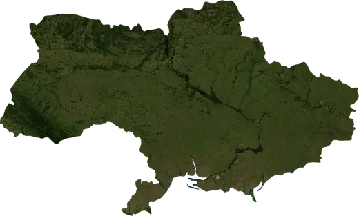
 Odesa
Odesa: earthquakes and wildfires
Latest earthquakes and wildfires in Odesa (Ukraine) on a live map, the strongest earthquakes and largest fires on record.
Live map – Odesa
Key statistics (30 days)
Earthquakes M2.5+ and the wildfire fronts shown on the map.
Recent events in Odesa
- 21 h agoWildfire near Bilhorod-Dnistrovskyi, Ukraine – active1,453 acres · 64 mi SSE of Bilhorod-Dnistrovskyi, Ukraine
- 2 days agoWildfire near Izmayil, Ukraine828 acres · 12 mi W of Izmayil, Ukraine
- 3 days agoWildfire near Nerushay, Ukraine1,233 acres · near Nerushay, Ukraine
- 317 days agoWildfire near Vylkove, Ukraine2,513 acres · 5 mi ESE of Vylkove, Ukraine
- 317 days agoWildfire near Vylkove, Ukraine2,476 acres · near Vylkove, Ukraine
Historical overview
Earthquakes M3.0+ and significant events of other hazards.
About Odesa
Odesa has recorded 5 earthquakes of magnitude 3.0 or more since 1992. The strongest was M4.9 in 2008.
Satellites have detected 2 significant wildfires here; the largest burned about 2,513 acres.
Know the official emergency number, prepare an emergency kit and follow the instructions of your civil protection authority.
Learn more ›Earthquakes
5 earthquakes of magnitude 3.0 or more since 1992. The strongest was M4.9.
Recent earthquakes
No earthquakes of magnitude 2.5+ in the last 12 months.
Strongest earthquakes on record
| Mag | Location | Time (UTC) | Depth |
|---|---|---|---|
| 4.9 | 64 mi SSE of Bilhorod-Dnistrovskyi, Ukraine | 6.2 mi | |
| 3.8 | 71 mi SSE of Bilhorod-Dnistrovskyi, Ukraine | 6.2 mi | |
| 3.6 | 73 mi SSE of Chornomors'k, Ukraine | 20.5 mi | |
| 3.4 | 64 mi SE of Mykolayivka, Ukraine | 20.5 mi | |
| 3.4 | 69 mi SSE of Bilhorod-Dnistrovskyi, Ukraine | 6.2 mi |
Earthquakes per year (M3.0+)
Year
| 2008 | 2 | M4.9 |
| 1992 | 3 | M3.6 |
Wildfires
2 major fires since 2026. The largest covered about 2,513 acres.
Recent fires
| Area | Location | Since | Status |
|---|---|---|---|
| 1,453 acres | 64 mi SSE of Bilhorod-Dnistrovskyi, Ukraine | Active | |
| 828 acres | 12 mi W of Izmayil, Ukraine | Inactive | |
| 1,233 acres | near Nerushay, Ukraine | Inactive | |
| 2,513 acres | 5 mi ESE of Vylkove, Ukraine | Inactive | |
| 2,476 acres | near Vylkove, Ukraine | Inactive |
Largest fires on record
| Area | Location | Since | Status |
|---|---|---|---|
| 2,513 acres | 5 mi ESE of Vylkove, Ukraine | Inactive | |
| 2,476 acres | near Vylkove, Ukraine | Inactive |