 Ukraine
: earthquakes and wildfires
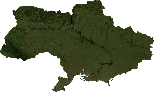
Latest earthquakes and active wildfires in Ukraine on a live map, the strongest earthquakes and largest fires on record, and statistics by year.
Live map – Ukraine
Key statistics (30 days)
Earthquakes M2.5+ and the wildfire fronts shown on the map.
Fire danger
Forecast for the area around: Kyiv. Danger can vary locally; follow official guidance. Source: Copernicus EMS – EFFIS (FWI).
Severe weather (forecast)
- Today: Rain – Very heavy rain (25–50 mm) · Pravyi Bereh
- Tomorrow: Rain – Very heavy rain (25–50 mm) · Pravyi Bereh
Forecast for the area around: Ukraine. It does not replace warnings from the national weather service. Source: ECMWF / Copernicus EMS.
Recent events in Ukraine
- 7 h agoWildfire near Olenevka, Ukraine – active3,286 acres · 43 mi W of Olenevka, Ukraine
- 15 h agoWildfire near Rivne, Ukraine – active1,320 acres · 5 mi S of Rivne, Ukraine
- 16 h agoWildfire near Bilhorod-Dnistrovskyi, Ukraine – active1,453 acres · 64 mi SSE of Bilhorod-Dnistrovskyi, Ukraine
- 16 h agoWildfire near Alchevsk, Ukraine – active4,011 acres · near Alchevsk, Ukraine
- 17 h agoWildfire near Tsentralno-Miskyi, Ukraine – active971 acres · near Tsentralno-Miskyi, Ukraine
- 17 h agoWildfire near Donetsk, Ukraine – active1,194 acres · 8 mi NE of Donetsk, Ukraine
Historical overview
Earthquakes M3.0+ and significant events of other hazards.
About Ukraine
Ukraine has recorded 53 earthquakes of magnitude 3.0 or more since 1977. The strongest was M4.9 in 2008.
Satellites have detected 41 significant wildfires here; the largest burned about 11,770 acres.
Know the official emergency number, prepare an emergency kit and follow the instructions of your civil protection authority.
Learn more ›Earthquakes
53 earthquakes of magnitude 3.0 or more since 1977. The strongest was M4.9.
Recent earthquakes
| Mag | Location | Time (UTC) | Depth |
|---|---|---|---|
| 4.4 | 4 mi WNW of Kyivskyi, Ukraine | 6.2 mi | |
| 4.3 | 19 mi SW of Sevastopol, Ukraine | 6.2 mi | |
| 4.3 | 14 mi SW of Sevastopol, Ukraine | 6.2 mi | |
| 4.8 | 16 mi NNW of Shcholkine, Ukraine | 6.2 mi | |
| 4.1 | 19 mi SW of Sevastopol, Ukraine | 5.8 mi |
Strongest earthquakes on record
| Mag | Location | Time (UTC) | Depth |
|---|---|---|---|
| 4.9 | 64 mi SSE of Bilhorod-Dnistrovskyi, Ukraine | 6.2 mi | |
| 4.8 | 16 mi NNW of Shcholkine, Ukraine | 6.2 mi | |
| 4.8 | near Tsentralnyi, Ukraine | 6.2 mi | |
| 4.8 | 4 mi S of Koson, Ukraine | 6.2 mi | |
| 4.7 | 41 mi S of Sevastopol, Ukraine | 14.6 mi | |
| 4.7 | 23 mi SSW of Dolyna, Ukraine | 6.2 mi | |
| 4.6 | 10 mi S of Sudak, Ukraine | 15.9 mi | |
| 4.6 | 6 mi S of Uzhhorod, Ukraine | 8.8 mi | |
| 4.5 | 6 mi ESE of Zavodske, Ukraine | 9.8 mi | |
| 4.5 | 10 mi N of Kryvyy Rih, Ukraine | 9.3 mi | |
| 4.4 | 4 mi WNW of Kyivskyi, Ukraine | 6.2 mi | |
| 4.4 | 12 mi NNE of Hadiach, Ukraine | 6.2 mi | |
| 4.4 | 118 mi WSW of Komyshova Bukhta, Ukraine | 28.0 mi | |
| 4.4 | 38 mi WNW of Sevastopol, Ukraine | 6.2 mi | |
| 4.3 | 19 mi SW of Sevastopol, Ukraine | 6.2 mi |
Earthquakes per year (M3.0+)
Year
| 2026 | 5 | M4.8 |
| 2025 | 1 | M4.1 |
| 2023 | 2 | M4.7 |
| 2021 | 1 | M4.5 |
| 2020 | 1 | M3.3 |
| 2016 | 1 | M4.8 |
| 2015 | 2 | M4.4 |
| 2014 | 1 | M4.1 |
| 2013 | 1 | M4.5 |
| 2011 | 1 | M4.7 |
| 2009 | 1 | M4.2 |
| 2008 | 4 | M4.9 |
| 2007 | 2 | M3.7 |
| 2006 | 2 | M4.8 |
| 2005 | 1 | M3.9 |
| 2003 | 1 | M3.8 |
| 2001 | 1 | M4.2 |
| 1999 | 1 | M4.1 |
| 1998 | 3 | M4.3 |
| 1997 | 1 | M3.7 |
| 1992 | 4 | M3.6 |
| 1990 | 5 | M4.6 |
| 1988 | 2 | M4.2 |
| 1986 | 3 | M4.4 |
| 1984 | 1 | M4.2 |
| 1983 | 2 | M3.9 |
| 1982 | 1 | M4.6 |
| 1979 | 1 | M4.3 |
| 1977 | 1 | M4.4 |
Wildfires
41 major fires since 2025. The largest covered about 11,770 acres.
Recent fires
| Area | Location | Since | Status |
|---|---|---|---|
| 3,286 acres | 43 mi W of Olenevka, Ukraine | Active | |
| 1,320 acres | 5 mi S of Rivne, Ukraine | Active | |
| 1,453 acres | 64 mi SSE of Bilhorod-Dnistrovskyi, Ukraine | Active | |
| 4,011 acres | near Alchevsk, Ukraine | Active | |
| 971 acres | near Tsentralno-Miskyi, Ukraine | Active | |
| 1,194 acres | 8 mi NE of Donetsk, Ukraine | Active | |
| 1,428 acres | near Rodynske, Ukraine | Active | |
| 5,612 acres | near Druzhkivka, Ukraine | Active | |
| 828 acres | 12 mi W of Izmayil, Ukraine | Inactive | |
| 1,233 acres | near Nerushay, Ukraine | Inactive |
Show all (48)
Largest fires on record
| Area | Location | Since | Status |
|---|---|---|---|
| 11,770 acres | near Kryvyy Rih, Ukraine | Inactive | |
| 8,048 acres | near Zaporizhzhya, Ukraine | Inactive | |
| 6,852 acres | 23 mi WSW of Slavutych, Ukraine | Inactive | |
| 5,795 acres | 30 mi NNE of Borodianka, Ukraine | Inactive | |
| 5,612 acres | near Druzhkivka, Ukraine | Active | |
| 5,340 acres | 13 mi NNE of Snovsk, Ukraine | Inactive | |
| 5,281 acres | 24 mi E of Kakhovka, Ukraine | Inactive | |
| 4,789 acres | 4 mi SSE of Lyman, Ukraine | Inactive | |
| 4,633 acres | 25 mi WSW of Rutchenkivskyi, Ukraine | Inactive | |
| 4,524 acres | 16 mi N of Koryukivka, Ukraine | Inactive | |
| 4,394 acres | 34 mi SW of Slavutych, Ukraine | Inactive | |
| 4,011 acres | near Alchevsk, Ukraine | Active | |
| 3,766 acres | 4 mi SSE of Dvorichna, Ukraine | Inactive | |
| 3,650 acres | 28 mi SW of Slavutych, Ukraine | Inactive | |
| 3,546 acres | 15 mi SSE of Oleshky, Ukraine | Inactive |
Major fires per year
Year
| 2026 | 40 | 11,770 acres |
| 2025 | 1 | 8,048 acres |
Regions
Places
- Kryvyy Rih
- Sevastopol
- Mykolayiv
- Vinnytsya
- Pravyi Bereh
- Simferopol
- Poltava
- Khmelnytskyi
- Chernivtsi
- Sumy
- Ivano-Frankivsk
- Mariupol
- Kamyanske
- Ternopil
- Kremenchuk
- Kropyvnytskyi
- Tsentralnyi
- Fortechnyi
- Zarichnyi
- Kerch
- Shevchenko
- Kovpakivskyi
- Livoberezhnyi
- Uzhhorod
- Kyivskyi
- Yevpatoriya
- Berdyansk
- Nikopol
- Kalmiuskyi
- Mukachevo
- Yalta
- Izmayil
- Feodosiya
- Korabelna Storona
- Arshyntseve
- Alushta
- Khust
- Saky
- Bakhchysaray
- Vynohradiv
- Berehove