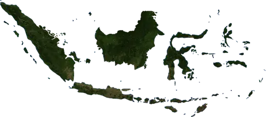
 North Maluku
: earthquakes and wildfires
M3.5 earthquake near Galela, Indonesia – now (Nov 21, 2026, 1:20 AM UTC). Latest earthquakes and wildfires in North Maluku (Indonesia) on a live map, the strongest earthquakes and largest fires on record.
Live map – North Maluku
Key statistics (30 days)
Earthquakes M2.5+ and the wildfire fronts shown on the map.
Recent events in North Maluku
- 3.115 min agoM3.1 earthquake near Galela, Indonesia – now93 mi W of Galela, Indonesia
- 3.439 min agoM3.4 earthquake near Galela, Indonesia – now82 mi NW of Galela, Indonesia
- 3.53 h agoM3.5 earthquake near Galela, Indonesia – now38 mi WSW of Galela, Indonesia
- 3.08 h agoM3.0 earthquake near Labuha, Indonesia27 mi SW of Labuha, Indonesia
- 11 h agoWildfire near Kawasi, Indonesia – active2,365 acres · 9 mi NNE of Kawasi, Indonesia
- 2.719 h agoM2.7 earthquake near Ternate, Indonesia32 mi WNW of Ternate, Indonesia
Historical overview
Earthquakes M3.0+ and significant events of other hazards.
About North Maluku
North Maluku has recorded 9,667 earthquakes of magnitude 3.0 or more since 1976. The strongest was M7.7 in 1998.
Satellites have detected 33 significant wildfires here; the largest burned about 84,307 acres.
Know the official emergency number, prepare an emergency kit and follow the instructions of your civil protection authority.
Learn more ›Earthquakes
9,667 earthquakes of magnitude 3.0 or more since 1976. The strongest was M7.7.
Recent earthquakes
| Mag | Location | Time (UTC) | Depth |
|---|---|---|---|
| 3.1 | 93 mi W of Galela, Indonesia | 23.6 mi | |
| 3.4 | 82 mi NW of Galela, Indonesia | 6.2 mi | |
| 3.5 | 38 mi WSW of Galela, Indonesia | 6.8 mi | |
| 3.0 | 27 mi SW of Labuha, Indonesia | 18.0 mi | |
| 2.7 | 32 mi WNW of Ternate, Indonesia | 9.3 mi | |
| 3.7 | 12 mi S of Daruba, Indonesia | 47.8 mi | |
| 2.7 | 51 mi NW of Ternate, Indonesia | 20.5 mi | |
| 3.0 | 39 mi NNE of Daruba, Indonesia | 128.0 mi | |
| 3.1 | 28 mi W of Galela, Indonesia | 63.4 mi | |
| 2.8 | 16 mi E of Daruba, Indonesia | 6.2 mi |
Show all (200)
Strongest earthquakes on record
| Mag | Location | Time (UTC) | Depth |
|---|---|---|---|
| 7.7 | 75 mi W of Sanana, Indonesia | 20.5 mi | |
| 7.5 | 78 mi WNW of Ternate, Indonesia | 13.7 mi | |
| 7.5 | 88 mi W of Galela, Indonesia | 20.5 mi | |
| 7.4 | 78 mi WNW of Ternate, Indonesia | 21.7 mi | |
| 7.3 | 43 mi E of Labuha, Indonesia | 6.2 mi | |
| 7.1 | 87 mi NW of Ternate, Indonesia | 20.5 mi | |
| 7.1 | 88 mi W of Galela, Indonesia | 28.0 mi | |
| 7.1 | 78 mi WNW of Galela, Indonesia | 27.3 mi | |
| 7.0 | 82 mi NW of Galela, Indonesia | 18.5 mi | |
| 7.0 | 44 mi ENE of Daruba, Indonesia | 19.3 mi | |
| 7.0 | 23 mi NNE of Sofifi, Indonesia | 12.4 mi | |
| 7.0 | 88 mi NW of Ternate, Indonesia | 31.5 mi | |
| 6.9 | 85 mi WSW of Ternate, Indonesia | 21.7 mi | |
| 6.9 | 76 mi NNW of Galela, Indonesia | 15.5 mi | |
| 6.9 | 75 mi ESE of Labuha, Indonesia | 20.5 mi |
Earthquakes per year (M3.0+)
Year
| 2026 | 391 | M7.4 |
| 2025 | 245 | M5.9 |
| 2024 | 278 | M6.4 |
| 2023 | 461 | M7.0 |
| 2022 | 272 | M5.9 |
| 2021 | 327 | M6.2 |
| 2020 | 279 | M6.4 |
| 2019 | 635 | M7.3 |
| 2018 | 258 | M6.0 |
| 2017 | 245 | M5.8 |
| 2016 | 260 | M6.3 |
| 2015 | 339 | M6.3 |
| 2014 | 439 | M7.1 |
| 2013 | 197 | M6.0 |
| 2012 | 201 | M6.6 |
| 2011 | 189 | M6.3 |
| 2010 | 147 | M6.4 |
| 2009 | 118 | M6.0 |
| 2008 | 252 | M6.6 |
| 2007 | 540 | M7.5 |
| 2006 | 207 | M6.2 |
| 2005 | 198 | M5.9 |
| 2004 | 181 | M5.6 |
| 2003 | 179 | M7.0 |
| 2002 | 99 | M5.9 |
| 2001 | 173 | M6.2 |
| 2000 | 129 | M5.9 |
| 1999 | 137 | M5.9 |
| 1998 | 196 | M7.7 |
| 1997 | 156 | M6.4 |
| 1996 | 196 | M6.0 |
| 1995 | 184 | M6.7 |
| 1994 | 113 | M7.0 |
| 1993 | 101 | M6.8 |
| 1992 | 125 | M6.7 |
| 1991 | 94 | M5.9 |
| 1990 | 69 | M6.2 |
| 1989 | 159 | M7.1 |
| 1988 | 67 | M5.9 |
| 1987 | 110 | M6.8 |
| 1986 | 163 | M7.5 |
| 1985 | 91 | M7.0 |
| 1984 | 74 | M6.4 |
| 1983 | 75 | M6.6 |
| 1982 | 56 | M5.7 |
| 1981 | 56 | M6.1 |
| 1980 | 53 | M5.8 |
| 1979 | 46 | M6.8 |
| 1978 | 35 | M5.9 |
| 1977 | 43 | M6.1 |
| 1976 | 29 | M5.6 |
Wildfires
33 major fires since 2025. The largest covered about 84,307 acres.
Recent fires
| Area | Location | Since | Status |
|---|---|---|---|
| 2,365 acres | 9 mi NNE of Kawasi, Indonesia | Active | |
| 6,192 acres | 28 mi SE of Sofifi, Indonesia | Active | |
| 3,153 acres | near Kawasi, Indonesia | Active | |
| 9,084 acres | 52 mi NNE of Ternate, Indonesia | Active | |
| 2,009 acres | 50 mi E of Kawasi, Indonesia | Active | |
| 3,588 acres | 16 mi SSW of Tobelo, Indonesia | Inactive | |
| 22,576 acres | 20 mi SSW of Tobelo, Indonesia | Inactive | |
| 10,593 acres | 3 mi SW of Maba, Indonesia | Inactive | |
| 5,063 acres | 54 mi NNE of Maba, Indonesia | Inactive | |
| 9,158 acres | 47 mi ESE of Ternate, Indonesia | Inactive |
Show all (41)
| Area | Location | Since | Status |
|---|---|---|---|
| 932 acres | 50 mi E of Kawasi, Indonesia | Inactive | |
| 4,858 acres | 18 mi NNE of Sofifi, Indonesia | Inactive | |
| 4,910 acres | 13 mi N of Maba, Indonesia | Inactive | |
| 1,228 acres | 12 mi S of Tobelo, Indonesia | Inactive | |
| 1,819 acres | 32 mi SSW of Tobelo, Indonesia | Inactive | |
| 833 acres | 5 mi ESE of Labuha, Indonesia | Inactive | |
| 21,716 acres | 31 mi SSE of Tobelo, Indonesia | Inactive | |
| 788 acres | 51 mi NE of Maba, Indonesia | Inactive | |
| 788 acres | 27 mi NNE of Sofifi, Indonesia | Inactive | |
| 2,852 acres | 29 mi SSW of Tobelo, Indonesia | Inactive | |
| 2,696 acres | 42 mi SE of Daruba, Indonesia | Inactive | |
| 9,469 acres | 37 mi SSW of Tobelo, Indonesia | Inactive | |
| 3,138 acres | 10 mi N of Bobong, Indonesia | Inactive | |
| 13,771 acres | 26 mi N of Maba, Indonesia | Inactive | |
| 9,106 acres | 28 mi ESE of Sanana, Indonesia | Inactive | |
| 4,020 acres | 6 mi NNE of Daruba, Indonesia | Inactive | |
| 4,950 acres | 9 mi N of Daruba, Indonesia | Inactive | |
| 4,013 acres | 28 mi NNW of Maba, Indonesia | Inactive | |
| 3,919 acres | 29 mi NNE of Sofifi, Indonesia | Inactive | |
| 3,042 acres | 37 mi SSW of Tobelo, Indonesia | Inactive | |
| 3,383 acres | 42 mi ENE of Ternate, Indonesia | Inactive | |
| 84,307 acres | 26 mi ESE of Sofifi, Indonesia | Inactive | |
| 3,284 acres | 8 mi NNE of Galela, Indonesia | Inactive | |
| 3,482 acres | 14 mi NE of Kawasi, Indonesia | Inactive | |
| 2,550 acres | 14 mi ENE of Sofifi, Indonesia | Inactive | |
| 8,429 acres | 42 mi ESE of Ternate, Indonesia | Inactive | |
| 2,941 acres | 6 mi N of Galela, Indonesia | Inactive | |
| 5,095 acres | 5 mi S of Maba, Indonesia | Inactive | |
| 2,501 acres | 32 mi NNE of Labuha, Indonesia | Inactive | |
| 2,693 acres | 42 mi ENE of Ternate, Indonesia | Inactive | |
| 3,576 acres | 26 mi NNW of Maba, Indonesia | Inactive |
Largest fires on record
| Area | Location | Since | Status |
|---|---|---|---|
| 84,307 acres | 26 mi ESE of Sofifi, Indonesia | Inactive | |
| 22,576 acres | 20 mi SSW of Tobelo, Indonesia | Inactive | |
| 21,716 acres | 31 mi SSE of Tobelo, Indonesia | Inactive | |
| 13,771 acres | 26 mi N of Maba, Indonesia | Inactive | |
| 10,593 acres | 3 mi SW of Maba, Indonesia | Inactive | |
| 9,469 acres | 37 mi SSW of Tobelo, Indonesia | Inactive | |
| 9,158 acres | 47 mi ESE of Ternate, Indonesia | Inactive | |
| 9,106 acres | 28 mi ESE of Sanana, Indonesia | Inactive | |
| 9,084 acres | 52 mi NNE of Ternate, Indonesia | Active | |
| 8,429 acres | 42 mi ESE of Ternate, Indonesia | Inactive | |
| 6,192 acres | 28 mi SE of Sofifi, Indonesia | Active | |
| 5,095 acres | 5 mi S of Maba, Indonesia | Inactive | |
| 5,063 acres | 54 mi NNE of Maba, Indonesia | Inactive | |
| 4,950 acres | 9 mi N of Daruba, Indonesia | Inactive | |
| 4,910 acres | 13 mi N of Maba, Indonesia | Inactive |
Major fires per year
Year
| 2026 | 32 | 84,307 acres |
| 2025 | 1 | 9,469 acres |