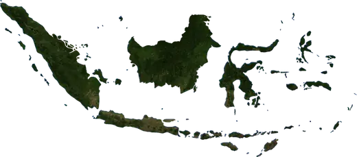
 Indonesia
: earthquakes and wildfires
Latest earthquakes and active wildfires in Indonesia on a live map, the strongest earthquakes and largest fires on record, and statistics by year.
Live map – Indonesia
Key statistics (30 days)
Earthquakes M2.5+ and the wildfire fronts shown on the map.
Fire danger
Forecast for the area around: Situbondo. Danger can vary locally; follow official guidance. Source: Copernicus EMS – EFFIS (FWI).
Severe weather (forecast)
- Today: Rain – Extreme rain (≥ 50 mm) · Medan
- Tomorrow: Rain – Extreme rain (≥ 50 mm) · Medan
Forecast for the area around: Indonesia. It does not replace warnings from the national weather service. Source: ECMWF / Copernicus EMS.
Recent events in Indonesia
- 2.72 h agoM2.7 earthquake near Ende, Indonesia – now38 mi NNW of Ende, Indonesia
- 5.13 h agoM5.1 earthquake near Bunobogu, Indonesia – now61 mi NE of Bunobogu, Indonesia
- 3 h agoWildfire near Merauke, Indonesia – active197,249 acres · 6 mi NNW of Merauke, Indonesia
- 3 h agoWildfire near Merauke, Indonesia – active108,452 acres · 46 mi NNE of Merauke, Indonesia
- 3 h agoWildfire near Merauke, Indonesia – active3,010 acres · 41 mi ESE of Merauke, Indonesia
- 3 h agoWildfire near Kimaam, Indonesia – active19,801 acres · 45 mi WSW of Kimaam, Indonesia
Historical overview
Earthquakes M3.0+ and significant events of other hazards.
About Indonesia
Indonesia has recorded 70,280 earthquakes of magnitude 3.0 or more since 1976. The strongest was M9.1 in 2004.
Satellites have detected 1,174 significant wildfires here; the largest burned about 1,800,123 acres.
Know the official emergency number, prepare an emergency kit and follow the instructions of your civil protection authority.
Learn more ›Earthquakes
Earthquakes today: Indonesia →
70,280 earthquakes of magnitude 3.0 or more since 1976. The strongest was M9.1.
Recent earthquakes
| Mag | Location | Time (UTC) | Depth |
|---|---|---|---|
| 2.7 | 38 mi NNW of Ende, Indonesia | 6.2 mi | |
| 5.1 | 61 mi NE of Bunobogu, Indonesia | 302.9 mi | |
| 3.1 | 77 mi NW of Ternate, Indonesia | 16.8 mi | |
| 2.7 | 28 mi N of Tambolaka, Indonesia | 64.6 mi | |
| 2.7 | 28 mi NNE of Ruteng, Indonesia | 6.2 mi | |
| 2.7 | 26 mi NNE of Ruteng, Indonesia | 6.2 mi | |
| 2.8 | 22 mi WSW of Reuleuet, Indonesia | 6.2 mi | |
| 3.7 | 19 mi SW of Marisa, Indonesia | 126.1 mi | |
| 3.3 | 24 mi W of Padangsidempuan, Indonesia | 51.0 mi | |
| 4.2 | 28 mi N of Ruteng, Indonesia | 6.2 mi |
Show all (200)
Strongest earthquakes on record
| Mag | Location | Time (UTC) | Depth |
|---|---|---|---|
| 9.1 | 60 mi S of Meulaboh, Indonesia | 18.6 mi | |
| 8.6 | 48 mi N of Lahewa, Indonesia | 18.6 mi | |
| 8.4 | 76 mi SW of Bengkulu, Indonesia | 21.1 mi | |
| 8.3 | 133 mi SSW of Tambolaka, Indonesia | 15.5 mi | |
| 8.2 | 63 mi ENE of Biak, Indonesia | 20.5 mi | |
| 7.9 | 55 mi SW of Sungai Penuh, Indonesia | 21.7 mi | |
| 7.9 | 65 mi S of Bengkulu, Indonesia | 20.5 mi | |
| 7.9 | 103 mi NW of Lewoleba, Indonesia | 364.9 mi | |
| 7.9 | 65 mi WSW of Toli-Toli, Indonesia | 14.9 mi | |
| 7.9 | 20 mi NW of Serui, Indonesia | 3.1 mi | |
| 7.8 | 106 mi SSE of Tuapejat, Indonesia | 12.4 mi | |
| 7.8 | 47 mi E of Sinabang, Indonesia | 19.3 mi | |
| 7.8 | 156 mi SSW of Kencong, Indonesia | 11.2 mi | |
| 7.8 | 24 mi WNW of Maumere, Indonesia | 17.4 mi | |
| 7.7 | 43 mi NNW of Ende, Indonesia | 6.2 mi |
Earthquakes per year (M3.0+)
Year
| 2026 | 2,186 | M7.7 |
| 2025 | 1,685 | M6.7 |
| 2024 | 1,650 | M6.4 |
| 2023 | 2,080 | M7.6 |
| 2022 | 1,955 | M6.9 |
| 2021 | 1,986 | M7.3 |
| 2020 | 1,711 | M6.9 |
| 2019 | 2,220 | M7.3 |
| 2018 | 1,968 | M7.5 |
| 2017 | 1,595 | M6.7 |
| 2016 | 1,770 | M6.7 |
| 2015 | 1,973 | M7.0 |
| 2014 | 2,215 | M7.1 |
| 2013 | 1,487 | M7.0 |
| 2012 | 1,440 | M7.1 |
| 2011 | 1,305 | M6.7 |
| 2010 | 1,419 | M7.8 |
| 2009 | 1,710 | M7.6 |
| 2008 | 2,282 | M7.4 |
| 2007 | 2,771 | M8.4 |
| 2006 | 2,617 | M7.7 |
| 2005 | 3,897 | M8.6 |
| 2004 | 2,048 | M9.1 |
| 2003 | 1,212 | M7.0 |
| 2002 | 1,265 | M7.6 |
| 2001 | 1,041 | M7.5 |
| 2000 | 1,311 | M7.9 |
| 1999 | 1,021 | M6.5 |
| 1998 | 1,416 | M7.7 |
| 1997 | 1,292 | M7.0 |
| 1996 | 1,982 | M8.2 |
| 1995 | 1,253 | M7.1 |
| 1994 | 843 | M7.8 |
| 1993 | 735 | M6.9 |
| 1992 | 791 | M7.8 |
| 1991 | 790 | M7.5 |
| 1990 | 805 | M7.6 |
| 1989 | 871 | M7.1 |
| 1988 | 769 | M7.0 |
| 1987 | 799 | M7.1 |
| 1986 | 782 | M7.5 |
| 1985 | 728 | M7.1 |
| 1984 | 711 | M7.4 |
| 1983 | 741 | M7.3 |
| 1982 | 509 | M6.4 |
| 1981 | 443 | M6.7 |
| 1980 | 444 | M6.3 |
| 1979 | 507 | M7.9 |
| 1978 | 346 | M6.7 |
| 1977 | 527 | M8.3 |
| 1976 | 375 | M7.1 |
Wildfires
1,174 major fires since 2025. The largest covered about 1,800,123 acres.
Recent fires
| Area | Location | Since | Status |
|---|---|---|---|
| 197,249 acres | 6 mi NNW of Merauke, Indonesia | Active | |
| 108,452 acres | 46 mi NNE of Merauke, Indonesia | Active | |
| 3,010 acres | 41 mi ESE of Merauke, Indonesia | Active | |
| 19,801 acres | 45 mi WSW of Kimaam, Indonesia | Active | |
| 12,701 acres | 48 mi WSW of Kimaam, Indonesia | Active | |
| 2,911 acres | 35 mi E of Serui, Indonesia | Active | |
| 4,596 acres | 5 mi WNW of Cilegon, Indonesia | Active | |
| 885 acres | 50 mi N of Bontang, Indonesia | Active | |
| 783 acres | 71 mi WNW of Bontang, Indonesia | Active | |
| 835 acres | 67 mi WNW of Samarinda, Indonesia | Active |
Show all (200)
| Area | Location | Since | Status |
|---|---|---|---|
| 885 acres | 9 mi NW of Bontang, Indonesia | Active | |
| 1,280 acres | 56 mi NW of Nusantara, Indonesia | Active | |
| 3,776 acres | 10 mi SSW of Bontang, Indonesia | Active | |
| 2,367 acres | 11 mi NNW of Bontang, Indonesia | Active | |
| 1,517 acres | 60 mi W of Bontang, Indonesia | Active | |
| 1,964 acres | 10 mi SSE of Kahala, Indonesia | Active | |
| 6,571 acres | 7 mi ENE of Kahala, Indonesia | Active | |
| 1,819 acres | near Bontang, Indonesia | Active | |
| 2,990 acres | 5 mi WSW of Kahala, Indonesia | Active | |
| 1,082 acres | 57 mi NNW of Kendari, Indonesia | Active | |
| 17,866 acres | 16 mi SE of Bima, Indonesia | Active | |
| 8,649 acres | 13 mi E of Sumbawa Besar, Indonesia | Active | |
| 2,486 acres | 44 mi SE of Sumbawa Besar, Indonesia | Active | |
| 885 acres | 13 mi SE of Kahala, Indonesia | Active | |
| 1,426 acres | 44 mi SSE of Poso, Indonesia | Active | |
| 932 acres | 59 mi NNW of Bungku, Indonesia | Active | |
| 2,108 acres | 10 mi N of Kahala, Indonesia | Active | |
| 2,649 acres | 80 mi S of Tanjung Selor, Indonesia | Active | |
| 4,823 acres | 66 mi N of Bontang, Indonesia | Active | |
| 2,165 acres | 21 mi N of Bontang, Indonesia | Active | |
| 2,987 acres | 83 mi NW of Sangatta, Indonesia | Active | |
| 2,024 acres | 37 mi SW of Luwuk, Indonesia | Active | |
| 21,118 acres | 60 mi NW of Nusantara, Indonesia | Active | |
| 15,096 acres | 45 mi NW of Bontang, Indonesia | Active | |
| 3,632 acres | 33 mi NE of Martapura, Indonesia | Active | |
| 11,186 acres | 62 mi NNW of Bontang, Indonesia | Active | |
| 3,872 acres | 41 mi NW of Samarinda, Indonesia | Active | |
| 27,011 acres | 48 mi W of Bontang, Indonesia | Active | |
| 4,075 acres | 14 mi S of Bungku, Indonesia | Active | |
| 15,815 acres | 41 mi W of Bungku, Indonesia | Active | |
| 4,275 acres | 53 mi NW of Bungku, Indonesia | Active | |
| 21,214 acres | 43 mi NW of Samarinda, Indonesia | Active | |
| 7,312 acres | 58 mi S of Tahuna, Indonesia | Active | |
| 932 acres | 54 mi WNW of Nusantara, Indonesia | Active | |
| 1,273 acres | 49 mi WNW of Kendari, Indonesia | Active | |
| 2,669 acres | 20 mi SE of Atambua, Indonesia | Active | |
| 2,676 acres | 16 mi ENE of Kefamenanu, Indonesia | Active | |
| 6,420 acres | 22 mi ESE of Malang, Indonesia | Active | |
| 2,429 acres | 14 mi E of Kupang, Indonesia | Active | |
| 1,606 acres | 21 mi ESE of Kupang, Indonesia | Active | |
| 9,659 acres | 50 mi E of Kupang, Indonesia | Active | |
| 2,681 acres | 31 mi E of Baubau, Indonesia | Active | |
| 8,105 acres | 11 mi NW of Kendari, Indonesia | Active | |
| 1,080 acres | 41 mi WNW of Kendari, Indonesia | Active | |
| 1,725 acres | 51 mi WNW of Kendari, Indonesia | Active | |
| 2,899 acres | 51 mi NW of Kendari, Indonesia | Active | |
| 6,066 acres | 24 mi E of Kupang, Indonesia | Active | |
| 1,895 acres | 22 mi SE of Atambua, Indonesia | Active | |
| 7,243 acres | 27 mi WNW of Namlea, Indonesia | Active | |
| 7,737 acres | 17 mi SE of Soe, Indonesia | Active | |
| 1,769 acres | 18 mi E of Katobu, Indonesia | Active | |
| 13,171 acres | 9 mi NE of Lewoleba, Indonesia | Active | |
| 2,061 acres | 19 mi SE of Raha, Indonesia | Active | |
| 1,574 acres | 7 mi NW of Kendari, Indonesia | Active | |
| 5,063 acres | 54 mi NNE of Maba, Indonesia | Active | |
| 70,158 acres | 20 mi SW of Namlea, Indonesia | Active | |
| 22,427 acres | 20 mi SSW of Tobelo, Indonesia | Active | |
| 1,764 acres | 50 mi E of Kawasi, Indonesia | Active | |
| 1,458 acres | 50 mi W of Kimaam, Indonesia | Active | |
| 27,757 acres | 42 mi W of Okaba, Indonesia | Active | |
| 2,086 acres | 30 mi SW of Kimaam, Indonesia | Active | |
| 2,145 acres | 35 mi NE of Dobo, Indonesia | Active | |
| 8,053 acres | 18 mi ENE of Okaba, Indonesia | Active | |
| 1,800,123 acres | 85 mi NE of Merauke, Indonesia | Active | |
| 83,875 acres | 49 mi SE of Merauke, Indonesia | Active | |
| 1,480 acres | 31 mi E of Pekanbaru, Indonesia | Active | |
| 3,981 acres | 9 mi N of Tanjungagung, Indonesia | Active | |
| 1,327 acres | 12 mi SE of Cepu, Indonesia | Active | |
| 1,028 acres | 18 mi SSW of Surabaya, Indonesia | Active | |
| 2,644 acres | 79 mi NNE of Bandar Lampung, Indonesia | Active | |
| 2,634 acres | 12 mi NW of Tuban, Indonesia | Active | |
| 4,567 acres | 38 mi N of Bontang, Indonesia | Active | |
| 830 acres | 63 mi W of Bontang, Indonesia | Active | |
| 2,790 acres | 89 mi NNE of Muara Teweh, Indonesia | Active | |
| 1,174 acres | 85 mi NNE of Muara Teweh, Indonesia | Active | |
| 4,868 acres | 38 mi N of Bontang, Indonesia | Active | |
| 1,569 acres | 18 mi NNW of Sungailiat, Indonesia | Active | |
| 2,120 acres | 14 mi NE of Tanjung, Indonesia | Active | |
| 7,035 acres | 7 mi ESE of Tanjung, Indonesia | Active | |
| 1,623 acres | 51 mi SSE of Tanjung Selor, Indonesia | Active | |
| 13,072 acres | 52 mi ENE of Banjarmasin, Indonesia | Active | |
| 4,423 acres | 28 mi NE of Martapura, Indonesia | Active | |
| 3,793 acres | 6 mi ENE of Jambi City, Indonesia | Active | |
| 10,341 acres | 41 mi WNW of Amuntai, Indonesia | Active | |
| 1,226 acres | 21 mi NE of Samarinda, Indonesia | Active | |
| 2,822 acres | 50 mi SSE of Surabaya, Indonesia | Active | |
| 887 acres | 14 mi SSW of Taliwang, Indonesia | Active | |
| 3,185 acres | 69 mi N of Banjarmasin, Indonesia | Active | |
| 9,652 acres | 41 mi SW of Bungku, Indonesia | Active | |
| 1,327 acres | 4 mi SSE of Andoolo, Indonesia | Active | |
| 3,341 acres | 7 mi SSE of Kendari, Indonesia | Active | |
| 885 acres | 45 mi WNW of Kendari, Indonesia | Active | |
| 1,127 acres | 56 mi N of Kendari, Indonesia | Active | |
| 835 acres | 40 mi SE of Banjarbaru, Indonesia | Active | |
| 788 acres | 67 mi NNE of Surabaya, Indonesia | Active | |
| 1,320 acres | 53 mi SW of Kendari, Indonesia | Active | |
| 39,856 acres | 26 mi SW of Bungku, Indonesia | Active | |
| 788 acres | 15 mi N of Bontang, Indonesia | Active | |
| 48,265 acres | 23 mi NNE of Namrole, Indonesia | Active | |
| 15,165 acres | 30 mi NW of Bontang, Indonesia | Active | |
| 7,974 acres | 80 mi WSW of Balikpapan, Indonesia | Active | |
| 2,805 acres | 35 mi ENE of Tanjung, Indonesia | Active | |
| 3,640 acres | 11 mi SSW of Loa Janan, Indonesia | Active | |
| 2,755 acres | 13 mi ESE of Loa Janan, Indonesia | Active | |
| 2,454 acres | 13 mi ESE of Nusantara, Indonesia | Active | |
| 1,371 acres | 59 mi NW of Nusantara, Indonesia | Active | |
| 791 acres | 18 mi ESE of Samarinda, Indonesia | Active | |
| 4,905 acres | 58 mi NW of Samarinda, Indonesia | Active | |
| 1,030 acres | 97 mi NNW of Bontang, Indonesia | Active | |
| 8,592 acres | 52 mi NNE of Ternate, Indonesia | Active | |
| 6,192 acres | 28 mi SE of Sofifi, Indonesia | Active | |
| 9,158 acres | 47 mi ESE of Ternate, Indonesia | Active | |
| 2,365 acres | 9 mi NNE of Kawasi, Indonesia | Active | |
| 3,104 acres | near Kawasi, Indonesia | Active | |
| 3,037 acres | 18 mi NNE of Sendawar, Indonesia | Active | |
| 1,900 acres | 57 mi NNE of Saumlaki, Indonesia | Active | |
| 1,233 acres | 19 mi NE of Makassar, Indonesia | Active | |
| 1,670 acres | 48 mi NW of Kendari, Indonesia | Active | |
| 1,021 acres | 100 mi W of Okaba, Indonesia | Active | |
| 17,016 acres | 25 mi SSE of Bungku, Indonesia | Active | |
| 1,821 acres | 29 mi SSW of Bungku, Indonesia | Active | |
| 1,712 acres | 22 mi ENE of Baubau, Indonesia | Active | |
| 1,648 acres | 47 mi ESE of Merauke, Indonesia | Active | |
| 932 acres | 50 mi E of Kawasi, Indonesia | Active | |
| 981 acres | 24 mi W of Bungku, Indonesia | Active | |
| 9,795 acres | 29 mi SSE of Bula, Indonesia | Active | |
| 1,406 acres | 75 mi W of Okaba, Indonesia | Active | |
| 1,752 acres | 60 mi NNE of Saumlaki, Indonesia | Active | |
| 1,119 acres | 60 mi NNE of Saumlaki, Indonesia | Active | |
| 4,379 acres | 16 mi NNW of Saumlaki, Indonesia | Active | |
| 7,450 acres | 13 mi W of Sengkang, Indonesia | Active | |
| 1,184 acres | 10 mi SSW of Manokwari, Indonesia | Active | |
| 6,407 acres | 38 mi ESE of Merauke, Indonesia | Active | |
| 69,429 acres | 15 mi NE of Merauke, Indonesia | Active | |
| 15,592 acres | 8 mi ESE of Merauke, Indonesia | Active | |
| 10,230 acres | 28 mi ENE of Merauke, Indonesia | Active | |
| 44,832 acres | 21 mi W of Okaba, Indonesia | Active | |
| 8,157 acres | 32 mi E of Merauke, Indonesia | Active | |
| 8,120 acres | 27 mi NNW of Merauke, Indonesia | Active | |
| 1,703 acres | 32 mi NW of Merauke, Indonesia | Active | |
| 7,131 acres | 64 mi ESE of Merauke, Indonesia | Active | |
| 7,885 acres | 44 mi NNW of Merauke, Indonesia | Active | |
| 1,843 acres | 36 mi NW of Merauke, Indonesia | Active | |
| 35,091 acres | 42 mi SE of Merauke, Indonesia | Active | |
| 45,969 acres | 54 mi NW of Okaba, Indonesia | Active | |
| 1,119 acres | 43 mi NNW of Okaba, Indonesia | Active | |
| 1,030 acres | 27 mi NW of Kahala, Indonesia | Active | |
| 1,668 acres | 13 mi S of Sendawar, Indonesia | Active | |
| 788 acres | 23 mi NNW of Manismata, Indonesia | Active | |
| 1,278 acres | 65 mi NW of Bontang, Indonesia | Active | |
| 5,582 acres | 24 mi NE of Bakau, Indonesia | Active | |
| 1,908 acres | 42 mi ENE of Muara Teweh, Indonesia | Active | |
| 783 acres | 18 mi NNW of Manismata, Indonesia | Active | |
| 2,995 acres | 21 mi NNW of Manismata, Indonesia | Active | |
| 3,828 acres | 57 mi NW of Bontang, Indonesia | Active | |
| 3,655 acres | 25 mi SW of Dompu, Indonesia | Active | |
| 2,187 acres | 8 mi NW of Ngawi, Indonesia | Active | |
| 1,601 acres | 28 mi SE of Situbondo, Indonesia | Active | |
| 2,044 acres | 6 mi W of Nganjuk, Indonesia | Active | |
| 981 acres | 64 mi NW of Bontang, Indonesia | Active | |
| 8,051 acres | 67 mi NNW of Bontang, Indonesia | Active | |
| 1,033 acres | 38 mi NNW of Bontang, Indonesia | Active | |
| 1,275 acres | 48 mi NNW of Bontang, Indonesia | Active | |
| 1,181 acres | 52 mi NNW of Bontang, Indonesia | Active | |
| 932 acres | 59 mi WNW of Bontang, Indonesia | Active | |
| 15,407 acres | 49 mi NW of Bontang, Indonesia | Active | |
| 3,331 acres | 50 mi SSW of Tanjung Selor, Indonesia | Active | |
| 1,428 acres | 75 mi NNW of Bontang, Indonesia | Active | |
| 4,268 acres | 55 mi SSW of Tanjung Selor, Indonesia | Active | |
| 4,179 acres | 80 mi NNW of Bontang, Indonesia | Active | |
| 1,075 acres | 26 mi SSE of Makassar, Indonesia | Active | |
| 15,298 acres | 6 mi NW of Kuala Pembuang, Indonesia | Active | |
| 5,632 acres | 25 mi WNW of Rumbia, Indonesia | Active | |
| 4,028 acres | 5 mi SSE of Kahala, Indonesia | Active | |
| 1,033 acres | 16 mi NE of Nusantara, Indonesia | Active | |
| 2,011 acres | 6 mi WNW of Margasarihilir, Indonesia | Active | |
| 1,282 acres | 16 mi SSW of Barabai, Indonesia | Active | |
| 1,371 acres | near Gunungbatubesar, Indonesia | Active | |
| 1,226 acres | 35 mi SW of Balikpapan, Indonesia | Active | |
| 1,280 acres | 40 mi SW of Luwuk, Indonesia | Active | |
| 1,423 acres | 3 mi NNW of Gunungbatubesar, Indonesia | Active | |
| 1,226 acres | 15 mi SE of Kahala, Indonesia | Active | |
| 4,507 acres | 6 mi SW of Manunggulama, Indonesia | Active | |
| 2,703 acres | 42 mi SE of Barabai, Indonesia | Active | |
| 1,673 acres | 64 mi ESE of Barabai, Indonesia | Active | |
| 934 acres | 30 mi W of Gorontalo, Indonesia | Active | |
| 786 acres | 18 mi ESE of Katobu, Indonesia | Active | |
| 5,780 acres | 10 mi E of Parepare, Indonesia | Active | |
| 2,157 acres | 27 mi ESE of Poso, Indonesia | Active | |
| 934 acres | 38 mi SW of Kendari, Indonesia | Active |
Largest fires on record
| Area | Location | Since | Status |
|---|---|---|---|
| 1,800,123 acres | 85 mi NE of Merauke, Indonesia | Active | |
| 952,461 acres | 41 mi SSE of Pangkalanbuun, Indonesia | Active | |
| 624,293 acres | 56 mi W of Banjarmasin, Indonesia | Inactive | |
| 609,470 acres | 13 mi ESE of Ketapang, Indonesia | Inactive | |
| 306,561 acres | 62 mi ENE of Merauke, Indonesia | Inactive | |
| 285,728 acres | 47 mi SE of Palembang, Indonesia | Inactive | |
| 283,795 acres | 24 mi SW of Barabai, Indonesia | Active | |
| 247,661 acres | 4 mi SSW of Bula, Indonesia | Inactive | |
| 197,103 acres | 6 mi NNW of Merauke, Indonesia | Active | |
| 168,943 acres | 27 mi S of Sampit, Indonesia | Inactive | |
| 162,457 acres | 16 mi S of Sampit, Indonesia | Inactive | |
| 140,437 acres | 40 mi SSW of Sampit, Indonesia | Inactive | |
| 117,899 acres | 6 mi W of Palangkaraya, Indonesia | Inactive | |
| 117,385 acres | 22 mi N of Kualakapuas, Indonesia | Inactive | |
| 108,452 acres | 46 mi NNE of Merauke, Indonesia | Active |
Major fires per year
Year
| 2026 | 1,162 | 1,800,123 acres |
| 2025 | 12 | 15,407 acres |
Regions
- Maluku
- North Maluku
- North Sulawesi
- East Nusa Tenggara
- Special Region of Aceh
- Special Region of Papua
- North Sumatra
- Central Sulawesi
- West Nusa Tenggara
- West Sumatra
- Bengkulu
- Gorontalo
- Central Papua
- East Java
- Highland Papua
- West Java
- South Sumatra
- West Papua
- Lampung
- Central Java
- Banten
- Jambi
- Bali
- Southwest Papua
- Special Region of Yogyakarta
- Southeast Sulawesi
- South Sulawesi
- West Sulawesi
- East Kalimantan
- North Kalimantan
- Riau
- South Papua
- Jakarta Special Capital Region
- West Kalimantan
- South Kalimantan
- Bangka–Belitung Islands
- Central Kalimantan
- Riau Islands
Places
- Jakarta
- Surabaya
- Bekasi
- Bandung
- Medan
- Depok
- Tangerang
- Palembang
- Semarang
- Makassar
- South Tangerang
- Jepara
- Pekanbaru
- Bandar Lampung
- Bogor
- Padang
- Malang
- Tasikmalaya
- Serang
- Balikpapan
- Pontianak
- Situbondo
- Denpasar
- Banjarmasin
- Jambi City
- Cimahi
- Surakarta
- Kupang
- Cilegon
- Manado
- Mataram
- Jayapura
- Bengkulu
- Palu
- Yogyakarta
- Sukabumi
- Cibinong
- Kendari
- Dumai
- Ambon
- Cirebon
- Pekalongan
- Percut
- Karawang
- Kediri
- Jember
- Tegal
- Banjarbaru
- Cileungsir
- Binjai
- Pematangsiantar
- Banda Aceh
- Pasarkemis
- Cilacap
- Tarakan
- Singkawang
- Padangsidempuan
- Probolinggo
- Toli-Toli
- Lubuklinggau
- Purwokerto
- Pangkalpinang
- Batu
- Bitung
- Klungkung
- Sorong
- Citeureup
- Pasuruan
- Ternate
- Banjar
- Ciputat
- Ciampea
- Gorontalo
- Madiun
- Rengasdengklok
- Lhokseumawe
- Sumedang
- Salatiga
- Sawangan
- Padalarang