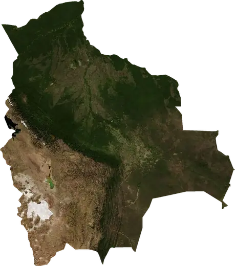
 Bolivia
: earthquakes and wildfires
Latest earthquakes and active wildfires in Bolivia on a live map, the strongest earthquakes and largest fires on record, and statistics by year.
Live map – Bolivia
Key statistics (30 days)
Earthquakes M2.5+ and the wildfire fronts shown on the map.
Fire danger
Forecast for the area around: La Paz. Danger can vary locally; follow official guidance. Source: Copernicus EMS – EFFIS (FWI).
Severe weather (forecast)
- Today: Rain – Extreme rain (≥ 50 mm) · Sipe Sipe
- Tomorrow: Rain – Extreme rain (≥ 50 mm) · La Santisima Trinidad
- Tomorrow: Lightning – High lightning · Yacuiba
Forecast for the area around: Bolivia. It does not replace warnings from the national weather service. Source: ECMWF / Copernicus EMS.
Recent events in Bolivia
- 4 h agoWildfire near San Ignacio de Velasco, Bolivia – active41 km² · 84 km WNW of San Ignacio de Velasco, Bolivia
- 4 h agoWildfire near Santa Rosa de Yacuma, Bolivia – active14 km² · 142 km N of Santa Rosa de Yacuma, Bolivia
- 4 h agoWildfire near Santa Rosa de Yacuma, Bolivia – active3.3 km² · 156 km N of Santa Rosa de Yacuma, Bolivia
- 5 h agoWildfire near Concepcion, Bolivia – active10 km² · 30 km SE of Concepcion, Bolivia
- 5 h agoWildfire near Concepcion, Bolivia – active31 km² · 65 km SSE of Concepcion, Bolivia
- 5 h agoWildfire near Ascencion de Guarayos, Bolivia – active9.4 km² · 101 km WNW of Ascencion de Guarayos, Bolivia
Historical overview
Earthquakes M3.0+ and significant events of other hazards.
About Bolivia
Bolivia has recorded 1,359 earthquakes of magnitude 3.0 or more since 1976. The strongest was M8.2 in 1994.
Satellites have detected 167 significant wildfires here; the largest burned about 187 km².
Know the official emergency number, prepare an emergency kit and follow the instructions of your civil protection authority.
Learn more ›Earthquakes
1,359 earthquakes of magnitude 3.0 or more since 1976. The strongest was M8.2.
Recent earthquakes
| Mag | Location | Time (UTC) | Depth |
|---|---|---|---|
| 3.1 | 12 km ESE of Ckochas, Bolivia | 18.4 km | |
| 2.8 | 144 km SW of Uyuni, Bolivia | 235.6 km | |
| 4.4 | 50 km N of Comarapa, Bolivia | 10.0 km | |
| 4.2 | 6 km NW of Yacuiba, Bolivia | 523.9 km | |
| 4.5 | 36 km SSW of Porco, Bolivia | 235.8 km | |
| 4.5 | 76 km W of Porco, Bolivia | 182.1 km | |
| 4.5 | 62 km WNW of Colchani, Bolivia | 193.2 km | |
| 4.2 | 114 km WSW of Porco, Bolivia | 172.5 km | |
| 4.0 | 78 km S of Cochabamba, Bolivia | 359.3 km | |
| 4.8 | 62 km SSE of Sacaba, Bolivia | 371.1 km |
Show all (36)
Strongest earthquakes on record
| Mag | Location | Time (UTC) | Depth |
|---|---|---|---|
| 8.2 | 56 km NNW of Reyes, Bolivia | 631.0 km | |
| 7.1 | 16 km NW of Villazon, Bolivia | 276.2 km | |
| 6.8 | 83 km NE of Villamontes, Bolivia | 559.0 km | |
| 6.6 | 62 km SSW of La Santisima Trinidad, Bolivia | 549.9 km | |
| 6.6 | 25 km NNW of Mizque, Bolivia | 24.0 km | |
| 6.6 | 91 km W of Potosi, Bolivia | 266.0 km | |
| 6.5 | 42 km E of Padilla, Bolivia | 596.0 km | |
| 6.5 | 28 km NNE of Oruro, Bolivia | 285.2 km | |
| 6.4 | 71 km SW of Uyuni, Bolivia | 218.0 km | |
| 6.3 | 55 km SSE of Sacaba, Bolivia | 359.0 km | |
| 6.3 | 109 km SSW of Oruro, Bolivia | 243.1 km | |
| 6.3 | 93 km WSW of Viacha, Bolivia | 172.0 km | |
| 6.2 | 26 km SSW of Ckochas, Bolivia | 352.7 km | |
| 6.2 | 56 km NE of Sacaba, Bolivia | 33.0 km | |
| 6.2 | 13 km WNW of Villazon, Bolivia | 279.3 km |
Earthquakes per year (M3.0+)
Year
| 2026 | 28 | M4.8 |
| 2025 | 54 | M5.4 |
| 2024 | 56 | M5.7 |
| 2023 | 50 | M5.1 |
| 2022 | 57 | M5.1 |
| 2021 | 47 | M5.4 |
| 2020 | 48 | M5.3 |
| 2019 | 32 | M6.3 |
| 2018 | 47 | M6.8 |
| 2017 | 43 | M6.5 |
| 2016 | 48 | M6.1 |
| 2015 | 33 | M4.9 |
| 2014 | 35 | M5.6 |
| 2013 | 33 | M5.0 |
| 2012 | 21 | M5.9 |
| 2011 | 18 | M6.6 |
| 2010 | 19 | M5.4 |
| 2009 | 17 | M5.8 |
| 2008 | 37 | M6.2 |
| 2007 | 33 | M5.4 |
| 2006 | 41 | M5.8 |
| 2005 | 33 | M4.9 |
| 2004 | 37 | M6.1 |
| 2003 | 16 | M6.0 |
| 2002 | 30 | M5.1 |
| 2001 | 29 | M6.2 |
| 2000 | 26 | M4.9 |
| 1999 | 32 | M6.4 |
| 1998 | 36 | M6.6 |
| 1997 | 20 | M7.1 |
| 1996 | 30 | M5.7 |
| 1995 | 35 | M5.6 |
| 1994 | 17 | M8.2 |
| 1993 | 21 | M4.7 |
| 1992 | 17 | M5.3 |
| 1991 | 15 | M5.8 |
| 1990 | 12 | M6.6 |
| 1989 | 11 | M6.1 |
| 1988 | 18 | M6.5 |
| 1987 | 18 | M5.4 |
| 1986 | 20 | M6.3 |
| 1985 | 14 | M5.8 |
| 1984 | 11 | M5.0 |
| 1983 | 10 | M6.3 |
| 1982 | 9 | M5.2 |
| 1981 | 7 | M5.3 |
| 1980 | 4 | M4.4 |
| 1979 | 10 | M5.1 |
| 1978 | 9 | M5.6 |
| 1977 | 7 | M5.1 |
| 1976 | 8 | M5.5 |
Wildfires
167 major fires since 2025. The largest covered about 187 km².
Recent fires
| Area | Location | Since | Status |
|---|---|---|---|
| 41 km² | 84 km WNW of San Ignacio de Velasco, Bolivia | Active | |
| 14 km² | 142 km N of Santa Rosa de Yacuma, Bolivia | Active | |
| 3.3 km² | 156 km N of Santa Rosa de Yacuma, Bolivia | Active | |
| 10 km² | 30 km SE of Concepcion, Bolivia | Active | |
| 31 km² | 65 km SSE of Concepcion, Bolivia | Active | |
| 9.4 km² | 101 km WNW of Ascencion de Guarayos, Bolivia | Active | |
| 18 km² | 43 km S of Concepcion, Bolivia | Active | |
| 3.0 km² | 31 km SW of Concepcion, Bolivia | Active | |
| 3.4 km² | 129 km SSW of Concepcion, Bolivia | Active | |
| 16 km² | 80 km ENE of La Santisima Trinidad, Bolivia | Active |
Show all (200)
| Area | Location | Since | Status |
|---|---|---|---|
| 3.1 km² | 99 km ENE of La Santisima Trinidad, Bolivia | Active | |
| 14 km² | 102 km NW of San Ignacio de Velasco, Bolivia | Active | |
| 8.4 km² | 44 km W of Urubicha, Bolivia | Active | |
| 8.0 km² | 35 km WNW of Ascension, Bolivia | Active | |
| 7.2 km² | 20 km WSW of San Ignacio de Velasco, Bolivia | Active | |
| 3.9 km² | 41 km NW of Puerto Suarez, Bolivia | Active | |
| 14 km² | 104 km SSE of Concepcion, Bolivia | Active | |
| 7.1 km² | 81 km ESE of La Santisima Trinidad, Bolivia | Active | |
| 6.1 km² | 58 km W of Urubicha, Bolivia | Active | |
| 7.6 km² | 92 km NW of San Ignacio de Velasco, Bolivia | Active | |
| 3.8 km² | 118 km ESE of Ascension, Bolivia | Active | |
| 5.5 km² | 81 km W of San Ignacio de Velasco, Bolivia | Active | |
| 8.7 km² | 129 km N of Santa Ana de Yacuma, Bolivia | Active | |
| 11 km² | 161 km N of Santa Rosa de Yacuma, Bolivia | Active | |
| 3.1 km² | 85 km ENE of Ixiamas, Bolivia | Active | |
| 4.3 km² | 151 km N of Santa Rosa de Yacuma, Bolivia | Active | |
| 10 km² | 82 km NE of Concepcion, Bolivia | Active | |
| 3.7 km² | 90 km NNE of Santa Rosa de Yacuma, Bolivia | Active | |
| 8.1 km² | 110 km N of Santa Rosa de Yacuma, Bolivia | Active | |
| 3.1 km² | 31 km ESE of Reyes, Bolivia | Active | |
| 3.5 km² | 38 km NE of San Ramon, Bolivia | Active | |
| 28 km² | 78 km SE of La Santisima Trinidad, Bolivia | Active | |
| 12 km² | 112 km WSW of Ascencion de Guarayos, Bolivia | Active | |
| 6.9 km² | 95 km ESE of La Santisima Trinidad, Bolivia | Active | |
| 9.3 km² | 116 km SE of Concepcion, Bolivia | Active | |
| 4.8 km² | 105 km WNW of San Ignacio de Velasco, Bolivia | Active | |
| 5.0 km² | 102 km SE of San Ignacio de Moxo, Bolivia | Active | |
| 21 km² | 60 km WSW of Ascencion de Guarayos, Bolivia | Active | |
| 6.7 km² | 110 km W of Ascencion de Guarayos, Bolivia | Active | |
| 6.3 km² | 131 km SSE of La Santisima Trinidad, Bolivia | Active | |
| 8.6 km² | 143 km S of La Santisima Trinidad, Bolivia | Active | |
| 4.8 km² | 36 km NNE of San Ignacio de Velasco, Bolivia | Active | |
| 5.9 km² | 41 km SSW of San Borja, Bolivia | Active | |
| 4.2 km² | 98 km NNW of Villa Yapacani, Bolivia | Active | |
| 4.8 km² | 23 km E of Ascencion de Guarayos, Bolivia | Active | |
| 4.9 km² | 124 km WSW of Ascencion de Guarayos, Bolivia | Active | |
| 47 km² | 40 km WNW of San Pedro, Bolivia | Active | |
| 14 km² | 58 km ENE of Concepcion, Bolivia | Active | |
| 7.8 km² | 20 km SSE of Concepcion, Bolivia | Active | |
| 10.0 km² | 40 km SE of Robore, Bolivia | Active | |
| 7.2 km² | 89 km NNW of Santa Rosa del Sara, Bolivia | Active | |
| 51 km² | 115 km SSE of Concepcion, Bolivia | Active | |
| 3.8 km² | 71 km N of San Pedro, Bolivia | Active | |
| 3.8 km² | 39 km W of Villa Yapacani, Bolivia | Active | |
| 21 km² | 105 km NW of San Pedro, Bolivia | Active | |
| 4.9 km² | 92 km SE of Pailon, Bolivia | Active | |
| 10 km² | 95 km W of San Ignacio de Velasco, Bolivia | Active | |
| 3.2 km² | 55 km WSW of Ascencion de Guarayos, Bolivia | Active | |
| 12 km² | 33 km S of Ascencion de Guarayos, Bolivia | Active | |
| 4.8 km² | 131 km S of La Santisima Trinidad, Bolivia | Active | |
| 5.9 km² | 62 km NNW of San Pedro, Bolivia | Active | |
| 3.6 km² | 27 km SE of Ascencion de Guarayos, Bolivia | Active | |
| 3.0 km² | 113 km NW of Montero, Bolivia | Active | |
| 41 km² | 133 km E of Concepcion, Bolivia | Active | |
| 13 km² | 66 km WSW of San Ignacio de Velasco, Bolivia | Active | |
| 27 km² | 115 km WSW of Ascencion de Guarayos, Bolivia | Active | |
| 4.2 km² | 33 km SW of Ascencion de Guarayos, Bolivia | Active | |
| 5.1 km² | 58 km SSE of Ascencion de Guarayos, Bolivia | Active | |
| 4.1 km² | 139 km SW of Riberalta, Bolivia | Active | |
| 187 km² | 95 km NNE of San Pedro, Bolivia | Active | |
| 14 km² | 137 km ESE of Villamontes, Bolivia | Active | |
| 6.4 km² | 14 km WNW of Yacuiba, Bolivia | Active | |
| 4.6 km² | 59 km NNW of San Pedro, Bolivia | Active | |
| 6.3 km² | 48 km NW of Ascension, Bolivia | Active | |
| 15 km² | 88 km NW of San Pedro, Bolivia | Active | |
| 6.6 km² | 35 km NE of Robore, Bolivia | Active | |
| 5.9 km² | 82 km WNW of San Ignacio de Velasco, Bolivia | Active | |
| 6.5 km² | 116 km WNW of San Ignacio de Velasco, Bolivia | Active | |
| 6.3 km² | 45 km WSW of San Ignacio de Velasco, Bolivia | Active | |
| 3.0 km² | 25 km SE of Ascension, Bolivia | Active | |
| 5.3 km² | 86 km S of Santa Cruz de la Sierra, Bolivia | Active | |
| 5.3 km² | 64 km WNW of San Ignacio de Velasco, Bolivia | Active | |
| 4.8 km² | 24 km SW of La Paz, Bolivia | Active | |
| 8.9 km² | 117 km NNW of San Pedro, Bolivia | Active | |
| 3.8 km² | near Sucre, Bolivia | Active | |
| 12 km² | 47 km NNE of San Pedro, Bolivia | Active | |
| 7.2 km² | 33 km W of San Matias, Bolivia | Active | |
| 4.5 km² | 51 km NNE of San Pedro, Bolivia | Active | |
| 20 km² | 104 km SE of Pailon, Bolivia | Active | |
| 14 km² | 91 km WNW of San Ignacio de Velasco, Bolivia | Active | |
| 5.3 km² | 54 km SW of San Ignacio de Velasco, Bolivia | Active | |
| 18 km² | 78 km SE of Concepcion, Bolivia | Active | |
| 7.2 km² | 103 km NNW of San Pedro, Bolivia | Active | |
| 3.4 km² | 105 km SW of Camiri, Bolivia | Active | |
| 3.3 km² | 134 km ESE of Villamontes, Bolivia | Active | |
| 5.3 km² | 112 km SSE of Santa Cruz de la Sierra, Bolivia | Active | |
| 3.3 km² | 17 km NW of Yacuiba, Bolivia | Active | |
| 15 km² | 93 km SE of Pailon, Bolivia | Active | |
| 3.0 km² | 20 km WSW of Villa Yapacani, Bolivia | Active | |
| 4.0 km² | 50 km ESE of Ascencion de Guarayos, Bolivia | Active | |
| 3.0 km² | 132 km E of Pailon, Bolivia | Active | |
| 10 km² | 102 km ESE of Santa Cruz de la Sierra, Bolivia | Active | |
| 46 km² | 110 km N of San Pedro, Bolivia | Active | |
| 3.0 km² | 33 km ESE of Ascencion de Guarayos, Bolivia | Active | |
| 34 km² | 146 km E of Pailon, Bolivia | Active | |
| 4.8 km² | 46 km SSE of Ascencion de Guarayos, Bolivia | Active | |
| 12 km² | 89 km NNW of San Pedro, Bolivia | Active | |
| 6.8 km² | 45 km N of Okinawa Uno, Bolivia | Active | |
| 10 km² | 37 km SE of Ascension, Bolivia | Active | |
| 5.9 km² | 85 km NNW of San Pedro, Bolivia | Active | |
| 12 km² | 99 km N of San Pedro, Bolivia | Active | |
| 13 km² | 73 km N of San Pedro, Bolivia | Inactive | |
| 4.4 km² | 31 km SE of Concepcion, Bolivia | Inactive | |
| 6.2 km² | 48 km ENE of Santa Ana de Yacuma, Bolivia | Inactive | |
| 7.0 km² | 105 km N of Santa Rosa de Yacuma, Bolivia | Inactive | |
| 30 km² | 113 km NW of San Ignacio de Velasco, Bolivia | Inactive | |
| 28 km² | 58 km W of San Ignacio de Velasco, Bolivia | Inactive | |
| 18 km² | 43 km NNE of San Ignacio de Velasco, Bolivia | Inactive | |
| 9.5 km² | 121 km NNW of San Ignacio de Velasco, Bolivia | Inactive | |
| 3.6 km² | 91 km E of La Santisima Trinidad, Bolivia | Inactive | |
| 6.3 km² | 74 km W of San Ignacio de Velasco, Bolivia | Inactive | |
| 6.6 km² | 85 km NNE of San Pedro, Bolivia | Inactive | |
| 5.3 km² | 101 km NNW of San Pedro, Bolivia | Inactive | |
| 16 km² | 94 km E of La Santisima Trinidad, Bolivia | Inactive | |
| 11 km² | 102 km WNW of San Ignacio de Velasco, Bolivia | Inactive | |
| 5.1 km² | 77 km E of Concepcion, Bolivia | Inactive | |
| 17 km² | 44 km WNW of San Ignacio de Velasco, Bolivia | Inactive | |
| 3.6 km² | 130 km NE of Montero, Bolivia | Inactive | |
| 17 km² | 83 km SSE of Concepcion, Bolivia | Inactive | |
| 19 km² | 114 km SE of Concepcion, Bolivia | Inactive | |
| 5.0 km² | 92 km ESE of La Santisima Trinidad, Bolivia | Inactive | |
| 41 km² | 81 km NNW of San Ignacio de Velasco, Bolivia | Inactive | |
| 3.8 km² | 93 km W of San Matias, Bolivia | Inactive | |
| 8.5 km² | 112 km SE of Concepcion, Bolivia | Inactive | |
| 7.4 km² | 71 km WSW of San Matias, Bolivia | Inactive | |
| 3.0 km² | 31 km S of Concepcion, Bolivia | Inactive | |
| 6.1 km² | 96 km S of Concepcion, Bolivia | Inactive | |
| 14 km² | 88 km N of San Pedro, Bolivia | Inactive | |
| 5.4 km² | 28 km SW of San Borja, Bolivia | Inactive | |
| 13 km² | 30 km ENE of Yacuiba, Bolivia | Inactive | |
| 4.4 km² | 31 km NE of Yacuiba, Bolivia | Inactive | |
| 9.9 km² | 90 km NW of San Ramon, Bolivia | Inactive | |
| 4.3 km² | 151 km NNW of Santa Ana de Yacuma, Bolivia | Inactive | |
| 4.0 km² | 34 km NW of San Borja, Bolivia | Inactive | |
| 3.1 km² | 143 km N of Santa Rosa de Yacuma, Bolivia | Inactive | |
| 4.1 km² | 119 km N of Santa Rosa de Yacuma, Bolivia | Inactive | |
| 6.6 km² | 123 km NW of Santa Ana de Yacuma, Bolivia | Inactive | |
| 3.4 km² | 48 km E of San Borja, Bolivia | Inactive | |
| 3.5 km² | 119 km SW of Riberalta, Bolivia | Inactive | |
| 22 km² | 64 km NE of Santa Rosa de Yacuma, Bolivia | Inactive | |
| 4.2 km² | 106 km E of La Santisima Trinidad, Bolivia | Inactive | |
| 5.9 km² | 52 km ENE of San Borja, Bolivia | Inactive | |
| 3.6 km² | 37 km ESE of Rurrenabaque, Bolivia | Inactive | |
| 6.1 km² | 105 km NE of La Santisima Trinidad, Bolivia | Inactive | |
| 7.2 km² | 121 km NW of Santa Ana de Yacuma, Bolivia | Inactive | |
| 7.3 km² | 62 km N of Santa Ana de Yacuma, Bolivia | Inactive | |
| 3.1 km² | 43 km SW of San Borja, Bolivia | Inactive | |
| 3.2 km² | 29 km SSW of San Borja, Bolivia | Inactive | |
| 3.4 km² | 31 km W of Ascencion de Guarayos, Bolivia | Inactive | |
| 3.6 km² | 55 km SSW of La Santisima Trinidad, Bolivia | Inactive | |
| 6.6 km² | 73 km SE of Santa Cruz de la Sierra, Bolivia | Inactive | |
| 6.8 km² | 71 km WSW of Ascencion de Guarayos, Bolivia | Inactive | |
| 7.4 km² | 47 km WNW of Santa Cruz de la Sierra, Bolivia | Inactive | |
| 5.5 km² | 107 km N of San Ignacio de Velasco, Bolivia | Inactive | |
| 17 km² | 115 km WNW of San Ignacio de Velasco, Bolivia | Inactive | |
| 12 km² | 27 km NE of San Pedro, Bolivia | Inactive | |
| 3.6 km² | 46 km WNW of Villa Yapacani, Bolivia | Inactive | |
| 5.7 km² | 83 km SE of Pailon, Bolivia | Inactive | |
| 7.9 km² | 107 km ESE of Pailon, Bolivia | Inactive | |
| 3.4 km² | 74 km WNW of Ascencion de Guarayos, Bolivia | Inactive | |
| 3.5 km² | 108 km NNE of Santa Rosa de Yacuma, Bolivia | Inactive | |
| 9.9 km² | 112 km SE of Concepcion, Bolivia | Inactive | |
| 9.1 km² | 80 km SSE of Concepcion, Bolivia | Inactive | |
| 4.6 km² | 123 km ESE of San Ramon, Bolivia | Inactive | |
| 72 km² | 150 km ENE of La Santisima Trinidad, Bolivia | Inactive | |
| 14 km² | 110 km SE of Concepcion, Bolivia | Inactive | |
| 13 km² | 81 km WSW of Ascencion de Guarayos, Bolivia | Inactive | |
| 3.8 km² | 24 km S of Ascencion de Guarayos, Bolivia | Inactive | |
| 3.9 km² | 38 km NW of Yacuiba, Bolivia | Inactive | |
| 11 km² | 119 km NW of San Pedro, Bolivia | Inactive | |
| 6.6 km² | 95 km NW of San Pedro, Bolivia | Inactive | |
| 3.8 km² | 109 km S of Concepcion, Bolivia | Inactive | |
| 4.9 km² | 86 km NNW of Santa Rosa del Sara, Bolivia | Inactive | |
| 6.1 km² | 36 km WSW of San Ignacio de Velasco, Bolivia | Inactive | |
| 3.1 km² | 84 km WNW of Ascension, Bolivia | Inactive | |
| 4.0 km² | 131 km NE of Montero, Bolivia | Inactive | |
| 71 km² | 96 km WSW of San Matias, Bolivia | Inactive | |
| 11 km² | 28 km SSW of Concepcion, Bolivia | Inactive | |
| 18 km² | 165 km SSW of Riberalta, Bolivia | Inactive | |
| 11 km² | 86 km WNW of San Ramon, Bolivia | Inactive | |
| 12 km² | 93 km NNW of Santa Ana de Yacuma, Bolivia | Inactive | |
| 13 km² | 58 km W of San Ramon, Bolivia | Inactive | |
| 40 km² | 91 km WNW of San Ramon, Bolivia | Inactive | |
| 75 km² | 98 km NE of Ixiamas, Bolivia | Inactive | |
| 12 km² | 143 km SSW of Riberalta, Bolivia | Inactive | |
| 14 km² | 78 km ENE of Ixiamas, Bolivia | Inactive | |
| 16 km² | 51 km WNW of La Santisima Trinidad, Bolivia | Inactive | |
| 11 km² | 114 km NNW of Urubicha, Bolivia | Inactive | |
| 20 km² | 29 km SW of Tarija, Bolivia | Inactive | |
| 11 km² | 76 km ENE of Ixiamas, Bolivia | Inactive |
Largest fires on record
| Area | Location | Since | Status |
|---|---|---|---|
| 187 km² | 95 km NNE of San Pedro, Bolivia | Active | |
| 83 km² | 102 km NNE of San Pedro, Bolivia | Inactive | |
| 78 km² | 91 km E of Concepcion, Bolivia | Inactive | |
| 75 km² | 98 km NE of Ixiamas, Bolivia | Inactive | |
| 72 km² | 150 km ENE of La Santisima Trinidad, Bolivia | Inactive | |
| 71 km² | 96 km WSW of San Matias, Bolivia | Inactive | |
| 66 km² | 61 km N of San Ignacio de Velasco, Bolivia | Inactive | |
| 51 km² | 115 km SSE of Concepcion, Bolivia | Active | |
| 49 km² | 72 km E of Robore, Bolivia | Inactive | |
| 49 km² | 71 km E of Robore, Bolivia | Inactive | |
| 48 km² | 124 km ESE of Concepcion, Bolivia | Inactive | |
| 47 km² | 40 km WNW of San Pedro, Bolivia | Active | |
| 46 km² | 111 km NE of Ixiamas, Bolivia | Inactive | |
| 46 km² | 110 km N of San Pedro, Bolivia | Active | |
| 43 km² | 13 km WNW of Tarija, Bolivia | Inactive |
Major fires per year
Year
| 2026 | 160 | 187 km² |
| 2025 | 7 | 46 km² |