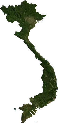
 Vietnam
: earthquakes and wildfires
Latest earthquakes and active wildfires in Vietnam on a live map, the strongest earthquakes and largest fires on record, and statistics by year.
Live map – Vietnam
Key statistics (30 days)
Earthquakes M2.5+ and the wildfire fronts shown on the map.
Fire danger
Forecast for the area around: Ho Chi Minh City. Danger can vary locally; follow official guidance. Source: Copernicus EMS – EFFIS (FWI).
Severe weather (forecast)
- Today: Rain – Extreme rain (≥ 50 mm) · Qui Nhon
- Tomorrow: Rain – Extreme rain (≥ 50 mm) · Can Tho
Forecast for the area around: Vietnam. It does not replace warnings from the national weather service. Source: ECMWF / Copernicus EMS.
Recent events in Vietnam
- 4 h agoWildfire near Vinh, Vietnam – active7.2 km² · 47 km NW of Vinh, Vietnam
- 15 h agoWildfire near Hoang Mai, Vietnam – active9.4 km² · 11 km NNW of Hoang Mai, Vietnam
- 15 h agoWildfire near Nghi Son, Vietnam – active6.6 km² · near Nghi Son, Vietnam
- 15 h agoWildfire near Hoang Mai, Vietnam – active4.0 km² · near Hoang Mai, Vietnam
- 15 h agoWildfire near Ky Anh, Vietnam – active20 km² · 14 km ESE of Ky Anh, Vietnam
- 16 h agoWildfire near Phu Ly, Vietnam – active5.1 km² · 5 km WSW of Phu Ly, Vietnam
Historical overview
Earthquakes M3.0+ and significant events of other hazards.
About Vietnam
Vietnam has recorded 131 earthquakes of magnitude 3.0 or more since 1982. The strongest was M6.9 in 1983.
Satellites have detected 104 significant wildfires here; the largest burned about 180 km².
Know the official emergency number, prepare an emergency kit and follow the instructions of your civil protection authority.
Learn more ›Earthquakes
131 earthquakes of magnitude 3.0 or more since 1982. The strongest was M6.9.
Recent earthquakes
| Mag | Location | Time (UTC) | Depth |
|---|---|---|---|
| 4.4 | 25 km ESE of Son La, Vietnam | 10.0 km | |
| 4.4 | 67 km SW of Tam Ky, Vietnam | 10.0 km | |
| 4.4 | 59 km WSW of Quang Ngai, Vietnam | 10.0 km | |
| 4.2 | 60 km NNE of Kon Tum, Vietnam | 10.0 km | |
| 4.2 | 58 km NNE of Kon Tum, Vietnam | 10.0 km | |
| 4.5 | 48 km NE of Kon Tum, Vietnam | 10.0 km | |
| 4.1 | 71 km W of Quang Ngai, Vietnam | 10.0 km | |
| 4.4 | 57 km SSW of Chieng Coi, Vietnam | 10.0 km | |
| 4.3 | 54 km NNE of Kon Tum, Vietnam | 9.7 km | |
| 4.1 | 69 km WSW of Quang Ngai, Vietnam | 10.0 km |
Show all (12)
| Mag | Location | Time (UTC) | Depth |
|---|---|---|---|
| 4.3 | 57 km NNE of Kon Tum, Vietnam | 10.0 km | |
| 4.2 | 58 km NE of Kon Tum, Vietnam | 10.0 km |
Strongest earthquakes on record
| Mag | Location | Time (UTC) | Depth |
|---|---|---|---|
| 6.9 | 43 km W of Dien Bien Phu, Vietnam | 33.0 km | |
| 6.3 | 53 km NW of Thi Tran Thuan Chau, Vietnam | 18.0 km | |
| 5.3 | 93 km SW of Phu Quy, Vietnam | 10.0 km | |
| 5.2 | 91 km SW of Phu Quy, Vietnam | 10.0 km | |
| 5.2 | 86 km SW of Phu Quy, Vietnam | 10.0 km | |
| 5.1 | 53 km NNE of Kon Tum, Vietnam | 8.1 km | |
| 5.1 | 45 km NW of Thi Tran Thuan Chau, Vietnam | 10.0 km | |
| 5.0 | 23 km ENE of Thi Tran Trung Khanh, Vietnam | 10.0 km | |
| 5.0 | 24 km NE of Thi Tran Trung Khanh, Vietnam | 10.0 km | |
| 5.0 | 100 km SSE of La Gi, Vietnam | 10.0 km | |
| 4.9 | 74 km W of Hoa Binh, Vietnam | 10.0 km | |
| 4.9 | 32 km W of Dien Bien Phu, Vietnam | 10.0 km | |
| 4.9 | 29 km N of Bac Giang, Vietnam | 10.0 km | |
| 4.9 | 19 km ESE of Nam Vi, Vietnam | 10.0 km | |
| 4.8 | 44 km NNE of Kon Tum, Vietnam | 10.0 km |
Earthquakes per year (M3.0+)
Year
| 2026 | 12 | M4.5 |
| 2025 | 8 | M4.7 |
| 2024 | 14 | M5.1 |
| 2023 | 5 | M4.6 |
| 2022 | 16 | M4.8 |
| 2021 | 3 | M4.4 |
| 2020 | 2 | M4.9 |
| 2019 | 3 | M5.0 |
| 2018 | 2 | M4.3 |
| 2017 | 3 | M4.5 |
| 2016 | 3 | M4.5 |
| 2015 | 1 | M4.0 |
| 2014 | 2 | M4.6 |
| 2012 | 2 | M4.2 |
| 2011 | 3 | M5.0 |
| 2010 | 4 | M4.8 |
| 2008 | 1 | M4.0 |
| 2007 | 3 | M5.2 |
| 2006 | 1 | M4.3 |
| 2005 | 6 | M5.3 |
| 2002 | 1 | M4.5 |
| 2001 | 6 | M4.9 |
| 1997 | 1 | M3.6 |
| 1996 | 3 | M4.3 |
| 1995 | 2 | M4.4 |
| 1994 | 1 | M4.6 |
| 1993 | 5 | M4.6 |
| 1992 | 1 | M3.8 |
| 1991 | 2 | M4.5 |
| 1989 | 1 | M4.1 |
| 1987 | 2 | M4.9 |
| 1986 | 1 | M4.4 |
| 1985 | 3 | M4.9 |
| 1983 | 7 | M6.9 |
| 1982 | 1 | M4.6 |
Wildfires
104 major fires since 2025. The largest covered about 180 km².
Recent fires
| Area | Location | Since | Status |
|---|---|---|---|
| 7.2 km² | 47 km NW of Vinh, Vietnam | Active | |
| 9.4 km² | 11 km NNW of Hoang Mai, Vietnam | Active | |
| 6.6 km² | near Nghi Son, Vietnam | Active | |
| 4.0 km² | near Hoang Mai, Vietnam | Active | |
| 20 km² | 14 km ESE of Ky Anh, Vietnam | Active | |
| 5.1 km² | 5 km WSW of Phu Ly, Vietnam | Active | |
| 6.9 km² | 24 km NNE of Xuan Loc, Vietnam | Active | |
| 16 km² | 23 km NW of Haiphong, Vietnam | Active | |
| 3.3 km² | 64 km SSW of Pleiku, Vietnam | Active | |
| 5.8 km² | 9 km NNW of Ha Long, Vietnam | Active |
Show all (118)
Largest fires on record
| Area | Location | Since | Status |
|---|---|---|---|
| 180 km² | 29 km WSW of Lao Bao, Vietnam | Inactive | |
| 74 km² | 82 km WSW of Quan Hau, Vietnam | Inactive | |
| 69 km² | 88 km SW of Dong Ha, Vietnam | Inactive | |
| 68 km² | 31 km WSW of Lao Bao, Vietnam | Inactive | |
| 58 km² | 76 km WSW of Cam Lo, Vietnam | Inactive | |
| 47 km² | 41 km NW of Rach Gia, Vietnam | Inactive | |
| 47 km² | 26 km ESE of Ha Tien, Vietnam | Inactive | |
| 43 km² | 76 km WSW of Cam Lo, Vietnam | Inactive | |
| 42 km² | 73 km SW of Cam Lo, Vietnam | Inactive | |
| 35 km² | 25 km NW of Lao Bao, Vietnam | Inactive | |
| 34 km² | 81 km SW of Thai Hoa, Vietnam | Inactive | |
| 33 km² | 67 km SSW of Cam Lo, Vietnam | Inactive | |
| 29 km² | 18 km ENE of Rach Gia, Vietnam | Inactive | |
| 29 km² | 58 km WNW of Ban Na Hy, Vietnam | Inactive | |
| 28 km² | 26 km N of Rach Gia, Vietnam | Inactive |
Major fires per year
Year
| 2026 | 103 | 180 km² |
| 2025 | 1 | 12 km² |
Regions
Places
- Hanoi
- Haiphong
- Hue
- Da Nang
- Thanh Hoa
- Bac Giang
- Nam Định
- Thai Nguyen
- Viet Tri
- GJong GJa
- Long Bien
- Bac Tu Liem
- Hoa Lu
- Gia Lam
- Hai Ba Trung
- Thanh Xuan
- Cau Giay
- Bac Ninh
- Ba Vi
- Quang Ngai
- Ha Long
- Thi Tran GJong Trieu
- Hai Duong
- Pho Yen
- Son Tay
- GJien Ban
- Ba Dinh
- Chi Linh
- Viet Yen
- Kon Tum
- Thanh Khe
- Lang Son
- Thuan Thanh
- Cam Pha
- Phuc Yen
- Thi Tran GJai Tu
- Tay Ho
- Tam Ky
- Dong Ha
- La Gi
- GJuc Pho
- Thi Tran Thuan Chau
- Phu Ly
- Tuong Mai
- Hoan Kiem
- Cam Pha Mines
- Hai Chau
- Lao Cai
- Thanh pho Song Cong
- Chu
- Bo GJe
- Hoa Cuong
- Vinh Yen
- Bac Quang
- Hung Yen
- Kien An
- My Hao
- Phong GJien
- Pleiku
- Mong Cai
- Son La
- Hoa Binh
- Tuyen Quang
- Yen Bai
- Son Tra
- Dien Bien Phu
- An Hai
- An Khe
- Cam Le
- Cao Bang
- Co GJo
- Nui Thanh
- Nghia Lo
- Ha Giang
- Lai Chau
- GJong Phu
- Thi Tran Pho Lu
- Hoi An
- Phu Quy
- My Lai