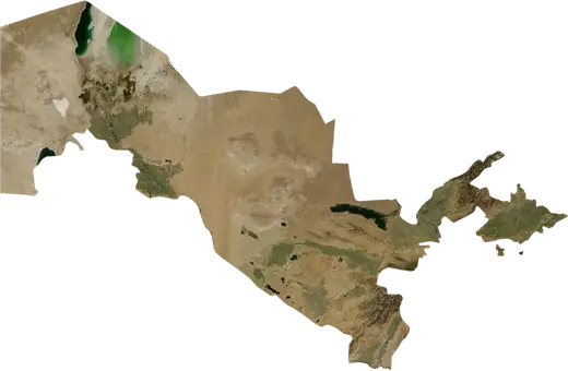
 Uzbekistan
: earthquakes and wildfires
Latest earthquakes and active wildfires in Uzbekistan on a live map, the strongest earthquakes and largest fires on record, and statistics by year.
Live map – Uzbekistan
Key statistics (30 days)
Earthquakes M2.5+ and the wildfire fronts shown on the map.
Fire danger
Forecast for the area around: Bukhara. Danger can vary locally; follow official guidance. Source: Copernicus EMS – EFFIS (FWI).
Severe weather (forecast)
- Today: Rain – Heavy rain (10–25 mm) · Samarkand
- Tomorrow: Rain – Heavy rain (10–25 mm) · Samarkand
Forecast for the area around: Uzbekistan. It does not replace warnings from the national weather service. Source: ECMWF / Copernicus EMS.
Recent events in Uzbekistan
- 5 h agoWildfire near Olmaliq, Uzbekistan – active20 km² · 6 km WNW of Olmaliq, Uzbekistan
- 15 h agoWildfire near G'ozg'on, Uzbekistan – active4.7 km² · 129 km NW of G'ozg'on, Uzbekistan
- 16 h agoWildfire near Ohangaron, Uzbekistan – active7.7 km² · near Ohangaron, Uzbekistan
- 16 h agoWildfire near Bekobod, Uzbekistan – active5.6 km² · near Bekobod, Uzbekistan
- 16 h agoWildfire near Jizzax, Uzbekistan – active3.6 km² · 43 km NW of Jizzax, Uzbekistan
- 40 h agoWildfire near Kattaqo'rg'on Shahri, Uzbekistan – active5.3 km² · 8 km SW of Kattaqo'rg'on Shahri, Uzbekistan
Historical overview
Earthquakes M3.0+ and significant events of other hazards.
About Uzbekistan
Uzbekistan has recorded 579 earthquakes of magnitude 3.0 or more since 1976. The strongest was M7.0 in 1984.
Satellites have detected 3 significant wildfires here; the largest burned about 20 km².
Know the official emergency number, prepare an emergency kit and follow the instructions of your civil protection authority.
Learn more ›Earthquakes
Earthquakes today: Uzbekistan →
579 earthquakes of magnitude 3.0 or more since 1976. The strongest was M7.0.
Recent earthquakes
| Mag | Location | Time (UTC) | Depth |
|---|---|---|---|
| 4.0 | 83 km N of Namangan, Uzbekistan | 5.0 km | |
| 4.0 | 47 km NNE of Andijon, Uzbekistan | 10.0 km | |
| 4.3 | 7 km WSW of Quvasoy, Uzbekistan | 29.9 km | |
| 4.1 | 36 km WNW of Gazli, Uzbekistan | 10.0 km | |
| 4.9 | 38 km NW of Gazli, Uzbekistan | 10.0 km | |
| 4.3 | 79 km W of Namangan, Uzbekistan | 19.2 km | |
| 4.2 | 33 km NE of Namangan, Uzbekistan | 15.7 km |
Strongest earthquakes on record
| Mag | Location | Time (UTC) | Depth |
|---|---|---|---|
| 7.0 | 23 km NNW of Gazli, Uzbekistan | 15.0 km | |
| 7.0 | 28 km N of Gazli, Uzbekistan | 10.0 km | |
| 7.0 | 82 km NW of Bukhara, Uzbekistan | 33.0 km | |
| 6.2 | 27 km NNE of Andijon, Uzbekistan | 50.0 km | |
| 6.2 | 69 km NW of Bukhara, Uzbekistan | 33.0 km | |
| 6.1 | 46 km SW of Fergana, Uzbekistan | 20.0 km | |
| 6.0 | 31 km NNE of Gazli, Uzbekistan | 33.0 km | |
| 5.7 | 45 km NE of Samarkand, Uzbekistan | 18.0 km | |
| 5.7 | 34 km NNW of Andijon, Uzbekistan | 14.8 km | |
| 5.6 | 41 km SSW of Fergana, Uzbekistan | 33.0 km | |
| 5.5 | 59 km S of Quvasoy, Uzbekistan | 32.0 km | |
| 5.5 | 9 km SW of Pop, Uzbekistan | 18.8 km | |
| 5.5 | 28 km NE of Gazli, Uzbekistan | 33.0 km | |
| 5.4 | 49 km N of Andijon, Uzbekistan | 33.0 km | |
| 5.3 | 25 km SW of Boysun, Uzbekistan | 30.3 km |
Earthquakes per year (M3.0+)
Year
| 2026 | 5 | M4.9 |
| 2025 | 10 | M5.1 |
| 2024 | 5 | M4.6 |
| 2023 | 8 | M4.7 |
| 2022 | 8 | M5.3 |
| 2021 | 7 | M4.9 |
| 2020 | 8 | M4.9 |
| 2019 | 6 | M4.8 |
| 2018 | 5 | M4.6 |
| 2017 | 6 | M4.8 |
| 2016 | 12 | M5.0 |
| 2015 | 10 | M4.7 |
| 2014 | 13 | M4.8 |
| 2013 | 6 | M5.7 |
| 2012 | 7 | M4.8 |
| 2011 | 9 | M6.1 |
| 2010 | 3 | M4.9 |
| 2009 | 5 | M5.0 |
| 2008 | 9 | M4.8 |
| 2007 | 16 | M5.0 |
| 2006 | 8 | M4.7 |
| 2005 | 7 | M5.1 |
| 2004 | 8 | M4.5 |
| 2003 | 17 | M5.1 |
| 2002 | 14 | M5.5 |
| 2001 | 8 | M5.3 |
| 2000 | 14 | M5.3 |
| 1999 | 10 | M5.0 |
| 1998 | 5 | M4.7 |
| 1997 | 5 | M4.5 |
| 1996 | 9 | M4.0 |
| 1995 | 6 | M5.7 |
| 1994 | 7 | M5.2 |
| 1993 | 6 | M4.8 |
| 1992 | 36 | M6.2 |
| 1991 | 9 | M5.0 |
| 1990 | 7 | M4.7 |
| 1989 | 5 | M4.7 |
| 1988 | 7 | M5.4 |
| 1987 | 11 | M5.2 |
| 1986 | 4 | M5.2 |
| 1985 | 10 | M5.1 |
| 1984 | 77 | M7.0 |
| 1983 | 24 | M5.0 |
| 1982 | 6 | M5.6 |
| 1981 | 3 | M4.6 |
| 1980 | 8 | M5.1 |
| 1979 | 4 | M4.9 |
| 1978 | 15 | M6.0 |
| 1977 | 10 | M5.5 |
| 1976 | 61 | M7.0 |
Wildfires
3 major fires since 2026. The largest covered about 20 km².
Recent fires
| Area | Location | Since | Status |
|---|---|---|---|
| 20 km² | 6 km WNW of Olmaliq, Uzbekistan | Active | |
| 4.7 km² | 129 km NW of G'ozg'on, Uzbekistan | Active | |
| 7.7 km² | near Ohangaron, Uzbekistan | Active | |
| 5.6 km² | near Bekobod, Uzbekistan | Active | |
| 3.6 km² | 43 km NW of Jizzax, Uzbekistan | Active | |
| 5.3 km² | 8 km SW of Kattaqo'rg'on Shahri, Uzbekistan | Active | |
| 3.0 km² | 13 km S of Beshariq, Uzbekistan | Active | |
| 9.9 km² | 112 km WNW of Chilanzar, Uzbekistan | Inactive | |
| 15 km² | 45 km NNW of Oltinko`l, Uzbekistan | Inactive | |
| 11 km² | 120 km NW of Chilanzar, Uzbekistan | Inactive |
Largest fires on record
| Area | Location | Since | Status |
|---|---|---|---|
| 20 km² | 6 km WNW of Olmaliq, Uzbekistan | Active | |
| 15 km² | 45 km NNW of Oltinko`l, Uzbekistan | Inactive | |
| 11 km² | 120 km NW of Chilanzar, Uzbekistan | Inactive |
Regions
Places
- Tashkent
- Andijon
- Namangan
- Samarkand
- Yunusobod
- Nukus
- Fergana
- Bukhara
- Qarshi
- Chilanzar
- Qo'qon
- Marg'ilon
- Angren
- Tirmiz
- Jizzax
- Chirchiq
- Urganch
- Navoiy
- Shahrisabz
- Olmaliq
- Sergeli
- Chust
- Quvasoy
- Beshariq
- Bekobod
- Kattaqo'rg'on Shahri
- Guliston
- Denov
- Shahrixon
- Koson
- Urgut Shahri
- Kogon Shahri
- Asaka
- Yangiyul
- Parkent
- Chortoq
- Tuytepa
- Kosonsoy
- Novyy Turtkul'
- Quva
- Yangiyer
- Xonobod
- G'ijduvon Shahri
- Kitob
- Uchqurghon Shahri
- Oqtosh
- Ohangaron
- Dashtobod
- Piskent
- Rishton
- Paxtaobod
- Qorasuv
- Oyim
- Nurota
- Bektemir
- To'rqao'rg'on
- Muborak
- Uychi
- Bulung'ur Shahri
- Sirdaryo
- Toshbuloq
- Yangiqo`rg`on
- Pop
- Qibray
- Iskandar
- Zomin Shaharchasi
- Boysun
- Uchkuduk
- Shofirkon Shahri
- Salor
- Haqqulobod
- Dardoq
- Poytug'
- Qo`rg`ontepa
- Oltiariq
- Sho'rchi
- Yaypan
- Yangiobod
- Gagarin Shahri
- Zafar