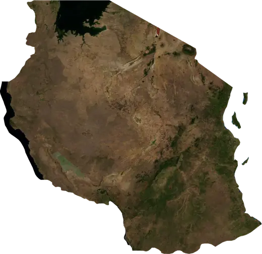
 Kigoma
: earthquakes and wildfires
Latest earthquakes and wildfires in Kigoma (Tanzania) on a live map, the strongest earthquakes and largest fires on record.
Live map – Kigoma
Key statistics (30 days)
Earthquakes M2.5+ and the wildfire fronts shown on the map.
Recent events in Kigoma
- 39 days agoWildfire near Nguruka, Tanzania23 km² · 34 km NW of Nguruka, Tanzania
- 43 days agoWildfire near Nguruka, Tanzania11 km² · 20 km NNW of Nguruka, Tanzania
- 55 days agoWildfire near Kigoma, Tanzania13 km² · 66 km WNW of Kigoma, Tanzania
- 58 days agoWildfire near Kigoma, Tanzania172 km² · 73 km WNW of Kigoma, Tanzania
- 60 days agoWildfire near Kibondo, Tanzania32 km² · 74 km SSE of Kibondo, Tanzania
- 62 days agoWildfire near Nguruka, Tanzania35 km² · 85 km NNE of Nguruka, Tanzania
Historical overview
Earthquakes M3.0+ and significant events of other hazards.
About Kigoma
Kigoma has recorded 28 earthquakes of magnitude 3.0 or more since 1986. The strongest was M5.8 in 1986.
Satellites have detected 61 significant wildfires here; the largest burned about 172 km².
Know the official emergency number, prepare an emergency kit and follow the instructions of your civil protection authority.
Learn more ›Earthquakes
28 earthquakes of magnitude 3.0 or more since 1986. The strongest was M5.8.
Recent earthquakes
No earthquakes of magnitude 2.5+ in the last 12 months.
Strongest earthquakes on record
| Mag | Location | Time (UTC) | Depth |
|---|---|---|---|
| 5.8 | 52 km S of Kigoma, Tanzania | 20.2 km | |
| 5.2 | 30 km WNW of Uvinza, Tanzania | 10.0 km | |
| 4.8 | 17 km W of Kigoma, Tanzania | 10.0 km | |
| 4.8 | 26 km S of Kigoma, Tanzania | 10.0 km | |
| 4.8 | 22 km WSW of Kigoma, Tanzania | 13.7 km | |
| 4.8 | 42 km N of Kasulu, Tanzania | 10.0 km | |
| 4.7 | 56 km SSE of Kigoma, Tanzania | 10.0 km | |
| 4.7 | 32 km NNW of Kigoma, Tanzania | 10.0 km | |
| 4.7 | 26 km WNW of Kigoma, Tanzania | 10.0 km | |
| 4.7 | 45 km SSW of Uvinza, Tanzania | 33.0 km | |
| 4.7 | 28 km WNW of Kigoma, Tanzania | 10.0 km | |
| 4.6 | 70 km SSE of Kigoma, Tanzania | 32.8 km | |
| 4.5 | 56 km SSE of Kigoma, Tanzania | 10.0 km | |
| 4.4 | 58 km NE of Kasulu, Tanzania | 10.0 km | |
| 4.4 | 54 km SW of Uvinza, Tanzania | 13.2 km |
Earthquakes per year (M3.0+)
Year
| 2024 | 1 | M4.8 |
| 2023 | 2 | M4.8 |
| 2021 | 1 | M4.1 |
| 2020 | 1 | M4.3 |
| 2017 | 1 | M4.4 |
| 2015 | 1 | M4.3 |
| 2014 | 2 | M4.8 |
| 2013 | 2 | M4.4 |
| 2010 | 2 | M4.3 |
| 2009 | 1 | M4.6 |
| 2008 | 4 | M5.2 |
| 2007 | 1 | M4.0 |
| 2006 | 1 | M4.7 |
| 2005 | 1 | M4.5 |
| 2003 | 1 | M4.8 |
| 2002 | 1 | M4.7 |
| 1997 | 1 | M4.7 |
| 1996 | 1 | M4.3 |
| 1988 | 1 | M3.8 |
| 1986 | 2 | M5.8 |
Wildfires
61 major fires since 2026. The largest covered about 172 km².
Recent fires
| Area | Location | Since | Status |
|---|---|---|---|
| 23 km² | 34 km NW of Nguruka, Tanzania | Inactive | |
| 11 km² | 20 km NNW of Nguruka, Tanzania | Inactive | |
| 13 km² | 66 km WNW of Kigoma, Tanzania | Inactive | |
| 172 km² | 73 km WNW of Kigoma, Tanzania | Inactive | |
| 32 km² | 74 km SSE of Kibondo, Tanzania | Inactive | |
| 35 km² | 85 km NNE of Nguruka, Tanzania | Inactive | |
| 89 km² | 86 km W of Kigoma, Tanzania | Inactive | |
| 12 km² | 52 km SE of Kibondo, Tanzania | Inactive | |
| 60 km² | 86 km NNW of Nguruka, Tanzania | Inactive | |
| 11 km² | 41 km SE of Kakonko, Tanzania | Inactive |
Show all (61)
Largest fires on record
| Area | Location | Since | Status |
|---|---|---|---|
| 172 km² | 73 km WNW of Kigoma, Tanzania | Inactive | |
| 167 km² | 64 km N of Nguruka, Tanzania | Inactive | |
| 89 km² | 86 km W of Kigoma, Tanzania | Inactive | |
| 60 km² | 86 km NNW of Nguruka, Tanzania | Inactive | |
| 60 km² | 69 km SE of Kibondo, Tanzania | Inactive | |
| 49 km² | 33 km N of Nguruka, Tanzania | Inactive | |
| 47 km² | 74 km S of Kibondo, Tanzania | Inactive | |
| 40 km² | 76 km NNE of Nguruka, Tanzania | Inactive | |
| 37 km² | 40 km N of Nguruka, Tanzania | Inactive | |
| 35 km² | 85 km NNE of Nguruka, Tanzania | Inactive | |
| 34 km² | 84 km SSE of Kibondo, Tanzania | Inactive | |
| 32 km² | 74 km SSE of Kibondo, Tanzania | Inactive | |
| 32 km² | 46 km NW of Nguruka, Tanzania | Inactive | |
| 28 km² | 70 km E of Kasulu, Tanzania | Inactive | |
| 28 km² | 55 km ESE of Kibondo, Tanzania | Inactive |