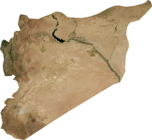
 `Afrin
: earthquakes and wildfires
Was there an earthquake or a fire near `Afrin just now? Live map within 100 km, the strongest earthquakes, the largest fires and statistics for `Afrin, Syria.
Live map – `Afrin
Earthquakes within 100 km of the city centre.
Key statistics (30 days)
Earthquakes M2.5+ and the wildfire fronts shown on the map.
Recent events in `Afrin
- 2.54 h agoM2.5 earthquake near Gaziantep, Republic of Türkiye – now20 km W of Gaziantep, Republic of Türkiye
- 5 h agoWildfire near İskenderun, Republic of Türkiye – active44 km² · 16 km N of İskenderun, Republic of Türkiye
- 5 h agoWildfire near Osmaniye, Republic of Türkiye – active25 km² · 15 km WSW of Osmaniye, Republic of Türkiye
- 4 days agoWildfire near Kahramanmaras, Republic of Türkiye8.1 km² · 33 km SE of Kahramanmaras, Republic of Türkiye
- 19 days agoWildfire near Kahramanmaras, Republic of Türkiye3.2 km² · 31 km SSE of Kahramanmaras, Republic of Türkiye
- 19 days agoWildfire near Kahramanmaras, Republic of Türkiye3.8 km² · 22 km S of Kahramanmaras, Republic of Türkiye
Historical overview
Earthquakes M3.0+ and significant events of other hazards.
About `Afrin
`Afrin has recorded 245 earthquakes of magnitude 3.0 or more since 1976. The strongest was M7.8 in 2023.
Satellites have detected 6 significant wildfires here; the largest burned about 44 km².
Know the official emergency number, prepare an emergency kit and follow the instructions of your civil protection authority.
Learn more ›Did you feel an earthquake in `Afrin?
No reports yet.
Earthquakes
245 earthquakes of magnitude 3.0 or more since 1976 within 100 km. The strongest was M7.8.
Recent earthquakes
| Mag | Location | Time (UTC) | Depth |
|---|---|---|---|
| 2.5 | 20 km W of Gaziantep, Republic of Türkiye | 9.6 km | |
| 4.4 | near Sakcagoez, Republic of Türkiye | 10.0 km | |
| 4.6 | 49 km W of Gaziantep, Republic of Türkiye | 10.0 km | |
| 4.3 | near Kirikhan, Republic of Türkiye | 10.0 km | |
| 4.1 | 18 km NNE of Kirikhan, Republic of Türkiye | 10.0 km | |
| 4.1 | near Antakya, Republic of Türkiye | 10.0 km | |
| 4.3 | 46 km SSW of Kahramanmaras, Republic of Türkiye | 10.0 km |
Strongest earthquakes on record
| Mag | Location | Time (UTC) | Depth |
|---|---|---|---|
| 7.8 | 32 km WNW of Gaziantep, Republic of Türkiye | 17.0 km | |
| 6.7 | 44 km S of Kahramanmaras, Republic of Türkiye | 9.8 km | |
| 6.3 | near Samandag, Republic of Türkiye | 16.0 km | |
| 5.7 | 39 km WNW of Gaziantep, Republic of Türkiye | 10.0 km | |
| 5.7 | 19 km SSE of Arsuz, Republic of Türkiye | 10.0 km | |
| 5.6 | 40 km ESE of Osmaniye, Republic of Türkiye | 10.0 km | |
| 5.5 | 10 km NNW of Samandag, Republic of Türkiye | 10.0 km | |
| 5.3 | 34 km NW of Gaziantep, Republic of Türkiye | 10.0 km | |
| 5.3 | 39 km WNW of Gaziantep, Republic of Türkiye | 11.4 km | |
| 5.3 | 16 km WNW of Antakya, Republic of Türkiye | 10.0 km | |
| 5.1 | 34 km E of Osmaniye, Republic of Türkiye | 10.0 km | |
| 5.1 | 26 km NNE of Osmaniye, Republic of Türkiye | 10.0 km | |
| 5.1 | 18 km NNW of Samandag, Republic of Türkiye | 10.0 km | |
| 5.1 | 25 km NW of İskenderun, Republic of Türkiye | 41.6 km | |
| 5.0 | 33 km SSE of Kahramanmaras, Republic of Türkiye | 4.1 km |
Earthquakes per year (M3.0+)
Year
| 2026 | 3 | M4.6 |
| 2025 | 7 | M4.3 |
| 2024 | 5 | M5.0 |
| 2023 | 131 | M7.8 |
| 2022 | 3 | M4.6 |
| 2021 | 3 | M4.6 |
| 2020 | 1 | M3.4 |
| 2019 | 1 | M3.0 |
| 2018 | 2 | M5.1 |
| 2017 | 1 | M4.6 |
| 2016 | 1 | M4.3 |
| 2015 | 3 | M4.4 |
| 2014 | 2 | M4.7 |
| 2013 | 3 | M4.3 |
| 2012 | 8 | M4.9 |
| 2010 | 2 | M4.9 |
| 2009 | 2 | M5.0 |
| 2008 | 2 | M4.0 |
| 2007 | 3 | M3.9 |
| 2006 | 7 | M4.4 |
| 2005 | 3 | M4.1 |
| 2004 | 3 | M3.5 |
| 2003 | 2 | M4.4 |
| 2002 | 1 | M3.9 |
| 2001 | 3 | M4.5 |
| 2000 | 2 | M4.7 |
| 1999 | 1 | M3.7 |
| 1998 | 4 | M4.1 |
| 1997 | 5 | M5.7 |
| 1996 | 6 | M4.4 |
| 1994 | 3 | M3.8 |
| 1993 | 1 | M4.2 |
| 1992 | 3 | M3.6 |
| 1991 | 2 | M4.4 |
| 1989 | 2 | M5.1 |
| 1987 | 2 | M4.3 |
| 1986 | 3 | M5.0 |
| 1985 | 1 | M4.5 |
| 1984 | 1 | M4.3 |
| 1983 | 1 | M4.7 |
| 1981 | 3 | M4.5 |
| 1980 | 1 | M4.7 |
| 1978 | 1 | M4.5 |
| 1976 | 1 | M4.2 |
Wildfires
6 major fires since 2025 within 100 km. The largest covered about 44 km².
Recent fires
| Area | Location | Since | Status |
|---|---|---|---|
| 44 km² | 16 km N of İskenderun, Republic of Türkiye | Active | |
| 25 km² | 15 km WSW of Osmaniye, Republic of Türkiye | Active | |
| 8.1 km² | 33 km SE of Kahramanmaras, Republic of Türkiye | Inactive | |
| 3.2 km² | 31 km SSE of Kahramanmaras, Republic of Türkiye | Inactive | |
| 3.8 km² | 22 km S of Kahramanmaras, Republic of Türkiye | Inactive | |
| 3.2 km² | 22 km SSE of Kahramanmaras, Republic of Türkiye | Inactive |
Largest fires on record
| Area | Location | Since | Status |
|---|---|---|---|
| 44 km² | 16 km N of İskenderun, Republic of Türkiye | Active | |
| 25 km² | 15 km WSW of Osmaniye, Republic of Türkiye | Active | |
| 8.1 km² | 33 km SE of Kahramanmaras, Republic of Türkiye | Inactive | |
| 3.8 km² | 22 km S of Kahramanmaras, Republic of Türkiye | Inactive | |
| 3.2 km² | 31 km SSE of Kahramanmaras, Republic of Türkiye | Inactive | |
| 3.2 km² | 22 km SSE of Kahramanmaras, Republic of Türkiye | Inactive |
Major fires per year
Year
| 2026 | 4 | 44 km² |
| 2025 | 2 | 25 km² |
Nearby places
- I`zaz 18 km
- Nubl 18 km
- Tall Rif`at 21 km
- Kilis 32 km
- Ad Dana 34 km
- Reyhanli 38 km
- Aleppo 43 km
- Batabo 44 km
- Kirikhan 46 km
- Kafr Takharim 54 km
- Salqin 56 km
- Ma`arratmisrin 58 km
- Al Bab 60 km
- Belen 60 km
- Tadif 62 km
- İskenderun 63 km
- Kabbasin 63 km
- Binnish 63 km
- As Safirah 66 km