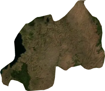
 Rwanda
Cutremure și incendii de vegetație în Rwanda
Ultimele cutremure și incendii de vegetație active din Rwanda pe o hartă live, cele mai puternice cutremure și cele mai mari incendii înregistrate, statistici pe ani.
Hartă live – Rwanda
Statistici principale (30 de zile)
Cutremure M2.5+ și fronturile de incendiu afișate pe hartă.
Pericol de incendiu
Prognoză pentru zona din jurul: Kigali. Pericolul poate varia local; urmați instrucțiunile autorităților. Sursa: Copernicus EMS – EFFIS (FWI).
Vreme severă (prognoză)
- Azi: Ploaie – Ploaie extremă (≥ 50 mm) · Kibungo
- Mâine: Ploaie – Ploaie extremă (≥ 50 mm) · Kibungo
Prognoză pentru zona din jurul: Rwanda. Nu înlocuiește avertizările serviciului meteorologic național. Sursa: ECMWF / Copernicus EMS.
Evenimente recente – Rwanda
- acum 10 hIncendiu de vegetație activ lângă Gisenyi, Rwanda621 km² · la 33 km N de Gisenyi, Rwanda
- acum 32 zileIncendiu de vegetație lângă Gisenyi, Rwanda11 km² · la 37 km NNV de Gisenyi, Rwanda
- acum 73 zileIncendiu de vegetație lângă Gisenyi, Rwanda11 km² · la 58 km VSV de Gisenyi, Rwanda
- acum 80 zileIncendiu de vegetație lângă Kigali, Rwanda17 km² · la 84 km ENE de Kigali, Rwanda
- acum 111 zileIncendiu de vegetație lângă Kigali, Rwanda20 km² · la 83 km NE de Kigali, Rwanda
- acum 123 zileIncendiu de vegetație lângă Kigali, Rwanda14 km² · la 79 km ENE de Kigali, Rwanda
Privire istorică
Cutremure M3,0+ și evenimente importante ale altor hazarduri.
Despre Rwanda
Rwanda: au fost înregistrate 65 cutremure cu magnitudine 3,0 sau mai mare din 1977. Cel mai puternic a fost M5,5, în 2002.
Sateliții au detectat aici 7 incendii de vegetație importante; cel mai mare a ars aproximativ 621 km².
Află numărul oficial de urgență, pregătește un kit de urgență și urmează instrucțiunile autorităților de protecție civilă.
Află mai multe ›Cutremure
65 cutremure cu magnitudinea de cel puțin 3,0 din 1977. Cel mai puternic a avut M5,5.
Cutremure recente
| Mag. | Locație | Ora (UTC) | Adâncime |
|---|---|---|---|
| 4,3 | la 108 km VNV de Gisenyi, Rwanda | 10,0 km | |
| 4,2 | la 77 km VNV de Gisenyi, Rwanda | 10,0 km |
Cele mai puternice cutremure înregistrate
| Mag. | Locație | Ora (UTC) | Adâncime |
|---|---|---|---|
| 5,5 | la 34 km VSV de Gisenyi, Rwanda | 10,0 km | |
| 5,2 | la 5 km NNV de Gikongoro, Rwanda | 10,0 km | |
| 5,2 | la 36 km NV de Gisenyi, Rwanda | 10,0 km | |
| 5,2 | la 99 km V de Gisenyi, Rwanda | 10,0 km | |
| 5,1 | la 94 km V de Gisenyi, Rwanda | 10,0 km | |
| 5,1 | la 25 km VSV de Gisenyi, Rwanda | 10,0 km | |
| 5,1 | la 31 km V de Gisenyi, Rwanda | 10,0 km | |
| 5,1 | la 84 km VNV de Gisenyi, Rwanda | 10,0 km | |
| 5,0 | la 102 km V de Gisenyi, Rwanda | 33,0 km | |
| 4,8 | la 34 km VNV de Kigali, Rwanda | 33,0 km | |
| 4,8 | la 56 km VNV de Gisenyi, Rwanda | 10,0 km | |
| 4,8 | la 34 km V de Gisenyi, Rwanda | 33,0 km | |
| 4,7 | la 16 km E de Gisenyi, Rwanda | 10,0 km | |
| 4,7 | la 20 km NE de Gisenyi, Rwanda | 10,0 km | |
| 4,7 | la 84 km VNV de Gisenyi, Rwanda | 10,0 km |
Cutremure pe an (magnitudine 3,0+)
An
| 2026 | 2 | M4,3 |
| 2023 | 2 | M4,6 |
| 2021 | 22 | M4,7 |
| 2020 | 1 | M4,2 |
| 2018 | 1 | M4,5 |
| 2016 | 1 | M5,1 |
| 2012 | 1 | M4,7 |
| 2009 | 2 | M4,1 |
| 2008 | 1 | M4,0 |
| 2006 | 2 | M4,2 |
| 2003 | 2 | M5,2 |
| 2002 | 20 | M5,5 |
| 2000 | 1 | M4,5 |
| 1995 | 1 | M5,1 |
| 1994 | 1 | M4,8 |
| 1991 | 1 | M4,6 |
| 1987 | 1 | M4,8 |
| 1983 | 1 | M5,2 |
| 1982 | 1 | M5,0 |
| 1977 | 1 | M4,8 |
Incendii de vegetație
7 incendii majore din 2026. Cel mai mare a acoperit aproximativ 621 km².
Incendii recente
| Suprafață | Locație | Din | Stare |
|---|---|---|---|
| 621 km² | la 33 km N de Gisenyi, Rwanda | Activ | |
| 11 km² | la 37 km NNV de Gisenyi, Rwanda | Inactiv | |
| 11 km² | la 58 km VSV de Gisenyi, Rwanda | Inactiv | |
| 17 km² | la 84 km ENE de Kigali, Rwanda | Inactiv | |
| 20 km² | la 83 km NE de Kigali, Rwanda | Inactiv | |
| 14 km² | la 79 km ENE de Kigali, Rwanda | Inactiv | |
| 16 km² | la 74 km ENE de Kigali, Rwanda | Inactiv |
Cele mai mari incendii înregistrate
| Suprafață | Locație | Din | Stare |
|---|---|---|---|
| 621 km² | la 33 km N de Gisenyi, Rwanda | Activ | |
| 20 km² | la 83 km NE de Kigali, Rwanda | Inactiv | |
| 17 km² | la 84 km ENE de Kigali, Rwanda | Inactiv | |
| 16 km² | la 74 km ENE de Kigali, Rwanda | Inactiv | |
| 14 km² | la 79 km ENE de Kigali, Rwanda | Inactiv | |
| 11 km² | la 58 km VSV de Gisenyi, Rwanda | Inactiv | |
| 11 km² | la 37 km NNV de Gisenyi, Rwanda | Inactiv |
Regiuni
Localități
- Kigali
- Gisenyi
- Musanze
- Nyagatare
- Gitarama
- Muhanga
- Butare
- Kibuye
- Cyangugu
- Shyorongi
- Byumba
- Ndera
- Kirambo
- Kagano
- Ngororero
- Nzega
- Macuba
- Karengera
- Nyanza
- Bugarama
- Gihombo
- Karambi
- Bushekeri
- Nyabitekeli
- Busogo
- Shangi
- Cyato
- Kirimbi
- Gitesi
- Bushenge
- Nyamata
- Ruhango
- Gikongoro
- Mahembe
- Rwamagana
- Kayonza
- Kibungo