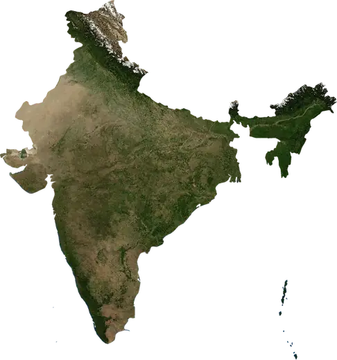
 Imphal
Cutremure și incendii lângă Imphal
A fost cutremur sau este un incendiu lângă Imphal chiar acum? Hartă live pe o rază de 100 km, cele mai puternice cutremure, cele mai mari incendii și statistici pentru Imphal, India.
Hartă live – Imphal
Cutremure pe o rază de 100 km de centrul orașului.
Statistici principale (30 de zile)
Cutremure M2.5+ și fronturile de incendiu afișate pe hartă.
Evenimente recente – Imphal
- 2,5acum 17 hCutremur de magnitudine 2,5 lângă Silchar, Indiala 53 km ESE de Silchar, India
- acum 4 zileIncendiu de vegetație lângă Imphal, India5,2 km² · la 28 km V de Imphal, India
- acum 4 zileIncendiu de vegetație lângă Maibong, India3,9 km² · la 19 km NE de Maibong, India
- 4,2acum 21 zileCutremur de magnitudine 4,2 lângă Tatkon, Myanmar (Birmania)la 26 km VNV de Tatkon, Myanmar (Birmania)
- 4,6acum 35 zileCutremur de magnitudine 4,6 lângă Imphal, Indiala 54 km ESE de Imphal, India
- 4,5acum 40 zileCutremur de magnitudine 4,5 lângă Tamu, Myanmar (Birmania)la 31 km E de Tamu, Myanmar (Birmania)
Privire istorică
Cutremure M3,0+ și evenimente importante ale altor hazarduri.
Despre Imphal
Imphal: au fost înregistrate 317 cutremure cu magnitudine 3,0 sau mai mare din 1976. Cel mai puternic a fost M6,7, în 2016.
Sateliții au detectat aici 3 incendii de vegetație importante; cel mai mare a ars aproximativ 21 km².
Află numărul oficial de urgență, pregătește un kit de urgență și urmează instrucțiunile autorităților de protecție civilă.
Află mai multe ›Ați simțit un cutremur lângă Imphal?
Încă nu există rapoarte.
Cutremure
317 cutremure cu magnitudinea 3,0 sau mai mare din 1976 (100 km). Cel mai puternic a avut magnitudinea 6,7.
Cutremure recente
| Mag. | Locație | Ora (UTC) | Adâncime |
|---|---|---|---|
| 2,5 | la 53 km ESE de Silchar, India | 25,0 km | |
| 4,2 | la 26 km VNV de Tatkon, Myanmar (Birmania) | 85,6 km | |
| 4,6 | la 54 km ESE de Imphal, India | 74,3 km | |
| 4,5 | la 31 km E de Tamu, Myanmar (Birmania) | 112,1 km | |
| 4,5 | la 31 km V de Tatkon, Myanmar (Birmania) | 110,0 km | |
| 4,5 | la 20 km SSE de Kakching, India | 52,1 km | |
| 4,4 | la 31 km ENE de Silchar, India | 48,2 km | |
| 5,0 | la 38 km V de Tatkon, Myanmar (Birmania) | 95,1 km | |
| 4,4 | la 8 km SE de Shuganu, India | 77,4 km | |
| 4,2 | la 67 km E de Imphal, India | 74,3 km |
Afișează tot (12)
| Mag. | Locație | Ora (UTC) | Adâncime |
|---|---|---|---|
| 4,4 | la 42 km ESE de Imphal, India | 84,6 km | |
| 4,1 | la 27 km VSV de Tatkon, Myanmar (Birmania) | 109,0 km |
Cele mai puternice cutremure înregistrate
| Mag. | Locație | Ora (UTC) | Adâncime |
|---|---|---|---|
| 6,7 | la 30 km V de Imphal, India | 55,0 km | |
| 6,3 | la 40 km V de Tatkon, Myanmar (Birmania) | 85,0 km | |
| 6,3 | la 58 km NNE de Imphal, India | 49,5 km | |
| 6,0 | la 15 km SV de Churachandpur, India | 33,0 km | |
| 5,9 | la 38 km ENE de Tamu, Myanmar (Birmania) | 95,0 km | |
| 5,7 | la 32 km VSV de Tatkon, Myanmar (Birmania) | 84,0 km | |
| 5,6 | la 18 km VNV de Tatkon, Myanmar (Birmania) | 33,0 km | |
| 5,6 | la 29 km VNV de Imphal, India | 66,4 km | |
| 5,6 | la 82 km ENE de Imphal, India | 66,5 km | |
| 5,6 | la 84 km ENE de Imphal, India | 62,8 km | |
| 5,5 | la 48 km VSV de Imphal, India | 53,0 km | |
| 5,5 | la 88 km S de Imphal, India | 72,1 km | |
| 5,5 | la 44 km VSV de Tatkon, Myanmar (Birmania) | 68,9 km | |
| 5,4 | la 41 km VSV de Tatkon, Myanmar (Birmania) | 88,2 km | |
| 5,4 | la 33 km ESE de Silchar, India | 40,7 km |
Cutremure pe an (magnitudine 3,0+)
An
| 2026 | 11 | M5,0 |
| 2025 | 11 | M5,4 |
| 2024 | 9 | M4,6 |
| 2023 | 8 | M5,1 |
| 2022 | 9 | M4,6 |
| 2021 | 7 | M4,9 |
| 2020 | 8 | M5,5 |
| 2019 | 15 | M5,1 |
| 2018 | 10 | M5,6 |
| 2017 | 13 | M5,1 |
| 2016 | 6 | M6,7 |
| 2015 | 11 | M4,8 |
| 2014 | 14 | M5,0 |
| 2013 | 4 | M4,4 |
| 2012 | 3 | M5,2 |
| 2011 | 14 | M6,3 |
| 2010 | 3 | M4,8 |
| 2009 | 3 | M5,9 |
| 2008 | 4 | M4,4 |
| 2007 | 6 | M4,7 |
| 2006 | 9 | M4,9 |
| 2005 | 6 | M5,7 |
| 2004 | 7 | M4,9 |
| 2003 | 3 | M4,5 |
| 2002 | 4 | M4,3 |
| 2001 | 3 | M4,8 |
| 2000 | 7 | M5,2 |
| 1999 | 8 | M5,6 |
| 1998 | 3 | M4,8 |
| 1997 | 6 | M4,5 |
| 1996 | 2 | M4,0 |
| 1995 | 9 | M4,7 |
| 1994 | 8 | M5,1 |
| 1993 | 5 | M4,6 |
| 1992 | 3 | M4,4 |
| 1991 | 8 | M5,5 |
| 1990 | 5 | M5,2 |
| 1989 | 6 | M5,6 |
| 1988 | 5 | M4,7 |
| 1987 | 1 | M6,3 |
| 1986 | 2 | M5,0 |
| 1985 | 4 | M5,0 |
| 1984 | 9 | M6,0 |
| 1983 | 4 | M5,6 |
| 1982 | 5 | M4,9 |
| 1981 | 2 | M4,8 |
| 1980 | 1 | M5,1 |
| 1979 | 4 | M5,3 |
| 1978 | 5 | M4,8 |
| 1976 | 4 | M4,7 |
Incendii de vegetație
3 incendii majore din 2026 (100 km). Cel mai mare a acoperit aproximativ 21 km².
Incendii recente
| Suprafață | Locație | Din | Stare |
|---|---|---|---|
| 5,2 km² | la 28 km V de Imphal, India | Inactiv | |
| 3,9 km² | la 19 km NE de Maibong, India | Inactiv | |
| 21 km² | la 18 km E de Tamu, Myanmar (Birmania) | Inactiv | |
| 13 km² | la 26 km S de Churachandpur, India | Inactiv | |
| 16 km² | la 34 km VNV de Imphal, India | Inactiv |
Cele mai mari incendii înregistrate
| Suprafață | Locație | Din | Stare |
|---|---|---|---|
| 21 km² | la 18 km E de Tamu, Myanmar (Birmania) | Inactiv | |
| 16 km² | la 34 km VNV de Imphal, India | Inactiv | |
| 13 km² | la 26 km S de Churachandpur, India | Inactiv |
Localități apropiate
- Keirao Bitra 11 km
- Nambol 18 km
- Thoubal 20 km
- Mayang Imphal 23 km
- Kakching 35 km
- Ukhrul 55 km