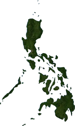
 Ternate
Earthquakes near Ternate
Was there an earthquake in Ternate just now? Live earthquakes within 100 km of Ternate, Philippines, the strongest in history and statistics.
Live map – Ternate
Loading live map…
Latest eventM 3.295.0 km depth · 26 h ago20 km SSW of Calatagan, Philippines
Low
Moderate
High
Very high
Extreme
Very extreme
Forecast: Copernicus EFFIS (FWI index)
Very light rain (0.1–1 mm)
Light rain (1–5 mm)
Moderate rain (5–10 mm)
Heavy rain (10–25 mm)
Very heavy rain (25–50 mm)
Extreme rain (≥ 50 mm)
Forecast: ECMWF via Copernicus EMS – GWIS
Calm (< 7 km/h, 0–1 Bf)
Light breeze (7–18 km/h, 2–3 Bf)
Moderate breeze (18–36 km/h, 4–5 Bf)
Strong breeze (36–54 km/h, 5–7 Bf)
Gale (54–72 km/h, 7–8 Bf)
Storm (≥ 72 km/h, 9+ Bf)
Forecast: ECMWF via Copernicus EMS – GWIS
Very low lightning
Low lightning
Moderate lightning
High lightning
Very high lightning
Extreme lightning
Forecast: ECMWF via Copernicus EMS – GWIS
Earthquakes
Wildfires
Floods
Storms
Volcanoes
Tsunamis
Earthquakes within 100 km of the city centre.
Key statistics (30 days)
Earthquakes M2.5+ and the wildfire fronts shown on the map.
Recent events in Ternate
- 3.226 h agoM3.2 earthquake near Calatagan, Philippines20 km SSW of Calatagan, Philippines
- 3.12 days agoM3.1 earthquake near Mariveles, Philippines59 km WSW of Mariveles, Philippines
- 4.538 days agoM4.5 earthquake near Bauan, Philippines34 km WSW of Bauan, Philippines
- 4.654 days agoM4.6 earthquake near Santol, Philippines10 km SW of Santol, Philippines
- 4.064 days agoM4.0 earthquake near Batangas, Philippines6 km SSW of Batangas, Philippines
- 4.370 days agoM4.3 earthquake near Batangas, Philippines21 km SSW of Batangas, Philippines
Historical overview
Earthquakes M3.0+ and significant events of other hazards.
About Ternate
Ternate has recorded 1,054 earthquakes of magnitude 3.0 or more since 1976. The strongest was M7.1 in 1994.
Know the official emergency number, prepare an emergency kit and follow the instructions of your civil protection authority.
Learn more ›Did you feel an earthquake in Ternate?
No reports yet.
Earthquakes
1,054 earthquakes of magnitude 3.0 or more since 1976 within 100 km. The strongest was M7.1.
Recent earthquakes
| Mag | Location | Time (UTC) | Depth |
|---|---|---|---|
| 3.2 | 20 km SSW of Calatagan, Philippines | 95.0 km | |
| 3.1 | 59 km WSW of Mariveles, Philippines | 2.0 km | |
| 4.5 | 34 km WSW of Bauan, Philippines | 82.3 km | |
| 4.6 | 10 km SW of Santol, Philippines | 143.4 km | |
| 4.0 | 6 km SSW of Batangas, Philippines | 162.7 km | |
| 4.3 | 21 km SSW of Batangas, Philippines | 139.5 km | |
| 4.4 | 10 km N of Nasugbu, Philippines | 120.3 km | |
| 4.1 | 43 km SW of Balayan, Philippines | 199.4 km | |
| 4.3 | near Batangas, Philippines | 195.7 km | |
| 4.4 | 34 km WNW of Calapan, Philippines | 106.2 km |
Show all (22)
| Mag | Location | Time (UTC) | Depth |
|---|---|---|---|
| 4.5 | 13 km S of Calatagan, Philippines | 157.4 km | |
| 4.5 | 18 km S of Calatagan, Philippines | 80.4 km | |
| 4.2 | 18 km SSW of Balayan, Philippines | 202.1 km | |
| 4.1 | near Binubusan, Philippines | 179.6 km | |
| 4.6 | 29 km SW of Bauan, Philippines | 148.3 km | |
| 4.4 | near Bulihan, Philippines | 146.4 km | |
| 5.0 | 8 km SSW of Balayan, Philippines | 177.4 km | |
| 4.6 | 11 km SSE of Calatagan, Philippines | 104.8 km | |
| 4.2 | near San Pascual, Philippines | 133.7 km | |
| 4.2 | 20 km S of Balayan, Philippines | 162.8 km | |
| 4.4 | near Naic, Philippines | 221.6 km | |
| 4.6 | 34 km SW of Batangas, Philippines | 186.3 km |
Strongest earthquakes on record
| Mag | Location | Time (UTC) | Depth |
|---|---|---|---|
| 7.1 | 18 km NW of Calapan, Philippines | 32.0 km | |
| 6.7 | 26 km S of Balayan, Philippines | 110.0 km | |
| 6.5 | 19 km SW of Nasugbu, Philippines | 105.0 km | |
| 6.3 | near Calatagan, Philippines | 109.0 km | |
| 6.2 | 19 km S of Balayan, Philippines | 112.0 km | |
| 6.2 | near Tuy, Philippines | 172.0 km | |
| 6.1 | near Lian, Philippines | 129.0 km | |
| 6.1 | 7 km NE of Dinalupihan, Philippines | 20.0 km | |
| 6.1 | 28 km SW of Subic, Philippines | 70.1 km | |
| 6.1 | 50 km SW of Olongapo, Philippines | 33.0 km | |
| 6.0 | near Tagbak, Philippines | 16.0 km | |
| 6.0 | 25 km SSW of Mariveles, Philippines | 115.4 km | |
| 5.9 | 25 km SW of Taal, Philippines | 121.0 km | |
| 5.9 | 8 km WSW of Bauan, Philippines | 14.0 km | |
| 5.9 | 8 km SSW of Olongapo, Philippines | 59.0 km |
Earthquakes per year (M3.0+)
Year
| 2026 | 19 | M5.0 |
| 2025 | 22 | M5.4 |
| 2024 | 25 | M4.9 |
| 2023 | 23 | M6.2 |
| 2022 | 36 | M6.1 |
| 2021 | 46 | M6.7 |
| 2020 | 101 | M6.3 |
| 2019 | 31 | M6.1 |
| 2018 | 20 | M5.5 |
| 2017 | 46 | M6.2 |
| 2016 | 19 | M5.2 |
| 2015 | 24 | M5.9 |
| 2014 | 32 | M5.5 |
| 2013 | 12 | M4.8 |
| 2012 | 19 | M5.3 |
| 2011 | 15 | M5.7 |
| 2010 | 10 | M6.0 |
| 2009 | 13 | M5.7 |
| 2008 | 53 | M5.9 |
| 2007 | 30 | M5.3 |
| 2006 | 30 | M5.8 |
| 2005 | 24 | M5.6 |
| 2004 | 44 | M6.5 |
| 2003 | 19 | M5.4 |
| 2002 | 16 | M5.8 |
| 2001 | 14 | M5.4 |
| 2000 | 16 | M5.9 |
| 1999 | 11 | M5.0 |
| 1998 | 21 | M6.1 |
| 1997 | 21 | M5.4 |
| 1996 | 22 | M6.1 |
| 1995 | 12 | M5.0 |
| 1994 | 14 | M7.1 |
| 1993 | 13 | M5.6 |
| 1992 | 15 | M5.2 |
| 1991 | 35 | M5.5 |
| 1990 | 11 | M5.1 |
| 1989 | 11 | M5.5 |
| 1988 | 9 | M5.9 |
| 1987 | 7 | M4.8 |
| 1986 | 9 | M5.7 |
| 1985 | 15 | M5.7 |
| 1984 | 7 | M5.1 |
| 1983 | 8 | M5.5 |
| 1982 | 12 | M5.4 |
| 1981 | 12 | M5.6 |
| 1980 | 9 | M5.7 |
| 1979 | 9 | M5.1 |
| 1978 | 4 | M5.4 |
| 1977 | 2 | M4.8 |
| 1976 | 6 | M5.8 |
Nearby places
- Maragondon 3 km
- Naic 6 km
- General Emilio Aguinaldo 15 km
- Indang 20 km
- General Trias 21 km
- Noveleta 23 km
- Dasmarinas 24 km
- Amadeo 26 km
- Kawit 26 km
- Nasugbu 26 km
- Mendez-Nunez 27 km
- Imus 28 km
- Silang 29 km
- Cavite City 29 km
- Mariveles 30 km