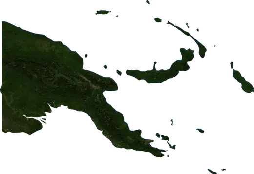
 Papua New Guinea
: earthquakes and wildfires
Latest earthquakes and active wildfires in Papua New Guinea on a live map, the strongest earthquakes and largest fires on record, and statistics by year.
Live map – Papua New Guinea
Key statistics (30 days)
Earthquakes M2.5+ and the wildfire fronts shown on the map.
Fire danger
Forecast for the area around: Port Moresby. Danger can vary locally; follow official guidance. Source: Copernicus EMS – EFFIS (FWI).
Severe weather (forecast)
- Today: Rain – Extreme rain (≥ 50 mm) · Lae
- Tomorrow: Rain – Extreme rain (≥ 50 mm) · Lae
Forecast for the area around: Papua New Guinea. It does not replace warnings from the national weather service. Source: ECMWF / Copernicus EMS.
Recent events in Papua New Guinea
- 10 h agoWildfire near Port Moresby, Papua New Guinea – active17 km² · 39 km NNW of Port Moresby, Papua New Guinea
- 10 h agoWildfire near Daru, Papua New Guinea – active8.1 km² · 93 km NNW of Daru, Papua New Guinea
- 10 h agoWildfire near Morehead, Papua New Guinea – active222 km² · 57 km SE of Morehead, Papua New Guinea
- 10 h agoWildfire near Daru, Papua New Guinea – active6.3 km² · 81 km WNW of Daru, Papua New Guinea
- 10 h agoWildfire near Port Moresby, Papua New Guinea – active20 km² · 21 km NW of Port Moresby, Papua New Guinea
- 10 h agoWildfire near Daru, Papua New Guinea – active14 km² · 69 km W of Daru, Papua New Guinea
Historical overview
Earthquakes M3.0+ and significant events of other hazards.
About Papua New Guinea
Papua New Guinea has recorded 29,867 earthquakes of magnitude 3.0 or more since 1976. The strongest was M8.0 in 2000.
Satellites have detected 296 significant wildfires here; the largest burned about 1,761 km².
Know the official emergency number, prepare an emergency kit and follow the instructions of your civil protection authority.
Learn more ›Earthquakes
Earthquakes today: Papua New Guinea →
29,867 earthquakes of magnitude 3.0 or more since 1976. The strongest was M8.0.
Recent earthquakes
| Mag | Location | Time (UTC) | Depth |
|---|---|---|---|
| 5.1 | 154 km NW of Kavieng, Papua New Guinea | 10.0 km | |
| 4.8 | 155 km NW of Kavieng, Papua New Guinea | 10.0 km | |
| 5.8 | 149 km NW of Kavieng, Papua New Guinea | 10.0 km | |
| 5.1 | 91 km W of Arawa, Papua New Guinea | 74.4 km | |
| 5.2 | 21 km WNW of Popondetta, Papua New Guinea | 124.3 km | |
| 4.7 | 120 km SW of Kokopo, Papua New Guinea | 120.8 km | |
| 4.6 | 135 km SSE of Kokopo, Papua New Guinea | 10.0 km | |
| 4.6 | 97 km NNW of Lae, Papua New Guinea | 97.8 km | |
| 4.3 | 98 km NE of Finschhafen, Papua New Guinea | 101.5 km | |
| 4.3 | 128 km SSW of Kokopo, Papua New Guinea | 10.0 km |
Show all (200)
Strongest earthquakes on record
| Mag | Location | Time (UTC) | Depth |
|---|---|---|---|
| 8.0 | 29 km NE of Rabaul, Papua New Guinea | 17.0 km | |
| 7.9 | 44 km W of Arawa, Papua New Guinea | 135.0 km | |
| 7.9 | 140 km E of Kokopo, Papua New Guinea | 95.0 km | |
| 7.8 | 139 km SSW of Kokopo, Papua New Guinea | 33.0 km | |
| 7.8 | 135 km SE of Kokopo, Papua New Guinea | 30.0 km | |
| 7.7 | 135 km E of Kokopo, Papua New Guinea | 90.0 km | |
| 7.7 | 156 km WNW of Panguna, Papua New Guinea | 30.0 km | |
| 7.7 | 54 km W of Kandrian, Papua New Guinea | 48.0 km | |
| 7.6 | 71 km E of Kainantu, Papua New Guinea | 116.0 km | |
| 7.6 | 49 km NE of Kokopo, Papua New Guinea | 10.0 km | |
| 7.6 | 67 km ESE of Aitape, Papua New Guinea | 13.0 km | |
| 7.6 | 104 km NE of Lae, Papua New Guinea | 55.0 km | |
| 7.6 | 157 km ESE of Kokopo, Papua New Guinea | 89.0 km | |
| 7.5 | 33 km SW of Tari, Papua New Guinea | 25.0 km | |
| 7.5 | 132 km SSW of Kokopo, Papua New Guinea | 55.0 km |
Earthquakes per year (M3.0+)
Year
| 2026 | 546 | M6.4 |
| 2025 | 871 | M6.9 |
| 2024 | 608 | M6.9 |
| 2023 | 769 | M7.0 |
| 2022 | 538 | M7.6 |
| 2021 | 615 | M6.3 |
| 2020 | 611 | M7.0 |
| 2019 | 660 | M7.6 |
| 2018 | 1,023 | M7.5 |
| 2017 | 622 | M7.9 |
| 2016 | 934 | M7.9 |
| 2015 | 1,126 | M7.5 |
| 2014 | 1,371 | M7.5 |
| 2013 | 634 | M7.3 |
| 2012 | 473 | M6.8 |
| 2011 | 543 | M7.1 |
| 2010 | 553 | M7.3 |
| 2009 | 298 | M6.7 |
| 2008 | 652 | M6.4 |
| 2007 | 936 | M6.9 |
| 2006 | 1,110 | M6.8 |
| 2005 | 719 | M7.7 |
| 2004 | 660 | M6.4 |
| 2003 | 588 | M6.8 |
| 2002 | 684 | M7.6 |
| 2001 | 679 | M7.0 |
| 2000 | 1,288 | M8.0 |
| 1999 | 624 | M7.4 |
| 1998 | 701 | M7.0 |
| 1997 | 631 | M7.2 |
| 1996 | 872 | M7.2 |
| 1995 | 723 | M7.7 |
| 1994 | 294 | M6.7 |
| 1993 | 489 | M6.9 |
| 1992 | 508 | M7.2 |
| 1991 | 326 | M6.6 |
| 1990 | 297 | M7.5 |
| 1989 | 314 | M7.1 |
| 1988 | 404 | M7.0 |
| 1987 | 603 | M7.7 |
| 1986 | 331 | M7.1 |
| 1985 | 491 | M7.2 |
| 1984 | 347 | M7.1 |
| 1983 | 274 | M7.6 |
| 1982 | 244 | M6.5 |
| 1981 | 300 | M6.9 |
| 1980 | 195 | M6.6 |
| 1979 | 260 | M6.2 |
| 1978 | 167 | M6.4 |
| 1977 | 165 | M6.6 |
| 1976 | 196 | M6.6 |
Wildfires
296 major fires since 2025. The largest covered about 1,761 km².
Recent fires
| Area | Location | Since | Status |
|---|---|---|---|
| 17 km² | 39 km NNW of Port Moresby, Papua New Guinea | Active | |
| 8.1 km² | 93 km NNW of Daru, Papua New Guinea | Active | |
| 222 km² | 57 km SE of Morehead, Papua New Guinea | Active | |
| 6.3 km² | 81 km WNW of Daru, Papua New Guinea | Active | |
| 20 km² | 21 km NW of Port Moresby, Papua New Guinea | Active | |
| 14 km² | 69 km W of Daru, Papua New Guinea | Active | |
| 28 km² | 55 km WNW of Daru, Papua New Guinea | Active | |
| 10 km² | 68 km NNW of Port Moresby, Papua New Guinea | Active | |
| 33 km² | 43 km WNW of Arawa, Papua New Guinea | Active | |
| 11 km² | 105 km SE of Wewak, Papua New Guinea | Active |
Show all (200)
Largest fires on record
| Area | Location | Since | Status |
|---|---|---|---|
| 1,761 km² | 21 km ENE of Morehead, Papua New Guinea | Active | |
| 1,460 km² | 91 km SSW of Kiunga, Papua New Guinea | Inactive | |
| 1,236 km² | 67 km SW of Kiunga, Papua New Guinea | Inactive | |
| 520 km² | 81 km W of Kimbe, Papua New Guinea | Inactive | |
| 456 km² | 99 km ESE of Kavieng, Papua New Guinea | Inactive | |
| 455 km² | 96 km SE of Wewak, Papua New Guinea | Active | |
| 320 km² | 71 km W of Daru, Papua New Guinea | Active | |
| 221 km² | 57 km SE of Morehead, Papua New Guinea | Active | |
| 203 km² | 141 km SSE of Kiunga, Papua New Guinea | Inactive | |
| 190 km² | 145 km NNW of Kokopo, Papua New Guinea | Active | |
| 169 km² | 145 km ESE of Wewak, Papua New Guinea | Active | |
| 146 km² | 101 km NE of Morehead, Papua New Guinea | Inactive | |
| 143 km² | 18 km S of Kokopo, Papua New Guinea | Active | |
| 124 km² | 68 km SSE of Wewak, Papua New Guinea | Active | |
| 116 km² | 73 km WSW of Kokopo, Papua New Guinea | Inactive |
Major fires per year
Year
| 2026 | 292 | 1,761 km² |
| 2025 | 4 | 64 km² |
Regions
- East New Britain Province
- Bougainville
- West New Britain Province
- Morobe Province
- Madang Province
- East Sepik Province
- Manus Province
- Eastern Highlands Province
- New Ireland
- Sandaun Province
- Milne Bay Province
- Hela Province
- Enga Province
- Southern Highlands Province
- Western Province
- Oro Province
- Western Highlands Province
- Chimbu Province
- Gulf Province
- National Capital
- Central Province