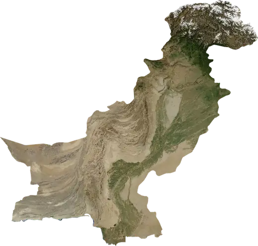
 Bhalwal
: earthquakes and wildfires
Was there an earthquake or a fire near Bhalwal just now? Live map within 100 km, the strongest earthquakes, the largest fires and statistics for Bhalwal, Pakistan.
Live map – Bhalwal
Earthquakes within 100 km of the city centre.
Key statistics (30 days)
Earthquakes M2.5+ and the wildfire fronts shown on the map.
Recent events in Bhalwal
- 11 h agoWildfire near Sargodha, Pakistan – active4.9 km² · 55 km N of Sargodha, Pakistan
- 25 h agoWildfire near Hafizabad, Pakistan – active34 km² · 18 km S of Hafizabad, Pakistan
- 25 h agoWildfire near Pindi Bhattian, Pakistan – active76 km² · 20 km NE of Pindi Bhattian, Pakistan
- 25 h agoWildfire near Faisalabad, Pakistan – active231 km² · 69 km WNW of Faisalabad, Pakistan
- 25 h agoWildfire near Pindi Bhattian, Pakistan – active23 km² · 7 km SSW of Pindi Bhattian, Pakistan
- 25 h agoWildfire near Pindi Bhattian, Pakistan – active9.2 km² · 16 km SE of Pindi Bhattian, Pakistan
Historical overview
Earthquakes M3.0+ and significant events of other hazards.
About Bhalwal
Bhalwal has recorded 34 earthquakes of magnitude 3.0 or more since 1978. The strongest was M5.2 in 2024.
Satellites have detected 8 significant wildfires here; the largest burned about 231 km².
Know the official emergency number, prepare an emergency kit and follow the instructions of your civil protection authority.
Learn more ›Did you feel an earthquake in Bhalwal?
No reports yet.
Earthquakes
34 earthquakes of magnitude 3.0 or more since 1978 within 100 km. The strongest was M5.2.
Recent earthquakes
| Mag | Location | Time (UTC) | Depth |
|---|---|---|---|
| 4.6 | 14 km NNE of Malakwal City, Pakistan | 13.4 km |
Strongest earthquakes on record
| Mag | Location | Time (UTC) | Depth |
|---|---|---|---|
| 5.2 | 9 km SSW of Sarai Alamgir, Pakistan | 10.0 km | |
| 5.1 | 65 km S of Rawalpindi, Pakistan | 50.5 km | |
| 5.0 | 29 km WNW of Faisalabad, Pakistan | 40.6 km | |
| 4.9 | 31 km SE of Pindi Bhattian, Pakistan | 47.7 km | |
| 4.9 | near Bhaun, Pakistan | 40.0 km | |
| 4.8 | 11 km SW of Sarai Alamgir, Pakistan | 10.0 km | |
| 4.7 | 68 km SSE of Rawalpindi, Pakistan | 33.0 km | |
| 4.6 | 14 km NNE of Malakwal City, Pakistan | 13.4 km | |
| 4.6 | near Khushab, Pakistan | 47.6 km | |
| 4.6 | 11 km SW of Chuhar Kana, Pakistan | 33.0 km | |
| 4.6 | 14 km NNW of Bhaun, Pakistan | 33.0 km | |
| 4.6 | 12 km W of Sargodha, Pakistan | 33.0 km | |
| 4.5 | 28 km SW of Sahiwal, Pakistan | 10.0 km | |
| 4.5 | 16 km ENE of Choa Saidan Shah, Pakistan | 13.7 km | |
| 4.5 | 20 km SW of Sahiwal, Pakistan | 33.0 km |
Earthquakes per year (M3.0+)
Year
| 2026 | 1 | M4.6 |
| 2024 | 1 | M5.2 |
| 2022 | 2 | M4.4 |
| 2021 | 1 | M3.4 |
| 2019 | 1 | M3.3 |
| 2017 | 1 | M4.5 |
| 2014 | 1 | M4.0 |
| 2013 | 1 | M4.5 |
| 2011 | 1 | M4.6 |
| 2008 | 1 | M3.7 |
| 2007 | 1 | M4.0 |
| 2005 | 1 | M3.4 |
| 2002 | 2 | M4.6 |
| 2001 | 1 | M5.1 |
| 2000 | 1 | M4.9 |
| 1999 | 1 | M4.5 |
| 1998 | 1 | M4.0 |
| 1997 | 1 | M4.8 |
| 1996 | 2 | M4.5 |
| 1992 | 1 | M3.9 |
| 1991 | 2 | M4.5 |
| 1987 | 1 | M3.7 |
| 1985 | 2 | M4.7 |
| 1984 | 3 | M5.0 |
| 1983 | 1 | M4.6 |
| 1980 | 1 | M4.0 |
| 1978 | 1 | M4.9 |
Wildfires
8 major fires since 2025 within 100 km. The largest covered about 231 km².
Recent fires
| Area | Location | Since | Status |
|---|---|---|---|
| 4.9 km² | 55 km N of Sargodha, Pakistan | Active | |
| 34 km² | 18 km S of Hafizabad, Pakistan | Active | |
| 76 km² | 20 km NE of Pindi Bhattian, Pakistan | Active | |
| 231 km² | 69 km WNW of Faisalabad, Pakistan | Active | |
| 23 km² | 7 km SSW of Pindi Bhattian, Pakistan | Active | |
| 9.2 km² | 16 km SE of Pindi Bhattian, Pakistan | Active | |
| 9.5 km² | 48 km NE of Faisalabad, Pakistan | Active | |
| 5.0 km² | 10 km SE of Kallar Kahar, Pakistan | Active | |
| 3.2 km² | 28 km WNW of Hafizabad, Pakistan | Active | |
| 5.2 km² | 12 km WNW of Hafizabad, Pakistan | Active |
Show all (22)
| Area | Location | Since | Status |
|---|---|---|---|
| 4.6 km² | 7 km N of Pindi Bhattian, Pakistan | Active | |
| 4.2 km² | 7 km W of Sahiwal, Pakistan | Active | |
| 21 km² | 18 km NW of Hafizabad, Pakistan | Active | |
| 6.6 km² | 21 km N of Hafizabad, Pakistan | Inactive | |
| 15 km² | 17 km NE of Hafizabad, Pakistan | Inactive | |
| 8.4 km² | 24 km WNW of Gujranwala, Pakistan | Inactive | |
| 20 km² | 20 km NE of Pindi Bhattian, Pakistan | Inactive | |
| 6.6 km² | 9 km N of Hafizabad, Pakistan | Inactive | |
| 4.1 km² | 40 km SSW of Sahiwal, Pakistan | Inactive | |
| 4.2 km² | 21 km E of Pindi Bhattian, Pakistan | Inactive | |
| 10 km² | 28 km SW of Gujranwala, Pakistan | Inactive | |
| 5.3 km² | 27 km WNW of Bhawana, Pakistan | Inactive |
Largest fires on record
| Area | Location | Since | Status |
|---|---|---|---|
| 231 km² | 69 km WNW of Faisalabad, Pakistan | Active | |
| 76 km² | 20 km NE of Pindi Bhattian, Pakistan | Active | |
| 34 km² | 18 km S of Hafizabad, Pakistan | Active | |
| 23 km² | 7 km SSW of Pindi Bhattian, Pakistan | Active | |
| 21 km² | 18 km NW of Hafizabad, Pakistan | Active | |
| 20 km² | 20 km NE of Pindi Bhattian, Pakistan | Inactive | |
| 15 km² | 17 km NE of Hafizabad, Pakistan | Inactive | |
| 10 km² | 28 km SW of Gujranwala, Pakistan | Inactive |
Major fires per year
Year
| 2026 | 7 | 231 km² |
| 2025 | 1 | 34 km² |
Nearby places
- Kot Mumin 15 km
- Bhera 24 km
- Jhawarian 28 km
- Sargodha 29 km
- Pind Dadan Khan 38 km
- Malakwal 44 km
- Malakwal City 44 km
- Khewra 44 km
- Lalian 50 km
- Choa Saidan Shah 51 km
- Khushab 51 km
- Pindi Bhattian 54 km
- Rabwah 57 km
- Jauharabad 58 km
- Sillanwali 59 km
- Chiniot 61 km
- Faruka 62 km
- Sahiwal 62 km
- Mandi Bahauddin 66 km
- Phalia 67 km
- Bhaun 67 km
- Sukheke Mandi 73 km
- Chakwal 74 km
- Mitha Tiwana 75 km