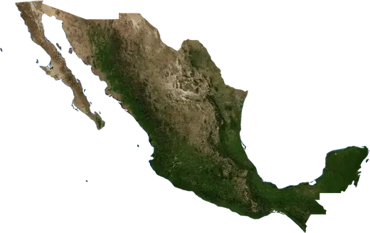
 Nayarit
: earthquakes and wildfires
Latest earthquakes and wildfires in Nayarit (Mexico) on a live map, the strongest earthquakes and largest fires on record.
Live map – Nayarit
Key statistics (30 days)
Earthquakes M2.5+ and the wildfire fronts shown on the map.
Recent events in Nayarit
- 42 h agoWildfire near Santa Teresa, Mexico – active7.5 km² · 12 km N of Santa Teresa, Mexico
- 43 h agoWildfire near Sauta, Mexico – active3.9 km² · near Sauta, Mexico
- 168 days agoWildfire near Tepic, Mexico11 km² · 50 km SE of Tepic, Mexico
- 177 days agoWildfire near Tepic, Mexico15 km² · 61 km NE of Tepic, Mexico
- 189 days agoWildfire near Ixtlan del Rio, Mexico16 km² · 45 km NE of Ixtlan del Rio, Mexico
- 192 days agoWildfire near Ixtlan del Rio, Mexico37 km² · 59 km N of Ixtlan del Rio, Mexico
Historical overview
Earthquakes M3.0+ and significant events of other hazards.
About Nayarit
Nayarit has recorded 28 earthquakes of magnitude 3.0 or more since 1976. The strongest was M5.6 in 2021.
Satellites have detected 11 significant wildfires here; the largest burned about 58 km².
Know the official emergency number, prepare an emergency kit and follow the instructions of your civil protection authority.
Learn more ›Earthquakes
28 earthquakes of magnitude 3.0 or more since 1976. The strongest was M5.6.
Recent earthquakes
No earthquakes of magnitude 2.5+ in the last 12 months.
Strongest earthquakes on record
| Mag | Location | Time (UTC) | Depth |
|---|---|---|---|
| 5.6 | 89 km WNW of Corral del Risco (Punta de Mita), Mexico | 10.0 km | |
| 5.6 | 60 km WSW of Villa Juarez, Mexico | 16.1 km | |
| 5.5 | 141 km WSW of Tuxpan, Mexico | 48.0 km | |
| 5.1 | 148 km WSW of Tuxpan, Mexico | 33.0 km | |
| 5.0 | 103 km SW of Santa Cruz, Mexico | 41.2 km | |
| 4.8 | 99 km SW of Santa Cruz, Mexico | 10.0 km | |
| 4.7 | 146 km WNW of Bucerias, Mexico | 10.0 km | |
| 4.5 | 75 km WSW of Villa Juarez, Mexico | 16.1 km | |
| 4.5 | 14 km N of San Jose del Valle, Mexico | 33.0 km | |
| 4.4 | 94 km WSW of Villa Juarez, Mexico | 10.0 km | |
| 4.4 | 27 km NNW of Tepic, Mexico | 59.0 km | |
| 4.4 | 25 km ENE of Tepic, Mexico | 10.0 km | |
| 4.4 | 88 km WNW of Corral del Risco (Punta de Mita), Mexico | 33.0 km | |
| 4.3 | 144 km W of Tuxpan, Mexico | 16.0 km | |
| 4.3 | 96 km WNW of Corral del Risco (Punta de Mita), Mexico | 33.0 km |
Earthquakes per year (M3.0+)
Year
| 2023 | 1 | M4.0 |
| 2022 | 1 | M4.4 |
| 2021 | 1 | M5.6 |
| 2017 | 2 | M4.2 |
| 2015 | 1 | M4.1 |
| 2013 | 1 | M4.2 |
| 2011 | 2 | M4.3 |
| 2010 | 4 | M5.6 |
| 2008 | 1 | M4.4 |
| 2007 | 2 | M5.0 |
| 2004 | 1 | M4.2 |
| 2001 | 2 | M4.0 |
| 1999 | 1 | M5.1 |
| 1998 | 2 | M4.4 |
| 1993 | 1 | M4.3 |
| 1989 | 1 | M4.7 |
| 1988 | 1 | M4.2 |
| 1984 | 1 | M4.4 |
| 1981 | 1 | M4.5 |
| 1976 | 1 | M5.5 |
Wildfires
11 major fires since 2026. The largest covered about 58 km².
Recent fires
| Area | Location | Since | Status |
|---|---|---|---|
| 7.5 km² | 12 km N of Santa Teresa, Mexico | Active | |
| 3.9 km² | near Sauta, Mexico | Active | |
| 11 km² | 50 km SE of Tepic, Mexico | Inactive | |
| 15 km² | 61 km NE of Tepic, Mexico | Inactive | |
| 16 km² | 45 km NE of Ixtlan del Rio, Mexico | Inactive | |
| 37 km² | 59 km N of Ixtlan del Rio, Mexico | Inactive | |
| 23 km² | 43 km NE of Ixtlan del Rio, Mexico | Inactive | |
| 10 km² | 9 km ESE of Santa Teresa, Mexico | Inactive | |
| 58 km² | 45 km NE of Ixtlan del Rio, Mexico | Inactive | |
| 15 km² | 60 km E of Tepic, Mexico | Inactive |
Show all (13)
| Area | Location | Since | Status |
|---|---|---|---|
| 14 km² | 33 km SE of Acaponeta, Mexico | Inactive | |
| 18 km² | 45 km NE of Ixtlan del Rio, Mexico | Inactive | |
| 11 km² | 43 km SSE of Tepic, Mexico | Inactive |
Largest fires on record
| Area | Location | Since | Status |
|---|---|---|---|
| 58 km² | 45 km NE of Ixtlan del Rio, Mexico | Inactive | |
| 37 km² | 59 km N of Ixtlan del Rio, Mexico | Inactive | |
| 23 km² | 43 km NE of Ixtlan del Rio, Mexico | Inactive | |
| 18 km² | 45 km NE of Ixtlan del Rio, Mexico | Inactive | |
| 16 km² | 45 km NE of Ixtlan del Rio, Mexico | Inactive | |
| 15 km² | 60 km E of Tepic, Mexico | Inactive | |
| 15 km² | 61 km NE of Tepic, Mexico | Inactive | |
| 14 km² | 33 km SE of Acaponeta, Mexico | Inactive | |
| 11 km² | 50 km SE of Tepic, Mexico | Inactive | |
| 11 km² | 43 km SSE of Tepic, Mexico | Inactive | |
| 10 km² | 9 km ESE of Santa Teresa, Mexico | Inactive |