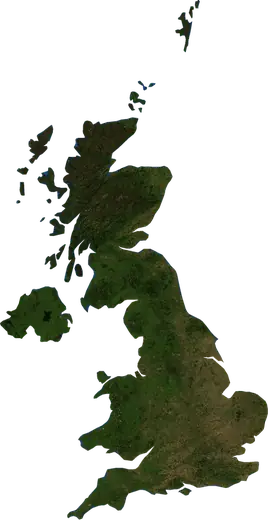
 Inghilterra
Terremoti e incendi in Inghilterra
Ultimi terremoti e incendi boschivi in Inghilterra (Regno Unito) su una mappa in tempo reale, i terremoti più forti e i più grandi incendi registrati.
Mappa in tempo reale – Inghilterra
Statistiche principali (30 giorni)
Terremoti M2,5+ e i fronti di incendio mostrati sulla mappa.
Eventi recenti in Inghilterra
- 12 h faIncendio boschivo vicino a Scunthorpe, Regno Unito – attivo23 km² · vicino a Scunthorpe, Regno Unito
- 20 h faIncendio boschivo vicino a Southampton, Regno Unito – attivo7,3 km² · a 8 km a SSE di Southampton, Regno Unito
- 21 h faIncendio boschivo vicino a Kingston upon Hull, Regno Unito – attivo10 km² · a 14 km a SSE di Kingston upon Hull, Regno Unito
- 45 h faIncendio boschivo vicino a Rotherham, Regno Unito – attivo3,7 km² · vicino a Rotherham, Regno Unito
- 4 giorni faIncendio boschivo vicino a High Peak, Regno Unito4,3 km² · a 7 km a ESE di High Peak, Regno Unito
- 124 giorni faIncendio boschivo vicino a Saddleworth, Regno Unito12 km² · a 7 km a SE di Saddleworth, Regno Unito
Panoramica storica
Terremoti M3,0+ ed eventi significativi di altri pericoli.
A proposito di Inghilterra
In Inghilterra sono stati registrati 102 terremoti di magnitudo 3,0 o superiore dal 1979. Il più forte è stato di M4,8 nel 2008.
I satelliti hanno rilevato qui 3 incendi boschivi significativi; il più grande ha bruciato circa 23 km².
Conosci il numero di emergenza ufficiale, prepara un kit di emergenza e segui le istruzioni della protezione civile.
Scopri di più ›Terremoti
102 terremoti di magnitudo 3,0 o superiore dal 1979. Il più forte è stato di M4,8.
Terremoti recenti
Nessun terremoto di magnitudo 2,5 o superiore negli ultimi 12 mesi.
Terremoti più forti registrati
| Mag. | Luogo | Ora (UTC) | Profondità |
|---|---|---|---|
| 4,8 | a 24 km a NE di Lincoln, Regno Unito | 18,0 km | |
| 4,8 | a 5 km a ONO di Dudley, Regno Unito | 9,0 km | |
| 4,7 | a 31 km a OSO di Loughton, Regno Unito | 18,0 km | |
| 4,6 | a 11 km a O di Folkestone, Regno Unito | 10,0 km | |
| 4,5 | a 16 km a E di Carlisle, Regno Unito | 10,0 km | |
| 4,4 | a 8 km a ESE di Thetford, Regno Unito | 10,0 km | |
| 4,3 | vicino a Manchester, Regno Unito | 5,0 km | |
| 4,2 | a 70 km a NNE di Great Yarmouth, Regno Unito | 4,0 km | |
| 4,2 | a 23 km a ESE di Nottingham, Regno Unito | 11,6 km | |
| 4,2 | a 49 km a NE di Great Yarmouth, Regno Unito | 10,0 km | |
| 4,1 | a 27 km a ENE di Kingston upon Hull, Regno Unito | 10,0 km | |
| 4,1 | a 58 km a NE di Broadstairs, Regno Unito | 10,0 km | |
| 4,1 | a 20 km a SSO di Penzance, Regno Unito | 10,0 km | |
| 4,0 | a 33 km a O di Bideford, Regno Unito | 28,7 km | |
| 4,0 | a 70 km a NNE di Norwich, Regno Unito | 10,0 km |
Terremoti per anno (M3,0+)
Anno
| 2025 | 1 | M3,4 |
| 2022 | 2 | M3,6 |
| 2020 | 2 | M3,9 |
| 2019 | 3 | M3,4 |
| 2018 | 1 | M4,1 |
| 2015 | 3 | M4,2 |
| 2014 | 1 | M3,5 |
| 2013 | 1 | M3,2 |
| 2011 | 2 | M3,9 |
| 2010 | 1 | M3,5 |
| 2009 | 3 | M3,7 |
| 2008 | 3 | M4,8 |
| 2007 | 6 | M4,6 |
| 2006 | 1 | M3,6 |
| 2005 | 3 | M3,6 |
| 2004 | 5 | M3,7 |
| 2003 | 2 | M3,5 |
| 2002 | 11 | M4,8 |
| 2001 | 3 | M4,2 |
| 2000 | 2 | M4,0 |
| 1999 | 3 | M3,3 |
| 1998 | 3 | M4,2 |
| 1997 | 1 | M3,2 |
| 1996 | 3 | M4,1 |
| 1995 | 4 | M3,7 |
| 1994 | 5 | M4,4 |
| 1993 | 3 | M3,2 |
| 1992 | 3 | M3,4 |
| 1991 | 1 | M3,3 |
| 1990 | 3 | M4,7 |
| 1989 | 1 | M3,3 |
| 1988 | 2 | M3,7 |
| 1987 | 1 | M3,4 |
| 1986 | 5 | M3,8 |
| 1985 | 3 | M3,4 |
| 1984 | 4 | M3,8 |
| 1979 | 1 | M4,5 |
Incendi boschivi
3 grandi incendi dal 2026. Il più grande ha interessato circa 23 km².
Incendi recenti
| Area | Luogo | Dal | Stato |
|---|---|---|---|
| 23 km² | vicino a Scunthorpe, Regno Unito | Attivo | |
| 7,3 km² | a 8 km a SSE di Southampton, Regno Unito | Attivo | |
| 10 km² | a 14 km a SSE di Kingston upon Hull, Regno Unito | Attivo | |
| 3,7 km² | vicino a Rotherham, Regno Unito | Attivo | |
| 4,3 km² | a 7 km a ESE di High Peak, Regno Unito | Inattivo | |
| 12 km² | a 7 km a SE di Saddleworth, Regno Unito | Inattivo |
Incendi più grandi registrati
| Area | Luogo | Dal | Stato |
|---|---|---|---|
| 23 km² | vicino a Scunthorpe, Regno Unito | Attivo | |
| 12 km² | a 7 km a SE di Saddleworth, Regno Unito | Inattivo | |
| 10 km² | a 14 km a SSE di Kingston upon Hull, Regno Unito | Attivo |
Località
- Londra
- Birmingham
- Manchester
- Sheffield
- Leeds
- Liverpool
- Bristol
- Leicester
- Bradford
- Coventry
- Brent
- Birkenhead
- Nottingham
- Islington
- Reading
- Kingston upon Hull
- Preston
- Newcastle upon Tyne
- Southend-on-Sea
- Brighton
- Derby
- Southampton
- Wolverhampton
- Plymouth
- Stoke-on-Trent
- Milton Keynes
- City of Westminster
- Northampton
- Oldham
- Bexley
- Luton
- Barking
- Archway
- Portsmouth
- Swindon
- Dudley
- Sutton
- St Helens
- Ipswich
- Wigan
- Croydon
- Warrington
- Walsall
- Mansfield
- Sunderland
- Ilford
- Slough
- Bournemouth
- Peterborough
- Oxford
- Enfield Town
- York
- Telford
- Poole
- Burnley
- Harrow
- Huddersfield
- Blackburn
- Cambridge
- Blackpool
- Basildon
- Norwich
- Middlesbrough
- Bolton
- Stockport
- High Wycombe
- Gloucester
- Exeter
- Colchester
- Tottenham
- Salford
- Newcastle under Lyme
- Solihull
- Watford
- Saint Peters
- Crawley
- Burton upon Trent
- Cheltenham
- Rotherham
- Worthing