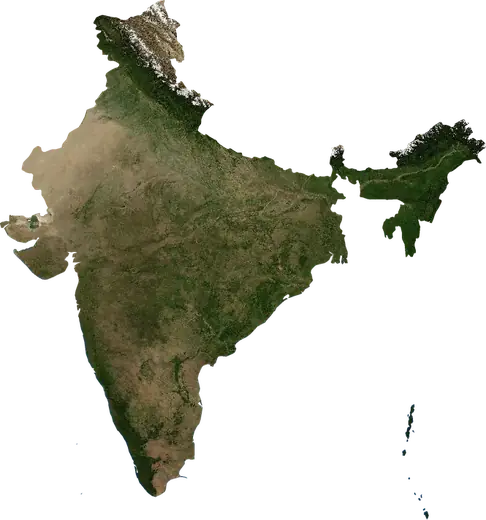
 Manipur
Terremoti e incendi in Manipur
Ultimi terremoti e incendi boschivi in Manipur (India) su una mappa in tempo reale, i terremoti più forti e i più grandi incendi registrati.
Mappa in tempo reale – Manipur
Statistiche principali (30 giorni)
Terremoti M2,5+ e i fronti di incendio mostrati sulla mappa.
Eventi recenti in Manipur
- 3 giorni faIncendio boschivo vicino a Imphal, India5,2 km² · a 28 km a O di Imphal, India
- 4,635 giorni faTerremoto di magnitudo 4,6 vicino a Imphal, Indiaa 54 km a ESE di Imphal, India
- 4,5150 giorni faTerremoto di magnitudo 4,5 vicino a Kakching, Indiaa 20 km a SSE di Kakching, India
- 212 giorni faIncendio boschivo vicino a Churachandpur, India13 km² · a 26 km a S di Churachandpur, India
- 4,4223 giorni faTerremoto di magnitudo 4,4 vicino a Shuganu, Indiaa 8 km a SE di Shuganu, India
- 4,2243 giorni faTerremoto di magnitudo 4,2 vicino a Imphal, Indiaa 67 km a E di Imphal, India
Panoramica storica
Terremoti M3,0+ ed eventi significativi di altri pericoli.
A proposito di Manipur
In Manipur sono stati registrati 194 terremoti di magnitudo 3,0 o superiore dal 1976. Il più forte è stato di M6,7 nel 2016.
I satelliti hanno rilevato qui 2 incendi boschivi significativi; il più grande ha bruciato circa 16 km².
Conosci il numero di emergenza ufficiale, prepara un kit di emergenza e segui le istruzioni della protezione civile.
Scopri di più ›Terremoti
194 terremoti di magnitudo 3,0 o superiore dal 1976. Il più forte è stato di M6,7.
Terremoti recenti
| Mag. | Luogo | Ora (UTC) | Profondità |
|---|---|---|---|
| 4,6 | a 54 km a ESE di Imphal, India | 74,3 km | |
| 4,5 | a 20 km a SSE di Kakching, India | 52,1 km | |
| 4,4 | a 8 km a SE di Shuganu, India | 77,4 km | |
| 4,2 | a 67 km a E di Imphal, India | 74,3 km | |
| 4,4 | a 42 km a ESE di Imphal, India | 84,6 km |
Terremoti più forti registrati
| Mag. | Luogo | Ora (UTC) | Profondità |
|---|---|---|---|
| 6,7 | a 30 km a O di Imphal, India | 55,0 km | |
| 6,3 | a 58 km a NNE di Imphal, India | 49,5 km | |
| 6,0 | a 15 km a SO di Churachandpur, India | 33,0 km | |
| 5,6 | a 21 km a ESE di Phek, India | 58,0 km | |
| 5,6 | a 29 km a ONO di Imphal, India | 66,4 km | |
| 5,6 | a 82 km a ENE di Imphal, India | 66,5 km | |
| 5,6 | a 84 km a ENE di Imphal, India | 62,8 km | |
| 5,5 | a 48 km a OSO di Imphal, India | 53,0 km | |
| 5,5 | a 88 km a S di Imphal, India | 72,1 km | |
| 5,4 | a 10 km a SSE di Churachandpur, India | 62,7 km | |
| 5,2 | a 49 km a SO di Churachandpur, India | 52,4 km | |
| 5,2 | a 40 km a ESE di Phek, India | 67,2 km | |
| 5,2 | a 73 km a SE di Imphal, India | 69,7 km | |
| 5,1 | a 42 km a SSO di Imphal, India | 50,0 km | |
| 5,1 | vicino a Kakching Khunou, India | 57,9 km |
Terremoti per anno (M3,0+)
Anno
| 2026 | 5 | M4,6 |
| 2025 | 4 | M5,1 |
| 2024 | 6 | M4,6 |
| 2023 | 3 | M4,6 |
| 2022 | 6 | M4,6 |
| 2021 | 8 | M5,0 |
| 2020 | 4 | M5,5 |
| 2019 | 11 | M5,0 |
| 2018 | 6 | M5,2 |
| 2017 | 10 | M5,1 |
| 2016 | 4 | M6,7 |
| 2015 | 6 | M4,8 |
| 2014 | 7 | M5,0 |
| 2013 | 3 | M4,4 |
| 2012 | 4 | M5,6 |
| 2011 | 5 | M4,7 |
| 2009 | 2 | M4,7 |
| 2008 | 3 | M4,1 |
| 2007 | 2 | M4,7 |
| 2006 | 4 | M4,6 |
| 2005 | 5 | M5,2 |
| 2004 | 5 | M4,9 |
| 2003 | 2 | M4,5 |
| 2002 | 2 | M4,3 |
| 2001 | 2 | M4,4 |
| 2000 | 2 | M4,1 |
| 1999 | 4 | M5,6 |
| 1998 | 3 | M4,8 |
| 1997 | 6 | M4,6 |
| 1996 | 4 | M4,7 |
| 1995 | 7 | M4,7 |
| 1994 | 4 | M5,0 |
| 1993 | 3 | M4,6 |
| 1992 | 2 | M4,4 |
| 1991 | 5 | M5,5 |
| 1990 | 2 | M5,0 |
| 1989 | 4 | M5,6 |
| 1988 | 5 | M4,8 |
| 1987 | 1 | M6,3 |
| 1986 | 1 | M4,5 |
| 1985 | 4 | M5,0 |
| 1984 | 4 | M6,0 |
| 1983 | 2 | M5,6 |
| 1982 | 2 | M4,9 |
| 1980 | 1 | M5,1 |
| 1979 | 3 | M4,7 |
| 1978 | 4 | M4,7 |
| 1976 | 2 | M4,6 |
Incendi boschivi
2 grandi incendi dal 2026. Il più grande ha interessato circa 16 km².
Incendi recenti
| Area | Luogo | Dal | Stato |
|---|---|---|---|
| 5,2 km² | a 28 km a O di Imphal, India | Inattivo | |
| 13 km² | a 26 km a S di Churachandpur, India | Inattivo | |
| 16 km² | a 34 km a ONO di Imphal, India | Inattivo |
Incendi più grandi registrati
| Area | Luogo | Dal | Stato |
|---|---|---|---|
| 16 km² | a 34 km a ONO di Imphal, India | Inattivo | |
| 13 km² | a 26 km a S di Churachandpur, India | Inattivo |