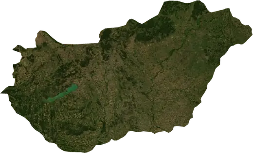
 Ungheria
Terremoti in Ungheria
Ultimi terremoti in Ungheria su una mappa in tempo reale, i terremoti più forti della storia, statistiche per anno e regioni.
Mappa in tempo reale – Ungheria
Statistiche principali (30 giorni)
Terremoti M2,5+ e i fronti di incendio mostrati sulla mappa.
Pericolo di incendio
Previsione per la zona di: Budapest. Il pericolo può variare localmente; seguire le indicazioni delle autorità. Fonte: Copernicus EMS – EFFIS (FWI).
Maltempo (previsione)
- Oggi: Pioggia – Pioggia molto forte (25–50 mm) · Budapest
- Domani: Pioggia – Pioggia molto forte (25–50 mm) · Budapest
Previsione per la zona di: Ungheria. Non sostituisce gli avvisi del servizio meteorologico nazionale. Fonte: ECMWF / Copernicus EMS.
Eventi recenti in Ungheria
Nessun evento significativo negli ultimi giorni.
Panoramica storica
Terremoti M3,0+ ed eventi significativi di altri pericoli.
A proposito di Ungheria
In Ungheria sono stati registrati 78 terremoti di magnitudo 3,0 o superiore dal 1978. Il più forte è stato di M5,2 nel 1985.
Conosci il numero di emergenza ufficiale, prepara un kit di emergenza e segui le istruzioni della protezione civile.
Scopri di più ›Terremoti
78 terremoti di magnitudo 3,0 o superiore dal 1978. Il più forte è stato di M5,2.
Terremoti recenti
Nessun terremoto di magnitudo 2,5 o superiore negli ultimi 12 mesi.
Terremoti più forti registrati
| Mag. | Luogo | Ora (UTC) | Profondità |
|---|---|---|---|
| 5,2 | a 31 km a OSO di Albareale, Ungheria | 10,0 km | |
| 4,6 | a 5 km a NO di Bekescsaba, Ungheria | 10,0 km | |
| 4,5 | a 29 km a ESE di Nagykanizsa, Ungheria | 10,0 km | |
| 4,5 | vicino a Balatonalmadi, Ungheria | 8,6 km | |
| 4,5 | vicino a Rackeve, Ungheria | 10,0 km | |
| 4,4 | a 5 km a ONO di Heves, Ungheria | 13,0 km | |
| 4,4 | a 22 km a NNE di Zalaegerszeg, Ungheria | 22,1 km | |
| 4,4 | a 33 km a SO di Albareale, Ungheria | 10,0 km | |
| 4,4 | vicino a Békés, Ungheria | 10,0 km | |
| 4,3 | vicino a Oroszlany, Ungheria | 10,0 km | |
| 4,3 | vicino a Kormend, Ungheria | 10,0 km | |
| 4,3 | a 9 km a NO di Siofok, Ungheria | 10,0 km | |
| 4,2 | a 32 km a OSO di Albareale, Ungheria | 15,3 km | |
| 4,1 | a 21 km a NNO di Szentes, Ungheria | 13,9 km | |
| 4,1 | vicino a Ersekvadkert, Ungheria | 6,2 km |
Terremoti per anno (M3,0+)
Anno
| 2025 | 2 | M4,1 |
| 2023 | 4 | M3,7 |
| 2019 | 1 | M4,5 |
| 2014 | 1 | M4,0 |
| 2013 | 2 | M4,4 |
| 2011 | 1 | M4,3 |
| 2007 | 2 | M3,0 |
| 2006 | 2 | M4,1 |
| 2005 | 3 | M3,9 |
| 2004 | 7 | M4,1 |
| 2003 | 6 | M4,3 |
| 2002 | 3 | M4,0 |
| 2001 | 1 | M3,0 |
| 2000 | 1 | M3,1 |
| 1995 | 3 | M3,8 |
| 1993 | 3 | M3,8 |
| 1992 | 1 | M3,1 |
| 1990 | 1 | M3,8 |
| 1989 | 6 | M4,4 |
| 1988 | 1 | M3,4 |
| 1986 | 1 | M3,2 |
| 1985 | 16 | M5,2 |
| 1984 | 2 | M3,2 |
| 1982 | 1 | M3,2 |
| 1981 | 1 | M3,5 |
| 1979 | 1 | M3,8 |
| 1978 | 5 | M4,6 |
Regioni
Località
- Budapest
- Pest
- Buda
- Debrecen
- Seghedino
- Miskolc
- Pécs
- Budapest XI. keruelet
- Zuglo
- Győr
- Budapest III. keruelet
- Nyiregyhaza
- Budapest XIII. keruelet
- Kecskemét
- Albareale
- Ujpest
- Budapest IV. keruelet
- Budapest XVIII. keruelet
- Budapest II. keruelet
- Budapest VIII. keruelet
- Budapest XV. keruelet
- Kobanya
- Budapest XVII. keruelet
- Szombathely
- Jozsefvaros
- Budapest XXI. keruelet
- Szolnok
- Budapest XVI. keruelet
- Tatabanya
- Kaposvar
- Budapest XX. keruelet
- Erd
- Sopron
- Angyalfoeld
- Erzsebetvaros
- Zalaegerszeg
- Budapest XIX. keruelet
- Kispest
- Bekescsaba
- Ferencvaros
- Pestlorinc
- Veszprém
- Budapest XII. keruelet
- Eger
- Kelenfoeld
- Budapest XXII. keruelet
- Dunaujvaros
- Nagykanizsa
- Hodmezovasarhely
- Budapest VI. keruelet
- Cegled
- Rakospalota
- Baja
- Ujlipotvaros
- Ujpalota
- Pesterzsebet
- Salgotarjan
- Szekszard
- Koezepso-Ferencvaros
- Obuda
- Vác
- Papa
- Gyongyos
- Kazincbarcika
- Godollo
- Gyula
- Hajduboszormeny
- Bekasmegyer
- Kiskunfelegyhaza
- Ajka
- Oroshaza
- Mosonmagyaróvár
- Dunakeszi
- Ozd
- Kiskunhalas
- Alsorakos
- Strigonio
- Szentes
- Jaszbereny
- Komlo