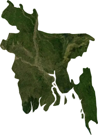
 Rangpur
Terremoti vicino a Rangpur
C’è stato un terremoto a Rangpur poco fa? Terremoti in tempo reale entro 100 km da Rangpur, Bangladesh, i più forti della storia e statistiche.
Mappa in tempo reale – Rangpur
Caricamento della mappa in tempo reale…
Ultimo eventoM 4,4profondità 10,0 km · 195 giorni faa 7 km a ONO di Jhagra Pt.III, India
Basso
Moderato
Alto
Molto alto
Estremo
Molto estremo
Previsione: Copernicus EFFIS (indice FWI)
Pioggia molto debole (0.1–1 mm)
Pioggia debole (1–5 mm)
Pioggia moderata (5–10 mm)
Pioggia forte (10–25 mm)
Pioggia molto forte (25–50 mm)
Pioggia estrema (≥ 50 mm)
Previsione: ECMWF tramite Copernicus EMS – GWIS
Calma (< 7 km/h, 0–1 Bf)
Brezza leggera (7–18 km/h, 2–3 Bf)
Brezza moderata (18–36 km/h, 4–5 Bf)
Vento forte (36–54 km/h, 5–7 Bf)
Burrasca (54–72 km/h, 7–8 Bf)
Tempesta (≥ 72 km/h, 9+ Bf)
Previsione: ECMWF tramite Copernicus EMS – GWIS
Pochissimi fulmini
Pochi fulmini
Attività elettrica moderata
Attività elettrica alta
Attività elettrica molto alta
Attività elettrica estrema
Previsione: ECMWF tramite Copernicus EMS – GWIS
Terremoti
Incendi boschivi
Alluvioni
Tempeste
Vulcani
Tsunami
Terremoti entro 100 km dal centro della città.
Statistiche principali (30 giorni)
Terremoti M2,5+ e i fronti di incendio mostrati sulla mappa.
Eventi recenti in Rangpur
Panoramica storica
Terremoti M3,0+ ed eventi significativi di altri pericoli.
A proposito di Rangpur
In Rangpur sono stati registrati 26 terremoti di magnitudo 3,0 o superiore dal 1979. Il più forte è stato di M5,0 nel 1991.
Conosci il numero di emergenza ufficiale, prepara un kit di emergenza e segui le istruzioni della protezione civile.
Scopri di più ›Hai sentito un terremoto a Rangpur?
Ancora nessuna segnalazione.
Terremoti
26 terremoti di magnitudo 3,0 o superiore dal 1979 entro 100 km. Il più forte è stato di M5,0.
Terremoti recenti
| Mag. | Luogo | Ora (UTC) | Profondità |
|---|---|---|---|
| 4,4 | a 7 km a ONO di Jhagra Pt.III, India | 10,0 km |
Terremoti più forti registrati
| Mag. | Luogo | Ora (UTC) | Profondità |
|---|---|---|---|
| 5,0 | a 14 km a S di Balurghat, India | 33,0 km | |
| 4,8 | a 27 km a N di Tura, India | 33,0 km | |
| 4,8 | a 23 km a NNO di Saidpur, Bangladesh | 33,0 km | |
| 4,7 | a 12 km a NNE di Alipur Duar, India | 13,6 km | |
| 4,7 | a 31 km a S di Rangpur, Bangladesh | 33,0 km | |
| 4,7 | a 9 km a NNE di Tura, India | 22,3 km | |
| 4,5 | a 6 km a ENE di Golakganj, India | 11,5 km | |
| 4,5 | a 23 km a N di Tura, India | 22,3 km | |
| 4,5 | a 8 km a ESE di Koch Bihar, India | 10,0 km | |
| 4,5 | a 8 km a NNE di Saidpur, Bangladesh | 40,0 km | |
| 4,5 | a 10 km a E di Matabhanga, India | 33,0 km |
Terremoti per anno (M3,0+)
Anno
| 2026 | 1 | M4,4 |
| 2022 | 1 | M4,0 |
| 2018 | 2 | M4,5 |
| 2016 | 1 | M4,3 |
| 2015 | 2 | M4,2 |
| 2014 | 4 | M4,3 |
| 2013 | 2 | M4,7 |
| 2010 | 1 | M4,5 |
| 2007 | 1 | M4,1 |
| 2006 | 1 | M3,8 |
| 2004 | 1 | M4,5 |
| 2002 | 1 | M4,5 |
| 1996 | 2 | M4,7 |
| 1994 | 1 | M3,9 |
| 1991 | 1 | M5,0 |
| 1985 | 1 | M4,7 |
| 1980 | 2 | M4,8 |
| 1979 | 1 | M4,8 |
Località vicine
- Badarganj 21 km
- Paotana Hat 27 km
- Lalmonirhat 27 km
- Parbatipur 33 km
- Saidpur 36 km
- Chilmari 47 km
- Dinhata 48 km
- Nageswari 50 km
- Dinajpur 63 km
- Mankachar 66 km
- Matabhanga 66 km
- Koch Bihar 67 km
- Joypur Hat 75 km
- Balurghat 75 km
- Tufanganj 76 km
- Dhubri 79 km
- Gauripur 80 km
- Gangarampur 82 km
- Shibganj 83 km
- Thakurgaon 84 km
- Falakata 86 km
- Alipur Duar 86 km
- Pirgaaj 90 km
- Kaliyaganj 94 km
- Panchagarh 95 km