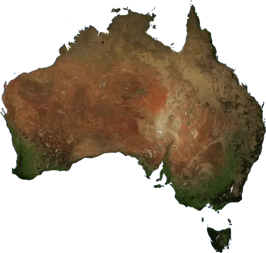
 Ástralía
Jarðskjálftar og gróðureldar – Ástralía
Nýjustu jarðskjálftar og virkir gróðureldar – Ástralía: kort í beinni, stærstu skráðu skjálftarnir og eldarnir og tölfræði eftir árum.
Lifandi kort – Ástralía
Helstu tölur (30 dagar)
Jarðskjálftar M2.5+ og eldlínur sem sjást á kortinu.
Gróðureldahætta
Spá fyrir svæðið í kringum: Perth. Hættan getur verið breytileg; fylgið fyrirmælum yfirvalda. Heimild: Copernicus EMS – EFFIS (FWI).
Óveður (spá)
- Í dag: Rigning – Aftakarigning (≥ 50 mm) · Newcastle
- Í dag: Eldingar – Mikil eldingavirkni · Maitland
- Á morgun: Rigning – Aftakarigning (≥ 50 mm) · Newcastle
Spá fyrir svæðið í kringum: Ástralía. Kemur ekki í stað viðvarana Veðurstofunnar. Heimild: ECMWF / Copernicus EMS.
Nýlegir atburðir – Ástralía
- 2,7fyrir 48 mín.Jarðskjálfti núna: stærð 2,7 – Kununurra, ÁstralíaKununurra, Ástralía: 95 km S
- fyrir 5 klst.Gróðureldur núna – Onslow, Ástralía16 km² · Onslow, Ástralía: 13 km VSV
- fyrir 6 klst.Gróðureldur núna – Derby, Ástralía23 km² · Derby, Ástralía: 142 km NA
- fyrir 6 klst.Gróðureldur núna – Derby, Ástralía12 km² · Derby, Ástralía: 133 km NA
- fyrir 6 klst.Gróðureldur núna – Fitzroy Crossing, Ástralía91 km² · Fitzroy Crossing, Ástralía: 238 km N
- fyrir 6 klst.Gróðureldur núna – Derby, Ástralía71 km² · Derby, Ástralía: 114 km N
Söguyfirlit
Jarðskjálftar M3,0+ og stórir atburðir annarrar náttúruvár.
Um svæðið – Ástralía
Ástralía: frá 1976 hafa mælst 1.032 jarðskjálftar af stærð 3,0 eða meira. Sá stærsti var M6,7 árið 1988.
Gervitungl hafa greint 1.397 stóra gróðurelda hér; sá stærsti brenndi um 3.561 km².
Kynntu þér neyðarnúmerið, útbúðu neyðarbúnað og fylgdu fyrirmælum almannavarna.
Frekari upplýsingar ›Jarðskjálftar
Jarðskjálftar í dag: Ástralía →
1.032 jarðskjálftar af stærð 3,0 eða meira frá 1976. Sá stærsti var M6,7.
Nýlegir jarðskjálftar
| Stærð | Staðsetning | Tími (UTC) | Dýpi |
|---|---|---|---|
| 2,7 | Kununurra, Ástralía: 95 km S | 9,2 km | |
| 3,0 | Encounter Bay, Ástralía: 92 km S | 10,0 km | |
| 3,5 | Pakenham, Ástralía: 49 km SA | 10,0 km | |
| 4,7 | Encounter Bay, Ástralía: 99 km S | 10,0 km | |
| 3,1 | Warragul, Ástralía: 20 km SSA | 10,0 km | |
| 4,7 | Pakenham, Ástralía: 46 km SA | 10,0 km | |
| 4,1 | Warrnambool, Ástralía: 82 km ASA | 10,0 km | |
| 4,4 | Tennant Creek, Ástralía: 49 km V | 6,3 km | |
| 4,5 | Tennant Creek, Ástralía: 35 km SV | 10,0 km | |
| 4,1 | Larapinta, Ástralía: 220 km VNV | 10,0 km |
Sýna allt (23)
| Stærð | Staðsetning | Tími (UTC) | Dýpi |
|---|---|---|---|
| 4,5 | Nhulunbuy, Ástralía: 185 km ANA | 13,0 km | |
| 4,2 | Fitzroy Crossing, Ástralía: 53 km N | 8,8 km | |
| 4,3 | Tennant Creek, Ástralía: 46 km SV | 5,0 km | |
| 4,5 | Yulara, Ástralía: 85 km SSV | 10,0 km | |
| 4,5 | Orange, Ástralía: 29 km SV | 10,0 km | |
| 4,4 | Yulara, Ástralía: 90 km SSV | 10,0 km | |
| 4,4 | Yulara, Ástralía: 93 km SSV | 10,0 km | |
| 4,4 | Yulara, Ástralía: 82 km SSV | 10,0 km | |
| 5,5 | Yulara, Ástralía: 83 km S | 10,0 km | |
| 4,4 | Boorowa, Ástralía: 18 km ANA | 10,0 km | |
| 4,2 | Katanning, Ástralía: 47 km A | 10,0 km | |
| 4,4 | Tennant Creek, Ástralía: 94 km S | 10,0 km | |
| 4,1 | Roxby Downs, Ástralía: 123 km NNA | 10,0 km |
Stærstu skráðu jarðskjálftarnir
| Stærð | Staðsetning | Tími (UTC) | Dýpi |
|---|---|---|---|
| 6,7 | Tennant Creek, Ástralía: 38 km VSV | 5,0 km | |
| 6,6 | Cable Beach, Ástralía: 198 km V | 10,0 km | |
| 6,3 | Derby, Ástralía: 162 km NNA | 10,0 km | |
| 6,3 | Tennant Creek, Ástralía: 34 km VSV | 5,0 km | |
| 6,3 | Tennant Creek, Ástralía: 46 km VSV | 5,0 km | |
| 6,1 | Northam, Ástralía: 105 km NNA | 6,0 km | |
| 6,0 | Yulara, Ástralía: 117 km VSV | 10,0 km | |
| 5,9 | Traralgon, Ástralía: 80 km N | 10,0 km | |
| 5,9 | Bilingurr, Ástralía: 266 km NV | 33,0 km | |
| 5,8 | East Carnarvon, Ástralía: 209 km NV | 10,0 km | |
| 5,8 | Yulara, Ástralía: 30 km NV | 10,0 km | |
| 5,7 | Whitsundays, Ástralía: 37 km NNV | 10,0 km | |
| 5,7 | Yulara, Ástralía: 207 km ASA | 10,0 km | |
| 5,6 | Tennant Creek, Ástralía: 61 km SV | 5,0 km | |
| 5,5 | Yulara, Ástralía: 83 km S | 10,0 km |
Jarðskjálftar á ári (stærð 3,0+)
Ár
| 2026 | 23 | M5,5 |
| 2025 | 17 | M5,1 |
| 2024 | 23 | M4,8 |
| 2023 | 16 | M5,2 |
| 2022 | 17 | M4,9 |
| 2021 | 17 | M5,9 |
| 2020 | 9 | M5,0 |
| 2019 | 36 | M6,6 |
| 2018 | 14 | M5,8 |
| 2017 | 13 | M4,9 |
| 2016 | 25 | M6,0 |
| 2015 | 11 | M5,5 |
| 2014 | 12 | M4,6 |
| 2013 | 5 | M5,3 |
| 2012 | 10 | M5,3 |
| 2011 | 17 | M5,3 |
| 2010 | 9 | M5,2 |
| 2009 | 13 | M5,0 |
| 2008 | 11 | M4,8 |
| 2007 | 37 | M4,9 |
| 2006 | 40 | M4,9 |
| 2005 | 59 | M4,9 |
| 2004 | 42 | M4,4 |
| 2003 | 45 | M4,8 |
| 2002 | 63 | M4,8 |
| 2001 | 46 | M5,0 |
| 2000 | 22 | M5,1 |
| 1999 | 17 | M4,7 |
| 1998 | 28 | M4,7 |
| 1997 | 16 | M6,3 |
| 1996 | 19 | M5,0 |
| 1995 | 10 | M4,8 |
| 1994 | 15 | M5,3 |
| 1993 | 6 | M4,6 |
| 1992 | 18 | M5,4 |
| 1991 | 34 | M5,2 |
| 1990 | 19 | M5,2 |
| 1989 | 22 | M5,8 |
| 1988 | 51 | M6,7 |
| 1987 | 23 | M5,4 |
| 1986 | 16 | M5,7 |
| 1985 | 23 | M5,3 |
| 1984 | 7 | M4,8 |
| 1983 | 4 | M5,1 |
| 1982 | 14 | M4,8 |
| 1981 | 11 | M5,1 |
| 1980 | 6 | M4,8 |
| 1979 | 12 | M6,1 |
| 1978 | 1 | M4,8 |
| 1977 | 7 | M4,9 |
| 1976 | 1 | M3,6 |
Gróðureldar
1.397 stórir eldar frá 2025. Sá stærsti náði yfir um 3.561 km².
Nýlegir eldar
| Svæði | Staðsetning | Frá | Staða |
|---|---|---|---|
| 16 km² | Onslow, Ástralía: 13 km VSV | Virkur | |
| 23 km² | Derby, Ástralía: 142 km NA | Virkur | |
| 12 km² | Derby, Ástralía: 133 km NA | Virkur | |
| 91 km² | Fitzroy Crossing, Ástralía: 238 km N | Virkur | |
| 71 km² | Derby, Ástralía: 114 km N | Virkur | |
| 87 km² | Derby, Ástralía: 243 km NNA | Virkur | |
| 83 km² | Derby, Ástralía: 44 km V | Virkur | |
| 207 km² | Derby, Ástralía: 220 km NNA | Virkur | |
| 140 km² | Derby, Ástralía: 106 km NNA | Virkur | |
| 162 km² | Derby, Ástralía: 80 km NA | Virkur |
Sýna allt (200)
| Svæði | Staðsetning | Frá | Staða |
|---|---|---|---|
| 97 km² | Derby, Ástralía: 84 km NA | Virkur | |
| 52 km² | Derby, Ástralía: 16 km SSA | Virkur | |
| 6,5 km² | Halls Creek, Ástralía: 128 km S | Virkur | |
| 32 km² | Karratha, Ástralía: 130 km SSV | Virkur | |
| 53 km² | Broome, Ástralía: 142 km SSA | Virkur | |
| 77 km² | Roebuck, Ástralía: 114 km ASA | Virkur | |
| 4,7 km² | Broome, Ástralía: 147 km SSA | Virkur | |
| 9,8 km² | Fitzroy Crossing, Ástralía: 36 km NNA | Virkur | |
| 6,6 km² | Derby, Ástralía: 82 km ANA | Virkur | |
| 3,2 km² | Derby, Ástralía: 118 km A | Virkur | |
| 12 km² | St George Ranges, Ástralía: 121 km V | Virkur | |
| 66 km² | Fitzroy Crossing, Ástralía: 117 km NNV | Virkur | |
| 90 km² | Derby, Ástralía: 59 km A | Virkur | |
| 31 km² | Broome, Ástralía: 125 km S | Virkur | |
| 12 km² | Fitzroy Crossing, Ástralía: 152 km N | Virkur | |
| 9,3 km² | Halls Creek, Ástralía: 252 km S | Virkur | |
| 32 km² | Alyangula, Ástralía: 91 km N | Virkur | |
| 11 km² | svæði: Kununurra, Ástralía | Virkur | |
| 15 km² | Kununurra, Ástralía: 86 km V | Virkur | |
| 4,6 km² | Kununurra, Ástralía: 34 km NNA | Virkur | |
| 9,8 km² | Katherine East, Ástralía: 131 km ANA | Virkur | |
| 5,7 km² | Katherine East, Ástralía: 137 km SA | Virkur | |
| 8,6 km² | Kununurra, Ástralía: 267 km NV | Virkur | |
| 11 km² | Ngukurr, Ástralía: 164 km VSV | Virkur | |
| 3,4 km² | Kununurra, Ástralía: 58 km NNV | Virkur | |
| 11 km² | Kununurra, Ástralía: 69 km NNV | Virkur | |
| 20 km² | Nhulunbuy, Ástralía: 23 km V | Virkur | |
| 15 km² | Kununurra, Ástralía: 78 km NNV | Virkur | |
| 63 km² | Kununurra, Ástralía: 79 km NNV | Virkur | |
| 41 km² | Kununurra, Ástralía: 91 km N | Virkur | |
| 26 km² | Kununurra, Ástralía: 95 km N | Virkur | |
| 42 km² | Derby, Ástralía: 258 km NA | Virkur | |
| 24 km² | Kununurra, Ástralía: 86 km V | Virkur | |
| 4,6 km² | Derby, Ástralía: 152 km NA | Virkur | |
| 29 km² | Alyangula, Ástralía: 10 km ASA | Virkur | |
| 15 km² | Derby, Ástralía: 192 km NA | Virkur | |
| 10 km² | Fitzroy Crossing, Ástralía: 183 km NNV | Virkur | |
| 3,1 km² | Ngukurr, Ástralía: 46 km V | Virkur | |
| 132 km² | Kununurra, Ástralía: 43 km A | Virkur | |
| 3,1 km² | Katherine East, Ástralía: 95 km SSA | Virkur | |
| 107 km² | Gunbalanya, Ástralía: 83 km NNV | Virkur | |
| 11 km² | Katherine East, Ástralía: 123 km ASA | Virkur | |
| 11 km² | Derby, Ástralía: 155 km ANA | Virkur | |
| 45 km² | Katherine East, Ástralía: 146 km SA | Virkur | |
| 4,8 km² | Kununurra, Ástralía: 175 km V | Virkur | |
| 5,0 km² | Katherine East, Ástralía: 150 km SSA | Virkur | |
| 67 km² | Ngukurr, Ástralía: 148 km VSV | Virkur | |
| 32 km² | Nhulunbuy, Ástralía: 27 km VNV | Virkur | |
| 39 km² | Kununurra, Ástralía: 82 km ASA | Virkur | |
| 178 km² | Alyangula, Ástralía: 57 km V | Virkur | |
| 161 km² | Alyangula, Ástralía: 107 km NNV | Virkur | |
| 105 km² | Nhulunbuy, Ástralía: 68 km SV | Virkur | |
| 3,2 km² | Halls Creek, Ástralía: 262 km ASA | Virkur | |
| 13 km² | East Side, Ástralía: 292 km NA | Virkur | |
| 14 km² | St George Ranges, Ástralía: 97 km NV | Virkur | |
| 3,5 km² | Soldiers Hill, Ástralía: 16 km NNV | Virkur | |
| 4,6 km² | Ngukurr, Ástralía: 163 km SSA | Virkur | |
| 8,7 km² | Derby, Ástralía: 47 km SSV | Virkur | |
| 3,1 km² | Katherine East, Ástralía: 160 km SA | Virkur | |
| 4,9 km² | Doomadgee, Ástralía: 200 km V | Virkur | |
| 15 km² | Doomadgee, Ástralía: 257 km V | Virkur | |
| 444 km² | Ngukurr, Ástralía: 136 km SSA | Virkur | |
| 19 km² | Fitzroy Crossing, Ástralía: 119 km N | Virkur | |
| 9,5 km² | Halls Creek, Ástralía: 288 km ASA | Virkur | |
| 4,2 km² | Katherine East, Ástralía: 168 km SSA | Virkur | |
| 6,5 km² | Katherine East, Ástralía: 169 km SA | Virkur | |
| 26 km² | Karratha, Ástralía: 16 km NNV | Virkur | |
| 39 km² | Ngukurr, Ástralía: 71 km NNA | Virkur | |
| 3,3 km² | Wadeye, Ástralía: 96 km S | Virkur | |
| 39 km² | Aurukun, Ástralía: 99 km ASA | Virkur | |
| 27 km² | Aurukun, Ástralía: 111 km ASA | Virkur | |
| 52 km² | Ngukurr, Ástralía: 147 km SA | Virkur | |
| 79 km² | Galiwinku, Ástralía: 97 km SSA | Virkur | |
| 4,3 km² | Milingimbi, Ástralía: 56 km S | Virkur | |
| 12 km² | Milingimbi, Ástralía: 118 km SSA | Virkur | |
| 8,1 km² | Mission River, Ástralía: 147 km A | Virkur | |
| 35 km² | Mission River, Ástralía: 157 km ASA | Virkur | |
| 371 km² | Bamaga, Ástralía: 54 km S | Virkur | |
| 4,8 km² | Ngukurr, Ástralía: 234 km SA | Virkur | |
| 93 km² | Mission River, Ástralía: 88 km A | Virkur | |
| 5,4 km² | Ngukurr, Ástralía: 84 km NA | Virkur | |
| 59 km² | Alyangula, Ástralía: 267 km S | Virkur | |
| 34 km² | Aurukun, Ástralía: 76 km ASA | Virkur | |
| 7,9 km² | Ngukurr, Ástralía: 129 km NNA | Virkur | |
| 14 km² | Ngukurr, Ástralía: 166 km SA | Virkur | |
| 5,5 km² | Cossack, Ástralía: 221 km SSV | Virkur | |
| 172 km² | Hope Vale, Ástralía: 89 km NV | Virkur | |
| 46 km² | Ngukurr, Ástralía: 77 km SA | Virkur | |
| 50 km² | Milingimbi, Ástralía: 143 km S | Virkur | |
| 4,5 km² | Mission River, Ástralía: 173 km ASA | Virkur | |
| 195 km² | Aurukun, Ástralía: 35 km N | Virkur | |
| 15 km² | Mission River, Ástralía: 59 km NNV | Virkur | |
| 192 km² | Nhulunbuy, Ástralía: 55 km SV | Virkur | |
| 227 km² | Nhulunbuy, Ástralía: 22 km SSV | Virkur | |
| 7,9 km² | Galiwinku, Ástralía: 68 km SA | Virkur | |
| 16 km² | Bamaga, Ástralía: 39 km SSV | Virkur | |
| 3,7 km² | Bamaga, Ástralía: 40 km SSV | Virkur | |
| 5,6 km² | Bamaga, Ástralía: 35 km SV | Virkur | |
| 8,7 km² | Nhulunbuy, Ástralía: 7 km SA | Virkur | |
| 20 km² | Galiwinku, Ástralía: 111 km SSA | Virkur | |
| 4,1 km² | Ingham, Ástralía: 157 km VSV | Virkur | |
| 3,7 km² | Cloncurry, Ástralía: 112 km SSV | Virkur | |
| 25 km² | Ingham, Ástralía: 144 km VSV | Virkur | |
| 11 km² | Hughenden, Ástralía: 129 km SSA | Virkur | |
| 12 km² | Ingham, Ástralía: 108 km VSV | Virkur | |
| 14 km² | Hughenden, Ástralía: 130 km NV | Virkur | |
| 3,2 km² | Doomadgee, Ástralía: 135 km SSV | Virkur | |
| 27 km² | Hughenden, Ástralía: 148 km N | Virkur | |
| 3,6 km² | Dubbo, Ástralía: 80 km NNV | Virkur | |
| 8,0 km² | Smithton, Ástralía: 22 km A | Virkur | |
| 8,0 km² | Bamaga, Ástralía: 24 km S | Virkur | |
| 3,1 km² | Mission River, Ástralía: 118 km A | Virkur | |
| 265 km² | Aurukun, Ástralía: 91 km ASA | Virkur | |
| 13 km² | Doomadgee, Ástralía: 155 km NV | Virkur | |
| 78 km² | Hope Vale, Ástralía: 80 km VNV | Virkur | |
| 30 km² | Karratha, Ástralía: 146 km V | Virkur | |
| 12 km² | Derby, Ástralía: 89 km NA | Virkur | |
| 42 km² | Gunbalanya, Ástralía: 76 km SA | Virkur | |
| 3,3 km² | Alyangula, Ástralía: 49 km SSA | Virkur | |
| 40 km² | Ngukurr, Ástralía: 89 km VNV | Virkur | |
| 128 km² | Wurrumiyanga, Ástralía: 24 km ANA | Virkur | |
| 40 km² | Ngukurr, Ástralía: 165 km S | Virkur | |
| 98 km² | Ngukurr, Ástralía: 7 km SV | Virkur | |
| 11 km² | Palmerston, Ástralía: 78 km A | Virkur | |
| 48 km² | svæði: Gunbalanya, Ástralía | Virkur | |
| 3,7 km² | Ngukurr, Ástralía: 82 km VNV | Virkur | |
| 14 km² | Ngukurr, Ástralía: 59 km SA | Virkur | |
| 218 km² | Maningrida, Ástralía: 131 km S | Virkur | |
| 8,4 km² | Point Cook, Ástralía: 10 km NNA | Virkur | |
| 27 km² | Lightning Ridge, Ástralía: 68 km NNV | Virkur | |
| 6,2 km² | Rockhampton, Ástralía: 48 km N | Virkur | |
| 48 km² | Hughenden, Ástralía: 165 km NNA | Virkur | |
| 7,3 km² | svæði: Hope Vale, Ástralía | Virkur | |
| 4,0 km² | Rockhampton, Ástralía: 41 km NNV | Virkur | |
| 11 km² | Ngukurr, Ástralía: 190 km SSA | Virkur | |
| 7,6 km² | Ngukurr, Ástralía: 191 km S | Virkur | |
| 17 km² | Ngukurr, Ástralía: 197 km S | Virkur | |
| 7,4 km² | Moranbah, Ástralía: 86 km A | Virkur | |
| 62 km² | Normanton, Ástralía: 190 km A | Virkur | |
| 9,4 km² | Millstream, Ástralía: 182 km SV | Virkur | |
| 5,1 km² | Hughenden, Ástralía: 235 km NNV | Virkur | |
| 92 km² | Ngukurr, Ástralía: 211 km SSA | Virkur | |
| 4,1 km² | Hughenden, Ástralía: 159 km NNA | Virkur | |
| 7,4 km² | Millstream, Ástralía: 21 km NNV | Virkur | |
| 4,0 km² | Ngukurr, Ástralía: 195 km S | Virkur | |
| 53 km² | Hughenden, Ástralía: 214 km NNV | Virkur | |
| 40 km² | Clermont, Ástralía: 157 km VNV | Virkur | |
| 4,3 km² | Millstream, Ástralía: 159 km VSV | Virkur | |
| 17 km² | Normanton, Ástralía: 240 km NA | Virkur | |
| 53 km² | Millstream, Ástralía: 237 km VSV | Virkur | |
| 445 km² | Hope Vale, Ástralía: 67 km VSV | Virkur | |
| 5,5 km² | Millstream, Ástralía: 37 km SSA | Virkur | |
| 33 km² | Normanton, Ástralía: 160 km ASA | Virkur | |
| 10 km² | Millstream, Ástralía: 59 km VSV | Virkur | |
| 56 km² | Normanton, Ástralía: 146 km ASA | Virkur | |
| 16 km² | Millstream, Ástralía: 36 km VSV | Virkur | |
| 40 km² | Normanton, Ástralía: 129 km ASA | Virkur | |
| 6,0 km² | Normanton, Ástralía: 127 km ASA | Virkur | |
| 680 km² | Dimbulah, Ástralía: 143 km VSV | Virkur | |
| 10 km² | Dimbulah, Ástralía: 113 km VSV | Virkur | |
| 25 km² | Cairns, Ástralía: 27 km V | Virkur | |
| 44 km² | Dimbulah, Ástralía: 86 km VNV | Virkur | |
| 103 km² | Dimbulah, Ástralía: 123 km VNV | Virkur | |
| 26 km² | Dimbulah, Ástralía: 93 km VNV | Virkur | |
| 5,1 km² | Dimbulah, Ástralía: 88 km NV | Virkur | |
| 15 km² | Karumba, Ástralía: 247 km NA | Virkur | |
| 19 km² | Cooktown, Ástralía: 95 km SV | Virkur | |
| 134 km² | Red Hill, Ástralía: 26 km VSV | Virkur | |
| 5,7 km² | Karumba, Ástralía: 244 km NA | Virkur | |
| 18 km² | Townsville, Ástralía: 41 km VSV | Virkur | |
| 72 km² | Hope Vale, Ástralía: 70 km VSV | Virkur | |
| 28 km² | Hope Vale, Ástralía: 56 km VSV | Virkur | |
| 98 km² | Aurukun, Ástralía: 246 km SSA | Virkur | |
| 181 km² | Hope Vale, Ástralía: 134 km V | Virkur | |
| 327 km² | Aurukun, Ástralía: 226 km SSA | Virkur | |
| 17 km² | Hughenden, Ástralía: 150 km NNA | Virkur | |
| 4,7 km² | Dimbulah, Ástralía: 206 km V | Virkur | |
| 13 km² | Hughenden, Ástralía: 138 km NNA | Virkur | |
| 66 km² | Dimbulah, Ástralía: 160 km V | Virkur | |
| 27 km² | Hughenden, Ástralía: 161 km NNA | Virkur | |
| 5,7 km² | Cairns, Ástralía: 114 km NNV | Virkur | |
| 9,5 km² | Moranbah, Ástralía: 36 km N | Virkur | |
| 9,3 km² | Mission River, Ástralía: 52 km N | Virkur | |
| 70 km² | Hope Vale, Ástralía: 133 km NNV | Virkur | |
| 18 km² | Mission River, Ástralía: 21 km NNA | Virkur | |
| 116 km² | Mission River, Ástralía: 14 km NV | Virkur | |
| 3,2 km² | Traralgon, Ástralía: 55 km A | Virkur | |
| 4,6 km² | Bingara, Ástralía: 31 km SA | Virkur | |
| 4,4 km² | Mackay, Ástralía: 119 km S | Virkur | |
| 23 km² | Mackay, Ástralía: 68 km S | Virkur |
Stærstu skráðu eldarnir
| Svæði | Staðsetning | Frá | Staða |
|---|---|---|---|
| 3.561 km² | Ngukurr, Ástralía: 66 km SSV | Virkur | |
| 1.555 km² | Kununurra, Ástralía: 194 km A | Óvirkur | |
| 993 km² | Ngukurr, Ástralía: 288 km SSV | Óvirkur | |
| 756 km² | Lavington, Ástralía: 56 km ASA | Óvirkur | |
| 680 km² | Dimbulah, Ástralía: 143 km VSV | Virkur | |
| 490 km² | Doomadgee, Ástralía: 80 km VSV | Óvirkur | |
| 487 km² | Shepparton, Ástralía: 71 km S | Óvirkur | |
| 466 km² | Doomadgee, Ástralía: 115 km S | Óvirkur | |
| 462 km² | Hotham Heights, Ástralía: 39 km SSV | Óvirkur | |
| 445 km² | Hope Vale, Ástralía: 67 km VSV | Virkur | |
| 444 km² | Ngukurr, Ástralía: 136 km SSA | Virkur | |
| 405 km² | Normanton, Ástralía: 205 km ANA | Óvirkur | |
| 382 km² | St George Ranges, Ástralía: 23 km NNA | Óvirkur | |
| 371 km² | Bamaga, Ástralía: 54 km S | Virkur | |
| 364 km² | Aurukun, Ástralía: 153 km A | Óvirkur |
Stórir eldar á ári
Ár
| 2026 | 1.235 | 3.561 km² |
| 2025 | 162 | 203 km² |
Svæði
Staðir
- Sydney
- Melbourne
- Brisbane
- Perth
- Adelaide
- Newcastle
- Sunshine Coast
- Canberra
- Central Coast
- Logan City
- Geelong
- Wollongong
- Hobart
- Townsville
- Cairns
- Toowoomba
- Darwin
- City of Port Phillip
- Ballarat
- Bendigo
- Maitland
- Tuggeranong
- Blue Mountains
- Adelaide Hills
- Point Cook
- Craigieburn
- Pittwater
- Melbourne City Centre
- Tarneit
- Pakenham
- Reservoir
- Berwick
- Werribee
- Blacktown
- Glen Waverley
- Orange
- Castle Hill
- Wodonga
- Sunbury
- St Albans
- Frankston
- Auburn
- Hoppers Crossing
- Baulkham Hills
- Truganina
- Bathurst
- Mount Waverley
- Saint Albans
- Bankstown
- Frankston East
- Preston
- Rowville
- Epping
- Warrnambool
- Shepparton
- Liverpool
- Doncaster East
- Noble Park
- Narre Warren South
- Maroubra
- Parramatta
- Bentleigh East
- Dandenong
- Keysborough
- Wangaratta
- Hurstville
- Merrylands
- Kalgoorlie
- Randwick
- Mill Park
- Richmond
- Bundoora
- Mosman
- Narre Warren
- Kellyville
- Ferntree Gully
- Doreen
- Traralgon
- Quakers Hill
- Coburg