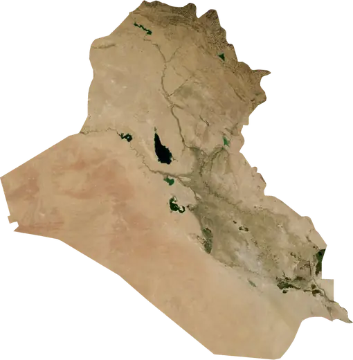
 Al-Musayab
: earthquakes and wildfires
Was there an earthquake or a fire near Al-Musayab just now? Live map within 100 km, the strongest earthquakes, the largest fires and statistics for Al-Musayab, Iraq.
Live map – Al-Musayab
Earthquakes within 100 km of the city centre.
Key statistics (30 days)
Earthquakes M2.5+ and the wildfire fronts shown on the map.
Recent events in Al-Musayab
- 10 h agoWildfire near Hillah, Iraq – active7.4 km² · 23 km NNE of Hillah, Iraq
- 10 h agoWildfire near Al Hindiyah, Iraq – active11 km² · 27 km SSW of Al Hindiyah, Iraq
- 10 h agoWildfire near Sadr City, Iraq – active8.6 km² · 40 km SE of Sadr City, Iraq
- 10 h agoWildfire near Sadr City, Iraq – active14 km² · 34 km ESE of Sadr City, Iraq
- 10 h agoWildfire near Kufa, Iraq – active5.1 km² · 10 km S of Kufa, Iraq
- 11 h agoWildfire near Sadr City, Iraq – active8.4 km² · 13 km SE of Sadr City, Iraq
Historical overview
Earthquakes M3.0+ and significant events of other hazards.
About Al-Musayab
Al-Musayab has recorded 1 earthquakes of magnitude 3.0 or more since 1990. The strongest was M4.6 in 1990.
Satellites have detected 4 significant wildfires here; the largest burned about 15 km².
Know the official emergency number, prepare an emergency kit and follow the instructions of your civil protection authority.
Learn more ›Did you feel an earthquake in Al-Musayab?
No reports yet.
Earthquakes
One earthquake of magnitude 3.0 or more within 100 km in our records: M4.6.
Recent earthquakes
No earthquakes of magnitude 2.5+ in the last 12 months.
Strongest earthquakes on record
| Mag | Location | Time (UTC) | Depth |
|---|---|---|---|
| 4.6 | 6 km NNW of Al Hindiyah, Iraq | 37.6 km |
Wildfires
4 major fires since 2026 within 100 km. The largest covered about 15 km².
Recent fires
| Area | Location | Since | Status |
|---|---|---|---|
| 7.4 km² | 23 km NNE of Hillah, Iraq | Active | |
| 11 km² | 27 km SSW of Al Hindiyah, Iraq | Active | |
| 8.6 km² | 40 km SE of Sadr City, Iraq | Active | |
| 14 km² | 34 km ESE of Sadr City, Iraq | Active | |
| 5.1 km² | 10 km S of Kufa, Iraq | Active | |
| 8.4 km² | 13 km SE of Sadr City, Iraq | Active | |
| 10 km² | 7 km SSE of Baghdad, Iraq | Active | |
| 15 km² | 38 km E of Sadr City, Iraq | Active | |
| 5.4 km² | near Sadr City, Iraq | Inactive |
Largest fires on record
| Area | Location | Since | Status |
|---|---|---|---|
| 15 km² | 38 km E of Sadr City, Iraq | Active | |
| 14 km² | 34 km ESE of Sadr City, Iraq | Active | |
| 11 km² | 27 km SSW of Al Hindiyah, Iraq | Active | |
| 10 km² | 7 km SSE of Baghdad, Iraq | Active |
Nearby places
- Saddat al Hindiyah 7 km
- Nahiyat al Iskandariyah 13 km
- Al Mahawil 17 km
- Al Hindiyah 27 km
- Abu Gharaq 28 km
- Karbala 31 km
- Al Mahmudiyah 32 km
- Hillah 37 km
- As Suwayrah 48 km
- Abu Ghurayb 59 km
- Baghdad 63 km
- Al-Qasim 65 km
- Sadr City 70 km
- Al 'Aziziyah 74 km
- Al Fallujah 79 km
- Kufa 82 km
- Najaf 84 km
- Ash Shamiyah 95 km
- Al Diwaniyah 106 km
- An Nu'maniyah 108 km
- Al Mishkhab 110 km
- Baqubah 112 km
- Habhab 114 km
- Khalis 117 km
- Ad Dujayl 119 km
- Nahiyat Ghammas 119 km
- 'Afak 120 km
- Nahiyat ash Shinafiyah 137 km