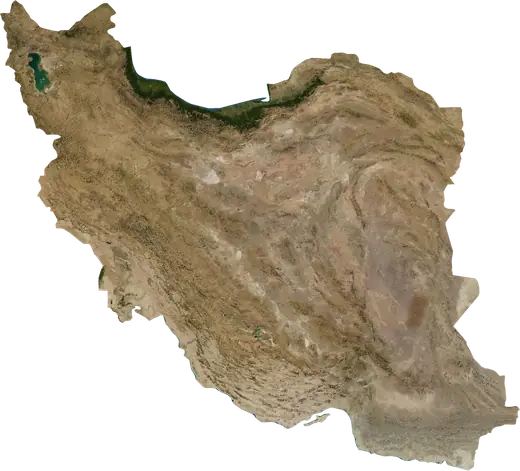
 Shahrak-e 'Ala'in
: earthquakes and wildfires
Was there an earthquake or a fire near Shahrak-e 'Ala'in just now? Live map within 100 km, the strongest earthquakes, the largest fires and statistics for Shahrak-e 'Ala'in, Iran.
Live map – Shahrak-e 'Ala'in
Earthquakes within 100 km of the city centre.
Key statistics (30 days)
Earthquakes M2.5+ and the wildfire fronts shown on the map.
Recent events in Shahrak-e 'Ala'in
- 15 h agoWildfire near Tehran, Iran – active15 km² · 15 km SSE of Tehran, Iran
- 2 days agoWildfire near Nazarabad, Iran7.2 km² · 7 km N of Nazarabad, Iran
- 3 days agoWildfire near Tehran, Iran27 km² · 18 km S of Tehran, Iran
- 3 days agoWildfire near Tehran, Iran4.5 km² · 33 km E of Tehran, Iran
- 3 days agoWildfire near Qods, Iran4.2 km² · near Qods, Iran
- 4.3189 days agoM4.3 earthquake near Bumahen, Irannear Bumahen, Iran
Historical overview
Earthquakes M3.0+ and significant events of other hazards.
About Shahrak-e 'Ala'in
Shahrak-e 'Ala'in has recorded 51 earthquakes of magnitude 3.0 or more since 1977. The strongest was M6.3 in 2004.
Satellites have detected 2 significant wildfires here; the largest burned about 27 km².
Know the official emergency number, prepare an emergency kit and follow the instructions of your civil protection authority.
Learn more ›Did you feel an earthquake in Shahrak-e 'Ala'in?
No reports yet.
Earthquakes
51 earthquakes of magnitude 3.0 or more since 1977 within 100 km. The strongest was M6.3.
Recent earthquakes
| Mag | Location | Time (UTC) | Depth |
|---|---|---|---|
| 4.3 | near Bumahen, Iran | 10.0 km |
Strongest earthquakes on record
| Mag | Location | Time (UTC) | Depth |
|---|---|---|---|
| 6.3 | 41 km SSE of Nowshahr, Iran | 17.0 km | |
| 5.4 | 31 km NNE of Damavand, Iran | 33.0 km | |
| 5.4 | near Garmsar, Iran | 33.0 km | |
| 5.4 | 45 km SSW of Istgah-e Rah Ahan-e Garmsar, Iran | 26.0 km | |
| 5.3 | 6 km NE of Istgah-e Rah Ahan-e Garmsar, Iran | 10.0 km | |
| 5.2 | 19 km N of Istgah-e Rah Ahan-e Garmsar, Iran | 10.0 km | |
| 4.9 | near Malard, Iran | 10.0 km | |
| 4.9 | 6 km SW of Istgah-e Rah Ahan-e Garmsar, Iran | 33.0 km | |
| 4.9 | 31 km NE of Damavand, Iran | 33.0 km | |
| 4.7 | 41 km NNE of Istgah-e Rah Ahan-e Garmsar, Iran | 14.3 km | |
| 4.7 | 28 km S of Chalus, Iran | 10.0 km | |
| 4.7 | 18 km NE of Saveh, Iran | 10.0 km | |
| 4.7 | 30 km NE of Damavand, Iran | 33.0 km | |
| 4.7 | 12 km NNE of Istgah-e Rah Ahan-e Garmsar, Iran | 33.0 km | |
| 4.6 | 6 km SE of Garmsar, Iran | 10.0 km |
Earthquakes per year (M3.0+)
Year
| 2026 | 1 | M4.3 |
| 2024 | 1 | M4.6 |
| 2023 | 1 | M3.9 |
| 2020 | 2 | M4.6 |
| 2018 | 1 | M4.0 |
| 2017 | 2 | M4.9 |
| 2014 | 2 | M4.1 |
| 2012 | 2 | M4.7 |
| 2011 | 1 | M4.2 |
| 2007 | 2 | M4.5 |
| 2006 | 1 | M4.2 |
| 2004 | 12 | M6.3 |
| 2003 | 1 | M4.7 |
| 2002 | 3 | M4.7 |
| 1998 | 1 | M4.5 |
| 1997 | 2 | M4.5 |
| 1994 | 1 | M4.5 |
| 1993 | 1 | M4.6 |
| 1991 | 1 | M4.6 |
| 1988 | 8 | M5.3 |
| 1983 | 3 | M5.4 |
| 1982 | 1 | M5.4 |
| 1977 | 1 | M5.4 |
Wildfires
2 major fires since 2026 within 100 km. The largest covered about 27 km².
Recent fires
| Area | Location | Since | Status |
|---|---|---|---|
| 15 km² | 15 km SSE of Tehran, Iran | Active | |
| 7.2 km² | 7 km N of Nazarabad, Iran | Inactive | |
| 27 km² | 18 km S of Tehran, Iran | Inactive | |
| 4.5 km² | 33 km E of Tehran, Iran | Inactive | |
| 4.2 km² | near Qods, Iran | Inactive |
Largest fires on record
| Area | Location | Since | Status |
|---|---|---|---|
| 27 km² | 18 km S of Tehran, Iran | Inactive | |
| 15 km² | 15 km SSE of Tehran, Iran | Active |
Nearby places
- Baqershahr 7 km
- Kahrizak 11 km
- Tehran 13 km
- Chahar Dangeh 13 km
- Vahidiyeh 15 km
- Ferunabad 17 km
- Qiamdasht 19 km
- Eslamshahr 20 km
- Qarchak 20 km
- Shahrak-e Qods 21 km
- Pakdasht 24 km
- Andisheh 24 km
- Tajrish 25 km
- Salehieh 25 km