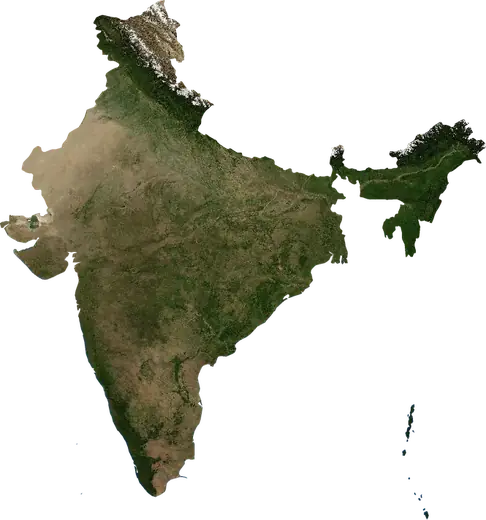
 Rajasthan
: earthquakes and wildfires
Latest earthquakes and wildfires in Rajasthan (India) on a live map, the strongest earthquakes and largest fires on record.
Live map – Rajasthan
Key statistics (30 days)
Earthquakes M2.5+ and the wildfire fronts shown on the map.
Recent events in Rajasthan
- 5 h agoWildfire near Suratgarh, India – active6.7 km² · 18 km WNW of Suratgarh, India
- 5 h agoWildfire near Suratgarh, India – active12 km² · 9 km ENE of Suratgarh, India
- 6 h agoWildfire near Bikaner, India – active4.2 km² · 26 km NNW of Bikaner, India
- 6 h agoWildfire near Bikaner, India – active15 km² · 36 km NNE of Bikaner, India
- 6 h agoWildfire near Bikaner, India – active4.5 km² · 32 km N of Bikaner, India
- 6 h agoWildfire near Bikaner, India – active20 km² · 36 km NNW of Bikaner, India
Historical overview
Earthquakes M3.0+ and significant events of other hazards.
About Rajasthan
Rajasthan has recorded 23 earthquakes of magnitude 3.0 or more since 1985. The strongest was M5.2 in 2009.
Satellites have detected 44 significant wildfires here; the largest burned about 114 km².
Know the official emergency number, prepare an emergency kit and follow the instructions of your civil protection authority.
Learn more ›Earthquakes
23 earthquakes of magnitude 3.0 or more since 1985. The strongest was M5.2.
Recent earthquakes
No earthquakes of magnitude 2.5+ in the last 12 months.
Strongest earthquakes on record
| Mag | Location | Time (UTC) | Depth |
|---|---|---|---|
| 5.2 | 29 km NNW of Jaisalmer, India | 44.0 km | |
| 5.0 | 72 km SSW of Jaisalmer, India | 22.0 km | |
| 4.8 | 16 km WNW of Barmer, India | 33.0 km | |
| 4.6 | 20 km ENE of Sadri, India | 13.5 km | |
| 4.5 | 33 km N of Jaipur, India | 10.0 km | |
| 4.5 | 65 km S of Jaisalmer, India | 19.2 km | |
| 4.4 | 21 km SSW of Jalor, India | 10.0 km | |
| 4.4 | 49 km N of Alwar, India | 10.0 km | |
| 4.3 | 12 km ESE of Jaipur, India | 10.0 km | |
| 4.2 | 36 km E of Jaipur, India | 10.0 km | |
| 4.2 | 51 km S of Jaisalmer, India | 33.0 km | |
| 4.1 | 5 km SSE of Neem ka Thana, India | 33.0 km | |
| 4.0 | near Nawalgarh, India | 10.7 km | |
| 4.0 | 20 km NW of Bikaner, India | 15.0 km | |
| 4.0 | 7 km SSE of Abu, India | 10.0 km |
Earthquakes per year (M3.0+)
Year
| 2024 | 1 | M4.0 |
| 2023 | 1 | M4.3 |
| 2021 | 1 | M4.4 |
| 2019 | 3 | M4.0 |
| 2018 | 1 | M3.6 |
| 2016 | 1 | M4.4 |
| 2015 | 1 | M4.0 |
| 2013 | 1 | M3.6 |
| 2012 | 1 | M3.9 |
| 2010 | 1 | M4.6 |
| 2009 | 1 | M5.2 |
| 2006 | 2 | M4.2 |
| 2003 | 1 | M4.5 |
| 2002 | 1 | M4.1 |
| 1996 | 1 | M3.5 |
| 1991 | 4 | M5.0 |
| 1985 | 1 | M4.8 |
Wildfires
44 major fires since 2025. The largest covered about 114 km².
Recent fires
| Area | Location | Since | Status |
|---|---|---|---|
| 6.7 km² | 18 km WNW of Suratgarh, India | Active | |
| 12 km² | 9 km ENE of Suratgarh, India | Active | |
| 4.2 km² | 26 km NNW of Bikaner, India | Active | |
| 15 km² | 36 km NNE of Bikaner, India | Active | |
| 4.5 km² | 32 km N of Bikaner, India | Active | |
| 20 km² | 36 km NNW of Bikaner, India | Active | |
| 6.6 km² | 34 km E of Anupgarh, India | Active | |
| 3.1 km² | 23 km SE of Mangrol, India | Active | |
| 114 km² | 35 km ESE of Kota, India | Active | |
| 77 km² | 47 km E of Baran, India | Active |
Show all (79)
| Area | Location | Since | Status |
|---|---|---|---|
| 13 km² | 10 km N of Baran, India | Active | |
| 4.0 km² | 29 km NW of Beawar, India | Active | |
| 6.1 km² | near Pindwara, India | Active | |
| 11 km² | 42 km SSW of Nagaur, India | Active | |
| 7.8 km² | 8 km WSW of Kotputli, India | Active | |
| 5.4 km² | 5 km N of Chittorgarh, India | Active | |
| 4.9 km² | 43 km NW of Nimach, India | Active | |
| 4.3 km² | 8 km N of Nimbahera, India | Active | |
| 3.2 km² | 8 km SW of Gotan, India | Active | |
| 6.7 km² | 10 km ENE of Bhauri, India | Active | |
| 71 km² | 14 km WSW of Khanpur, India | Active | |
| 4.7 km² | 16 km NW of Kota, India | Active | |
| 13 km² | 39 km E of Baran, India | Active | |
| 4.3 km² | near Bundi, India | Active | |
| 3.8 km² | 6 km S of Bundi, India | Active | |
| 27 km² | 12 km E of Kota, India | Active | |
| 12 km² | 10 km WSW of Pilibangan, India | Active | |
| 50 km² | 43 km SE of Kota, India | Active | |
| 7.2 km² | 45 km SE of Baran, India | Active | |
| 3.2 km² | near Morak, India | Active | |
| 9.9 km² | 13 km SE of Baran, India | Inactive | |
| 34 km² | 14 km SE of Bundi, India | Inactive | |
| 4.9 km² | 25 km ENE of Chhabra, India | Inactive | |
| 4.3 km² | 40 km ESE of Kota, India | Inactive | |
| 8.8 km² | 23 km ESE of Mangrol, India | Inactive | |
| 15 km² | 10 km WSW of Hanumangarh, India | Inactive | |
| 25 km² | 8 km E of Hanumangarh, India | Inactive | |
| 4.9 km² | near Sangod, India | Inactive | |
| 3.4 km² | 14 km ENE of Bundi, India | Inactive | |
| 12 km² | 29 km S of Baran, India | Inactive | |
| 3.6 km² | 39 km SE of Kota, India | Inactive | |
| 8.1 km² | 21 km NE of Kota, India | Inactive | |
| 16 km² | 27 km NNE of Chhabra, India | Inactive | |
| 7.4 km² | 52 km E of Baran, India | Inactive | |
| 3.3 km² | 12 km ESE of Hanumangarh, India | Inactive | |
| 13 km² | 14 km ESE of Pokaran, India | Inactive | |
| 8.7 km² | 29 km NNW of Pokaran, India | Inactive | |
| 5.8 km² | 26 km NNW of Phalodi, India | Inactive | |
| 32 km² | 32 km NNW of Phalodi, India | Inactive | |
| 3.0 km² | 36 km NW of Phalodi, India | Inactive | |
| 17 km² | 44 km NW of Phalodi, India | Inactive | |
| 3.5 km² | 35 km N of Phalodi, India | Inactive | |
| 6.0 km² | 38 km NNW of Phalodi, India | Inactive | |
| 7.2 km² | 38 km N of Phalodi, India | Inactive | |
| 24 km² | 55 km NW of Phalodi, India | Inactive | |
| 12 km² | 84 km WSW of Bikaner, India | Inactive | |
| 6.5 km² | 60 km NW of Phalodi, India | Inactive | |
| 15 km² | 26 km NNW of Bikaner, India | Inactive | |
| 21 km² | 42 km NW of Bikaner, India | Inactive | |
| 10 km² | 29 km NNW of Bikaner, India | Inactive | |
| 12 km² | 29 km N of Bikaner, India | Inactive | |
| 15 km² | 70 km SSE of Jaisalmer, India | Inactive | |
| 27 km² | 49 km E of Kota, India | Inactive | |
| 22 km² | 8 km W of Mangrol, India | Inactive | |
| 11 km² | near Baran, India | Inactive | |
| 31 km² | 14 km WSW of Baran, India | Inactive | |
| 13 km² | 7 km ESE of Chhabra, India | Inactive | |
| 15 km² | 63 km ENE of Kota, India | Inactive | |
| 12 km² | 27 km SSE of Baran, India | Inactive | |
| 17 km² | 54 km SW of Pokaran, India | Inactive | |
| 19 km² | 54 km SW of Pokaran, India | Inactive | |
| 10 km² | 43 km WSW of Pokaran, India | Inactive | |
| 19 km² | 42 km NW of Bikaner, India | Inactive | |
| 17 km² | 36 km W of Pokaran, India | Inactive | |
| 20 km² | 36 km W of Pokaran, India | Inactive | |
| 14 km² | 37 km NNW of Bikaner, India | Inactive | |
| 15 km² | 37 km NNW of Bikaner, India | Inactive | |
| 11 km² | 75 km SW of Bikaner, India | Inactive | |
| 13 km² | 36 km NNE of Bikaner, India | Inactive |
Largest fires on record
| Area | Location | Since | Status |
|---|---|---|---|
| 114 km² | 35 km ESE of Kota, India | Active | |
| 77 km² | 47 km E of Baran, India | Active | |
| 71 km² | 14 km WSW of Khanpur, India | Active | |
| 50 km² | 43 km SE of Kota, India | Active | |
| 34 km² | 14 km SE of Bundi, India | Inactive | |
| 32 km² | 32 km NNW of Phalodi, India | Inactive | |
| 31 km² | 14 km WSW of Baran, India | Inactive | |
| 27 km² | 49 km E of Kota, India | Inactive | |
| 27 km² | 12 km E of Kota, India | Active | |
| 25 km² | 8 km E of Hanumangarh, India | Inactive | |
| 24 km² | 55 km NW of Phalodi, India | Inactive | |
| 22 km² | 8 km W of Mangrol, India | Inactive | |
| 21 km² | 42 km NW of Bikaner, India | Inactive | |
| 20 km² | 36 km W of Pokaran, India | Inactive | |
| 20 km² | 36 km NNW of Bikaner, India | Active |
Major fires per year
Year
| 2026 | 38 | 114 km² |
| 2025 | 6 | 27 km² |
Places
- Jaipur
- Jodhpur
- Bikaner
- Udaipur
- Alwar
- Bharatpur
- Sikar
- Sri Ganganagar
- Pali
- Sujangarh
- Tonk
- Kishangarh
- Sawai Madhopur
- Churu
- Gangapur
- Jhunjhunun
- Hindaun
- Bhiwadi
- Dausa
- Jaisalmer
- Chaumu
- Nawalgarh
- Laxmangarh
- Kotputli
- Bandikui
- Chidawa
- Khairtal
- Kaman
- Neem ka Thana
- Shahpura
- Chaksu
- Sri Madhopur
- Bagru
- Udaipur
- Ramgarh
- Pilani
- Behror
- Udaipurwati
- Renwal
- Khandela
- Manoharpur
- Losal
- Rajgarh
- Reengus
- Phulera
- Basi
- Nagar
- Tijara
- Sambhar
- Baswa
- Nawa
- Surajgarh
- Viratnagar
- Chhabra
- Mangrol
- Baran
- Anta
- Sangod
- Kapren
- Aklera
- Lakheri
- Keshorai Patan
- Kaithoon
- Jhalawar
- Jhalrapatan
- Sadulshahar
- Suket
- Kota
- Ramganj Mandi
- Nokha
- Sangaria
- Rawatbhata
- Napasar
- Bundi
- Sri Dungargarh
- Pokaran
- Phalodi
- Hanumangarh
- Karanpur
- Pilibangan