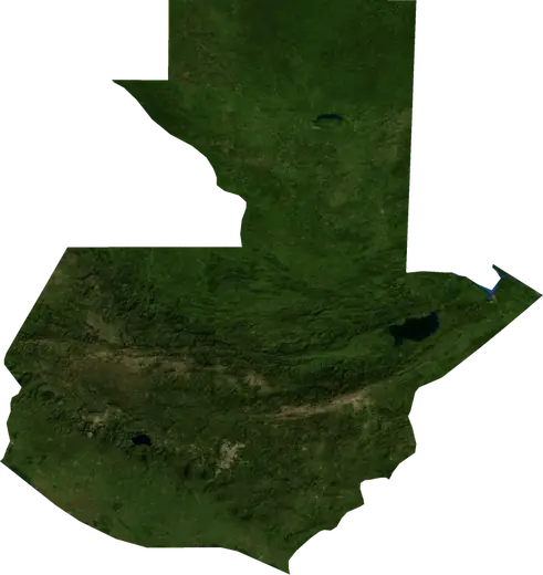
 Quiché
Earthquakes in Quiché
Latest earthquakes in Quiché (Guatemala), the strongest recorded, statistics and nearby places.
Live map – Quiché
Loading live map…
Low
Moderate
High
Very high
Extreme
Very extreme
Forecast: Copernicus EFFIS (FWI index)
Very light rain (0.1–1 mm)
Light rain (1–5 mm)
Moderate rain (5–10 mm)
Heavy rain (10–25 mm)
Very heavy rain (25–50 mm)
Extreme rain (≥ 50 mm)
Forecast: ECMWF via Copernicus EMS – GWIS
Calm (< 7 km/h, 0–1 Bf)
Light breeze (7–18 km/h, 2–3 Bf)
Moderate breeze (18–36 km/h, 4–5 Bf)
Strong breeze (36–54 km/h, 5–7 Bf)
Gale (54–72 km/h, 7–8 Bf)
Storm (≥ 72 km/h, 9+ Bf)
Forecast: ECMWF via Copernicus EMS – GWIS
Very low lightning
Low lightning
Moderate lightning
High lightning
Very high lightning
Extreme lightning
Forecast: ECMWF via Copernicus EMS – GWIS
Earthquakes
Wildfires
Floods
Storms
Volcanoes
Tsunamis
Key statistics (30 days)
Earthquakes M2.5+ and the wildfire fronts shown on the map.
Recent events in Quiché
No significant events in the last few days.
Historical overview
Earthquakes M3.0+ and significant events of other hazards.
About Quiché
Quiché has recorded 30 earthquakes of magnitude 3.0 or more since 1976. The strongest was M6.4 in 2023.
Know the official emergency number, prepare an emergency kit and follow the instructions of your civil protection authority.
Learn more ›Earthquakes
30 earthquakes of magnitude 3.0 or more since 1976. The strongest was M6.4.
Recent earthquakes
No earthquakes of magnitude 2.5+ in the last 12 months.
Strongest earthquakes on record
| Mag | Location | Time (UTC) | Depth |
|---|---|---|---|
| 6.4 | 38 km ENE of Chichicastenango, Guatemala | 252.0 km | |
| 5.2 | 20 km ESE of Chichicastenango, Guatemala | 5.0 km | |
| 4.8 | 11 km SW of Santa Cruz del Quiche, Guatemala | 117.0 km | |
| 4.7 | 16 km NE of Chichicastenango, Guatemala | 204.2 km | |
| 4.7 | 34 km ENE of Santa Cruz del Quiche, Guatemala | 33.0 km | |
| 4.7 | near Uspantan, Guatemala | 33.0 km | |
| 4.5 | 16 km WNW of Santa Cruz del Quiche, Guatemala | 192.4 km | |
| 4.5 | 16 km E of Chichicastenango, Guatemala | 248.6 km | |
| 4.5 | 21 km NNW of Nebaj, Guatemala | 20.0 km | |
| 4.5 | 19 km ESE of Chichicastenango, Guatemala | 108.3 km | |
| 4.5 | 23 km ENE of Santa Cruz del Quiche, Guatemala | 33.0 km | |
| 4.5 | 43 km NE of Santa Cruz del Quiche, Guatemala | 5.0 km | |
| 4.4 | 13 km NNE of Santa Cruz del Quiche, Guatemala | 263.1 km | |
| 4.4 | 11 km SW of Chichicastenango, Guatemala | 162.2 km | |
| 4.4 | 14 km NNE of Santa Cruz del Quiche, Guatemala | 253.9 km |
Earthquakes per year (M3.0+)
Year
| 2025 | 1 | M4.5 |
| 2024 | 1 | M4.2 |
| 2023 | 2 | M6.4 |
| 2020 | 1 | M4.4 |
| 2018 | 3 | M4.4 |
| 2012 | 1 | M4.4 |
| 2011 | 1 | M4.1 |
| 2009 | 1 | M4.2 |
| 2008 | 2 | M4.4 |
| 2007 | 1 | M4.5 |
| 2005 | 2 | M4.5 |
| 2004 | 1 | M3.7 |
| 2003 | 2 | M4.5 |
| 2002 | 1 | M4.5 |
| 2001 | 1 | M4.2 |
| 1996 | 1 | M4.7 |
| 1993 | 1 | M3.8 |
| 1985 | 1 | M4.5 |
| 1982 | 1 | M4.7 |
| 1981 | 1 | M4.1 |
| 1978 | 1 | M4.7 |
| 1977 | 1 | M4.8 |
| 1976 | 2 | M5.2 |