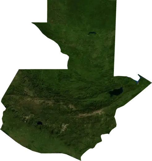
 Escuintla
: earthquakes and wildfires
Was there an earthquake or a fire near Escuintla just now? Live map within 100 km, the strongest earthquakes, the largest fires and statistics for Escuintla, Guatemala.
Live map – Escuintla
Earthquakes within 100 km of the city centre.
Key statistics (30 days)
Earthquakes M2.5+ and the wildfire fronts shown on the map.
Recent events in Escuintla
- 11 h agoWildfire near La Gomera, Guatemala – active7.1 km² · near La Gomera, Guatemala
- 11 h agoWildfire near Villa Nueva, Guatemala – active4.0 km² · 41 km SW of Villa Nueva, Guatemala
- 11 h agoWildfire near Villa Nueva, Guatemala – active111 km² · 33 km W of Villa Nueva, Guatemala
- 11 h agoWildfire near Quetzaltenango, Guatemala – active28 km² · 13 km SSW of Quetzaltenango, Guatemala
- 3.521 h agoM3.5 earthquake near Puerto San Jose, Guatemala54 km SSW of Puerto San Jose, Guatemala
- 23 h agoWildfire near La Gomera, Guatemala – active15 km² · 18 km SW of La Gomera, Guatemala
Historical overview
Earthquakes M3.0+ and significant events of other hazards.
About Escuintla
Escuintla has recorded 1,518 earthquakes of magnitude 3.0 or more since 1976. The strongest was M6.8 in 2017.
Satellites have detected 4 significant wildfires here; the largest burned about 111 km².
Know the official emergency number, prepare an emergency kit and follow the instructions of your civil protection authority.
Learn more ›Did you feel an earthquake in Escuintla?
No reports yet.
Earthquakes
1,518 earthquakes of magnitude 3.0 or more since 1976 within 100 km. The strongest was M6.8.
Recent earthquakes
| Mag | Location | Time (UTC) | Depth |
|---|---|---|---|
| 3.5 | 54 km SSW of Puerto San Jose, Guatemala | 30.0 km | |
| 2.9 | 28 km WNW of Jutiapa, Guatemala | 9.0 km | |
| 2.5 | 51 km SSW of Puerto San Jose, Guatemala | 5.0 km | |
| 4.8 | 33 km S of Puerto San Jose, Guatemala | 58.3 km | |
| 5.5 | 40 km S of Puerto San Jose, Guatemala | 59.7 km | |
| 4.2 | 13 km ENE of Totonicapan, Guatemala | 181.7 km | |
| 4.6 | 11 km SSW of Chicacao, Guatemala | 98.8 km | |
| 4.0 | 64 km SW of Santa Lucia Cotzumalguapa, Guatemala | 60.5 km | |
| 4.2 | near Santa Lucia Cotzumalguapa, Guatemala | 120.0 km | |
| 4.6 | 30 km WSW of Escuintla, Guatemala | 90.3 km |
Show all (31)
Strongest earthquakes on record
| Mag | Location | Time (UTC) | Depth |
|---|---|---|---|
| 6.8 | 28 km SW of Puerto San Jose, Guatemala | 38.0 km | |
| 6.8 | 12 km SW of Puerto San Jose, Guatemala | 58.0 km | |
| 6.7 | 76 km SSE of Masagua, Guatemala | 23.0 km | |
| 6.6 | 18 km S of Mazatenango, Guatemala | 33.0 km | |
| 6.6 | 49 km SSE of Masagua, Guatemala | 65.0 km | |
| 6.5 | 33 km S of Puerto San Jose, Guatemala | 24.0 km | |
| 6.4 | 38 km ENE of Chichicastenango, Guatemala | 252.0 km | |
| 6.3 | 5 km S of San Lucas Toliman, Guatemala | 108.0 km | |
| 6.3 | 6 km ESE of Puerto San Jose, Guatemala | 33.0 km | |
| 6.3 | 29 km SSE of Puerto San Jose, Guatemala | 33.0 km | |
| 6.2 | 7 km E of Jalapa, Guatemala | 272.0 km | |
| 6.2 | 45 km WSW of Santa Lucia Cotzumalguapa, Guatemala | 60.0 km | |
| 6.2 | 14 km ESE of Villa Nueva, Guatemala | 189.0 km | |
| 6.2 | 5 km SE of Patzun, Guatemala | 5.0 km | |
| 6.1 | 32 km SE of Escuintla, Guatemala | 90.0 km |
Earthquakes per year (M3.0+)
Year
| 2026 | 27 | M5.5 |
| 2025 | 40 | M5.7 |
| 2024 | 30 | M6.2 |
| 2023 | 38 | M6.4 |
| 2022 | 38 | M6.2 |
| 2021 | 39 | M5.8 |
| 2020 | 24 | M5.3 |
| 2019 | 38 | M5.9 |
| 2018 | 36 | M5.7 |
| 2017 | 45 | M6.8 |
| 2016 | 48 | M5.5 |
| 2015 | 41 | M5.7 |
| 2014 | 62 | M5.9 |
| 2013 | 32 | M6.2 |
| 2012 | 50 | M5.5 |
| 2011 | 55 | M5.6 |
| 2010 | 30 | M5.9 |
| 2009 | 30 | M6.3 |
| 2008 | 57 | M6.1 |
| 2007 | 47 | M6.7 |
| 2006 | 22 | M6.0 |
| 2005 | 38 | M5.4 |
| 2004 | 31 | M5.7 |
| 2003 | 44 | M6.5 |
| 2002 | 35 | M6.0 |
| 2001 | 37 | M5.9 |
| 2000 | 23 | M5.2 |
| 1999 | 30 | M6.3 |
| 1998 | 48 | M6.6 |
| 1997 | 28 | M6.1 |
| 1996 | 21 | M5.1 |
| 1995 | 23 | M5.5 |
| 1994 | 19 | M5.5 |
| 1993 | 18 | M6.0 |
| 1992 | 13 | M6.0 |
| 1991 | 17 | M6.2 |
| 1990 | 13 | M4.8 |
| 1989 | 9 | M5.4 |
| 1988 | 44 | M6.0 |
| 1987 | 11 | M5.8 |
| 1986 | 6 | M5.9 |
| 1985 | 11 | M5.6 |
| 1984 | 15 | M4.9 |
| 1983 | 21 | M5.4 |
| 1982 | 21 | M5.3 |
| 1981 | 8 | M5.3 |
| 1980 | 18 | M5.4 |
| 1979 | 18 | M6.8 |
| 1978 | 21 | M5.7 |
| 1977 | 16 | M5.0 |
| 1976 | 32 | M5.7 |
Wildfires
4 major fires since 2025 within 100 km. The largest covered about 111 km².
Recent fires
| Area | Location | Since | Status |
|---|---|---|---|
| 7.1 km² | near La Gomera, Guatemala | Active | |
| 4.0 km² | 41 km SW of Villa Nueva, Guatemala | Active | |
| 111 km² | 33 km W of Villa Nueva, Guatemala | Active | |
| 28 km² | 13 km SSW of Quetzaltenango, Guatemala | Active | |
| 15 km² | 18 km SW of La Gomera, Guatemala | Active | |
| 3.8 km² | 12 km SSE of Escuintla, Guatemala | Active | |
| 8.6 km² | 5 km W of Santa Lucia Cotzumalguapa, Guatemala | Inactive | |
| 15 km² | 38 km SE of Escuintla, Guatemala | Inactive |
Largest fires on record
| Area | Location | Since | Status |
|---|---|---|---|
| 111 km² | 33 km W of Villa Nueva, Guatemala | Active | |
| 28 km² | 13 km SSW of Quetzaltenango, Guatemala | Active | |
| 15 km² | 18 km SW of La Gomera, Guatemala | Active | |
| 15 km² | 38 km SE of Escuintla, Guatemala | Inactive |
Major fires per year
Year
| 2026 | 3 | 111 km² |
| 2025 | 1 | 15 km² |
Nearby places
- Masagua 13 km
- Palin 15 km
- Alotenango 21 km
- Santa Maria de Jesus 23 km
- Ciudad Vieja 25 km
- Santa Lucia Cotzumalguapa 26 km
- Amatitlan 26 km
- Yepocapa 29 km
- Antigua Guatemala 29 km
- Petapa 33 km
- Villa Nueva 33 km
- Villa Canales 34 km
- San Andres Itzapa 36 km
- San Lucas Sacatepequez 37 km
- La Gomera 38 km
- Sumpango 39 km
- Santiago Sacatepequez 39 km