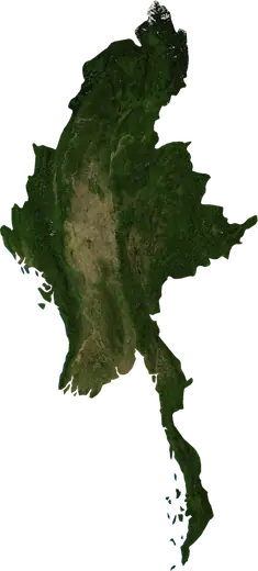
 État de Shan
Tremblements de terre et feux de forêt – État de Shan
État de Shan (Birmanie) : derniers séismes et feux de forêt sur une carte en direct, les séismes les plus forts et les plus grands feux enregistrés.
Carte en direct – État de Shan
Statistiques clés (30 jours)
Séismes de M2,5+ et fronts d'incendie affichés sur la carte.
Événements récents – État de Shan
- il y a 3 joursFeu de forêt près de Thibaw, Birmanie52 km² · à 32 km E de Thibaw, Birmanie
- 4,4il y a 30 joursSéisme de magnitude 4,4 près de Man Wein, Birmanieà 13 km ESE de Man Wein, Birmanie
- 4,4il y a 38 joursSéisme de magnitude 4,4 près de Man Wein, Birmanieà 15 km NE de Man Wein, Birmanie
- 4,4il y a 73 joursSéisme de magnitude 4,4 près de Keng Tung, Birmanieà 77 km SO de Keng Tung, Birmanie
- il y a 214 joursFeu de forêt près de Keng Tung, Birmanie14 km² · à 29 km S de Keng Tung, Birmanie
- il y a 214 joursFeu de forêt près de Hsupwo, Birmanie35 km² · à 36 km S de Hsupwo, Birmanie
Aperçu historique
Séismes de M3,0+ et événements importants des autres aléas.
À propos – État de Shan
État de Shan a enregistré 156 séismes de magnitude 3,0 ou plus depuis 1976. Le plus fort a été de M6,8 en 2011.
Les satellites y ont détecté 143 feux de forêt importants; le plus grand a brûlé environ 152 km².
Connaissez le numéro d'urgence officiel, préparez une trousse d'urgence et suivez les consignes de votre autorité de sécurité civile.
En savoir plus ›Séismes
156 séismes de magnitude 3,0 ou plus depuis 1976. Le plus fort : M6,8.
Séismes récents
| Mag. | Lieu | Heure (UTC) | Profondeur |
|---|---|---|---|
| 4,4 | à 13 km ESE de Man Wein, Birmanie | 10,0 km | |
| 4,4 | à 15 km NE de Man Wein, Birmanie | 10,0 km | |
| 4,4 | à 77 km SO de Keng Tung, Birmanie | 10,0 km |
Séismes les plus forts enregistrés
| Mag. | Lieu | Heure (UTC) | Profondeur |
|---|---|---|---|
| 6,8 | à 27 km NNO de Tachilek, Birmanie | 8,0 km | |
| 6,8 | à 53 km ONO de Moeng Yang, Birmanie | 10,0 km | |
| 6,2 | à 42 km NO de Pangkham, Birmanie | 9,6 km | |
| 6,1 | à 39 km NO de Pangkham, Birmanie | 12,0 km | |
| 5,9 | à 50 km O de Moeng Yawng, Birmanie | 5,0 km | |
| 5,9 | à 56 km ONO de Moeng Yang, Birmanie | 10,1 km | |
| 5,9 | à 15 km SSO de Pangkham, Birmanie | 16,7 km | |
| 5,8 | près de Nansang, Birmanie | 38,5 km | |
| 5,8 | à 95 km SSO de Tangyan, Birmanie | 15,8 km | |
| 5,7 | à 77 km SO de Keng Tung, Birmanie | 15,7 km | |
| 5,7 | à 25 km NNO de Tachilek, Birmanie | 10,0 km | |
| 5,6 | à 23 km SO de Keng Tung, Birmanie | 22,0 km | |
| 5,4 | à 9 km SSO de Keng Tung, Birmanie | 12,2 km | |
| 5,2 | à 17 km SSE de Laukkai, Birmanie | 10,0 km | |
| 5,1 | à 8 km NNE de Nansang, Birmanie | 20,1 km |
Séismes par année (M3,0+)
Année
| 2026 | 3 | M4,4 |
| 2025 | 6 | M4,5 |
| 2024 | 1 | M4,2 |
| 2023 | 8 | M5,7 |
| 2022 | 18 | M5,9 |
| 2021 | 2 | M4,7 |
| 2020 | 1 | M4,6 |
| 2019 | 1 | M4,6 |
| 2018 | 4 | M4,6 |
| 2017 | 1 | M4,6 |
| 2016 | 2 | M4,7 |
| 2015 | 2 | M5,2 |
| 2014 | 2 | M4,8 |
| 2013 | 3 | M4,9 |
| 2012 | 2 | M4,2 |
| 2011 | 11 | M6,8 |
| 2010 | 1 | M4,9 |
| 2008 | 2 | M4,8 |
| 2007 | 5 | M5,6 |
| 2006 | 3 | M4,4 |
| 2005 | 3 | M4,3 |
| 2004 | 2 | M5,8 |
| 2003 | 1 | M4,3 |
| 2002 | 3 | M4,6 |
| 2001 | 4 | M4,7 |
| 1999 | 2 | M4,8 |
| 1998 | 1 | M4,3 |
| 1997 | 1 | M4,2 |
| 1996 | 7 | M4,7 |
| 1995 | 21 | M6,8 |
| 1994 | 1 | M4,5 |
| 1992 | 10 | M6,2 |
| 1991 | 3 | M4,4 |
| 1990 | 2 | M4,3 |
| 1989 | 4 | M5,8 |
| 1988 | 2 | M4,6 |
| 1987 | 2 | M4,7 |
| 1986 | 1 | M4,4 |
| 1984 | 3 | M5,9 |
| 1983 | 1 | M4,5 |
| 1981 | 1 | M5,0 |
| 1980 | 1 | M5,0 |
| 1977 | 1 | M4,6 |
| 1976 | 1 | M4,8 |
Feux de forêt
143 feux majeurs depuis 2025. Le plus grand couvrait environ 152 km².
Feux récents
| Superficie | Lieu | Depuis | État |
|---|---|---|---|
| 52 km² | à 32 km E de Thibaw, Birmanie | Inactif | |
| 14 km² | à 29 km S de Keng Tung, Birmanie | Inactif | |
| 35 km² | à 36 km S de Hsupwo, Birmanie | Inactif | |
| 11 km² | à 83 km OSO de Moeng Yang, Birmanie | Inactif | |
| 25 km² | à 47 km SSO de Moeng Yawng, Birmanie | Inactif | |
| 14 km² | à 116 km SO de Moeng Yang, Birmanie | Inactif | |
| 14 km² | à 111 km SO de Moeng Yang, Birmanie | Inactif | |
| 12 km² | à 34 km S de Keng Tung, Birmanie | Inactif | |
| 11 km² | à 80 km SO de Mu-se, Birmanie | Inactif | |
| 19 km² | à 29 km S de Hsupwo, Birmanie | Inactif |
Tout afficher (143)
Plus grands feux enregistrés
| Superficie | Lieu | Depuis | État |
|---|---|---|---|
| 152 km² | à 53 km NE de Lawksawk, Birmanie | Inactif | |
| 107 km² | à 94 km E de Nansang, Birmanie | Inactif | |
| 97 km² | à 116 km SO de Moeng Yang, Birmanie | Inactif | |
| 93 km² | à 29 km N de Taunggyi, Birmanie | Inactif | |
| 59 km² | à 96 km SE de Yawnghwe, Birmanie | Inactif | |
| 55 km² | à 115 km ONO de Tachilek, Birmanie | Inactif | |
| 55 km² | à 120 km SE de Yawnghwe, Birmanie | Inactif | |
| 53 km² | à 34 km S de Lashio, Birmanie | Inactif | |
| 52 km² | à 32 km E de Thibaw, Birmanie | Inactif | |
| 49 km² | à 35 km SE de Nansang, Birmanie | Inactif | |
| 48 km² | à 104 km ENE de Nansang, Birmanie | Inactif | |
| 47 km² | à 19 km NE de Nansang, Birmanie | Inactif | |
| 47 km² | à 98 km SE de Yawnghwe, Birmanie | Inactif | |
| 46 km² | à 40 km NE de Lawksawk, Birmanie | Inactif | |
| 45 km² | à 65 km SSO de Wein Nawng, Birmanie | Inactif |
Feux majeurs par année
Année
| 2026 | 142 | 152 km² |
| 2025 | 1 | 52 km² |