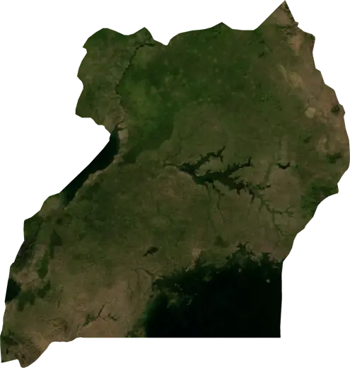
 Ibanda
Terremotos e incendios cerca de Ibanda
¿Ha habido un terremoto o un incendio cerca de Ibanda hace un momento? Mapa en directo en un radio de 100 km, los terremotos más fuertes, los mayores incendios y estadísticas de Ibanda, Uganda.
Mapa en vivo – Ibanda
Terremotos en un radio de 100 km del centro de la ciudad.
Estadísticas clave (30 días)
Terremotos M2,5+ y los frentes de incendio que se ven en el mapa.
Eventos recientes en Ibanda
- hace 142 díasIncendio forestal cerca de Kyamahungu, Uganda10 km² · a 32 km al O de Kyamahungu, Uganda
- 4,2hace 195 díasTerremoto de magnitud 4,2 cerca de Mpondwe, Ugandaa 8 km al E de Mpondwe, Uganda
- hace 302 díasIncendio forestal cerca de Mpondwe, Uganda14 km² · a 18 km al SSO de Mpondwe, Uganda
- hace 305 díasIncendio forestal cerca de Kasese, Uganda19 km² · a 50 km al SSO de Kasese, Uganda
- hace 305 díasIncendio forestal cerca de Kihihi, Uganda13 km² · a 27 km al NNE de Kihihi, Uganda
- hace 306 díasIncendio forestal cerca de Kisinga, Uganda25 km² · a 18 km al SSE de Kisinga, Uganda
Panorama histórico
Terremotos M3,0+ y eventos significativos de otros peligros.
Acerca de Ibanda
En Ibanda se han registrado 58 terremotos de magnitud 3,0 o superior desde 1977. El más fuerte fue de M6,2 en 1994.
Los satélites han detectado aquí 6 incendios forestales significativos; el mayor quemó unos 25 km².
Conoce el número oficial de emergencias, prepara un kit de emergencia y sigue las instrucciones de protección civil.
Más información ›¿Sentiste un terremoto en Ibanda?
Aún no hay informes.
Terremotos
58 terremotos de magnitud 3,0 o superior desde 1977 en un radio de 100 km. El más fuerte fue de M6,2.
Terremotos recientes
| Mag. | Ubicación | Hora (UTC) | Profundidad |
|---|---|---|---|
| 4,2 | a 8 km al E de Mpondwe, Uganda | 10,0 km |
Terremotos más fuertes registrados
| Mag. | Ubicación | Hora (UTC) | Profundidad |
|---|---|---|---|
| 6,2 | a 10 km al SSE de Nyahuka, Uganda | 14,0 km | |
| 5,4 | cerca de Buhesi, Uganda | 10,0 km | |
| 5,4 | a 6 km al OSO de Mpondwe, Uganda | 33,0 km | |
| 5,3 | a 30 km al SSE de Mpondwe, Uganda | 10,0 km | |
| 5,3 | a 17 km al NO de Kasese, Uganda | 10,0 km | |
| 5,2 | a 9 km al O de Hima, Uganda | 10,0 km | |
| 5,2 | cerca de Kibiito, Uganda | 10,0 km | |
| 4,9 | cerca de Buhesi, Uganda | 10,0 km | |
| 4,9 | a 8 km al OSO de Buhesi, Uganda | 10,0 km | |
| 4,9 | a 5 km al O de Hima, Uganda | 23,9 km | |
| 4,9 | cerca de Kibiito, Uganda | 19,4 km | |
| 4,9 | a 6 km al N de Buhesi, Uganda | 33,0 km | |
| 4,8 | a 22 km al ONO de Kyamahungu, Uganda | 16,7 km | |
| 4,8 | a 20 km al S de Mpondwe, Uganda | 10,0 km | |
| 4,8 | a 14 km al ONO de Kasese, Uganda | 10,0 km |
Terremotos por año (M3,0+)
Año
| 2026 | 1 | M4,2 |
| 2025 | 1 | M4,7 |
| 2024 | 2 | M4,5 |
| 2023 | 5 | M4,6 |
| 2022 | 4 | M4,9 |
| 2021 | 2 | M4,7 |
| 2020 | 3 | M4,6 |
| 2019 | 3 | M4,6 |
| 2017 | 2 | M5,3 |
| 2015 | 2 | M4,7 |
| 2014 | 1 | M4,5 |
| 2013 | 2 | M4,6 |
| 2012 | 2 | M4,8 |
| 2009 | 1 | M4,9 |
| 2006 | 3 | M5,2 |
| 2005 | 2 | M4,5 |
| 2004 | 2 | M4,4 |
| 2003 | 1 | M3,8 |
| 2002 | 1 | M4,8 |
| 2001 | 1 | M5,3 |
| 1998 | 1 | M4,4 |
| 1996 | 2 | M5,4 |
| 1994 | 6 | M6,2 |
| 1993 | 1 | M4,9 |
| 1989 | 1 | M4,8 |
| 1988 | 2 | M4,6 |
| 1986 | 1 | M4,7 |
| 1984 | 1 | M4,7 |
| 1983 | 1 | M5,2 |
| 1977 | 1 | M5,4 |
Incendios forestales
6 grandes incendios desde 2026 en un radio de 100 km. El mayor abarcó unos 25 km².
Incendios recientes
| Superficie | Ubicación | Desde | Estado |
|---|---|---|---|
| 10 km² | a 32 km al O de Kyamahungu, Uganda | Inactivo | |
| 14 km² | a 18 km al SSO de Mpondwe, Uganda | Inactivo | |
| 19 km² | a 50 km al SSO de Kasese, Uganda | Inactivo | |
| 13 km² | a 27 km al NNE de Kihihi, Uganda | Inactivo | |
| 25 km² | a 18 km al SSE de Kisinga, Uganda | Inactivo | |
| 11 km² | a 68 km al ESE de Butembo, República Democrática del Congo | Inactivo |
Mayores incendios registrados
| Superficie | Ubicación | Desde | Estado |
|---|---|---|---|
| 25 km² | a 18 km al SSE de Kisinga, Uganda | Inactivo | |
| 19 km² | a 50 km al SSO de Kasese, Uganda | Inactivo | |
| 14 km² | a 18 km al SSO de Mpondwe, Uganda | Inactivo | |
| 13 km² | a 27 km al NNE de Kihihi, Uganda | Inactivo | |
| 11 km² | a 68 km al ESE de Butembo, República Democrática del Congo | Inactivo | |
| 10 km² | a 32 km al O de Kyamahungu, Uganda | Inactivo |
Lugares cercanos
- Kasozi 17 km
- Kamwenge 36 km
- Rutoma 50 km
- Bwizibwera 53 km
- Mbarara 55 km
- Rwamwanja Refugee Camp 56 km
- Kasese 58 km
- Ishaka 61 km
- Nyachera 86 km
- Kyenjojo 86 km
- Ntungamo 87 km
- Nakivale Refugee Camp 87 km
- Mpondwe 88 km
- Kyaka II Refugee Camp 88 km
- Isingiro 90 km