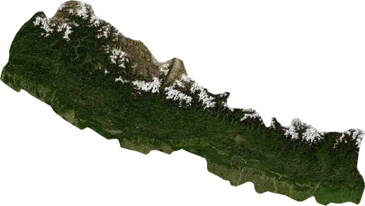
 Malangawa
Terremotos e incendios cerca de Malangawa
¿Ha habido un terremoto o un incendio cerca de Malangawa hace un momento? Mapa en directo en un radio de 100 km, los terremotos más fuertes, los mayores incendios y estadísticas de Malangawa, Nepal.
Mapa en vivo – Malangawa
Terremotos en un radio de 100 km del centro de la ciudad.
Estadísticas clave (30 días)
Terremotos M2,5+ y los frentes de incendio que se ven en el mapa.
Eventos recientes en Malangawa
- 4,1hace 44 hTerremoto de magnitud 4,1 cerca de Patan, Nepala 30 km al SSE de Patan, Nepal
- hace 217 díasIncendio forestal cerca de Hetauda, Nepal22 km² · a 24 km al SO de Hetauda, Nepal
- hace 222 díasIncendio forestal cerca de Hetauda, Nepal20 km² · a 23 km al SO de Hetauda, Nepal
- hace 247 díasIncendio forestal cerca de Malangawa, Nepal12 km² · a 24 km al NE de Malangawa, Nepal
Panorama histórico
Terremotos M3,0+ y eventos significativos de otros peligros.
Acerca de Malangawa
En Malangawa se han registrado 101 terremotos de magnitud 3,0 o superior desde 1976. El más fuerte fue de M6,1 en 2015.
Los satélites han detectado aquí 3 incendios forestales significativos; el mayor quemó unos 22 km².
Conoce el número oficial de emergencias, prepara un kit de emergencia y sigue las instrucciones de protección civil.
Más información ›¿Sentiste un terremoto en Malangawa?
Aún no hay informes.
Terremotos
101 terremotos de magnitud 3,0 o superior desde 1976 en un radio de 100 km. El más fuerte fue de M6,1.
Terremotos recientes
| Mag. | Ubicación | Hora (UTC) | Profundidad |
|---|---|---|---|
| 4,1 | a 30 km al SSE de Patan, Nepal | 134,4 km |
Terremotos más fuertes registrados
| Mag. | Ubicación | Hora (UTC) | Profundidad |
|---|---|---|---|
| 6,1 | a 23 km al ESE de Patan, Nepal | 10,0 km | |
| 5,5 | a 12 km al S de Charikot, Nepal | 7,0 km | |
| 5,3 | a 21 km al ESE de Patan, Nepal | 10,0 km | |
| 5,0 | a 12 km al OSO de Katmandú, Nepal | 10,0 km | |
| 5,0 | a 26 km al E de Katmandú, Nepal | 10,0 km | |
| 4,9 | a 12 km al S de Charikot, Nepal | 10,0 km | |
| 4,9 | a 101 km al ESE de Katmandú, Nepal | 10,0 km | |
| 4,9 | a 8 km al OSO de Charikot, Nepal | 11,6 km | |
| 4,9 | a 17 km al OSO de Katmandú, Nepal | 10,0 km | |
| 4,9 | a 43 km al E de Katmandú, Nepal | 10,0 km | |
| 4,9 | a 25 km al E de Katmandú, Nepal | 33,0 km | |
| 4,9 | a 57 km al ESE de Katmandú, Nepal | 38,5 km | |
| 4,8 | a 94 km al ESE de Katmandú, Nepal | 10,0 km | |
| 4,8 | a 20 km al SSE de Charikot, Nepal | 10,0 km | |
| 4,8 | a 12 km al SO de Charikot, Nepal | 10,0 km |
Terremotos por año (M3,0+)
Año
| 2026 | 1 | M4,1 |
| 2023 | 1 | M4,6 |
| 2022 | 1 | M3,6 |
| 2021 | 1 | M4,4 |
| 2017 | 5 | M4,8 |
| 2016 | 5 | M4,3 |
| 2015 | 71 | M6,1 |
| 2011 | 1 | M4,0 |
| 2006 | 1 | M4,7 |
| 1999 | 1 | M4,5 |
| 1998 | 3 | M4,9 |
| 1997 | 1 | M4,7 |
| 1994 | 1 | M4,3 |
| 1993 | 1 | M4,6 |
| 1988 | 3 | M4,9 |
| 1985 | 1 | M4,6 |
| 1984 | 1 | M4,6 |
| 1979 | 1 | M4,3 |
| 1976 | 1 | M4,8 |
Incendios forestales
3 grandes incendios desde 2026 en un radio de 100 km. El mayor abarcó unos 22 km².
Incendios recientes
| Superficie | Ubicación | Desde | Estado |
|---|---|---|---|
| 22 km² | a 24 km al SO de Hetauda, Nepal | Inactivo | |
| 20 km² | a 23 km al SO de Hetauda, Nepal | Inactivo | |
| 12 km² | a 24 km al NE de Malangawa, Nepal | Inactivo |
Mayores incendios registrados
| Superficie | Ubicación | Desde | Estado |
|---|---|---|---|
| 22 km² | a 24 km al SO de Hetauda, Nepal | Inactivo | |
| 20 km² | a 23 km al SO de Hetauda, Nepal | Inactivo | |
| 12 km² | a 24 km al NE de Malangawa, Nepal | Inactivo |