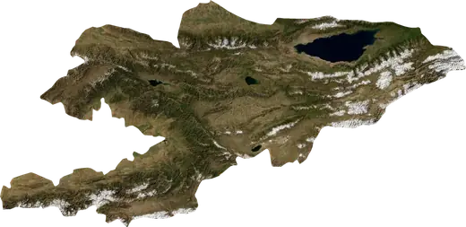
 Kirguistán
Terremotos e incendios forestales en Kirguistán
Últimos terremotos e incendios forestales activos en Kirguistán en un mapa en directo, los terremotos más fuertes y los mayores incendios registrados, y estadísticas por año.
Mapa en vivo – Kirguistán
Estadísticas clave (30 días)
Terremotos M2,5+ y los frentes de incendio que se ven en el mapa.
Peligro de incendio
Pronóstico para la zona de: Balikci. El peligro puede variar localmente; siga las indicaciones oficiales. Fuente: Copernicus EMS – EFFIS (FWI).
Fenómenos meteorológicos adversos (pronóstico)
- Hoy: Lluvia – Lluvia fuerte (10–25 mm) · Suzak
- Mañana: Lluvia – Lluvia fuerte (10–25 mm) · Karakol
Pronóstico para la zona de: Kirguistán. No sustituye los avisos del servicio meteorológico nacional. Fuente: ECMWF / Copernicus EMS.
Eventos recientes en Kirguistán
- hace 23 hIncendio forestal cerca de Osh, Kirguistán – activo4,2 km² · a 23 km al ONO de Osh, Kirguistán
- hace 23 hIncendio forestal cerca de Osh, Kirguistán – activo3,5 km² · a 19 km al ONO de Osh, Kirguistán
- hace 47 hIncendio forestal cerca de Osh, Kirguistán – activo3,3 km² · a 17 km al O de Osh, Kirguistán
- hace 47 hIncendio forestal cerca de Biskek, Kirguistán – activo10 km² · a 24 km al ENE de Biskek, Kirguistán
- hace 47 hIncendio forestal cerca de Kyzyl-Kyya, Kirguistán – activo3,0 km² · a 6 km al E de Kyzyl-Kyya, Kirguistán
- 4,4hace 7 díasTerremoto de magnitud 4,4 cerca de Osh, Kirguistána 144 km al SSE de Osh, Kirguistán
Panorama histórico
Terremotos M3,0+ y eventos significativos de otros peligros.
Acerca de Kirguistán
En Kirguistán se han registrado 1.129 terremotos de magnitud 3,0 o superior desde 1976. El más fuerte fue de M7,5 en 1992.
Los satélites han detectado aquí 1 incendios forestales significativos; el mayor quemó unos 10 km².
Conoce el número oficial de emergencias, prepara un kit de emergencia y sigue las instrucciones de protección civil.
Más información ›Terremotos
1.129 terremotos de magnitud 3,0 o superior desde 1976. El más fuerte fue de M7,5.
Terremotos recientes
| Mag. | Ubicación | Hora (UTC) | Profundidad |
|---|---|---|---|
| 4,4 | a 144 km al SSE de Osh, Kirguistán | 10,0 km | |
| 4,4 | a 136 km al SSE de Osh, Kirguistán | 10,0 km | |
| 4,4 | a 141 km al SSE de Osh, Kirguistán | 10,0 km | |
| 4,5 | a 144 km al SSE de Osh, Kirguistán | 10,0 km | |
| 4,6 | a 102 km al SSE de Nookat, Kirguistán | 10,0 km | |
| 5,2 | a 141 km al SSE de Osh, Kirguistán | 10,0 km | |
| 4,5 | a 40 km al S de Daroot-Korgon, Kirguistán | 29,0 km | |
| 4,5 | a 50 km al NNE de Jalal-Abad, Kirguistán | 10,0 km | |
| 4,0 | a 29 km al SE de Chayek, Kirguistán | 12,1 km | |
| 5,0 | a 115 km al SSE de Biskek, Kirguistán | 10,0 km |
Ver todos (18)
| Mag. | Ubicación | Hora (UTC) | Profundidad |
|---|---|---|---|
| 4,1 | a 35 km al NO de Naryn, Kirguistán | 10,0 km | |
| 4,3 | a 83 km al E de Jalal-Abad, Kirguistán | 10,0 km | |
| 4,4 | a 83 km al S de Osh, Kirguistán | 10,0 km | |
| 4,6 | a 31 km al NNO de Kazarman, Kirguistán | 10,0 km | |
| 4,3 | cerca de Uzgen, Kirguistán | 10,0 km | |
| 4,3 | a 9 km al OSO de Gul'cha, Kirguistán | 10,0 km | |
| 4,2 | a 37 km al ESE de Kyzyl-Eshme, Kirguistán | 9,9 km | |
| 4,3 | a 106 km al SSE de Gul'cha, Kirguistán | 10,0 km |
Terremotos más fuertes registrados
| Mag. | Ubicación | Hora (UTC) | Profundidad |
|---|---|---|---|
| 7,5 | a 116 km al SO de Biskek, Kirguistán | 27,0 km | |
| 7,1 | a 23 km al ENE de Tyup, Kirguistán | 33,0 km | |
| 6,8 | a 38 km al SE de Kyzyl-Eshme, Kirguistán | 7,0 km | |
| 6,6 | a 141 km al SE de Osh, Kirguistán | 27,0 km | |
| 6,6 | a 35 km al NE de Toktogul, Kirguistán | 18,5 km | |
| 6,4 | a 125 km al SSE de Osh, Kirguistán | 13,0 km | |
| 6,4 | a 58 km al NNO de Karakol, Kirguistán | 19,1 km | |
| 6,3 | a 37 km al NE de Toktogul, Kirguistán | 21,1 km | |
| 6,1 | a 56 km al ENE de Toktogul, Kirguistán | 33,0 km | |
| 6,1 | a 109 km al S de Nookat, Kirguistán | 50,0 km | |
| 5,9 | a 150 km al SSE de Osh, Kirguistán | 35,0 km | |
| 5,8 | a 34 km al S de Balikci, Kirguistán | 12,0 km | |
| 5,8 | a 109 km al E de Jalal-Abad, Kirguistán | 22,0 km | |
| 5,7 | a 108 km al SSE de Nookat, Kirguistán | 37,2 km | |
| 5,6 | a 38 km al ESE de Osh, Kirguistán | 18,0 km |
Terremotos por año (M3,0+)
Año
| 2026 | 18 | M5,2 |
| 2025 | 20 | M4,8 |
| 2024 | 25 | M5,4 |
| 2023 | 11 | M4,6 |
| 2022 | 14 | M4,7 |
| 2021 | 8 | M4,6 |
| 2020 | 23 | M5,1 |
| 2019 | 7 | M4,9 |
| 2018 | 17 | M4,8 |
| 2017 | 28 | M5,0 |
| 2016 | 115 | M6,4 |
| 2015 | 26 | M5,6 |
| 2014 | 24 | M5,2 |
| 2013 | 30 | M5,0 |
| 2012 | 16 | M5,2 |
| 2011 | 15 | M5,0 |
| 2010 | 26 | M5,5 |
| 2009 | 23 | M5,4 |
| 2008 | 146 | M6,6 |
| 2007 | 20 | M5,1 |
| 2006 | 24 | M5,8 |
| 2005 | 20 | M5,1 |
| 2004 | 27 | M4,9 |
| 2003 | 17 | M4,7 |
| 2002 | 18 | M4,8 |
| 2001 | 22 | M4,7 |
| 2000 | 18 | M5,0 |
| 1999 | 21 | M5,2 |
| 1998 | 16 | M5,3 |
| 1997 | 14 | M5,8 |
| 1996 | 30 | M5,2 |
| 1995 | 10 | M5,0 |
| 1994 | 7 | M4,7 |
| 1993 | 7 | M4,7 |
| 1992 | 64 | M7,5 |
| 1991 | 9 | M5,2 |
| 1990 | 17 | M6,4 |
| 1989 | 15 | M4,9 |
| 1988 | 10 | M4,9 |
| 1987 | 8 | M4,9 |
| 1986 | 9 | M4,8 |
| 1985 | 13 | M4,9 |
| 1984 | 7 | M4,9 |
| 1983 | 12 | M5,7 |
| 1982 | 9 | M5,0 |
| 1981 | 8 | M5,4 |
| 1980 | 7 | M5,4 |
| 1979 | 11 | M5,2 |
| 1978 | 40 | M7,1 |
| 1977 | 9 | M5,1 |
| 1976 | 18 | M6,1 |
Incendios forestales
1 grandes incendios desde 2025. El mayor abarcó unos 10 km².
Incendios recientes
| Superficie | Ubicación | Desde | Estado |
|---|---|---|---|
| 4,2 km² | a 23 km al ONO de Osh, Kirguistán | Activo | |
| 3,5 km² | a 19 km al ONO de Osh, Kirguistán | Activo | |
| 3,3 km² | a 17 km al O de Osh, Kirguistán | Activo | |
| 10 km² | a 24 km al ENE de Biskek, Kirguistán | Activo | |
| 3,0 km² | a 6 km al E de Kyzyl-Kyya, Kirguistán | Activo |
Mayores incendios registrados
| Superficie | Ubicación | Desde | Estado |
|---|---|---|---|
| 10 km² | a 24 km al ENE de Biskek, Kirguistán | Activo |