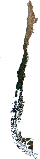
 Ñuble
Terremotos e incendios forestales en Ñuble
Últimos terremotos e incendios forestales en Ñuble (Chile) en un mapa en directo, los terremotos más fuertes y los mayores incendios registrados.
Mapa en vivo – Ñuble
Estadísticas clave (30 días)
Terremotos M2,5+ y los frentes de incendio que se ven en el mapa.
Eventos recientes en Ñuble
- hace 11 hIncendio forestal cerca de Coihueco, Chile – activo4,1 km² · a 48 km al SE de Coihueco, Chile
- hace 35 hIncendio forestal cerca de San Carlos, Chile – activo3,8 km² · a 9 km al ESE de San Carlos, Chile
- hace 46 hIncendio forestal cerca de Chillán, Chile – activo5,7 km² · a 19 km al S de Chillán, Chile
- 4,5hace 84 díasTerremoto de magnitud 4,5 cerca de Coihueco, Chilea 25 km al ESE de Coihueco, Chile
- hace 182 díasIncendio forestal cerca de Coihueco, Chile11 km² · a 35 km al NE de Coihueco, Chile
- hace 217 díasIncendio forestal cerca de Chillán, Chile11 km² · a 44 km al SSE de Chillán, Chile
Panorama histórico
Terremotos M3,0+ y eventos significativos de otros peligros.
Acerca de Ñuble
En Ñuble se han registrado 190 terremotos de magnitud 3,0 o superior desde 1978. El más fuerte fue de M8,8 en 2010.
Los satélites han detectado aquí 7 incendios forestales significativos; el mayor quemó unos 30 km².
Conoce el número oficial de emergencias, prepara un kit de emergencia y sigue las instrucciones de protección civil.
Más información ›Terremotos
190 terremotos de magnitud 3,0 o superior desde 1978. El más fuerte fue de M8,8.
Terremotos recientes
| Mag. | Ubicación | Hora (UTC) | Profundidad |
|---|---|---|---|
| 4,5 | a 25 km al ESE de Coihueco, Chile | 100,1 km |
Terremotos más fuertes registrados
| Mag. | Ubicación | Hora (UTC) | Profundidad |
|---|---|---|---|
| 8,8 | a 9 km al O de Cobquecura, Chile | 22,0 km | |
| 5,7 | a 48 km al NO de Chillán, Chile | 47,0 km | |
| 5,6 | a 139 km al ONO de Cobquecura, Chile | 7,7 km | |
| 5,4 | a 6 km al ENE de Coelemu, Chile | 35,0 km | |
| 5,3 | a 8 km al E de Cobquecura, Chile | 35,0 km | |
| 5,2 | a 68 km al ESE de Coihueco, Chile | 8,9 km | |
| 5,2 | a 111 km al E de Coihueco, Chile | 141,8 km | |
| 5,2 | a 64 km al NNO de Chillán, Chile | 44,5 km | |
| 5,1 | a 9 km al E de Cobquecura, Chile | 37,5 km | |
| 5,1 | cerca de San Carlos, Chile | 61,0 km | |
| 5,0 | a 17 km al NNE de Cobquecura, Chile | 33,8 km | |
| 5,0 | a 48 km al NO de Chillán, Chile | 35,0 km | |
| 5,0 | a 9 km al N de Cobquecura, Chile | 27,6 km | |
| 5,0 | a 30 km al ONO de Chillán, Chile | 59,0 km | |
| 5,0 | a 21 km al ONO de Chillan Viejo, Chile | 54,5 km |
Terremotos por año (M3,0+)
Año
| 2026 | 1 | M4,5 |
| 2024 | 3 | M4,3 |
| 2023 | 3 | M4,6 |
| 2022 | 2 | M4,6 |
| 2021 | 1 | M4,5 |
| 2020 | 3 | M4,6 |
| 2019 | 3 | M4,3 |
| 2018 | 1 | M4,5 |
| 2017 | 3 | M4,9 |
| 2016 | 3 | M4,7 |
| 2015 | 7 | M4,9 |
| 2014 | 2 | M4,3 |
| 2013 | 3 | M4,2 |
| 2012 | 1 | M4,2 |
| 2011 | 3 | M4,6 |
| 2010 | 41 | M8,8 |
| 2009 | 1 | M4,6 |
| 2008 | 7 | M4,5 |
| 2007 | 5 | M3,6 |
| 2006 | 7 | M4,1 |
| 2005 | 8 | M4,6 |
| 2004 | 6 | M4,4 |
| 2003 | 10 | M4,0 |
| 2002 | 11 | M3,9 |
| 2001 | 9 | M4,9 |
| 2000 | 5 | M4,0 |
| 1999 | 4 | M4,0 |
| 1998 | 11 | M4,4 |
| 1997 | 1 | M3,8 |
| 1996 | 3 | M4,6 |
| 1995 | 5 | M5,6 |
| 1992 | 3 | M4,3 |
| 1991 | 2 | M5,2 |
| 1988 | 1 | M5,0 |
| 1987 | 1 | M3,4 |
| 1986 | 2 | M4,5 |
| 1985 | 1 | M5,0 |
| 1984 | 1 | M5,2 |
| 1982 | 2 | M4,8 |
| 1981 | 2 | M4,6 |
| 1979 | 1 | M5,1 |
| 1978 | 1 | M5,7 |
Incendios forestales
7 grandes incendios desde 2026. El mayor abarcó unos 30 km².
Incendios recientes
| Superficie | Ubicación | Desde | Estado |
|---|---|---|---|
| 4,1 km² | a 48 km al SE de Coihueco, Chile | Activo | |
| 3,8 km² | a 9 km al ESE de San Carlos, Chile | Activo | |
| 5,7 km² | a 19 km al S de Chillán, Chile | Activo | |
| 11 km² | a 35 km al NE de Coihueco, Chile | Inactivo | |
| 11 km² | a 44 km al SSE de Chillán, Chile | Inactivo | |
| 11 km² | a 42 km al SSE de Chillán, Chile | Inactivo | |
| 28 km² | a 26 km al SE de Chillán, Chile | Inactivo | |
| 10 km² | a 45 km al ENE de Coihueco, Chile | Inactivo | |
| 30 km² | a 45 km al ENE de Coihueco, Chile | Inactivo | |
| 20 km² | a 8 km al SE de Quillon, Chile | Inactivo |
Mayores incendios registrados
| Superficie | Ubicación | Desde | Estado |
|---|---|---|---|
| 30 km² | a 45 km al ENE de Coihueco, Chile | Inactivo | |
| 28 km² | a 26 km al SE de Chillán, Chile | Inactivo | |
| 20 km² | a 8 km al SE de Quillon, Chile | Inactivo | |
| 11 km² | a 42 km al SSE de Chillán, Chile | Inactivo | |
| 11 km² | a 35 km al NE de Coihueco, Chile | Inactivo | |
| 11 km² | a 44 km al SSE de Chillán, Chile | Inactivo | |
| 10 km² | a 45 km al ENE de Coihueco, Chile | Inactivo |