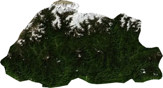
 Phuntsholing
Sismos cerca de Phuntsholing
¿Tembló en Phuntsholing hace un momento? Sismos en vivo en un radio de 100 km de Phuntsholing, Bután, los más fuertes de la historia y estadísticas.
Mapa en vivo – Phuntsholing
Cargando el mapa en vivo…
Último eventoM 5.634.0 km de profundidad · hace 163 díasa 13 km al OSO de Distrito de Punakha, Bután
Bajo
Moderado
Alto
Muy alto
Extremo
Muy extremo
Pronóstico: Copernicus EFFIS (índice FWI)
Lluvia muy débil (0.1–1 mm)
Lluvia débil (1–5 mm)
Lluvia moderada (5–10 mm)
Lluvia fuerte (10–25 mm)
Lluvia muy fuerte (25–50 mm)
Lluvia extrema (≥ 50 mm)
Pronóstico: ECMWF vía Copernicus EMS – GWIS
Calma (< 7 km/h, 0–1 Bf)
Brisa ligera (7–18 km/h, 2–3 Bf)
Brisa moderada (18–36 km/h, 4–5 Bf)
Viento fuerte (36–54 km/h, 5–7 Bf)
Temporal (54–72 km/h, 7–8 Bf)
Tormenta (≥ 72 km/h, 9+ Bf)
Pronóstico: ECMWF vía Copernicus EMS – GWIS
Muy pocos rayos
Pocos rayos
Actividad eléctrica moderada
Actividad eléctrica alta
Actividad eléctrica muy alta
Actividad eléctrica extrema
Pronóstico: ECMWF vía Copernicus EMS – GWIS
Sismos
Incendios forestales
Inundaciones
Tormentas
Volcanes
Tsunamis
Sismos en un radio de 100 km del centro de la ciudad.
Estadísticas clave (30 días)
Terremotos M2,5+ y los frentes de incendio que se ven en el mapa.
Eventos recientes en Phuntsholing
Panorama histórico
Terremotos M3.0+ y eventos significativos de otros peligros.
Acerca de Phuntsholing
En Phuntsholing se han registrado 45 terremotos de magnitud 3.0 o superior desde 1980. El más fuerte fue de M6.1 en 1980.
Conoce el número oficial de emergencias, prepara un kit de emergencia y sigue las instrucciones de protección civil.
Más información ›¿Sentiste un sismo en Phuntsholing?
Aún no hay reportes.
Sismos
45 sismos de magnitud 3.0 o mayor desde 1980 en un radio de 100 km. El más fuerte fue de M6.1.
Sismos recientes
| Mag. | Ubicación | Hora (UTC) | Profundidad |
|---|---|---|---|
| 5.6 | a 13 km al OSO de Distrito de Punakha, Bután | 34.0 km |
Sismos más fuertes registrados
| Mag. | Ubicación | Hora (UTC) | Profundidad |
|---|---|---|---|
| 6.1 | a 16 km al ENE de Gangtok, India | 17.0 km | |
| 5.6 | a 13 km al OSO de Distrito de Punakha, Bután | 34.0 km | |
| 5.5 | a 38 km al SO de Timbu, Bután | 47.0 km | |
| 5.3 | a 5 km al NE de Sapatgram, India | 10.0 km | |
| 5.2 | a 36 km al ESE de Gangtok, India | 10.0 km | |
| 5.1 | a 27 km al ENE de Gangtok, India | 33.0 km | |
| 5.1 | a 42 km al ENE de Phuntsholing, Bután | 33.0 km | |
| 4.8 | a 13 km al NNE de Goshaingaon, India | 30.4 km | |
| 4.8 | a 10 km al S de Gangtok, India | 49.2 km | |
| 4.7 | a 12 km al NNE de Alipur Duar, India | 13.6 km | |
| 4.6 | a 18 km al ESE de Gangtok, India | 10.0 km | |
| 4.6 | cerca de Gangtok, India | 42.2 km | |
| 4.6 | a 29 km al NNE de Jaigaon, India | 57.6 km | |
| 4.5 | a 6 km al ENE de Golakganj, India | 11.5 km | |
| 4.5 | a 31 km al ENE de Darjiling, India | 24.4 km |
Sismos por año (M3.0+)
Año
| 2026 | 1 | M5.6 |
| 2024 | 1 | M4.3 |
| 2022 | 3 | M4.2 |
| 2021 | 4 | M5.2 |
| 2020 | 1 | M3.9 |
| 2019 | 1 | M3.8 |
| 2018 | 3 | M5.3 |
| 2017 | 2 | M4.5 |
| 2016 | 2 | M3.9 |
| 2015 | 2 | M4.3 |
| 2014 | 4 | M4.3 |
| 2013 | 2 | M4.7 |
| 2012 | 1 | M4.6 |
| 2011 | 1 | M3.5 |
| 2009 | 2 | M4.8 |
| 2008 | 2 | M4.8 |
| 2006 | 2 | M4.1 |
| 2004 | 1 | M4.5 |
| 2003 | 1 | M5.5 |
| 1998 | 1 | M3.8 |
| 1994 | 1 | M3.9 |
| 1985 | 1 | M4.4 |
| 1982 | 3 | M5.1 |
| 1981 | 1 | M5.1 |
| 1980 | 2 | M6.1 |
Lugares cercanos
- Jaigaon 1 km
- Hasimara 12 km
- Birpara 29 km
- Goyerkata 40 km
- Falakata 41 km
- Alipur Duar 43 km
- Dhupgari 48 km
- Koch Bihar 59 km
- Matabhanga 59 km
- Mainaguri 65 km
- Tufanganj 66 km
- Timbu 73 km
- Jalpaiguri 75 km
- Tsirang 75 km
- Kalimpong 78 km
- Dinhata 80 km
- Gangtok 93 km