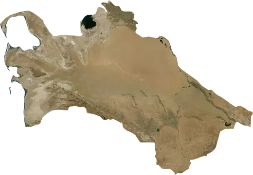
 Turkmenistan
: earthquakes and wildfires
Latest earthquakes and active wildfires in Turkmenistan on a live map, the strongest earthquakes and largest fires on record, and statistics by year.
Live map – Turkmenistan
Key statistics (30 days)
Earthquakes M2.5+ and the wildfire fronts shown on the map.
Fire danger
Forecast for the area around: Dasoguz. Danger can vary locally; follow official guidance. Source: Copernicus EMS – EFFIS (FWI).
Severe weather (forecast)
- Today: Rain – Heavy rain (10–25 mm) · Kerki
- Tomorrow: Rain – Heavy rain (10–25 mm) · Kerki
Forecast for the area around: Turkmenistan. It does not replace warnings from the national weather service. Source: ECMWF / Copernicus EMS.
Recent events in Turkmenistan
- 31 h agoWildfire near Yoloeten, Turkmenistan – active3,882 acres · 19 mi S of Yoloeten, Turkmenistan
- 41 h agoWildfire near Yoloeten, Turkmenistan – active4,053 acres · 12 mi S of Yoloeten, Turkmenistan
- 41 h agoWildfire near Ashgabat, Turkmenistan – active1,913 acres · 10 mi E of Ashgabat, Turkmenistan
- 41 h agoWildfire near Sarahs, Turkmenistan – active1,858 acres · 40 mi ESE of Sarahs, Turkmenistan
- 41 h agoWildfire near Dasoguz, Turkmenistan – active2,286 acres · 3 mi WNW of Dasoguz, Turkmenistan
- 41 h agoWildfire near Turkmenabat, Turkmenistan – active1,391 acres · 31 mi ESE of Turkmenabat, Turkmenistan
Historical overview
Earthquakes M3.0+ and significant events of other hazards.
About Turkmenistan
Turkmenistan has recorded 400 earthquakes of magnitude 3.0 or more since 1976. The strongest was M7.0 in 2000.
Satellites have detected 8 significant wildfires here; the largest burned about 8,229 acres.
Know the official emergency number, prepare an emergency kit and follow the instructions of your civil protection authority.
Learn more ›Earthquakes
Earthquakes today: Turkmenistan →
400 earthquakes of magnitude 3.0 or more since 1976. The strongest was M7.0.
Recent earthquakes
| Mag | Location | Time (UTC) | Depth |
|---|---|---|---|
| 4.5 | 68 mi WNW of Tuerkmenbasy, Turkmenistan | 6.2 mi | |
| 4.3 | 57 mi NW of Tuerkmenbasy, Turkmenistan | 21.7 mi | |
| 5.1 | 38 mi N of Balkanabat, Turkmenistan | 6.2 mi | |
| 4.3 | 19 mi NW of Gyzylarbat, Turkmenistan | 6.2 mi | |
| 5.1 | 76 mi NW of Tuerkmenbasy, Turkmenistan | 30.7 mi |
Strongest earthquakes on record
| Mag | Location | Time (UTC) | Depth |
|---|---|---|---|
| 7.0 | 23 mi E of Balkanabat, Turkmenistan | 18.6 mi | |
| 6.5 | 64 mi W of Guwlymayak, Turkmenistan | 34.1 mi | |
| 6.3 | 63 mi W of Guwlymayak, Turkmenistan | 20.5 mi | |
| 6.2 | 65 mi W of Tuerkmenbasy, Turkmenistan | 31.9 mi | |
| 5.8 | 21 mi SW of Jebel, Turkmenistan | 20.5 mi | |
| 5.7 | 14 mi NE of Gumdag, Turkmenistan | 22.8 mi | |
| 5.6 | 27 mi ENE of Tuerkmenbasy, Turkmenistan | 25.4 mi | |
| 5.5 | 62 mi W of Guwlymayak, Turkmenistan | 19.0 mi | |
| 5.5 | 65 mi WSW of Tuerkmenbasy, Turkmenistan | 20.5 mi | |
| 5.4 | 8 mi ESE of Balkanabat, Turkmenistan | 16.2 mi | |
| 5.4 | 5 mi SSE of Belek, Turkmenistan | 21.2 mi | |
| 5.4 | 51 mi S of Sarahs, Turkmenistan | 6.2 mi | |
| 5.3 | 28 mi NE of Balkanabat, Turkmenistan | 26.6 mi | |
| 5.3 | near Tuerkmenbasy, Turkmenistan | 20.5 mi | |
| 5.3 | 16 mi ENE of Kaka, Turkmenistan | 15.2 mi |
Earthquakes per year (M3.0+)
Year
| 2026 | 4 | M5.1 |
| 2025 | 5 | M5.1 |
| 2024 | 6 | M4.7 |
| 2023 | 10 | M5.1 |
| 2022 | 7 | M4.5 |
| 2021 | 2 | M4.7 |
| 2020 | 13 | M5.2 |
| 2019 | 10 | M4.7 |
| 2018 | 3 | M4.9 |
| 2017 | 19 | M5.2 |
| 2016 | 6 | M5.4 |
| 2015 | 7 | M5.1 |
| 2014 | 9 | M5.5 |
| 2013 | 5 | M5.2 |
| 2012 | 8 | M4.6 |
| 2011 | 5 | M4.7 |
| 2010 | 6 | M5.0 |
| 2009 | 3 | M5.0 |
| 2008 | 20 | M4.7 |
| 2007 | 10 | M4.8 |
| 2006 | 18 | M5.3 |
| 2005 | 7 | M5.2 |
| 2004 | 12 | M4.6 |
| 2003 | 8 | M4.8 |
| 2002 | 8 | M5.2 |
| 2001 | 11 | M5.4 |
| 2000 | 25 | M7.0 |
| 1999 | 5 | M5.4 |
| 1998 | 5 | M4.4 |
| 1997 | 6 | M5.2 |
| 1996 | 8 | M5.0 |
| 1995 | 2 | M5.5 |
| 1994 | 8 | M5.6 |
| 1993 | 8 | M4.6 |
| 1992 | 5 | M5.3 |
| 1991 | 7 | M5.0 |
| 1990 | 4 | M5.1 |
| 1989 | 20 | M6.5 |
| 1988 | 2 | M4.5 |
| 1987 | 4 | M5.7 |
| 1986 | 18 | M6.3 |
| 1985 | 5 | M4.8 |
| 1984 | 9 | M5.8 |
| 1983 | 18 | M5.2 |
| 1982 | 3 | M4.9 |
| 1981 | 3 | M5.1 |
| 1980 | 2 | M4.7 |
| 1979 | 3 | M5.1 |
| 1978 | 5 | M5.1 |
| 1977 | 2 | M4.8 |
| 1976 | 1 | M4.7 |
Wildfires
8 major fires since 2025. The largest covered about 8,229 acres.
Recent fires
| Area | Location | Since | Status |
|---|---|---|---|
| 3,882 acres | 19 mi S of Yoloeten, Turkmenistan | Active | |
| 4,053 acres | 12 mi S of Yoloeten, Turkmenistan | Active | |
| 1,913 acres | 10 mi E of Ashgabat, Turkmenistan | Active | |
| 1,858 acres | 40 mi ESE of Sarahs, Turkmenistan | Active | |
| 2,286 acres | 3 mi WNW of Dasoguz, Turkmenistan | Active | |
| 1,391 acres | 31 mi ESE of Turkmenabat, Turkmenistan | Active | |
| 1,048 acres | 9 mi SW of Turkmenabat, Turkmenistan | Active | |
| 2,674 acres | 17 mi ENE of Hazar, Turkmenistan | Active | |
| 1,821 acres | 21 mi N of Ashgabat, Turkmenistan | Active | |
| 3,193 acres | 7 mi S of Mary, Turkmenistan | Active |
Show all (24)
| Area | Location | Since | Status |
|---|---|---|---|
| 976 acres | 7 mi SE of Doewletli, Turkmenistan | Active | |
| 1,623 acres | 42 mi SSW of Gumdag, Turkmenistan | Inactive | |
| 2,256 acres | near Hazar, Turkmenistan | Inactive | |
| 1,502 acres | 39 mi SSW of Gumdag, Turkmenistan | Inactive | |
| 1,075 acres | 6 mi W of Tuerkmenbasy, Turkmenistan | Inactive | |
| 1,784 acres | 31 mi SW of Gumdag, Turkmenistan | Inactive | |
| 8,229 acres | 23 mi WNW of Hazar, Turkmenistan | Inactive | |
| 2,239 acres | near Tuerkmenbasy, Turkmenistan | Inactive | |
| 1,013 acres | near Balkanabat, Turkmenistan | Inactive | |
| 1,344 acres | 33 mi E of Sarahs, Turkmenistan | Inactive | |
| 899 acres | 15 mi WNW of Turkmenabat, Turkmenistan | Inactive | |
| 3,096 acres | 18 mi WNW of Turkmenabat, Turkmenistan | Inactive | |
| 3,734 acres | 15 mi W of Mary, Turkmenistan | Inactive | |
| 2,543 acres | 18 mi SE of Birata, Turkmenistan | Inactive |
Largest fires on record
| Area | Location | Since | Status |
|---|---|---|---|
| 8,229 acres | 23 mi WNW of Hazar, Turkmenistan | Inactive | |
| 4,053 acres | 12 mi S of Yoloeten, Turkmenistan | Active | |
| 3,882 acres | 19 mi S of Yoloeten, Turkmenistan | Active | |
| 3,734 acres | 15 mi W of Mary, Turkmenistan | Inactive | |
| 3,193 acres | 7 mi S of Mary, Turkmenistan | Active | |
| 3,096 acres | 18 mi WNW of Turkmenabat, Turkmenistan | Inactive | |
| 2,674 acres | 17 mi ENE of Hazar, Turkmenistan | Active | |
| 2,543 acres | 18 mi SE of Birata, Turkmenistan | Inactive |
Major fires per year
Year
| 2026 | 6 | 8,229 acres |
| 2025 | 2 | 3,193 acres |