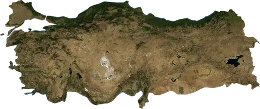
 Republic of Türkiye
: earthquakes and wildfires
Latest earthquakes and active wildfires in Republic of Türkiye on a live map, the strongest earthquakes and largest fires on record, and statistics by year.
Live map – Republic of Türkiye
Key statistics (30 days)
Earthquakes M2.5+ and the wildfire fronts shown on the map.
Fire danger
Forecast for the area around: Istanbul. Danger can vary locally; follow official guidance. Source: Copernicus EMS – EFFIS (FWI).
Severe weather (forecast)
- Today: Rain – Very heavy rain (25–50 mm) · Istanbul
- Tomorrow: Rain – Very heavy rain (25–50 mm) · Istanbul
Forecast for the area around: Republic of Türkiye. It does not replace warnings from the national weather service. Source: ECMWF / Copernicus EMS.
Recent events in Republic of Türkiye
- 2.847 min agoM2.8 earthquake near Datca, Republic of Türkiye – now15 mi NNE of Datca, Republic of Türkiye
- 2.52 h agoM2.5 earthquake near Gaziantep, Republic of Türkiye – now12 mi W of Gaziantep, Republic of Türkiye
- 3 h agoWildfire near Ceylanpinar, Republic of Türkiye – active23,250 acres · 8 mi NE of Ceylanpinar, Republic of Türkiye
- 3 h agoWildfire near Osmaniye, Republic of Türkiye – active6,076 acres · 9 mi WSW of Osmaniye, Republic of Türkiye
- 3 h agoWildfire near Igdir, Republic of Türkiye – active1,463 acres · 6 mi NNW of Igdir, Republic of Türkiye
- 3.810 h agoM3.8 earthquake near Datca, Republic of Türkiye16 mi NNE of Datca, Republic of Türkiye
Historical overview
Earthquakes M3.0+ and significant events of other hazards.
About Republic of Türkiye
Republic of Türkiye has recorded 11,534 earthquakes of magnitude 3.0 or more since 1976. The strongest was M7.8 in 2023.
Satellites have detected 145 significant wildfires here; the largest burned about 79,046 acres.
Know the official emergency number, prepare an emergency kit and follow the instructions of your civil protection authority.
Learn more ›Earthquakes
Earthquakes today: Republic of Türkiye →
11,534 earthquakes of magnitude 3.0 or more since 1976. The strongest was M7.8.
Recent earthquakes
| Mag | Location | Time (UTC) | Depth |
|---|---|---|---|
| 2.8 | 15 mi NNE of Datca, Republic of Türkiye | 9.3 mi | |
| 2.5 | 12 mi W of Gaziantep, Republic of Türkiye | 6.0 mi | |
| 3.8 | 16 mi NNE of Datca, Republic of Türkiye | 9.3 mi | |
| 3.3 | 30 mi SW of Erzincan, Republic of Türkiye | 3.1 mi | |
| 2.7 | 31 mi SW of Erzincan, Republic of Türkiye | 1.7 mi | |
| 2.5 | 5 mi SW of Adapazari, Republic of Türkiye | 6.8 mi | |
| 4.0 | 16 mi NNW of Niluefer, Republic of Türkiye | 8.5 mi | |
| 2.8 | 27 mi SW of Ezine, Republic of Türkiye | 4.3 mi | |
| 4.7 | 30 mi NNE of Adana, Republic of Türkiye | 6.2 mi | |
| 4.1 | 6 mi WSW of Dinar, Republic of Türkiye | 6.2 mi |
Show all (82)
Strongest earthquakes on record
| Mag | Location | Time (UTC) | Depth |
|---|---|---|---|
| 7.8 | 20 mi WNW of Gaziantep, Republic of Türkiye | 10.6 mi | |
| 7.6 | near Izmit, Republic of Türkiye | 8.1 mi | |
| 7.5 | 13 mi S of Elbistan, Republic of Türkiye | 6.2 mi | |
| 7.5 | 70 mi WSW of Ezine, Republic of Türkiye | 6.2 mi | |
| 7.2 | 6 mi S of Duezce, Republic of Türkiye | 6.2 mi | |
| 7.1 | 17 mi NNE of Van, Republic of Türkiye | 9.9 mi | |
| 6.9 | 5 mi W of Uzumlu, Republic of Türkiye | 16.8 mi | |
| 6.9 | 17 mi E of Narman, Republic of Türkiye | 7.5 mi | |
| 6.7 | 27 mi S of Kahramanmaras, Republic of Türkiye | 6.1 mi | |
| 6.7 | 19 mi SSW of Elazig, Republic of Türkiye | 6.2 mi | |
| 6.5 | 4 mi NE of Sultandagi, Republic of Türkiye | 3.1 mi | |
| 6.4 | 9 mi N of Bingoel, Republic of Türkiye | 6.2 mi | |
| 6.4 | near Dinar, Republic of Türkiye | 20.5 mi | |
| 6.4 | 6 mi NE of Olur, Republic of Türkiye | 6.2 mi | |
| 6.3 | near Samandag, Republic of Türkiye | 9.9 mi |
Earthquakes per year (M3.0+)
Year
| 2026 | 66 | M5.4 |
| 2025 | 142 | M6.2 |
| 2024 | 111 | M6.0 |
| 2023 | 653 | M7.8 |
| 2022 | 85 | M6.1 |
| 2021 | 128 | M5.6 |
| 2020 | 148 | M6.7 |
| 2019 | 84 | M5.8 |
| 2018 | 53 | M5.3 |
| 2017 | 100 | M5.6 |
| 2016 | 48 | M5.4 |
| 2015 | 68 | M5.4 |
| 2014 | 84 | M5.3 |
| 2013 | 67 | M5.9 |
| 2012 | 109 | M6.1 |
| 2011 | 237 | M7.1 |
| 2010 | 52 | M6.1 |
| 2009 | 33 | M5.3 |
| 2008 | 420 | M5.2 |
| 2007 | 520 | M5.7 |
| 2006 | 494 | M5.0 |
| 2005 | 977 | M5.9 |
| 2004 | 580 | M5.7 |
| 2003 | 233 | M6.4 |
| 2002 | 154 | M6.5 |
| 2001 | 240 | M5.5 |
| 2000 | 244 | M6.0 |
| 1999 | 691 | M7.6 |
| 1998 | 414 | M6.3 |
| 1997 | 163 | M5.7 |
| 1996 | 239 | M6.2 |
| 1995 | 442 | M6.4 |
| 1994 | 788 | M5.5 |
| 1993 | 579 | M5.3 |
| 1992 | 346 | M6.9 |
| 1991 | 430 | M5.4 |
| 1990 | 223 | M5.4 |
| 1989 | 169 | M5.6 |
| 1988 | 75 | M5.5 |
| 1987 | 56 | M5.3 |
| 1986 | 76 | M5.9 |
| 1985 | 66 | M5.2 |
| 1984 | 88 | M6.4 |
| 1983 | 72 | M6.9 |
| 1982 | 75 | M5.4 |
| 1981 | 65 | M7.5 |
| 1980 | 42 | M5.2 |
| 1979 | 104 | M5.9 |
| 1978 | 57 | M5.1 |
| 1977 | 44 | M5.8 |
| 1976 | 100 | M5.5 |
Wildfires
145 major fires since 2025. The largest covered about 79,046 acres.
Recent fires
| Area | Location | Since | Status |
|---|---|---|---|
| 23,250 acres | 8 mi NE of Ceylanpinar, Republic of Türkiye | Active | |
| 6,076 acres | 9 mi WSW of Osmaniye, Republic of Türkiye | Active | |
| 1,463 acres | 6 mi NNW of Igdir, Republic of Türkiye | Active | |
| 1,596 acres | 22 mi SSW of Canakkale, Republic of Türkiye | Active | |
| 10,890 acres | 10 mi N of İskenderun, Republic of Türkiye | Active | |
| 1,067 acres | near Yesilli, Republic of Türkiye | Active | |
| 2,187 acres | 19 mi NW of Kesan, Republic of Türkiye | Active | |
| 3,556 acres | 7 mi ESE of Samsun, Republic of Türkiye | Active | |
| 4,631 acres | near Karabuek, Republic of Türkiye | Active | |
| 778 acres | 13 mi ESE of Bismil, Republic of Türkiye | Active |
Show all (146)
Largest fires on record
| Area | Location | Since | Status |
|---|---|---|---|
| 79,046 acres | 10 mi W of Osmaniye, Republic of Türkiye | Inactive | |
| 28,560 acres | 4 mi ENE of Akcakale, Republic of Türkiye | Active | |
| 23,052 acres | 8 mi NE of Ceylanpinar, Republic of Türkiye | Active | |
| 11,545 acres | 4 mi SSW of Aliaga, Republic of Türkiye | Inactive | |
| 10,890 acres | 10 mi N of İskenderun, Republic of Türkiye | Active | |
| 9,758 acres | 25 mi SE of Sanliurfa, Republic of Türkiye | Inactive | |
| 9,452 acres | 16 mi W of Kozan, Republic of Türkiye | Inactive | |
| 8,414 acres | 13 mi E of Ayvalik, Republic of Türkiye | Inactive | |
| 8,369 acres | 17 mi E of Fethiye, Republic of Türkiye | Inactive | |
| 8,053 acres | 8 mi SSE of Hueyuek, Republic of Türkiye | Inactive | |
| 6,679 acres | 14 mi NNE of Antalya, Republic of Türkiye | Inactive | |
| 6,037 acres | 9 mi WSW of Osmaniye, Republic of Türkiye | Inactive | |
| 5,587 acres | 13 mi ESE of Sanliurfa, Republic of Türkiye | Inactive | |
| 5,034 acres | 8 mi W of Kaman, Republic of Türkiye | Inactive | |
| 4,930 acres | 20 mi SE of Fethiye, Republic of Türkiye | Inactive |
Major fires per year
Year
| 2026 | 121 | 79,046 acres |
| 2025 | 24 | 28,560 acres |
Regions
- Muğla
- İzmir Province
- Balıkesir
- Canakkale
- Antalya
- Manisa
- Denizli
- Kahramanmaraş
- Van
- Aydın
- Afyonkarahisar Province
- Burdur
- Bursa Province
- Kütahya
- Malatya
- Adıyaman Province
- Sakarya
- Tekirdağ
- Bingöl
- Erzurum
- Hatay
- Kocaeli
- Elazığ
- Adana
- Ankara
- Uşak
- Istanbul
- Erzincan
- Isparta
- Düzce
- Osmaniye
- Konya
- Çankırı
- Çorum
- Bolu
- Mersin
- Sivas
- Hakkâri
- Ağrı
- Bitlis
- Diyarbakır Province
- Eskişehir
- Gaziantep
- Yalova
- Kayseri
- Amasya
- Tokat Province
- Kars Province
- Muş
- Kastamonu
- Zonguldak Province
- Bartın
- Ardahan
- Şanlıurfa
- Samsun
- Sinop
- Kırklareli
- Tunceli
- Şırnak
- Karabük Province
- Gümüşhane Province
- Bayburt Province
- Edirne
- Kırşehir
- Siirt
- Aksaray
- Kırıkkale
- Iğdır
- Trabzon
- Ordu
- Yozgat
- Karaman
- Mardin
Places
- Istanbul
- Ankara
- Bursa
- Izmir
- Gaziantep
- Diyarbakir
- Adana
- Kayseri
- Konya
- Antalya
- Esenyurt
- Eskisehir
- Cankaya
- Kuecuekcekmece
- Erzurum
- Malatya
- Bagcilar
- Bahcelievler
- UEmraniye
- Mersin
- Niluefer
- Van
- Üsküdar
- Esenler
- Sancaktepe
- Karabaglar
- Bornova
- Batman
- Muratpasa
- Sanliurfa
- Elazig
- Sultangazi
- Maltepe
- Beylikduezue
- Antakya
- Samsun
- Kahramanmaras
- Usak
- Alanya
- Atasehir
- Sultanbeyli
- Fatih
- Tarsus
- Karsiyaka
- Konak
- Aksaray
- Sisli
- Denizli
- Batikent
- Adıyaman
- Adapazari
- Gebze
- Zeytinburnu
- Merkezefendi
- Corum
- Sivas
- Afyonkarahisar
- İskenderun
- Trabzon
- Manisa
- Balikesir
- Ordu
- Cigli
- Osmaniye
- Corlu
- Arnavutkoey
- Izmit
- Duezce
- Basaksehir
- Kirikkale
- Kuetahya
- Bolu
- Edirne
- Karaman
- Siverek
- Isparta
- Goelbasi
- Bueyuekcekmece
- Aydin
- Eregli