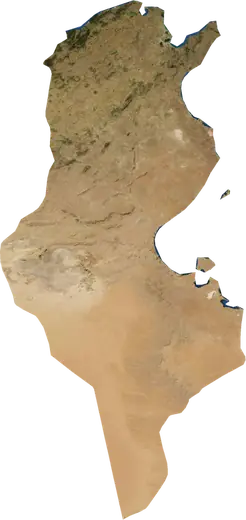
 Tunisia
: earthquakes and wildfires
Latest earthquakes and active wildfires in Tunisia on a live map, the strongest earthquakes and largest fires on record, and statistics by year.
Live map – Tunisia
Key statistics (30 days)
Earthquakes M2.5+ and the wildfire fronts shown on the map.
Fire danger
Forecast for the area around: Gafsa. Danger can vary locally; follow official guidance. Source: Copernicus EMS – EFFIS (FWI).
Severe weather (forecast)
The forecast shows no heavy rain, gales or thunderstorms for today and tomorrow.
Forecast for the area around: Tunisia. It does not replace warnings from the national weather service. Source: ECMWF / Copernicus EMS.
Recent events in Tunisia
- 6 h agoWildfire near El Borma, Tunisia – active3,025 acres · 82 mi WSW of El Borma, Tunisia
- 7 h agoWildfire near Zarzis, Tunisia – active2,165 acres · 60 mi ENE of Zarzis, Tunisia
- 18 h agoWildfire near Douz, Tunisia – active2,110 acres · 28 mi WSW of Douz, Tunisia
- 18 h agoWildfire near El Borma, Tunisia – active4,243 acres · 77 mi SW of El Borma, Tunisia
- 19 h agoWildfire near El Borma, Tunisia – active2,142 acres · 92 mi SW of El Borma, Tunisia
- 19 h agoWildfire near Sidi Husayn, Tunisia – active870 acres · 12 mi WSW of Sidi Husayn, Tunisia
Historical overview
Earthquakes M3.0+ and significant events of other hazards.
About Tunisia
Tunisia has recorded 111 earthquakes of magnitude 3.0 or more since 1977. The strongest was M5.2 in 2002.
Satellites have detected 5 significant wildfires here; the largest burned about 18,135 acres.
Know the official emergency number, prepare an emergency kit and follow the instructions of your civil protection authority.
Learn more ›Earthquakes
111 earthquakes of magnitude 3.0 or more since 1977. The strongest was M5.2.
Recent earthquakes
| Mag | Location | Time (UTC) | Depth |
|---|---|---|---|
| 4.2 | 8 mi WSW of Mezzouna, Tunisia | 6.2 mi | |
| 4.4 | near Tabursuq, Tunisia | 6.2 mi |
Strongest earthquakes on record
| Mag | Location | Time (UTC) | Depth |
|---|---|---|---|
| 5.2 | 17 mi NW of Kairouan, Tunisia | 6.2 mi | |
| 5.2 | 5 mi ESE of Degache, Tunisia | 6.2 mi | |
| 5.2 | 4 mi W of Tabursuq, Tunisia | 6.2 mi | |
| 5.2 | 12 mi SSW of Metlaoui, Tunisia | 6.2 mi | |
| 5.2 | 56 mi ENE of El Mgarsa, Tunisia | 6.2 mi | |
| 5.1 | 42 mi W of Ar Rudayyif, Tunisia | 6.2 mi | |
| 5.1 | 43 mi NNW of Gabes, Tunisia | 6.2 mi | |
| 5.1 | 17 mi SSE of Douane, Tunisia | 6.2 mi | |
| 5.1 | 33 mi ENE of Mahdia, Tunisia | 10.4 mi | |
| 5.1 | 33 mi ENE of Mahdia, Tunisia | 6.2 mi | |
| 5.1 | 17 mi WNW of Jendouba, Tunisia | 13.7 mi | |
| 5.0 | 11 mi SW of Ar Rudayyif, Tunisia | 6.2 mi | |
| 5.0 | 22 mi NE of Monastir, Tunisia | 6.2 mi | |
| 5.0 | 36 mi E of Mahdia, Tunisia | 6.2 mi | |
| 4.9 | 6 mi SE of El Kef, Tunisia | 6.2 mi |
Earthquakes per year (M3.0+)
Year
| 2026 | 2 | M4.4 |
| 2025 | 4 | M5.1 |
| 2024 | 3 | M4.4 |
| 2023 | 2 | M5.0 |
| 2022 | 1 | M4.1 |
| 2019 | 1 | M4.3 |
| 2018 | 2 | M5.1 |
| 2017 | 1 | M4.4 |
| 2016 | 1 | M4.0 |
| 2013 | 4 | M4.7 |
| 2010 | 1 | M4.8 |
| 2008 | 4 | M4.6 |
| 2007 | 4 | M4.5 |
| 2006 | 3 | M4.6 |
| 2005 | 13 | M5.1 |
| 2004 | 1 | M3.0 |
| 2003 | 3 | M4.4 |
| 2002 | 6 | M5.2 |
| 2001 | 3 | M4.6 |
| 1999 | 2 | M4.1 |
| 1998 | 3 | M4.9 |
| 1997 | 1 | M5.2 |
| 1996 | 1 | M3.8 |
| 1995 | 3 | M4.6 |
| 1994 | 2 | M5.2 |
| 1993 | 4 | M4.7 |
| 1992 | 5 | M5.2 |
| 1991 | 2 | M4.8 |
| 1990 | 6 | M5.2 |
| 1989 | 8 | M5.1 |
| 1988 | 2 | M4.3 |
| 1987 | 1 | M3.6 |
| 1986 | 3 | M4.7 |
| 1984 | 1 | M4.6 |
| 1981 | 1 | M4.4 |
| 1979 | 3 | M4.9 |
| 1978 | 1 | M4.9 |
| 1977 | 3 | M5.1 |
Wildfires
5 major fires since 2025. The largest covered about 18,135 acres.
Recent fires
| Area | Location | Since | Status |
|---|---|---|---|
| 3,025 acres | 82 mi WSW of El Borma, Tunisia | Active | |
| 2,165 acres | 60 mi ENE of Zarzis, Tunisia | Active | |
| 2,110 acres | 28 mi WSW of Douz, Tunisia | Active | |
| 4,243 acres | 77 mi SW of El Borma, Tunisia | Active | |
| 2,142 acres | 92 mi SW of El Borma, Tunisia | Active | |
| 870 acres | 12 mi WSW of Sidi Husayn, Tunisia | Active | |
| 1,315 acres | 4 mi W of Chenini Nahal, Tunisia | Active | |
| 1,028 acres | 18 mi SSE of Tunis, Tunisia | Active | |
| 18,135 acres | 13 mi SSE of Ghardimaou, Tunisia | Inactive | |
| 1,661 acres | 13 mi WNW of Kairouan, Tunisia | Inactive |
Show all (13)
| Area | Location | Since | Status |
|---|---|---|---|
| 840 acres | 48 mi SE of Sfax, Tunisia | Inactive | |
| 5,543 acres | 49 mi SW of El Borma, Tunisia | Inactive | |
| 4,673 acres | 4 mi E of Robaa Ouled Yahia, Tunisia | Inactive |
Largest fires on record
| Area | Location | Since | Status |
|---|---|---|---|
| 18,135 acres | 13 mi SSE of Ghardimaou, Tunisia | Inactive | |
| 5,543 acres | 49 mi SW of El Borma, Tunisia | Inactive | |
| 4,673 acres | 4 mi E of Robaa Ouled Yahia, Tunisia | Inactive | |
| 4,243 acres | 77 mi SW of El Borma, Tunisia | Active | |
| 3,025 acres | 82 mi WSW of El Borma, Tunisia | Active |
Major fires per year
Year
| 2026 | 4 | 18,135 acres |
| 2025 | 1 | 5,543 acres |
Regions
Places
- Tunis
- Sfax
- Sousse
- Sukrah
- Kairouan
- Bizerte
- Sidi Husayn
- Sakiet ed Daier
- El Mourouj
- Aryanah
- Gabes
- Hammamet
- Sakiet ez Zit
- Gafsa
- Rawad
- Monastir
- La Marsa
- Msaken
- Houmt Souk
- Ben Arous
- Le Kram
- Kasserine
- Ettadhamen
- Douar Hicher
- Feriana
- Rades
- Le Bardo
- Nabeul
- La Mohammedia
- Oued Lill
- Korba
- Skanes
- Kelaa Kebira
- Kelibia
- Moknine
- Beja
- Douane
- Menzel Bourguiba
- Mnihla
- Ksar Hellal
- Djemmal
- El Kef
- Mahdia
- Jendouba
- Sidi Bouzid
- El Hamma
- La Goulette
- Fouchana
- Soliman
- Jedeida
- Zouila
- Kalaa Srira
- Hammam-Lif
- El Ain
- Hammam Sousse
- Dar Chabanne
- Teboulba
- Gremda
- Boumhel El Bassatine
- Metlaoui
- Menzel Temime
- Ksour Essaf
- Tozeur
- Ez Zahra
- Douz
- El Ksar
- La Sebala du Mornag
- Sidi Abid
- Mateur
- Manouba
- Borj Cedria
- Rass el Djebel
- Siliana
- Dahmani
- Tebourba
- Rhennouch
- Grombalia
- Akouda
- Ar Rudayyif
- Den Den