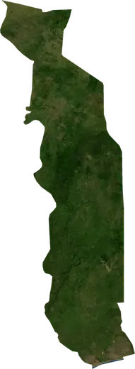
 Togo
Wildfires in Togo
Active wildfires in Togo on a live satellite map, the largest fires on record and major fires per year.
Live map – Togo
Key statistics (30 days)
Earthquakes M2.5+ and the wildfire fronts shown on the map.
Fire danger
Forecast for the area around: Dapaong. Danger can vary locally; follow official guidance. Source: Copernicus EMS – EFFIS (FWI).
Severe weather (forecast)
- Today: Rain – Heavy rain (10–25 mm) · Aneho
- Tomorrow: Rain – Heavy rain (10–25 mm) · Tsevie
Forecast for the area around: Togo. It does not replace warnings from the national weather service. Source: ECMWF / Copernicus EMS.
Recent events in Togo
- 14 h agoWildfire near Dapaong, Togo – active1,485 acres · 21 mi NNE of Dapaong, Togo
- 26 h agoWildfire near Bassar, Togo – active1,505 acres · 27 mi WSW of Bassar, Togo
- 26 h agoWildfire near Sokode, Togo – active1,119 acres · 58 mi WSW of Sokode, Togo
- 38 h agoWildfire near Tabligbo, Togo – active1,221 acres · near Tabligbo, Togo
- 2 days agoWildfire near Bassar, Togo1,890 acres · 19 mi WSW of Bassar, Togo
- 2 days agoWildfire near Anie, Togo971 acres · near Anie, Togo
Historical overview
Earthquakes M3.0+ and significant events of other hazards.
About Togo
Satellites have detected 34 significant wildfires here; the largest burned about 47,924 acres.
Know the official emergency number, prepare an emergency kit and follow the instructions of your civil protection authority.
Learn more ›Wildfires
34 major fires since 2025. The largest covered about 47,924 acres.
Recent fires
| Area | Location | Since | Status |
|---|---|---|---|
| 1,485 acres | 21 mi NNE of Dapaong, Togo | Active | |
| 1,505 acres | 27 mi WSW of Bassar, Togo | Active | |
| 1,119 acres | 58 mi WSW of Sokode, Togo | Active | |
| 1,221 acres | near Tabligbo, Togo | Active | |
| 1,890 acres | 19 mi WSW of Bassar, Togo | Inactive | |
| 971 acres | near Anie, Togo | Inactive | |
| 2,481 acres | 25 mi NW of Atakpame, Togo | Inactive | |
| 1,053 acres | 4 mi S of Mandouri, Togo | Inactive | |
| 3,244 acres | 23 mi WSW of Bassar, Togo | Inactive | |
| 2,659 acres | near Kande, Togo | Inactive |
Show all (41)
Largest fires on record
| Area | Location | Since | Status |
|---|---|---|---|
| 47,924 acres | 14 mi NW of Atakpame, Togo | Inactive | |
| 9,822 acres | 15 mi SSE of Bassar, Togo | Inactive | |
| 8,775 acres | 51 mi SSW of Sokode, Togo | Inactive | |
| 7,349 acres | 44 mi NW of Lomé, Togo | Inactive | |
| 7,129 acres | 17 mi SW of Blitta, Togo | Inactive | |
| 6,921 acres | 24 mi S of Bassar, Togo | Inactive | |
| 5,772 acres | 9 mi NNE of Mandouri, Togo | Inactive | |
| 5,300 acres | 6 mi NW of Mango, Togo | Inactive | |
| 4,804 acres | 38 mi NW of Atakpame, Togo | Inactive | |
| 4,554 acres | 23 mi W of Sotouboua, Togo | Inactive | |
| 4,490 acres | 6 mi W of Niamtougou, Togo | Inactive | |
| 4,307 acres | 13 mi S of Bassar, Togo | Inactive | |
| 4,171 acres | 22 mi WSW of Blitta, Togo | Inactive | |
| 4,102 acres | 73 mi WNW of Kara, Togo | Inactive | |
| 4,099 acres | 31 mi SW of Mango, Togo | Inactive |
Major fires per year
Year
| 2026 | 23 | 47,924 acres |
| 2025 | 11 | 9,822 acres |