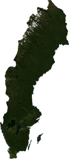
 Sweden
: earthquakes and wildfires
Latest earthquakes and active wildfires in Sweden on a live map, the strongest earthquakes and largest fires on record, and statistics by year.
Live map – Sweden
Key statistics (30 days)
Earthquakes M2.5+ and the wildfire fronts shown on the map.
Fire danger
Forecast for the area around: Stockholm. Danger can vary locally; follow official guidance. Source: Copernicus EMS – EFFIS (FWI).
Severe weather (forecast)
- Today: Rain – Very heavy rain (25–50 mm) · Umea
- Tomorrow: Rain – Extreme rain (≥ 50 mm) · Umea
Forecast for the area around: Sweden. It does not replace warnings from the national weather service. Source: ECMWF / Copernicus EMS.
Recent events in Sweden
- 15 h agoWildfire near Oxeloesund, Sweden – active4,910 acres · near Oxeloesund, Sweden
- 16 h agoWildfire near Visby, Sweden – active1,275 acres · 19 mi ENE of Visby, Sweden
- 17 h agoWildfire near Haparanda, Sweden – active2,449 acres · 5 mi SSE of Haparanda, Sweden
- 28 h agoWildfire near Skelleftea, Sweden – active1,725 acres · 11 mi ESE of Skelleftea, Sweden
- 37 h agoWildfire near Avesta, Sweden – active2,278 acres · near Avesta, Sweden
- 38 h agoWildfire near Uddevalla, Sweden – active1,142 acres · 19 mi W of Uddevalla, Sweden
Historical overview
Earthquakes M3.0+ and significant events of other hazards.
About Sweden
Sweden has recorded 76 earthquakes of magnitude 3.0 or more since 1983. The strongest was M4.8 in 1986.
Satellites have detected 1 significant wildfires here; the largest burned about 4,910 acres.
Know the official emergency number, prepare an emergency kit and follow the instructions of your civil protection authority.
Learn more ›Earthquakes
76 earthquakes of magnitude 3.0 or more since 1983. The strongest was M4.8.
Recent earthquakes
No earthquakes of magnitude 2.5+ in the last 12 months.
Strongest earthquakes on record
| Mag | Location | Time (UTC) | Depth |
|---|---|---|---|
| 4.8 | near Skoevde, Sweden | 6.2 mi | |
| 4.6 | 26 mi NNE of AElvdalen, Sweden | 9.8 mi | |
| 4.4 | 27 mi NW of Hoeganaes, Sweden | 20.5 mi | |
| 4.3 | 16 mi SSE of Lund, Sweden | 6.2 mi | |
| 4.2 | 35 mi ESE of Pitea, Sweden | 9.3 mi | |
| 4.2 | 26 mi SW of Falkenberg, Sweden | 6.1 mi | |
| 4.2 | 11 mi NE of Vilhelmina, Sweden | 20.5 mi | |
| 4.2 | 23 mi NW of Hoeganaes, Sweden | 20.5 mi | |
| 4.1 | 20 mi SSE of Skelleftea, Sweden | 13.4 mi | |
| 4.1 | 53 mi NW of OErnskoeldsvik, Sweden | 6.2 mi | |
| 4.0 | near Gaellivare, Sweden | 9.9 mi | |
| 3.9 | 16 mi SSW of Falkenberg, Sweden | 6.2 mi | |
| 3.9 | 15 mi NE of Vaesteras, Sweden | 6.2 mi | |
| 3.8 | 24 mi S of Skelleftea, Sweden | 6.2 mi | |
| 3.8 | 30 mi E of Umea, Sweden | 6.2 mi |
Earthquakes per year (M3.0+)
Year
| 2018 | 1 | M3.5 |
| 2016 | 1 | M4.2 |
| 2015 | 2 | M4.0 |
| 2014 | 1 | M4.6 |
| 2012 | 1 | M4.2 |
| 2010 | 1 | M4.1 |
| 2008 | 1 | M4.3 |
| 2007 | 1 | M3.1 |
| 2005 | 2 | M3.2 |
| 2004 | 3 | M3.7 |
| 1998 | 1 | M3.4 |
| 1995 | 3 | M3.9 |
| 1994 | 6 | M3.2 |
| 1993 | 9 | M4.2 |
| 1992 | 19 | M3.8 |
| 1991 | 4 | M3.5 |
| 1990 | 3 | M3.9 |
| 1989 | 3 | M3.4 |
| 1988 | 2 | M3.3 |
| 1987 | 3 | M3.4 |
| 1986 | 6 | M4.8 |
| 1985 | 2 | M4.4 |
| 1983 | 1 | M4.1 |
Wildfires
1 major fires since 2026. The largest covered about 4,910 acres.
Recent fires
| Area | Location | Since | Status |
|---|---|---|---|
| 4,910 acres | near Oxeloesund, Sweden | Active | |
| 1,275 acres | 19 mi ENE of Visby, Sweden | Active | |
| 2,449 acres | 5 mi SSE of Haparanda, Sweden | Active | |
| 1,725 acres | 11 mi ESE of Skelleftea, Sweden | Active | |
| 2,278 acres | near Avesta, Sweden | Active | |
| 1,142 acres | 19 mi W of Uddevalla, Sweden | Active |
Largest fires on record
| Area | Location | Since | Status |
|---|---|---|---|
| 4,910 acres | near Oxeloesund, Sweden | Active |